My Store
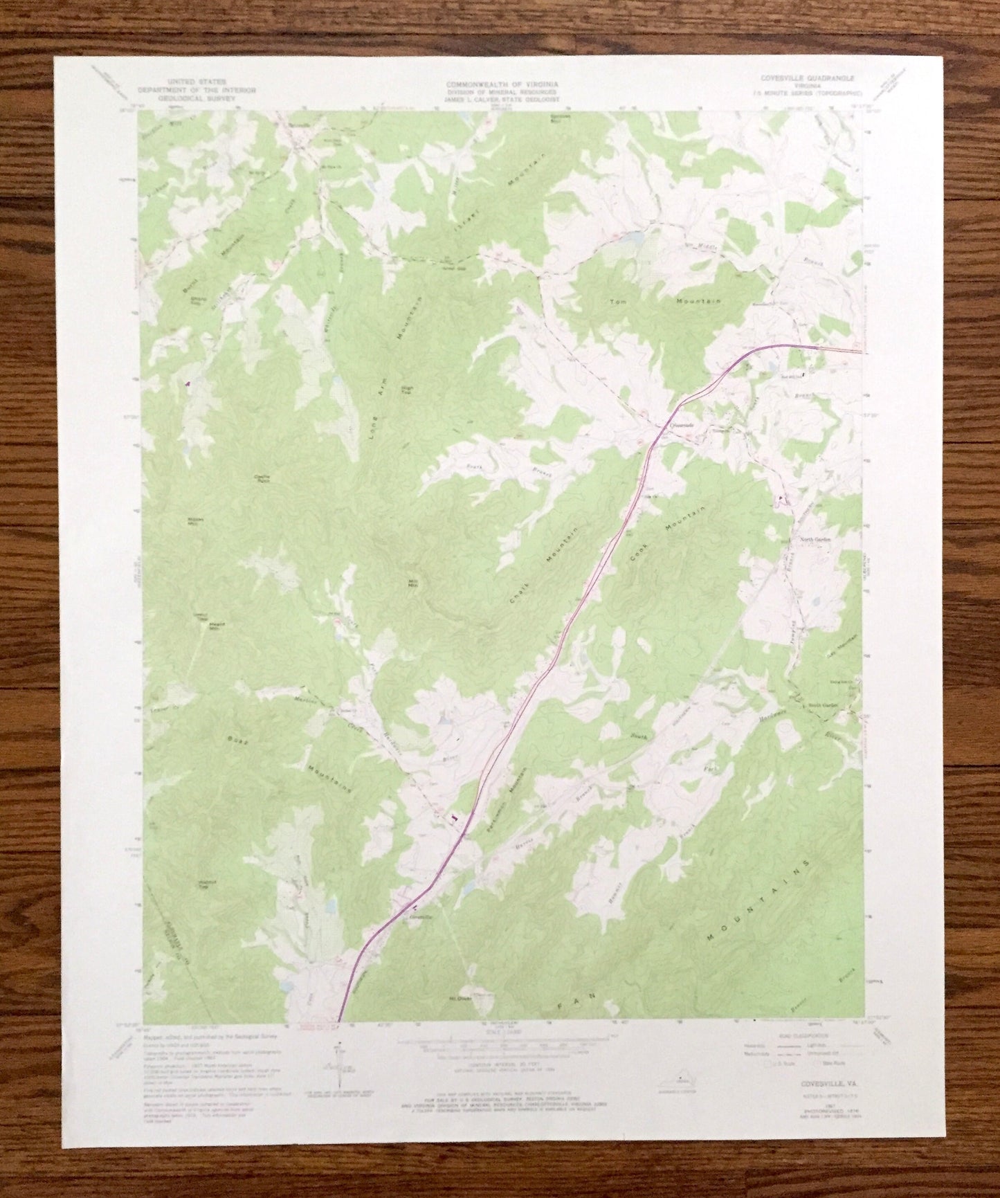
Antique Covesville, Virginia 1967 US Geological Survey Topographic Map – Albemarle County, South, North Garden, Batesville, Crossroads, VA
Antique Covesville, Virginia 1967 US Geological Survey Topographic Map – Albemarle County, South, North Garden, Batesville, Crossroads, VA
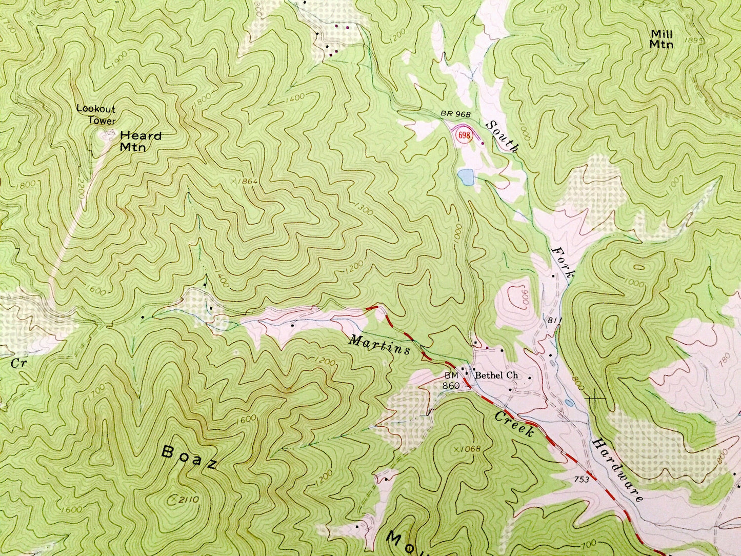
Beautiful, antique map of Covesville, Virginia and surrounding Albemarle County area. This is an authentic 1967 edition, 1977 print from the U.S. Geological Survey and NOT a computer reproduction.
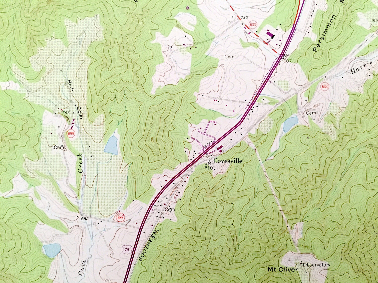
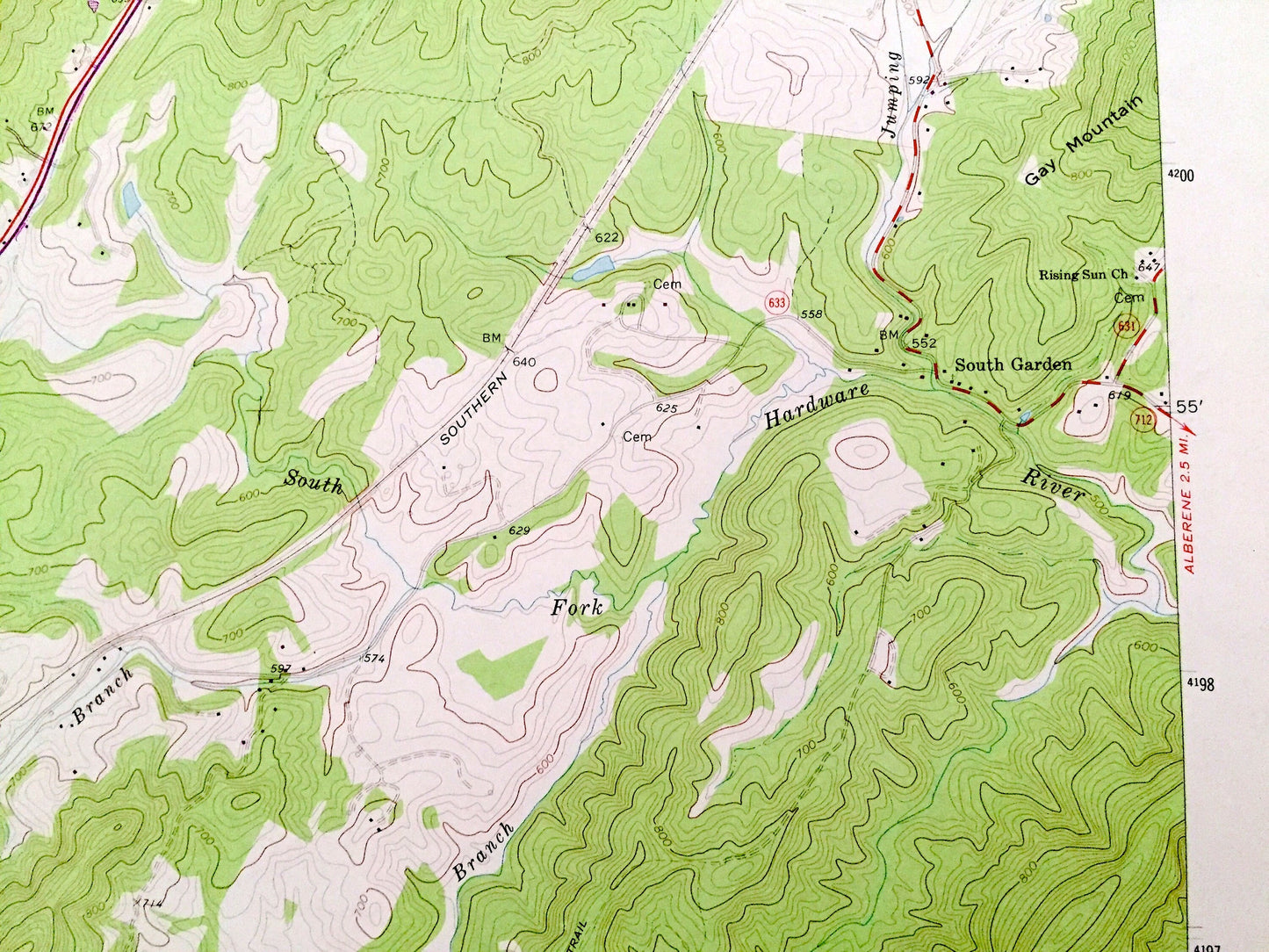
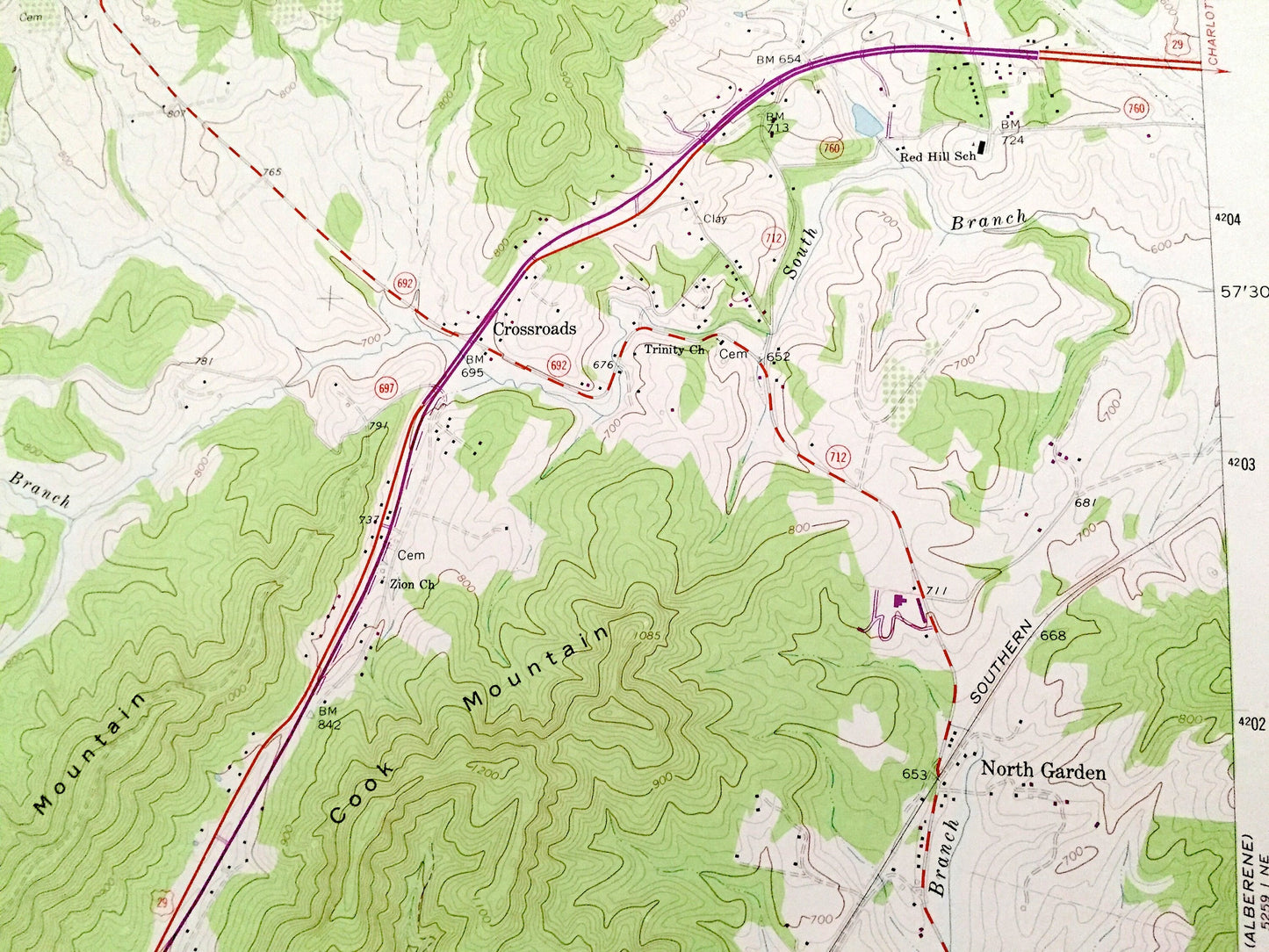
See what Virginia looked like over 55 years ago. Lots of intricate details and geological contours. Map even has little squares for every house that existed at the time. The USGS cartographers were very thorough back then!
Perfect for the historian, map-lover, the curious or just as a conversation starter. Wonderful and rare. Vintage maps such as these make great gifts.
Edition of 1967, printed 1977
Dimensions: 22" width x 27" height
----
Features
Cities & Towns: Covesville, South Garden, North Garden, Crossroads, Batesville.
Points of Interest: Albermarle County, Nelson County, Chalk Mountain, Southern Railway, Boaz Mountains, Fan Mountains, Cook Mountain, Tom Mountain, Long Arm Mountain, Israel Mountain, Burnt Mountain, Stillhouse Creek, Sharp Top, Walnut Top, Gay Mountain, Castle Rock, and many more hills, streams, ponds, houses, schools, churches and roads.
Condition: Good Vintage condition, commensurate with age. This map is in great shape for being over 45 years old. Has light wear, but this will add to vintage character when framed.
----
We will happily adjust shipping price for multiple purchases. Maps are rolled up and shipped in sturdy mailing tubes, never folded.
Couldn't load pickup availability
Share