My Store
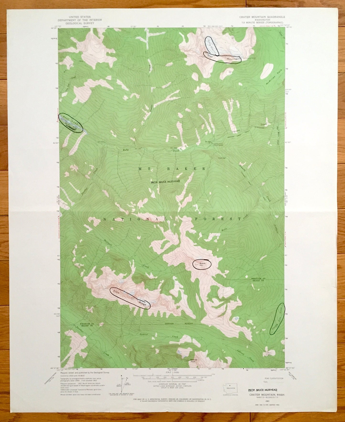
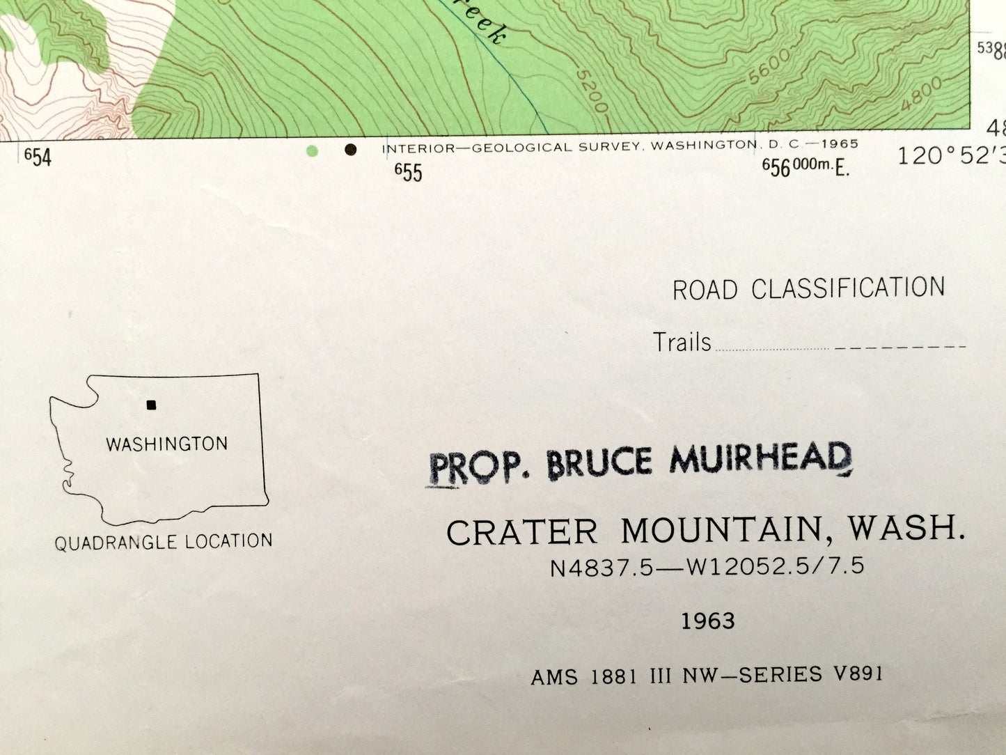
Antique Crater Mountain, Washington 1963 US Geological Survey Topographic Map – Mt Baker National Forest Beebe Mountain Ross Lake Skagit WA
Antique Crater Mountain, Washington 1963 US Geological Survey Topographic Map – Mt Baker National Forest Beebe Mountain Ross Lake Skagit WA
Beautiful, antique map of Crater Mountain, Washington and surrounding Whatcom County and Skagit County areas including Mt Baker National Forest. This is an authentic 1963 print from the U.S. Geological Survey and NOT a computer reproduction.
See what Washington State looked like more than 50 years ago. Lots of intricate details and geological contours. Map even has little squares for every house that existed at the time. The USGS cartographers were very thorough back then!
Perfect for the historian, map-lover, the curious or just as a conversation starter. Wonderful and rare. Vintage maps such as these make great gifts.
Edition of 1963, printed 1963
Dimensions: 22" width x 27" height
----
Features
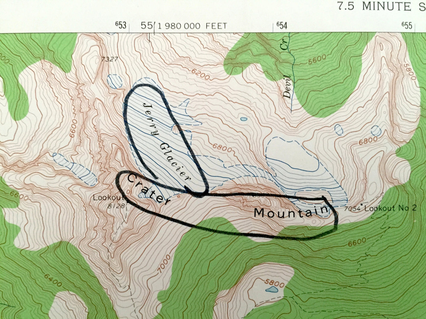
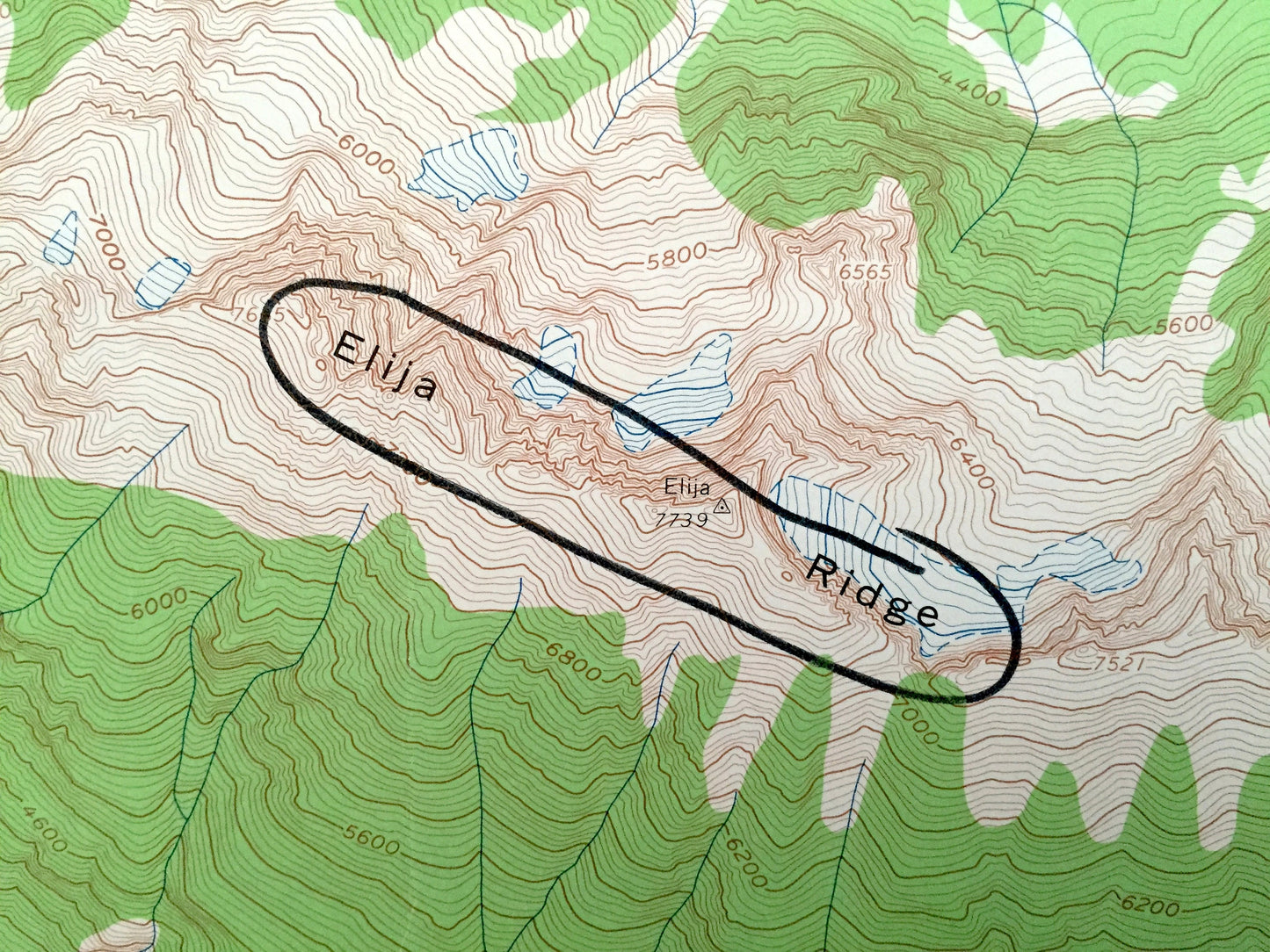
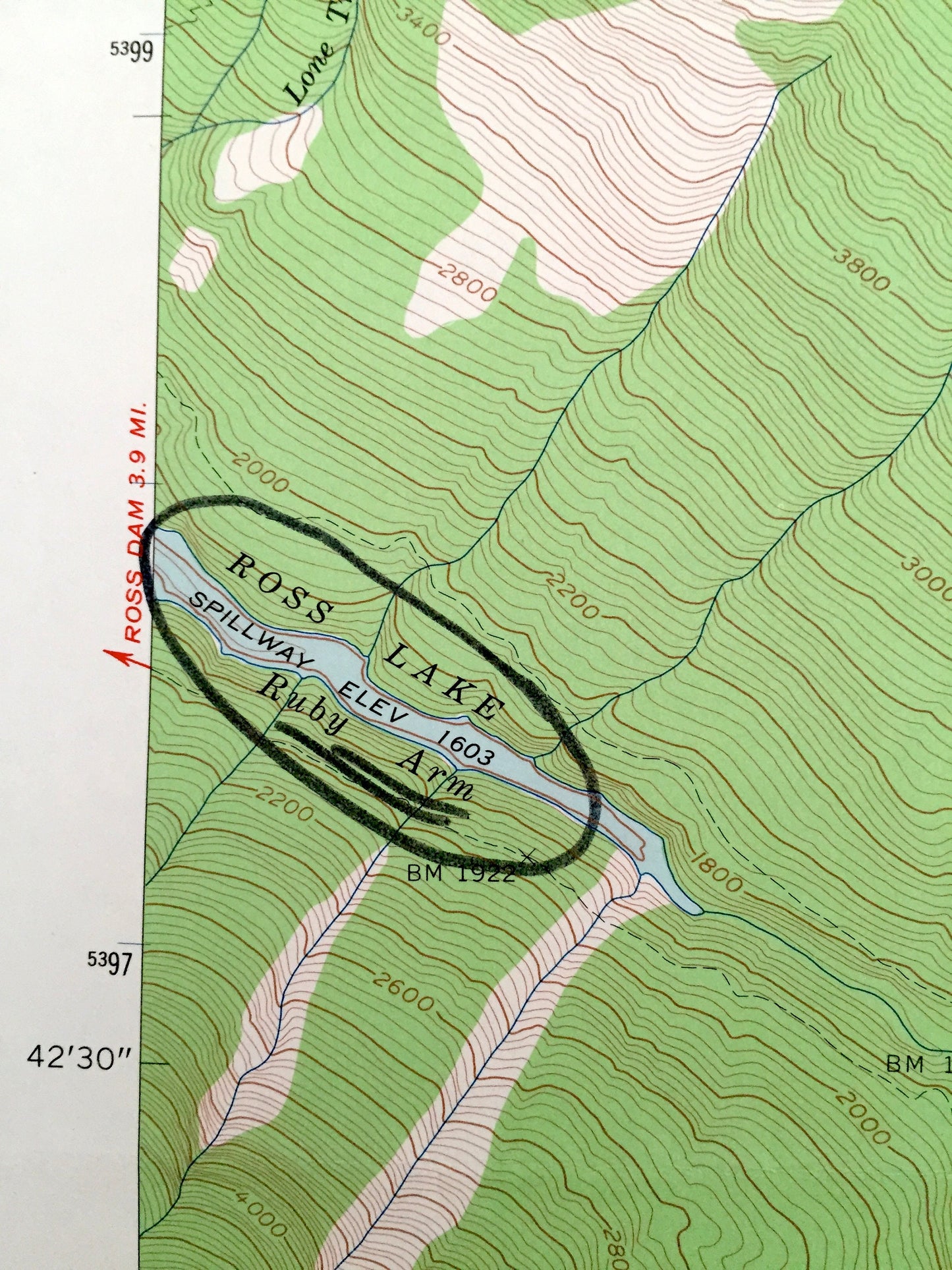
Points of Interest: Whatcom County, Skagit County, Mt Baker National Forest, Elija Ridge, Crater Mountain, Ross Lake, Ruby Creek, Granite Creek, Jerry Glacier, Panther Creek, Gabriel Creek, Gabriel Peak, Cabinet Creek, County Line Creek, Stillwell Creek, Beebe Mountain, Cascade Crest Trail, Beebe Creek, Crater Creek, and lots more hills, rivers, creeks, ponds, and trails.
Condition: Very Good condition, commensurate with age. This map is in incredible shape for being over 50 years old. Some edge-wear, circled places of interest, and a fold as issued, all of which will read as vintage character when framed.
----
We will happily adjust shipping price for multiple purchases. Maps are rolled up and shipped in sturdy mailing tubes, never folded.
Couldn't load pickup availability
Share