My Store
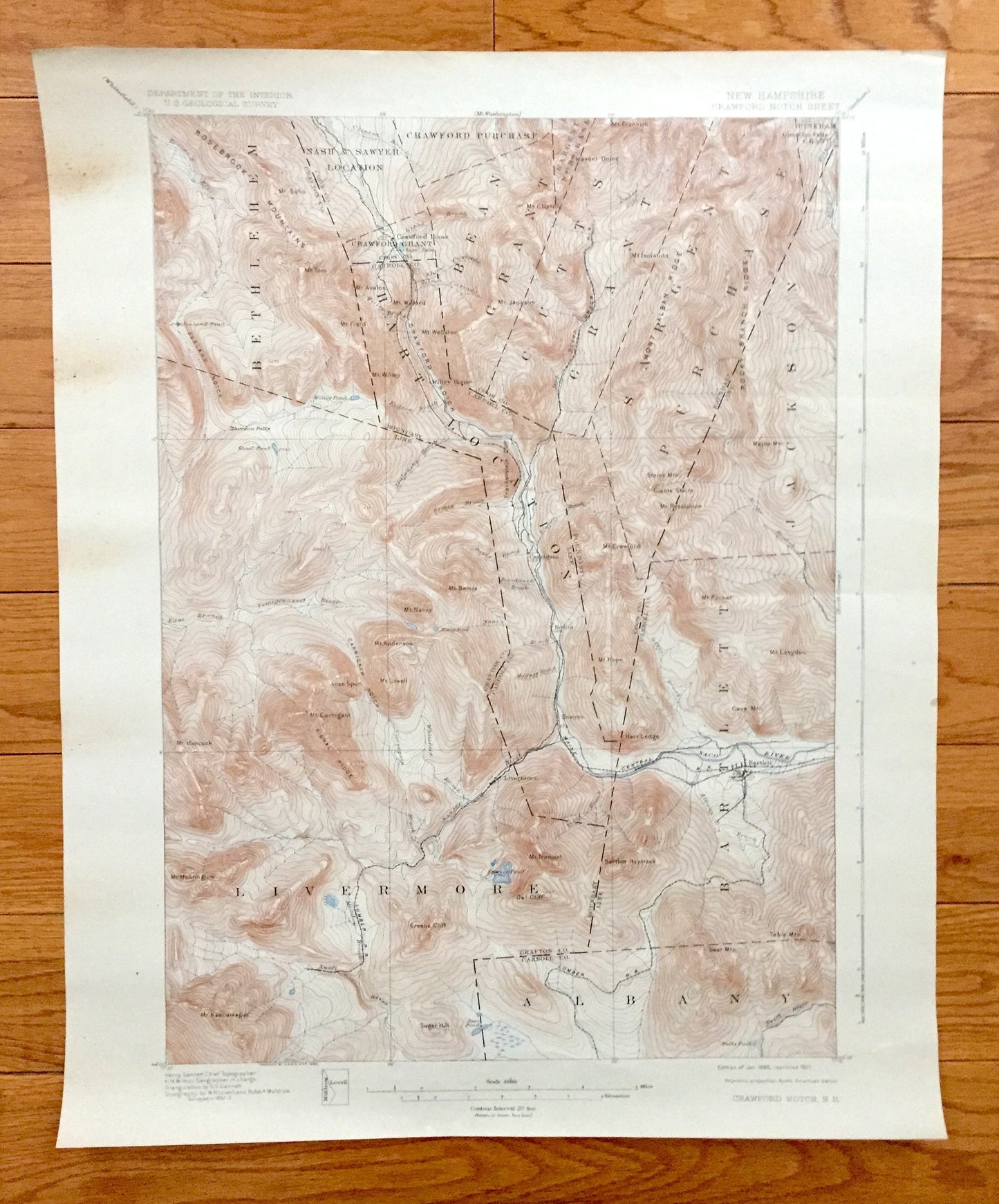
Antique Crawford Notch, New Hampshire 1896 US Geological Survey Topographic Map – Coos, Carroll, Grafton County, Bartlett White Mountains NH
Antique Crawford Notch, New Hampshire 1896 US Geological Survey Topographic Map – Coos, Carroll, Grafton County, Bartlett White Mountains NH
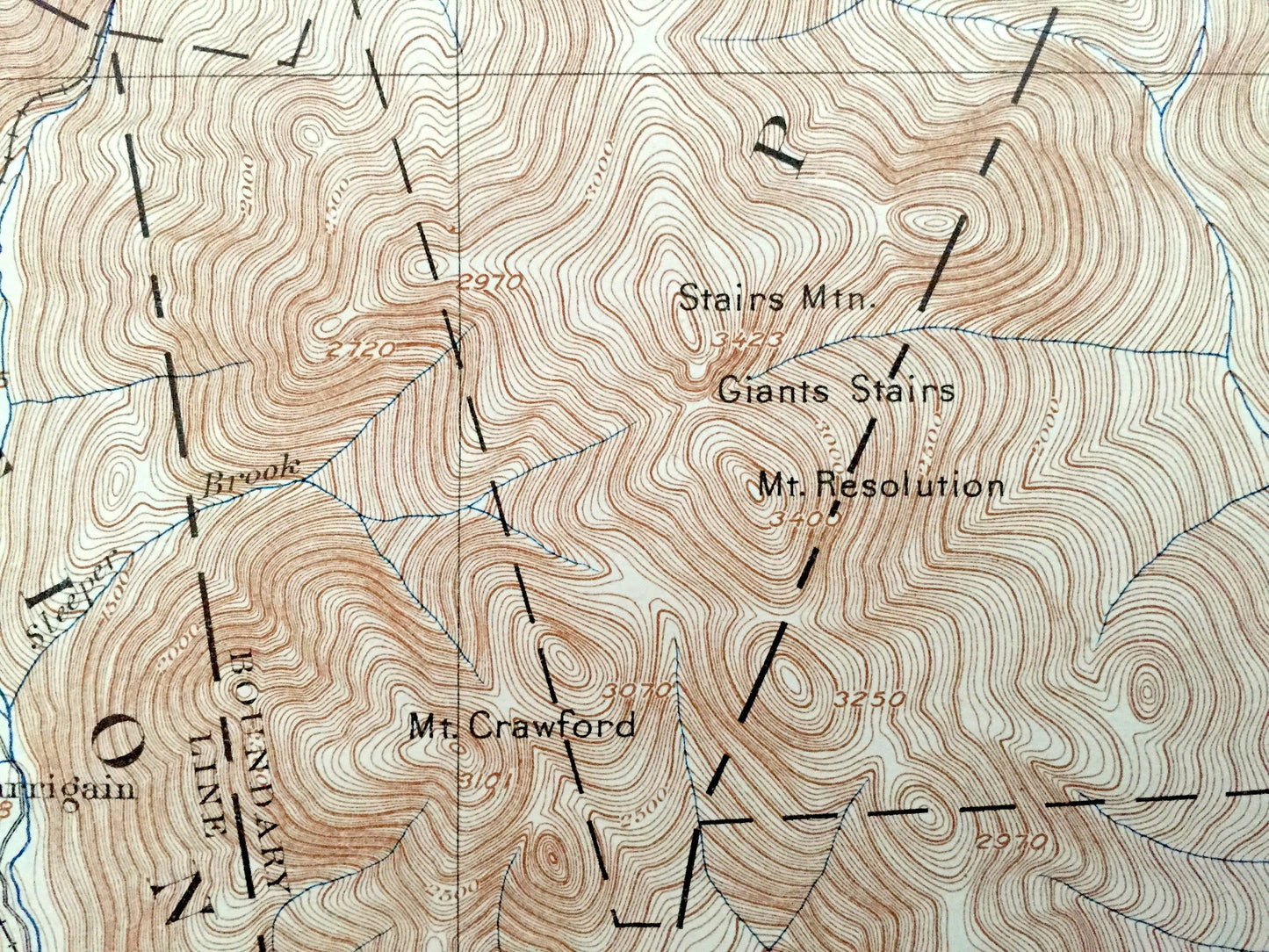
Beautiful, antique map of Crawford Notch and surrounding White Mountain National Forest of New Hampshire, including Coos, Carroll & Grafton County. This is an authentic 1896 edition, 1927 print from the U.S. Geological Survey and NOT a computer reproduction.
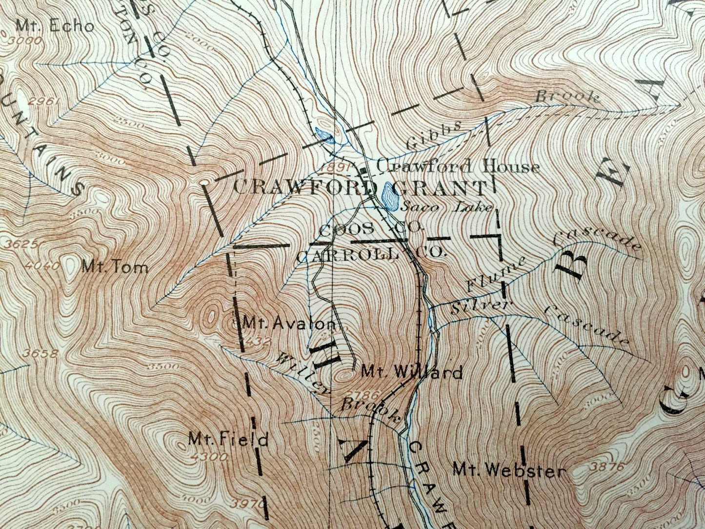
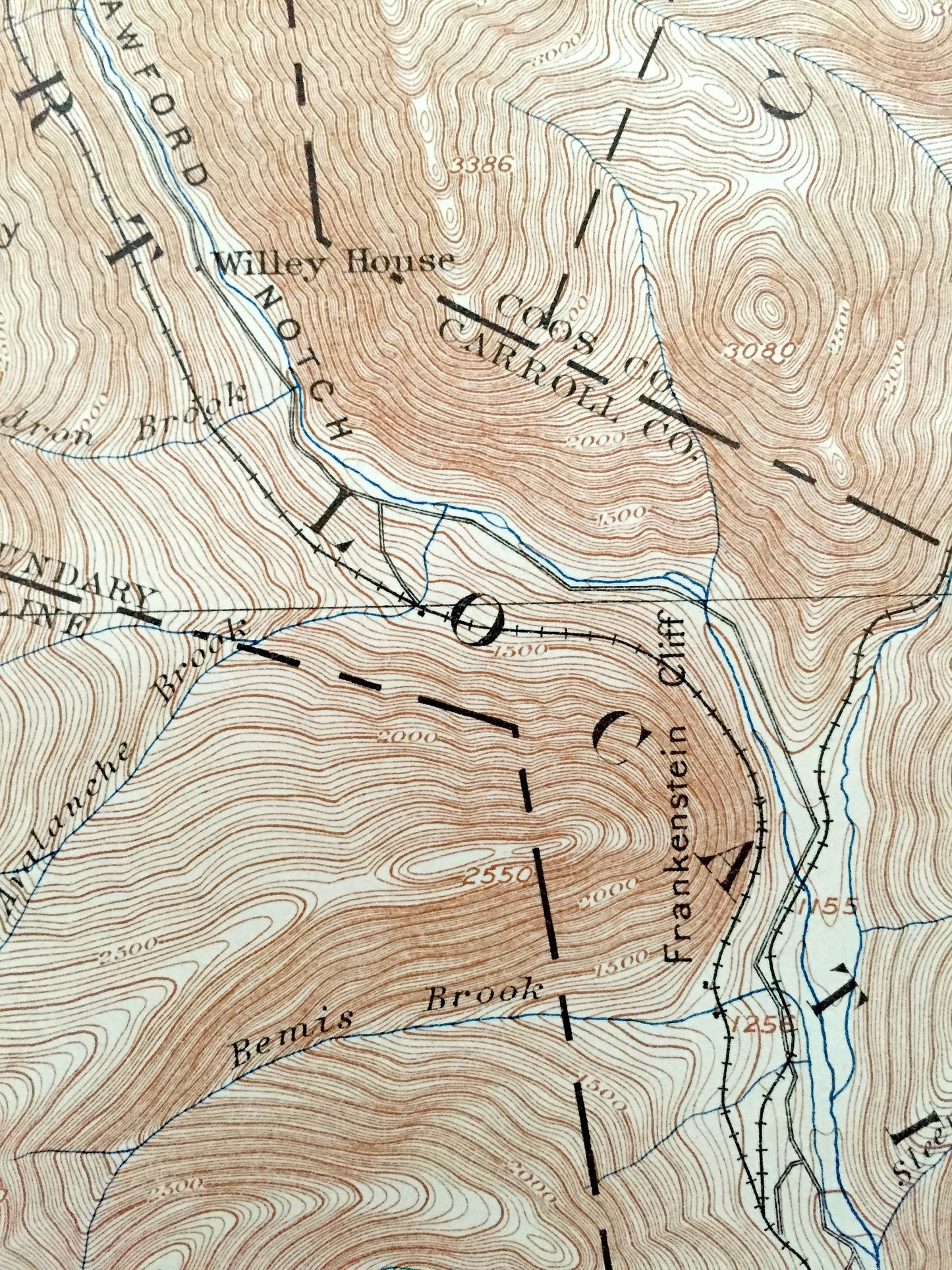
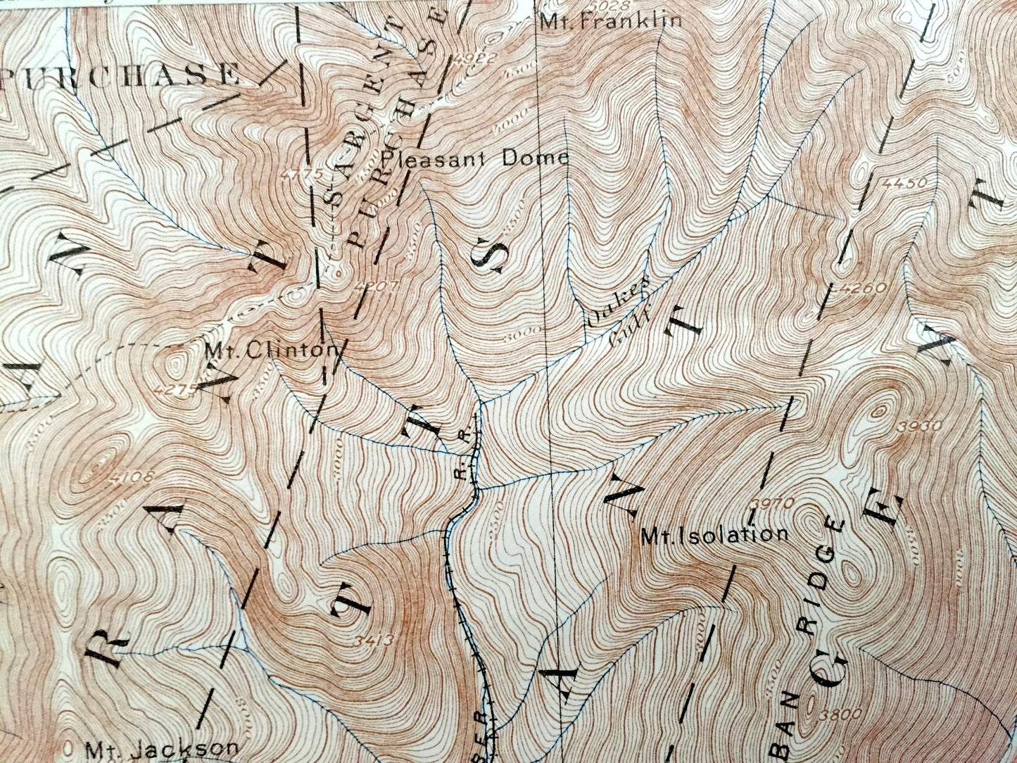
See what the White Mountains of New Hampshire looked like 125 years ago. Lots of intricate details and geological contours. Map even has little squares for every house that existed at the time. The USGS cartographers were very thorough back then! On the back is a description of topographic symbols and map guide.
Perfect for the historian, map-lover, the curious or just as a conversation starter. Wonderful and rare. Vintage maps such as these make great gifts.
Edition of 1896, printed 1927
Dimensions: 16 1/2" width x 20" height
----
Features
Cities & Towns: Crawfords Purchase, Sargents Purchase, Bethlehem, Carroll, Harts Location, Cutts Grant, Hadleys Purchase, Beans Grant, Jackson, Bartlett, Albany, Pinkhams Grant, Stillwater, Notchland.
Points of Interest: White Mountain National Forest, Crawford Notch, Saco River, Crawford Notch State Reservation, Presidential Range, Mount Albany Ridge, Rocky Branch Ridge, Signal Ridge, Zealand Notch, Mt. Tom, Mt. Avalon, Mt. Wiley, Rosebrook Mountains, Mt. Jackson, Mt. Webster, Mt. Isolation, Mt. Davis, Engine hill, Maple Mountain, Mt. Resolution, Mt. Hope, Mt. Langdon, Hart Ledge, Mt. Anderson, Duck Pond Mountain, Vose Spur, Mt. Hancock, Hancock Notch, Mt. Huntington. Mt. Tremont, Bartlett Haystack, Bear Mountain, Table Mountain, Owls Cliff, Greens Cliff, Mt. Kancamagus, Mt. Saunders, Sawyers River, Bemis Ridge, Maine Central Railroad and lots more hills, mountains, streams, ponds, camps, trails, notches, roads and railroads.
Condition: Good Vintage condition, commensurate with age. This map is in great shape for being over 90 years old. Has some edge-wear accrued over the years, but this will add to the vintage character when framed.
----
We will happily adjust shipping price for multiple purchases. Maps are rolled up and shipped in sturdy mailing tubes, never folded.
Couldn't load pickup availability
Share