My Store
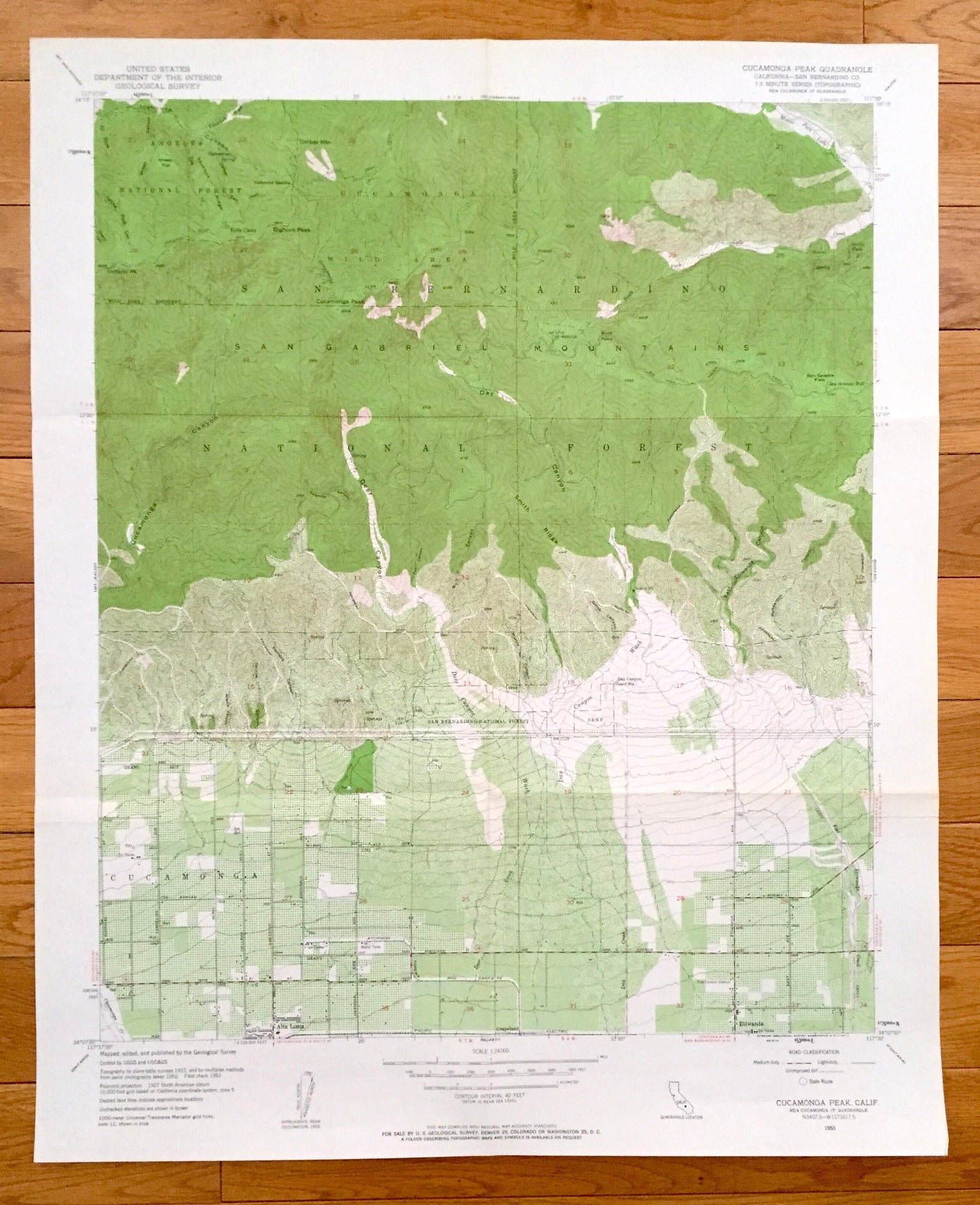
Antique Cucamonga Peak, California 1953 US Geological Survey Topographic Map –San Bernardino County, Cucamonga,Alta Loma, Grapeland,Etiwanda
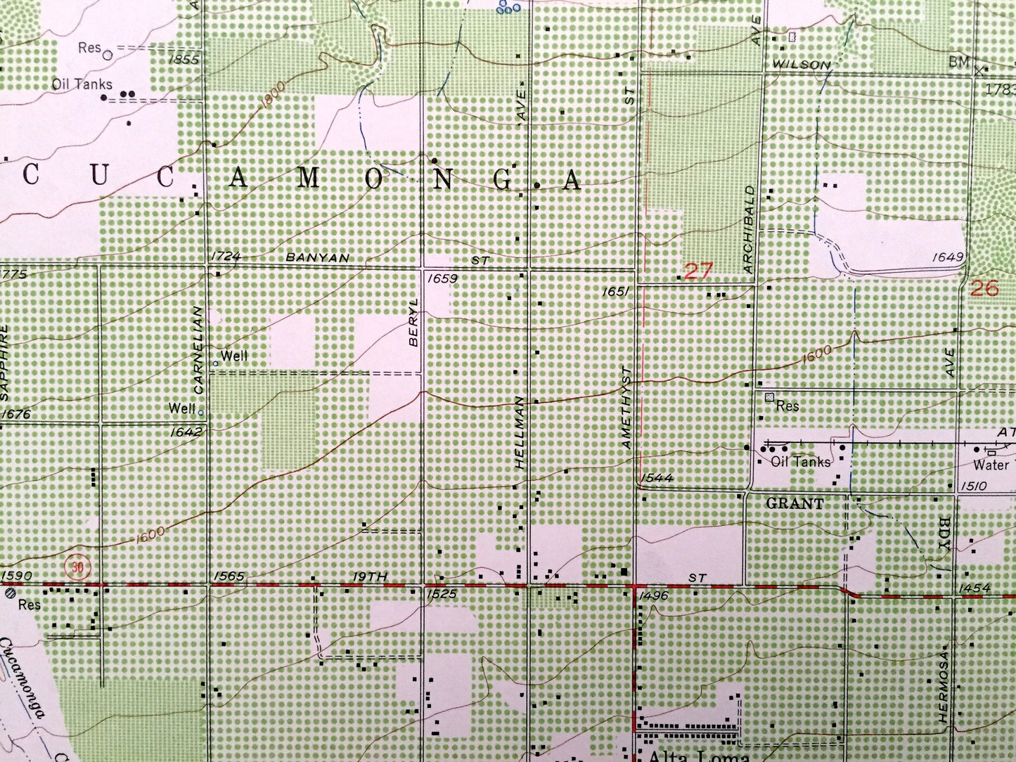
Antique Cucamonga Peak, California 1953 US Geological Survey Topographic Map –San Bernardino County, Cucamonga,Alta Loma, Grapeland,Etiwanda
Beautiful, antique map of Cucamonga Peak, California and surrounding San Bernardino County area. This is an authentic 1953 print from the U.S. Geological Survey and NOT a computer reproduction.
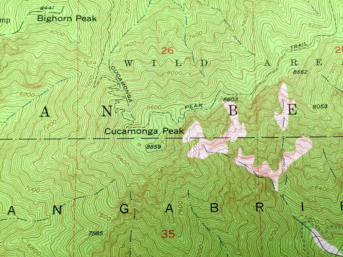
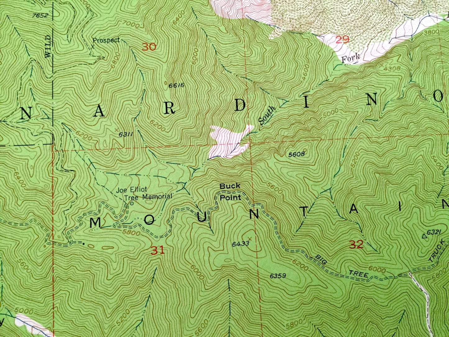
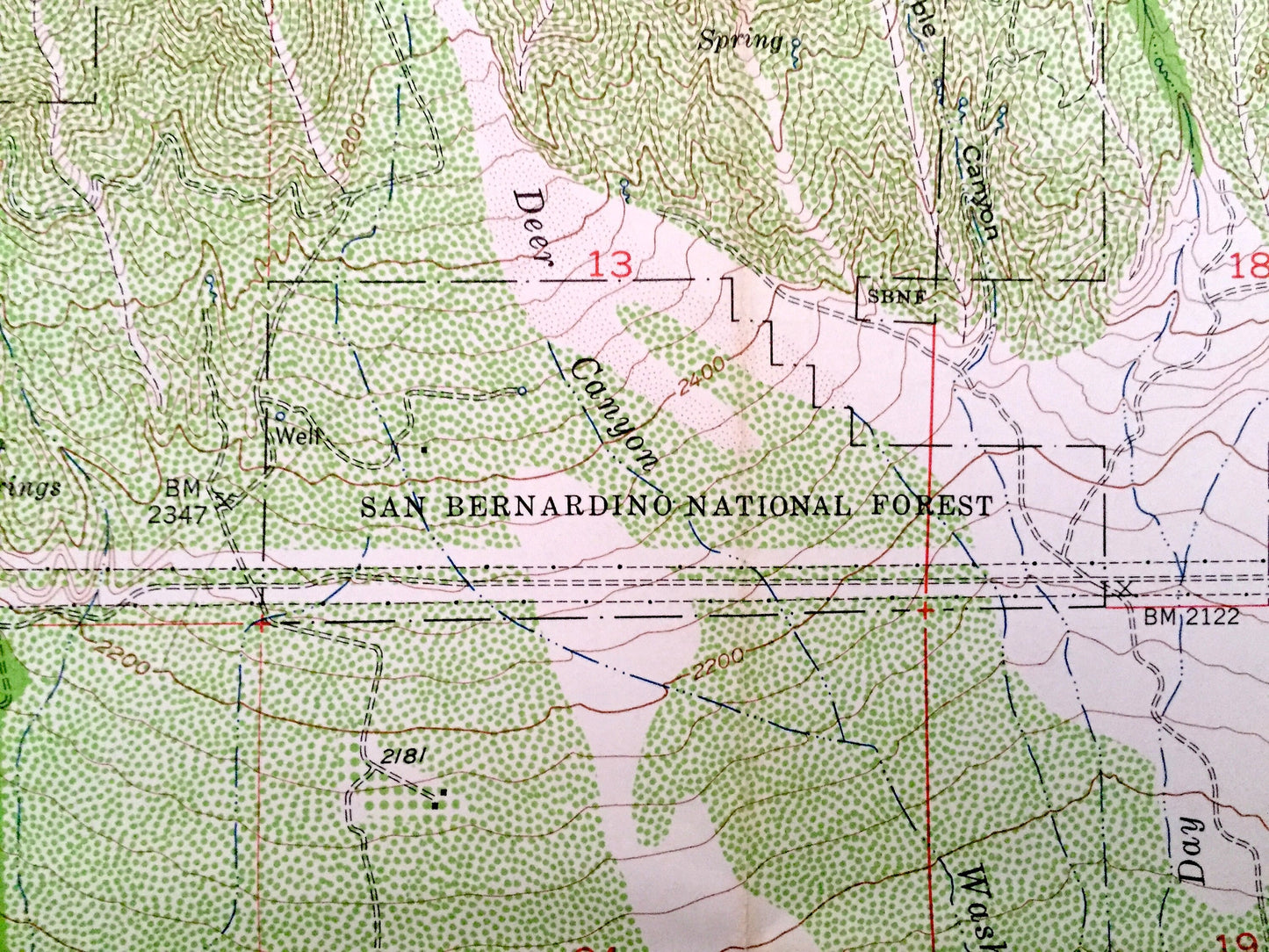
See what California looked like 65 years ago. Lots of intricate details and geological contours. Map even has little squares for every house that existed at the time. The USGS cartographers were very thorough back then!
Perfect for the historian, map-lover, the curious or just as a conversation starter. Wonderful and rare. Vintage maps such as these make great gifts.
Edition of 1953, printed 1953
Dimensions: 22" width x 27" height
----
Features
Cities & Towns: Cucamonga, Alta Loma, Grapeland, Etiwanda.
Points of Interest: Cucamonga Peak, Angeles National Forest, San Bernardino National Forest, San Gabriel Mountains, Cucamonga Wild Area, Sheep Flat, Ontario Peak, Bighorn Peak, Kelly Camp, Timber Mountain, Buck Point, San Sevaine Flats, Day Canyon, Smith Ridge, East Etiwanda Canyon, Cucamonga Canyon, Deer Canyon, Icehouse Canyon, and many more hills, streams, ponds, houses, schools, churches and roads.
Condition: Very Good condition, commensurate with age. This map is in incredible shape for being 65 years old. Has some fold marks, but this will read as vintage character when framed.
----
We will happily adjust shipping price for multiple purchases. Maps are rolled up and shipped in sturdy mailing tubes, never folded.
Couldn't load pickup availability
Share