My Store
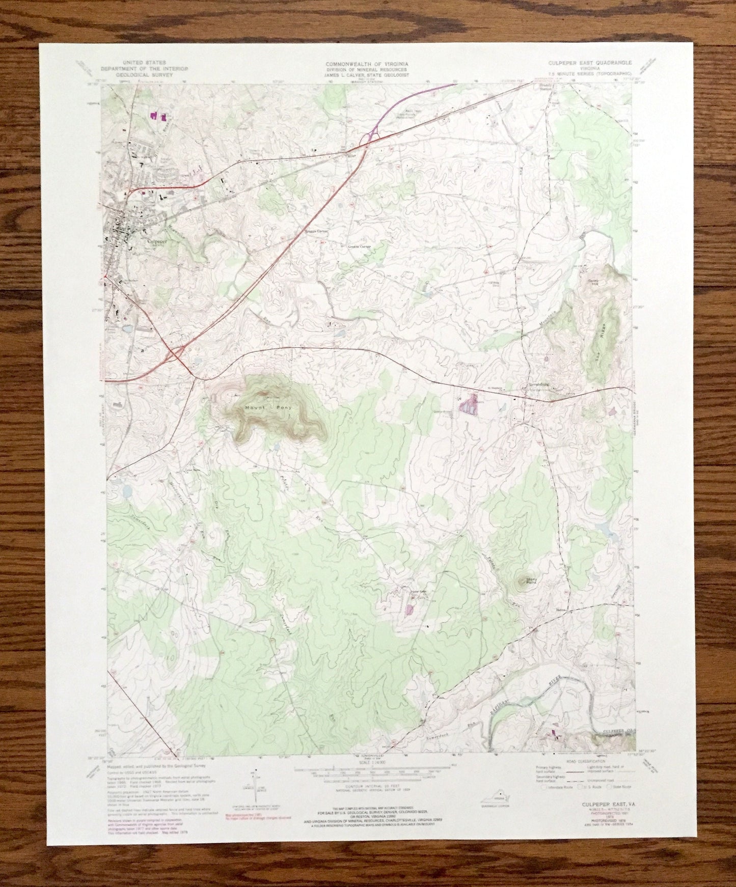
Antique Culpeper East, Virginia 1973 US Geological Survey Topographic Map – Orange County, Stevensburg, Brandy Station, Mount Pony, VA
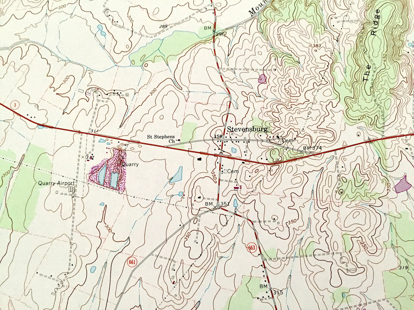
Antique Culpeper East, Virginia 1973 US Geological Survey Topographic Map – Orange County, Stevensburg, Brandy Station, Mount Pony, VA
Beautiful, antique map of Culpeper, Virginia and surrounding Culpeper County and Orange County area. This is an authentic 1973 edition, 1978 print from the U.S. Geological Survey and NOT a computer reproduction.
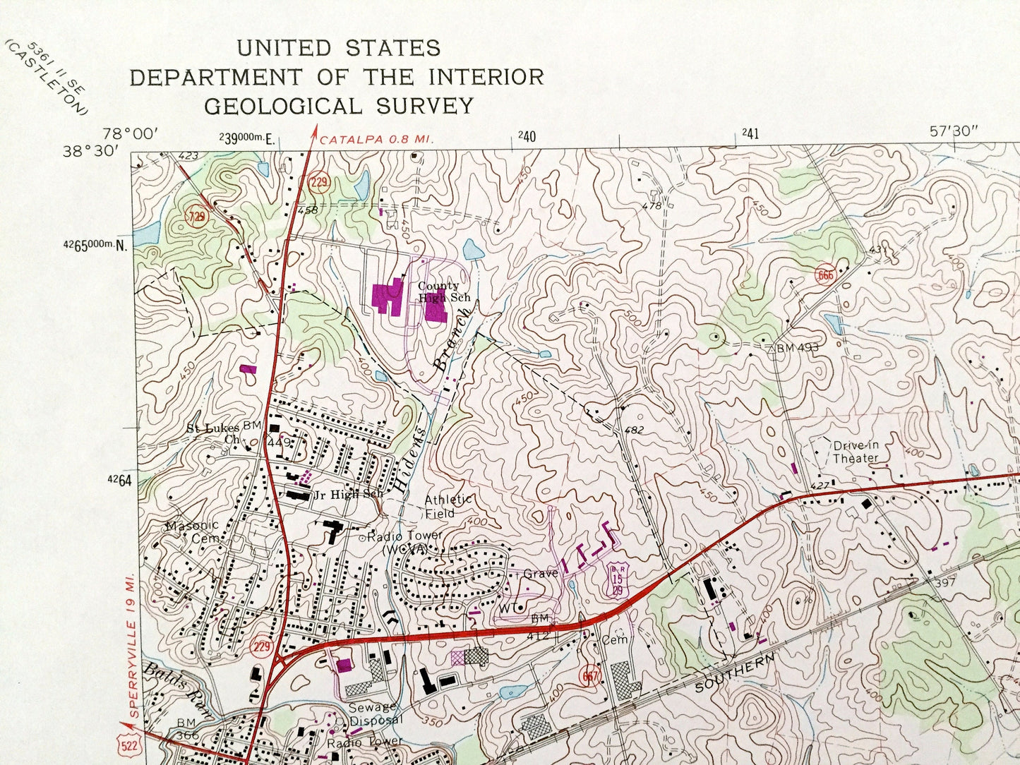
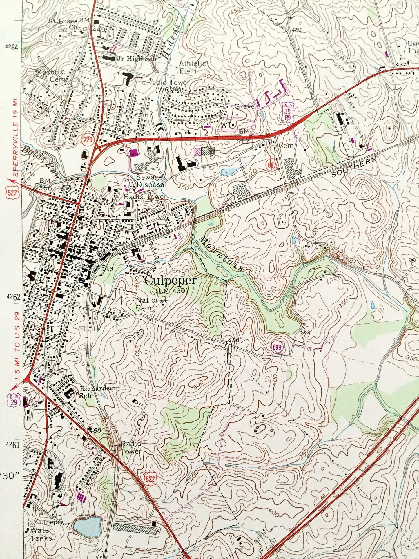
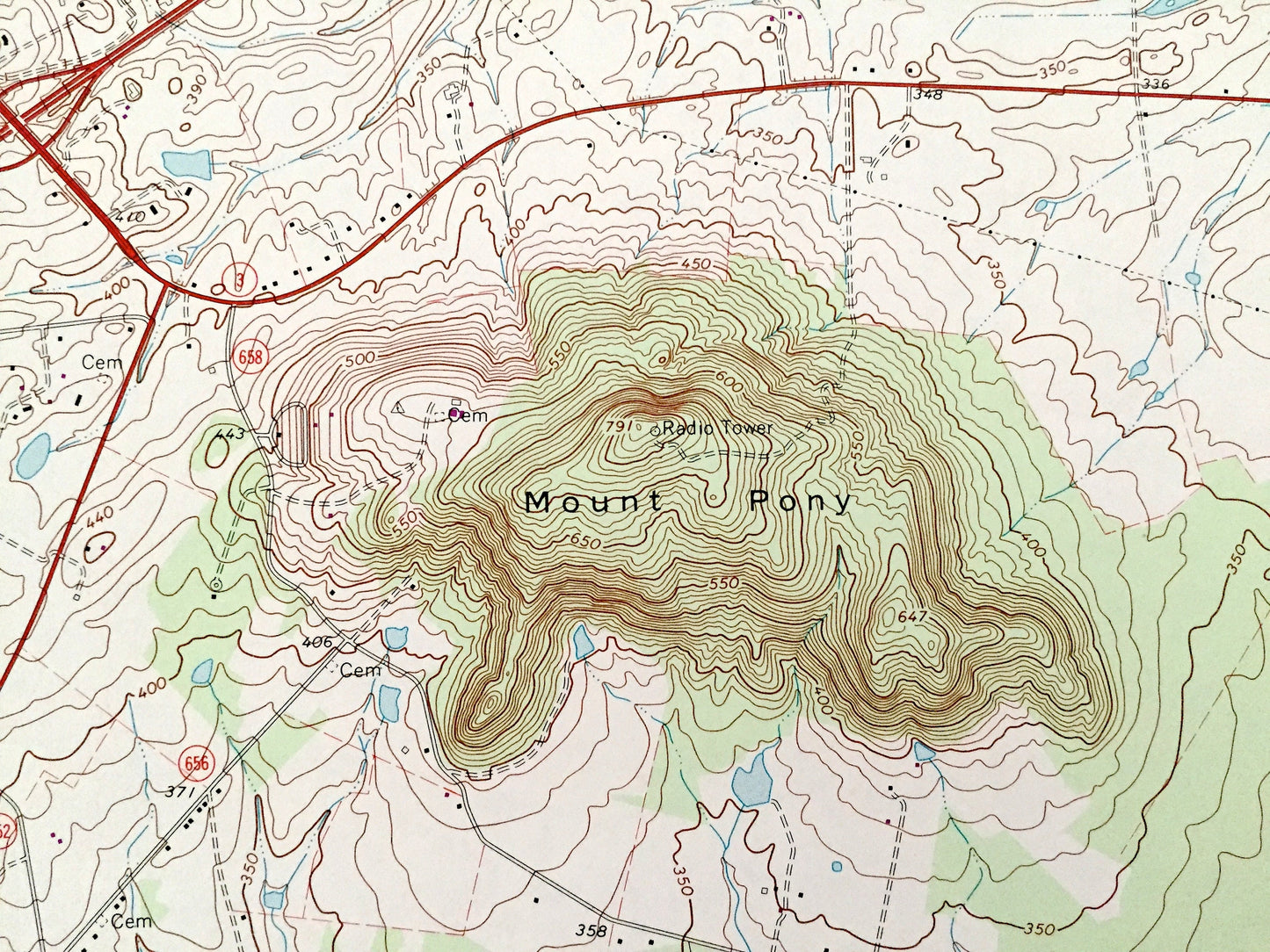
See what Virginia looked like 50 years ago. Lots of intricate details and geological contours. Map even has little squares for every house that existed at the time. The USGS cartographers were very thorough back then!
Perfect for the historian, map-lover, the curious or just as a conversation starter. Wonderful and rare. Vintage maps such as these make great gifts.
Edition of 1973, printed 1978
Dimensions: 22" width x 27" height
----
Features
Cities & Towns: Culpeper, Brandy Station, Stevensburg, Inlet, Batna, Braggs Corner, Greens Corner.
Points of Interest: Orange County, Culpepper County, Rapidan River, Mount Pony, Mountain Run, Coles Hill, The Ridge, Sumerduck Run, Stony Point , and lots more hills, mountains, rivers, streams, ponds, lakes, houses, churches, schools and roads.
Condition: Good Vintage condition, commensurate with age. This map is in great shape for being 50 years old. Has light edge-wear but this will add to the real vintage character when framed.
----
We will happily adjust shipping price for multiple purchases. Maps are rolled up and shipped in sturdy mailing tubes, never folded.
Couldn't load pickup availability
Share