My Store
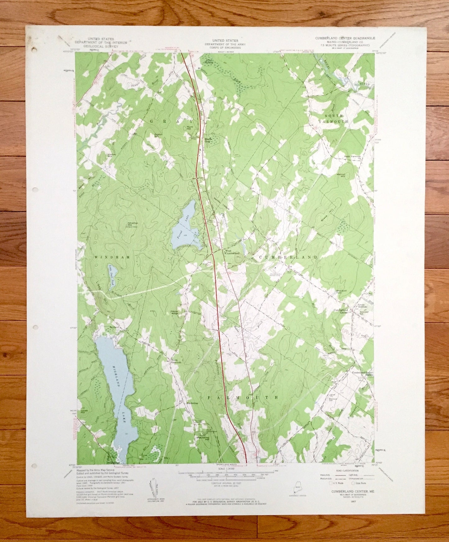
Antique Cumberland Center, Maine 1957 US Geological Survey Topographic Map – County, Gray, Windham, Falmouth, North Yarmouth, Forest Lake ME
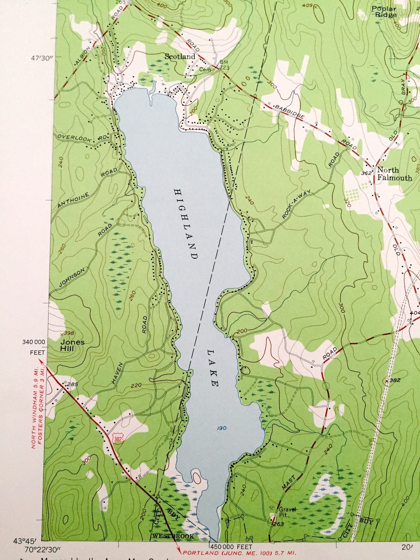
Antique Cumberland Center, Maine 1957 US Geological Survey Topographic Map – County, Gray, Windham, Falmouth, North Yarmouth, Forest Lake ME
Beautiful, antique map of Cumberland Center, Maine and surrounding Cumberland County area. This is an authentic 1957 edition, 1959 print from the U.S. Geological Survey and NOT a computer reproduction.
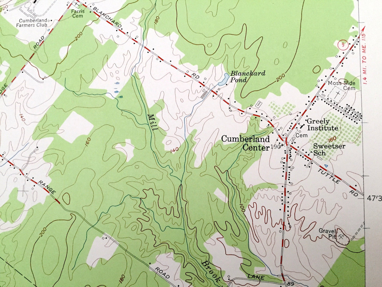
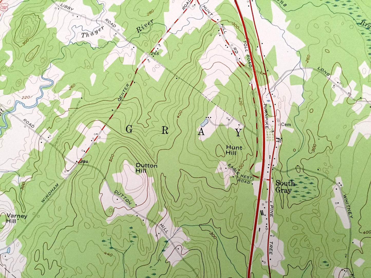
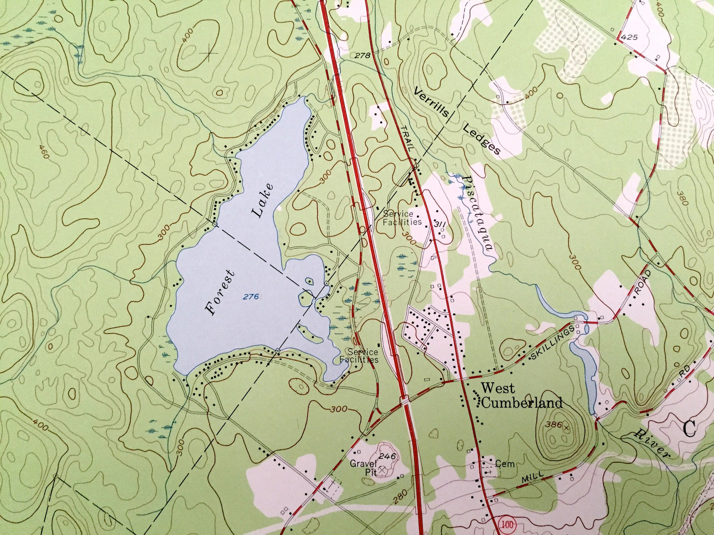
See what Maine looked like over 60 years ago. Lots of intricate details and geological contours. Map even has little squares for every house that existed at the time. The USGS cartographers were very thorough back then!
Perfect for the historian, map-lover, the curious or just as a conversation starter. Wonderful and rare. Vintage maps such as these make great gifts.
Edition of 1957, printed 1959
Dimensions: 22" width x 27" height
----
Features
Cities & Towns: Gray, Windham, Falmouth, North Yarmouth, Westbrook, South Gray, West Cumberland, Scotland, North Falmouth, Blackstrap.
Points of Interest: Greeley Institute, Cumberland Farmers Club, Mount Independence, Varney Hill, Dutton Hill, Hunt Hill, Atherton Hill, Poplar Ridge, Blackstrap Hill, Bruce Hill, Forest Lake, Highland Lake, Pleasant River, Royal River, Piscataqua River, Thayer Brook, Wiggins Brook, Baker Brook, McIntosh Brook, and many more hills, streams, ponds, houses, schools, railroads, churches and roads.
Condition: Very Good Vintage condition, commensurate with age. This map is in great shape for being over 60 years old. Has subtle edge-wear with some staining and a four-hole-punch on the left hand margin, all of which will read as character when framed.
----
We will happily adjust shipping price for multiple purchases.
Couldn't load pickup availability
Share