My Store
Antique Cumberland, Maryland 1949 US Geological Survey Topographic Map – Allegany County, Pennsylvania, West Virginia, Ridgeley Ellerslie MD
Antique Cumberland, Maryland 1949 US Geological Survey Topographic Map – Allegany County, Pennsylvania, West Virginia, Ridgeley Ellerslie MD
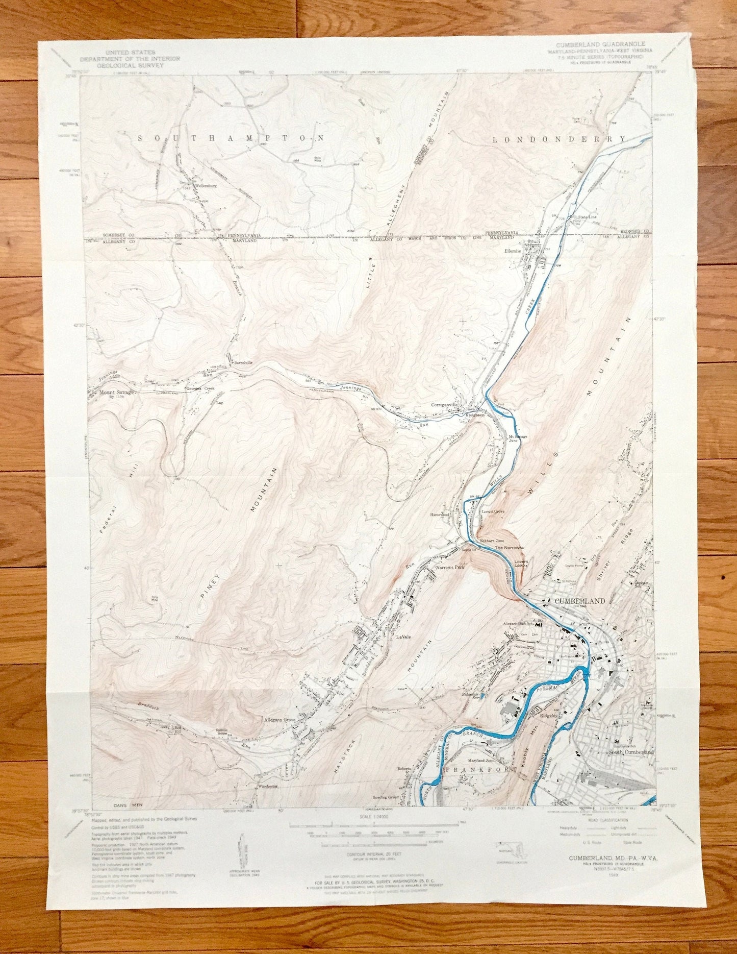
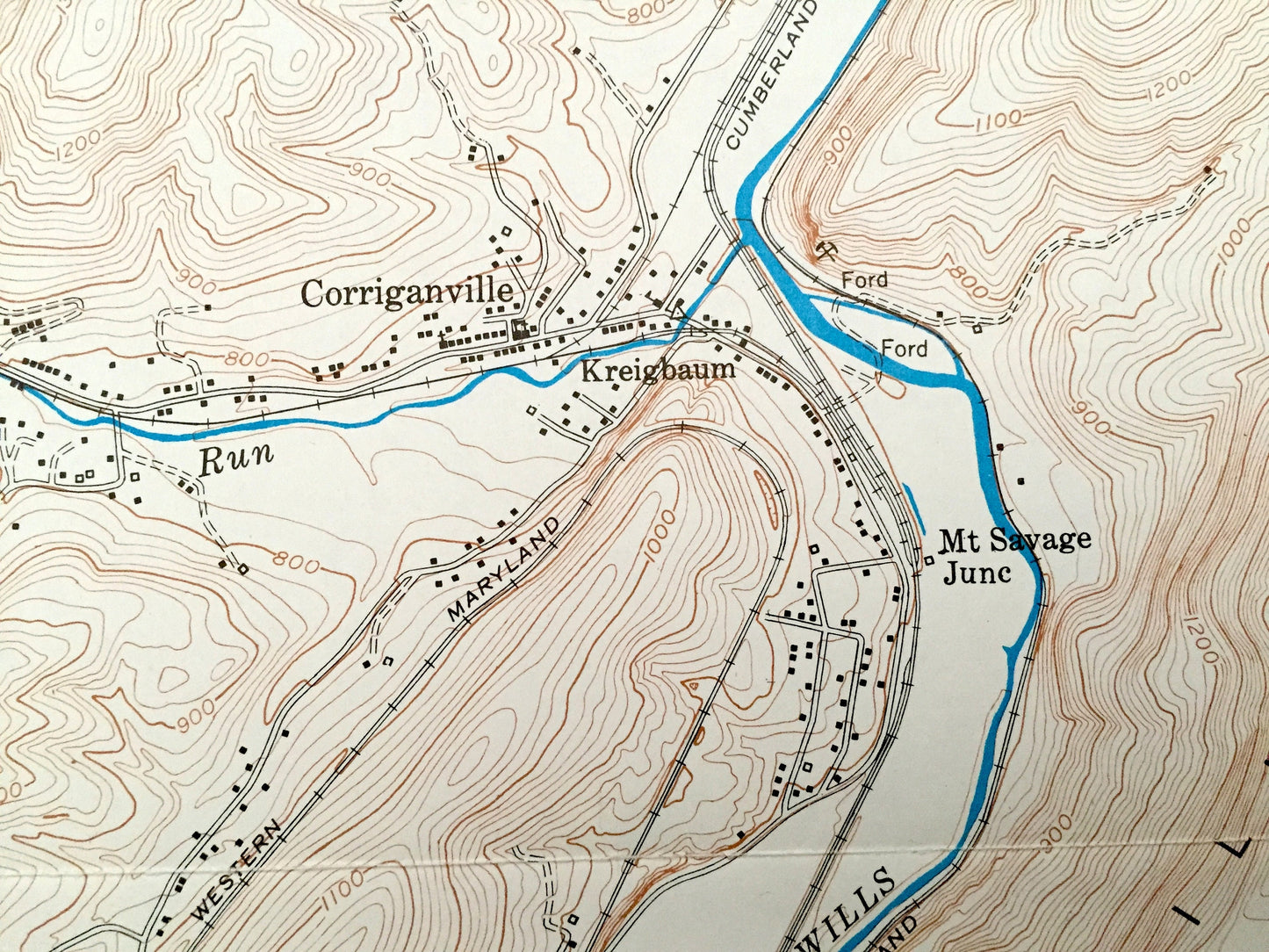
Beautiful, antique map of Cumberland, Maryland and surrounding Allegany County, including parts of Somerset & Bedford County, Pennsylvania and Mineral County, West Virginia. This is an authentic 1949 edition, 1962 print from the U.S. Geological Survey and NOT a computer reproduction.
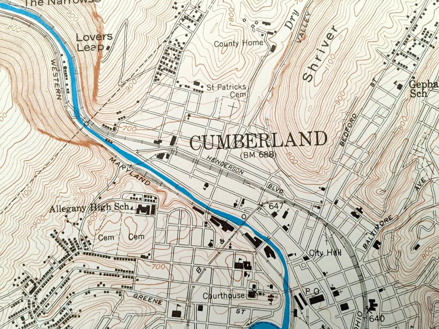
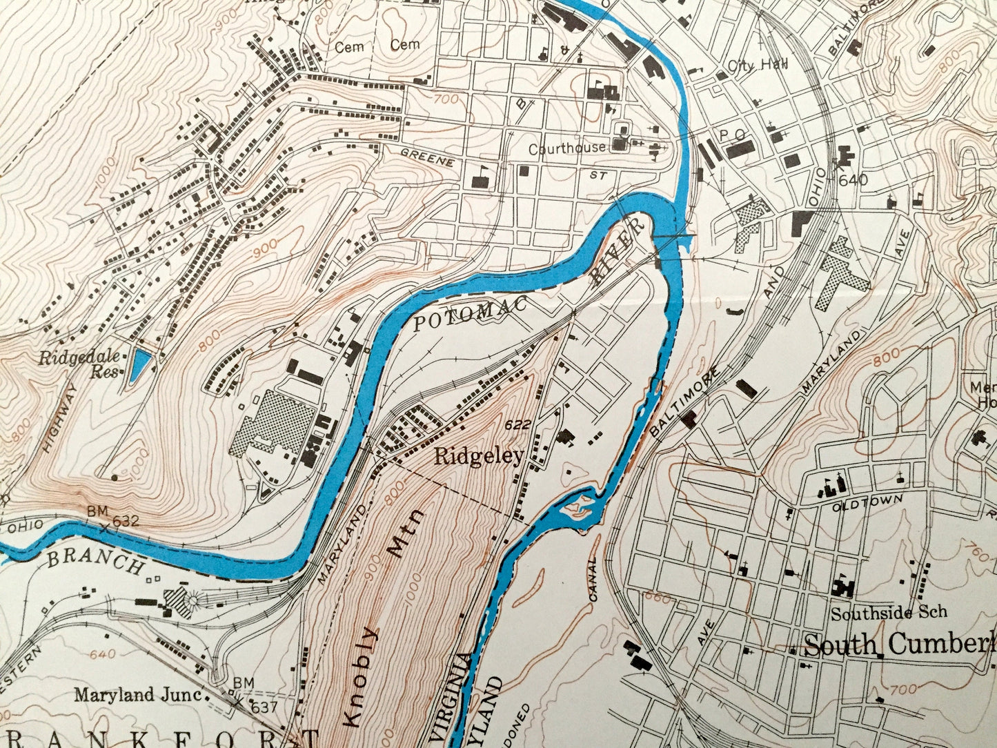
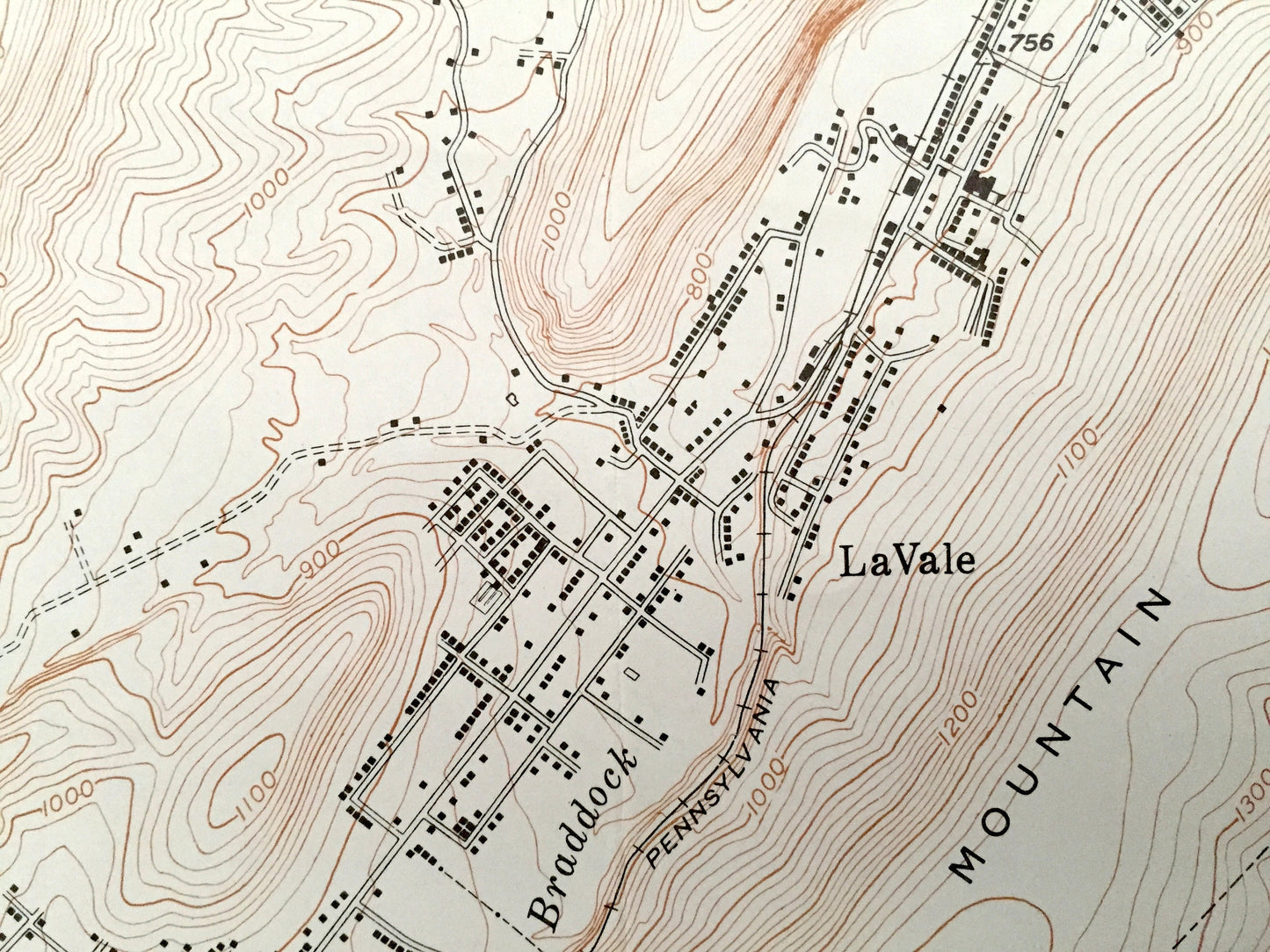
See what Western Maryland on the Potomac River looked like over 70 years ago. Lots of intricate details and geological contours. Map even has little squares for every house that existed at the time. The USGS cartographers were very thorough back then!
Perfect for the historian, map-lover, the curious or just as a conversation starter. Wonderful and rare. Vintage maps such as these make great gifts.
Edition of 1949, printed 1962
Dimensions: 20" width x 27" height
----
Features
Cities & Towns: MARYLAND: Cumberland, Mount Savage, Barrelville, Georges Creek, Corriganville, Ellerslie, Homewood, Locust Grove, Narrows Park, LaVale, Allegany Grove, South Cumberland, Winchester, Roberts, Bowling Green, Sixmile House, Red Hill, Lap, Narrows Park.
PENNSYLVANIA: Southampton, Londonderry, Wellersburg, State Line.
WEST VIRGINIA: Frankfort, Ridgeley, Maryland Junction.
Points of Interest: Allegany County, Mineral County, Somerset County, Bedford County, Potomac River, Wills Creek, Piney Mountain, Federal Hill, Wills Mountain, The Narrows, Lovers Leap, Haystack Mountain, Knobly Mountain, Jennings Run, Shriver Ridge, Little Allegheny Mountain, Braddock Run and lots more hills, mountains, creeks, towns, schools, churches, roads and marshes.
Condition: Good Vintage condition, commensurate with age. This map is in great shape for being 60 years old. Has light edge-wear, old now-flattened fold lines, but this will add to vintage character when framed.
----
We will happily adjust shipping price for multiple purchases. Maps are rolled up and shipped in sturdy mailing tubes, never folded.
Couldn't load pickup availability
Share