My Store
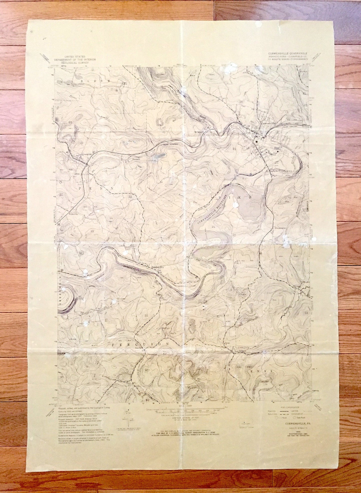
Antique Curwensville, Pennsylvania 1959 US Geological Survey Topographic Map – Clearfield County, Lake, Lumber City, Grampian Susquehanna PA
Antique Curwensville, Pennsylvania 1959 US Geological Survey Topographic Map – Clearfield County, Lake, Lumber City, Grampian Susquehanna PA
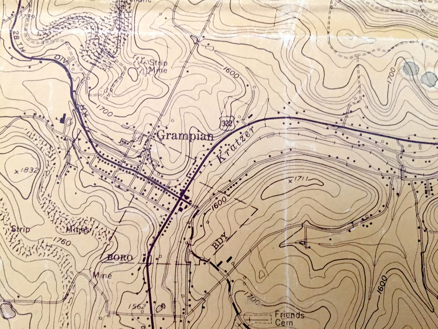
Beautiful, antique map of Curwensville, Pennsylvania and surrounding Clearfield County area. This is an authentic 1959 edition, 1970 print from the U.S. Geological Survey and NOT a computer reproduction.
See what Pennsylvania looked like over 60 years ago. Lots of intricate details and geological contours. Map even has little squares for every house that existed at the time. The USGS cartographers were very thorough back then! This is a rare duplicate, possibly used in the field.
Perfect for the historian, map-lover, the curious or just as a conversation starter. Wonderful and rare. Vintage maps such as these make great gifts.
Edition of 1959, printed 1970
Dimensions: 21" width x 30 1/2" height
----
Features
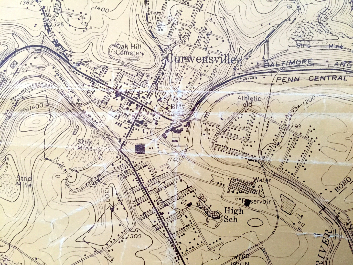
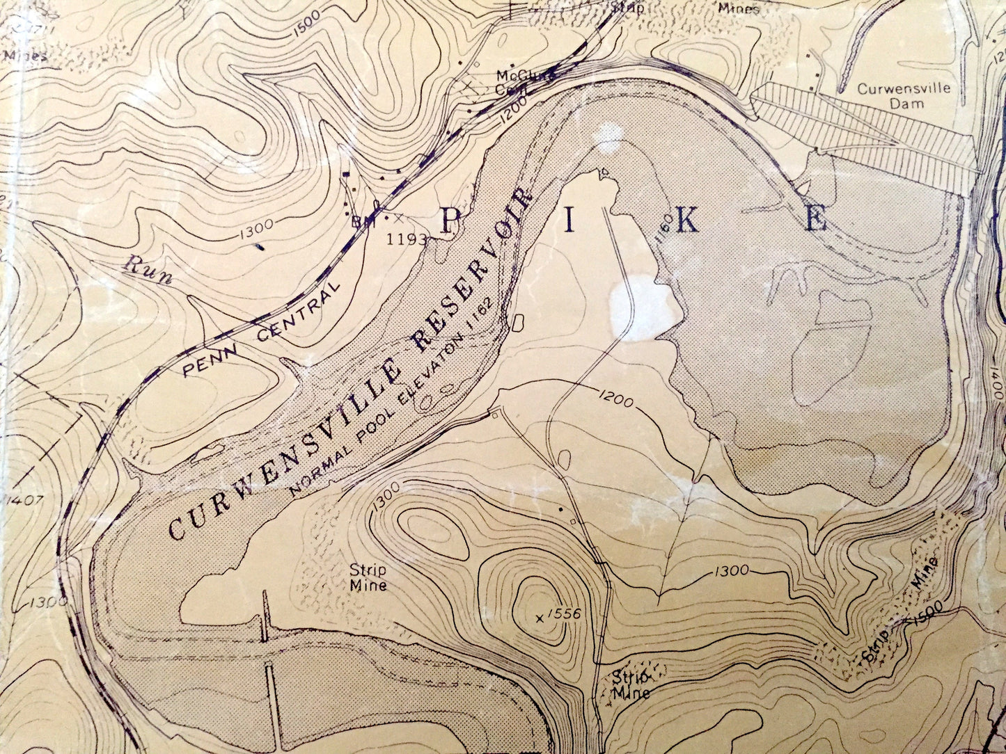
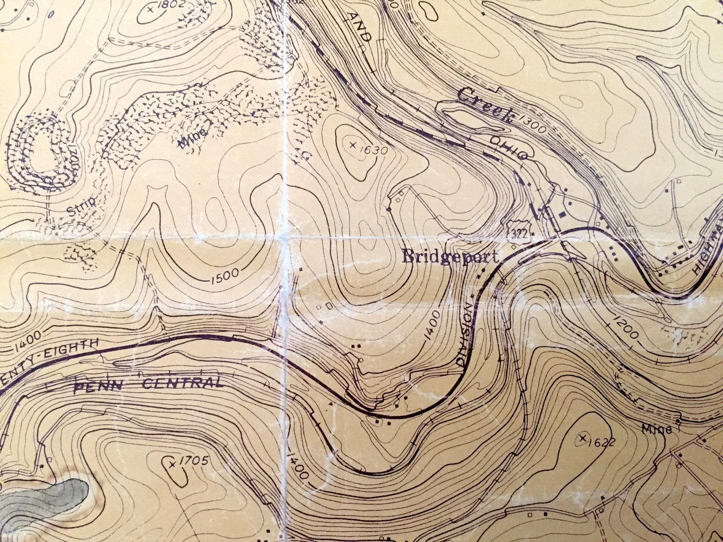
Cities & Towns: Curwensville, Bloom, Penn, Pike, Ferguson, Knox, Greenwood, Grampian, Stronach, Hepburnia, Bridgeport, Lumber City, Kerrmoor, Olanta, New Millport
Points of Interest: Clearfield County, Curwensville Lake (Reservoir), Susquehanna River, Clearfield Creek, Watts Creek, Gazzam Run, and lots more hills, mountains, creeks, towns, roads and train tracks.
Condition: Good or "Very Vintage" condition, commensurate with age. This map is in great shape for being over 50 years old. Has some wear, coloring, rips in margins marks and folds as-issued, but these will flatten easily and all will read as vintage character when framed.
----
We will happily adjust shipping price for multiple purchases.
Couldn't load pickup availability
Share