My Store
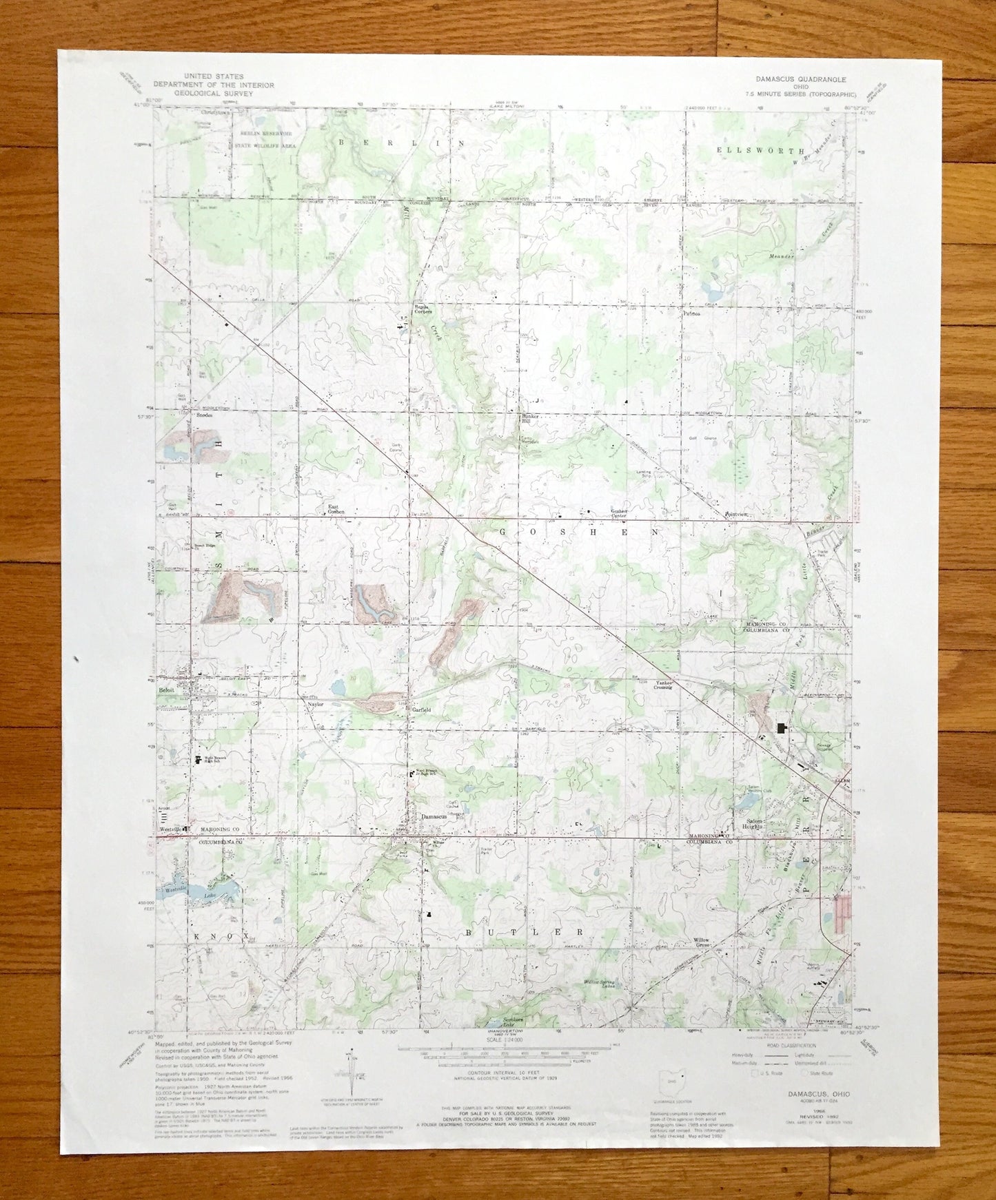
Antique Damascus, Ohio 1966 US Geological Survey Topographic Map — Mahoning, Columbiana County, Berlin, Ellsworth, Smith, Goshen, Butler, OH
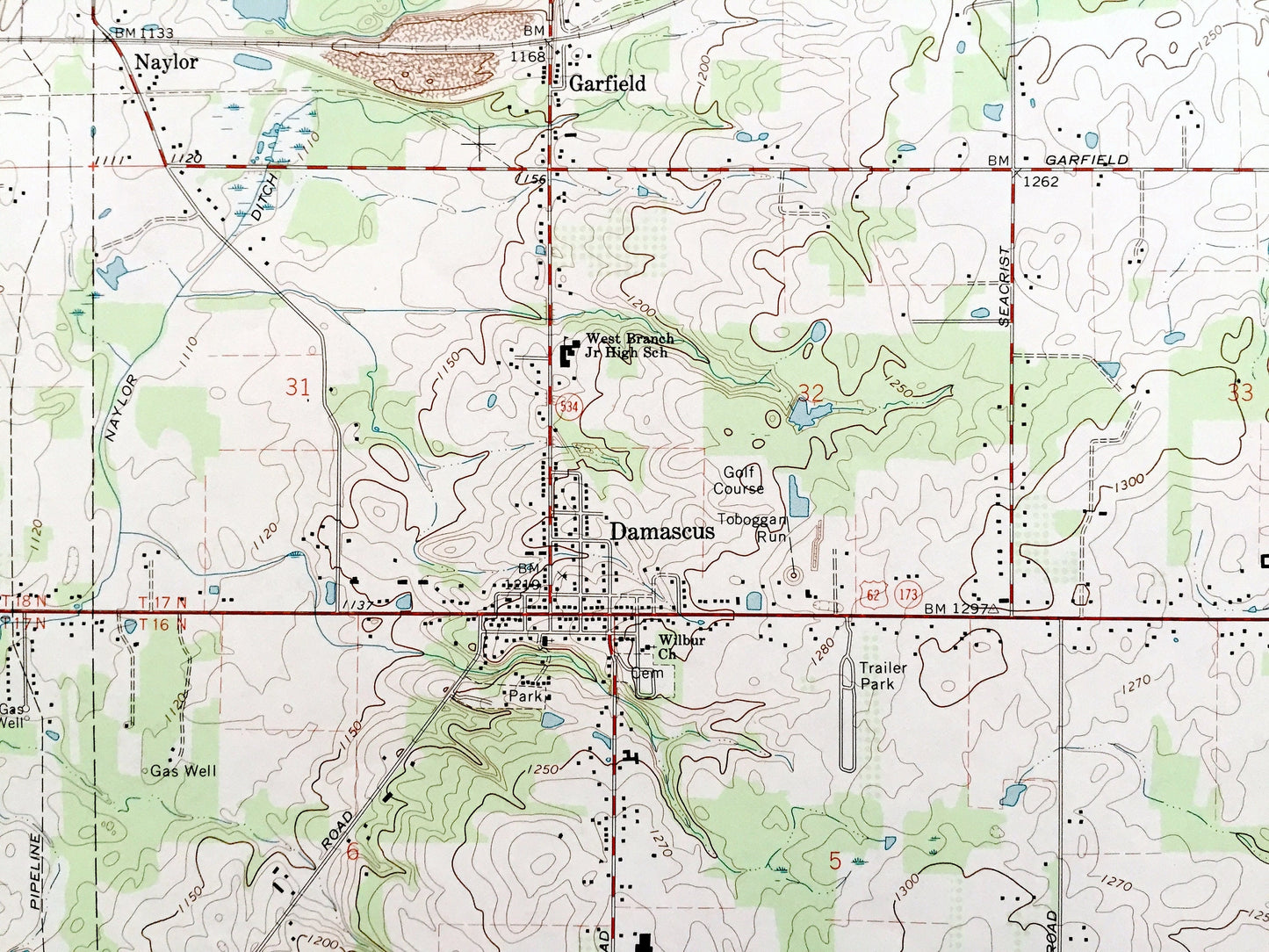
Antique Damascus, Ohio 1966 US Geological Survey Topographic Map — Mahoning, Columbiana County, Berlin, Ellsworth, Smith, Goshen, Butler, OH
Beautiful, antique map of Damascus, Ohio and surrounding Mahoning County and Columbiana County areas. This is an authentic 1966 edition, 1992 print from the U.S. Geological Survey and NOT a computer reproduction.
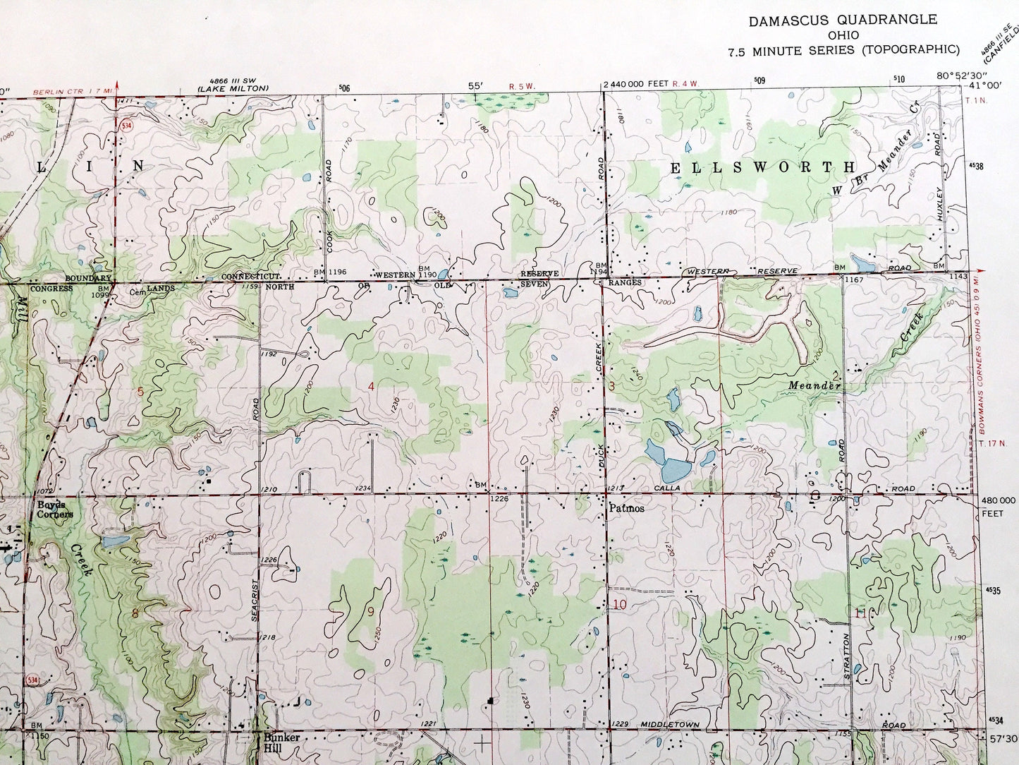
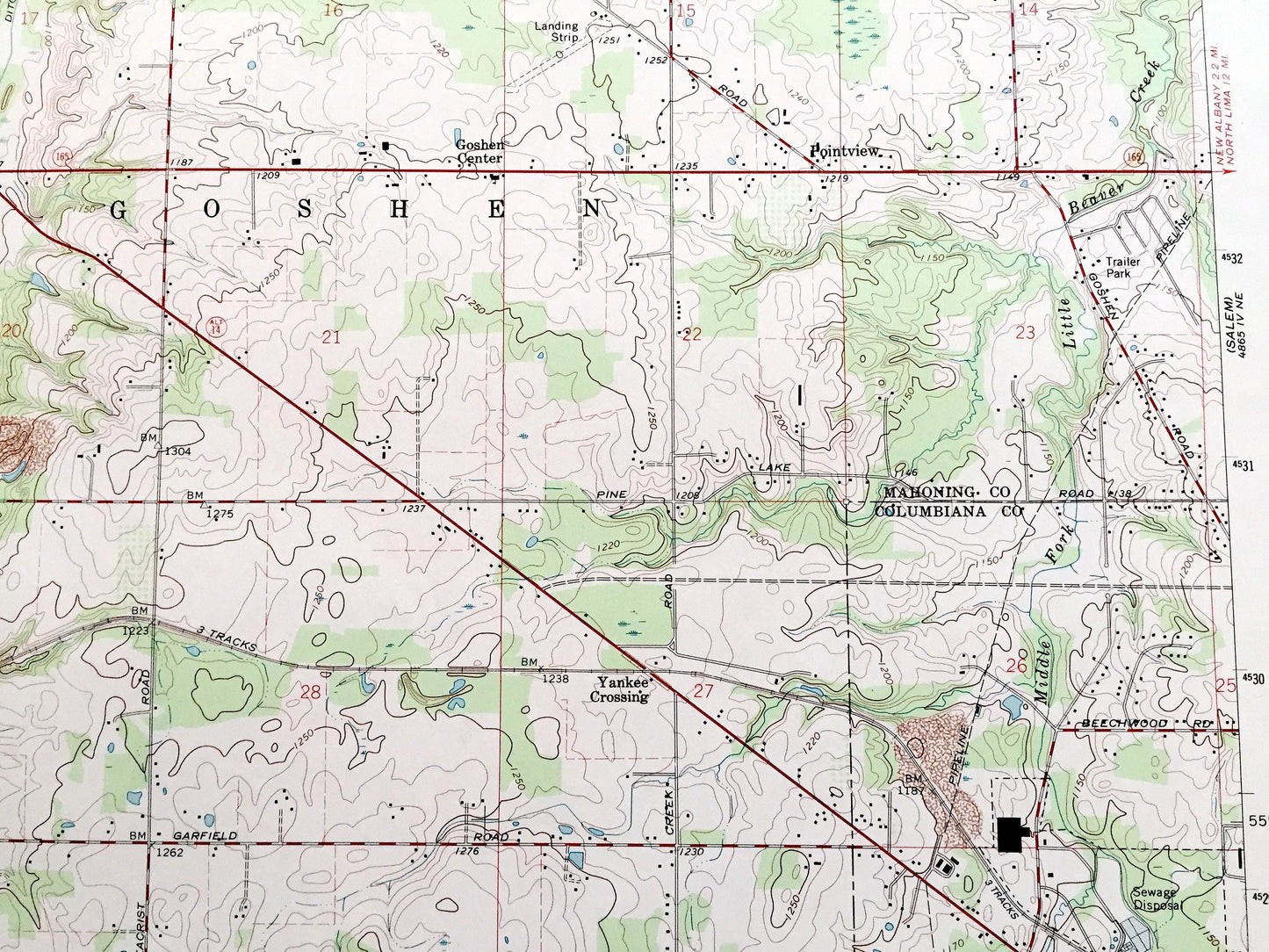
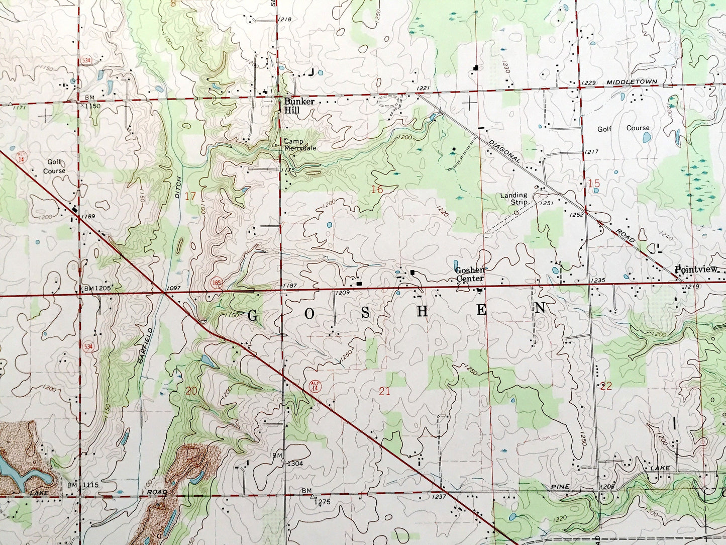
See what Ohio looked like over 55 years ago. Lots of intricate details and geological contours. Map even has little squares for every house that existed at the time. The USGS cartographers were very thorough back then!
Perfect for the historian, map-lover, the curious or just as a conversation starter. Wonderful and rare. Vintage maps such as these make great gifts.
Edition of 1966, printed 1992
Dimensions: 22" width x 27" height
----
Features
Cities & Towns: Berlin, Ellsworth, Smith, Goshen, Butler, Knox, Perry, Christytown, Snodes, Bunker Hill, Pointview, Goshen Center, East Goshen, Beloit, Garfield, Yankee Crossing, Patmos, Boyds Corners, Salem Heights, Willow Grove, Westville, Naylor.
Points of Interest: Berlin Reservoir State Wildlife Area, Camp Merrydale, Blackburn Hill, Willow Spring Lakes, Sevakeen Lake, Westville Lake, Mill Creek, Meander Creek, Little Beaver Creek, Middle Fork, and many more hills, streams, ponds, houses, schools, railroads, churches and roads.
Condition: Very Good Vintage condition, commensurate with age. This map is in great shape for being over 30 years old. Has subtle edge-wear and fold creases but will read as character when framed.
----
We will happily adjust shipping price for multiple purchases. Maps are rolled up and shipped in sturdy mailing tubes, never folded.
Couldn't load pickup availability
Share