My Store
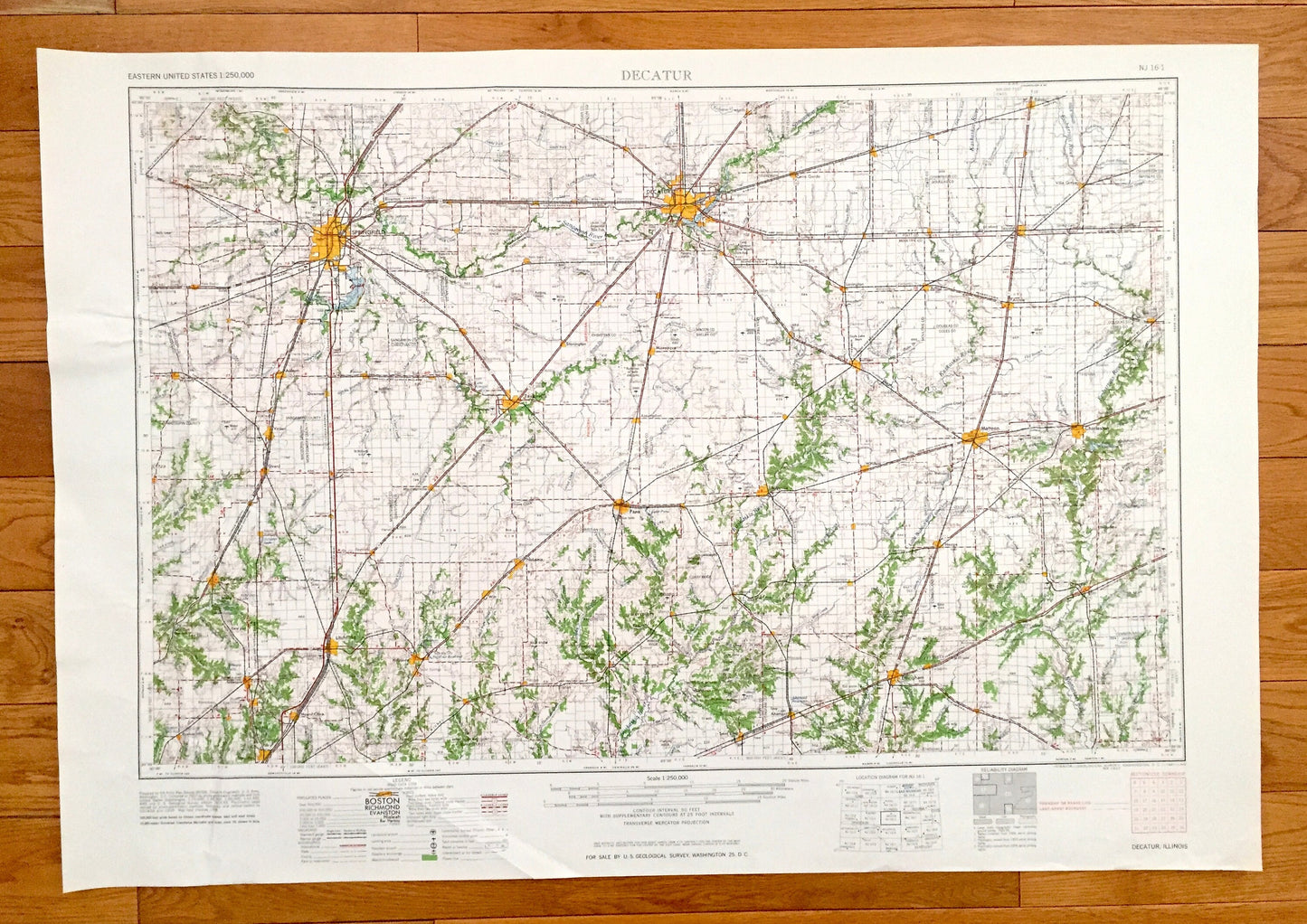
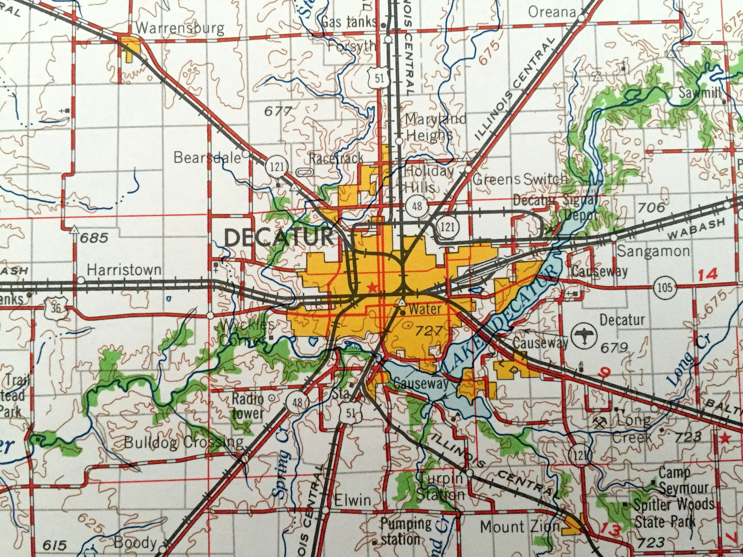
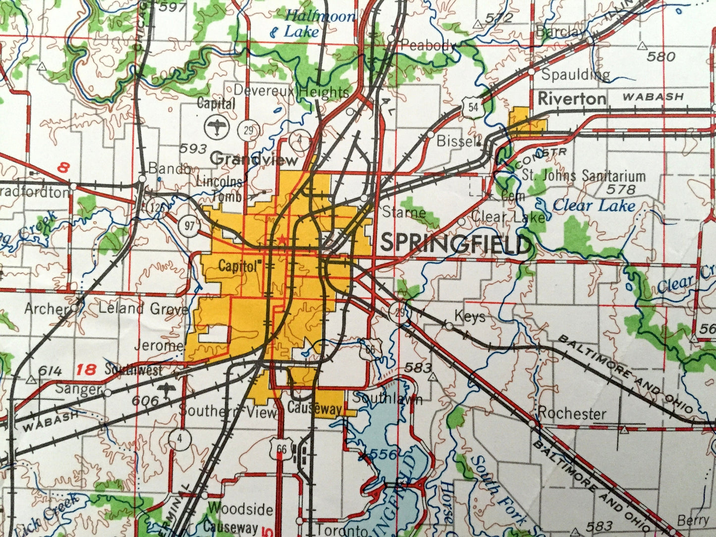
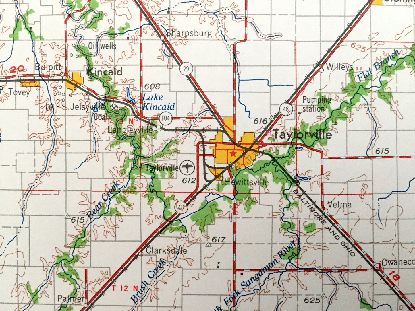
Antique Decatur, Illinois 1961 US Geological Survey Topographic Map – Springfield, Taylorville, Litchfield, Shelbyville, Effingham, Mattoon
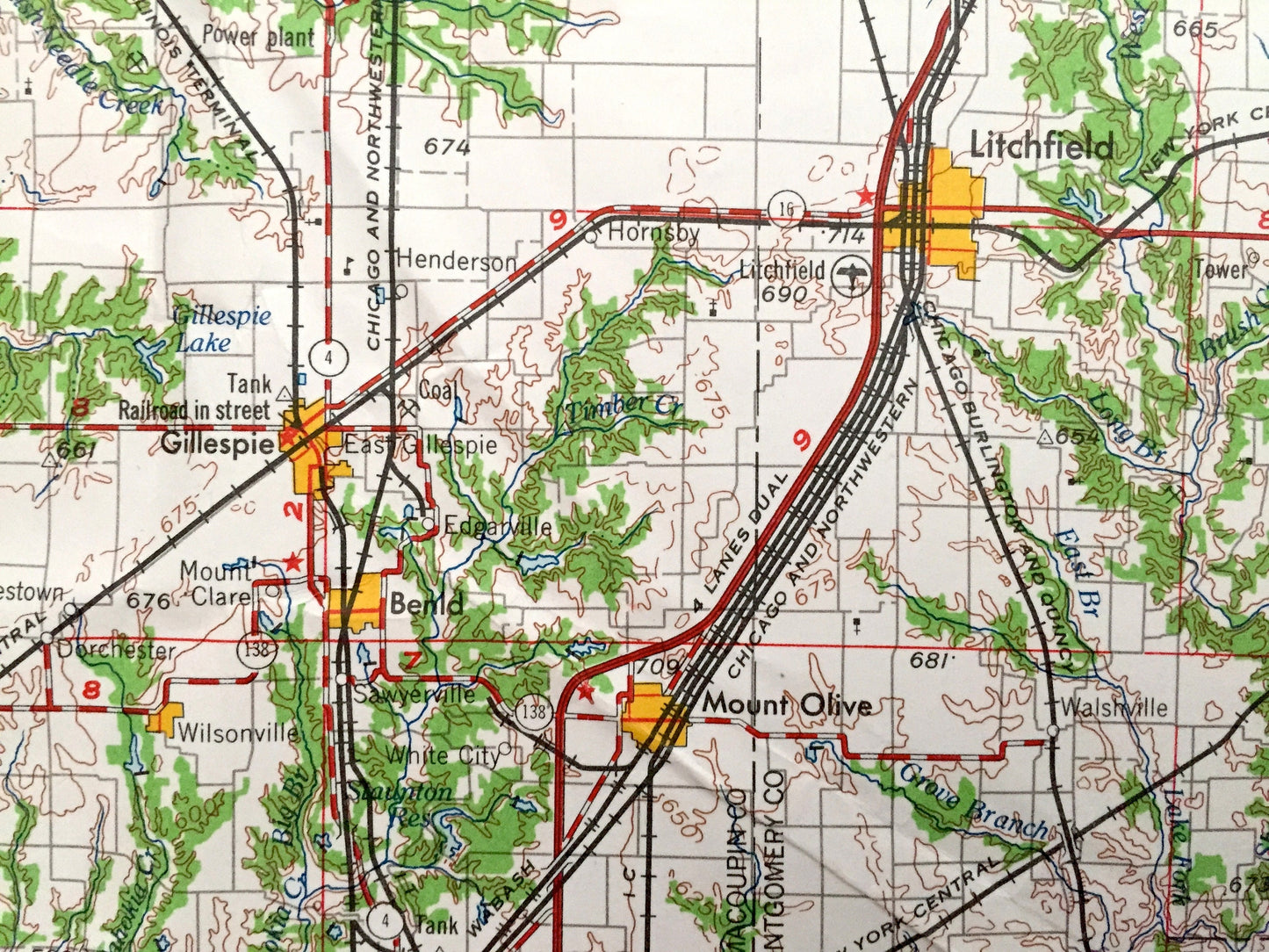
Antique Decatur, Illinois 1961 US Geological Survey Topographic Map – Springfield, Taylorville, Litchfield, Shelbyville, Effingham, Mattoon
Beautiful, antique map of Decatur, Illinois and surrounding area. This is an authentic
1961 edition, 1961 print from the U.S. Geological Survey and NOT a computer reproduction.
See what Illinois looked like over 55 years ago. Lots of intricate details and geological contours. Map is incredibly large and in the grand 1:250,000 scale. The USGS cartographers were very thorough back then!
Perfect for the historian, map-lover, the curious or just as a conversation starter. Wonderful and rare. Vintage maps such as these make great gifts.
Edition of 1961, printed 1961
Dimensions: 32" width x 22 1/2" height
----
Features
Cities & Towns: Decatur, Cerro Gordo, Bement, Tuscola, Arcola, Arthur, Lovington, Sullivan, Charleston, Greenup, Neoga, Pana, Nokomis, Witt, Hillsboro, Litchfield, Mount Olive, Staunton, Bunker Hill, Gillespie, Carlinville, Virden, Waverly, Kincaid, Assumption, Moweaqua, Athens, Springfield, Taylorville, Litchfield, Shelbyville, Effingham, Mattoon.
Points of Interest: Lake Decatur, Lake Springfield, Lake Charleston, Kaskaskia River, Sangamon River, Embarrass River, Stevens Creek, Buckhart Creek, Mosquito Creek and lots more hills, mountains, lakes, rivers, creeks, roads, highways and railroads.
Condition: Very Good condition, commensurate with age. This map is in incredible shape for being over 55 years old. Has some light edge-wears, all of which will read as vintage character when framed.
----
We will happily adjust shipping price for multiple purchases. Maps are rolled up and shipped in sturdy mailing tubes, never folded.
Couldn't load pickup availability
Share