My Store
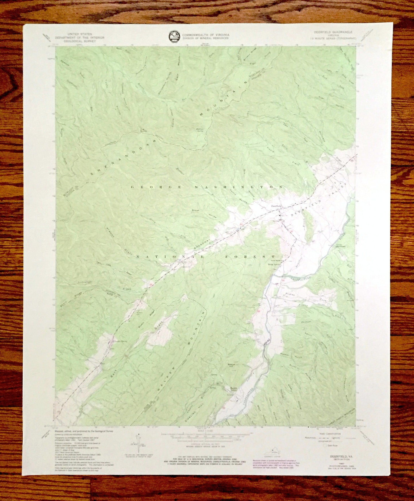
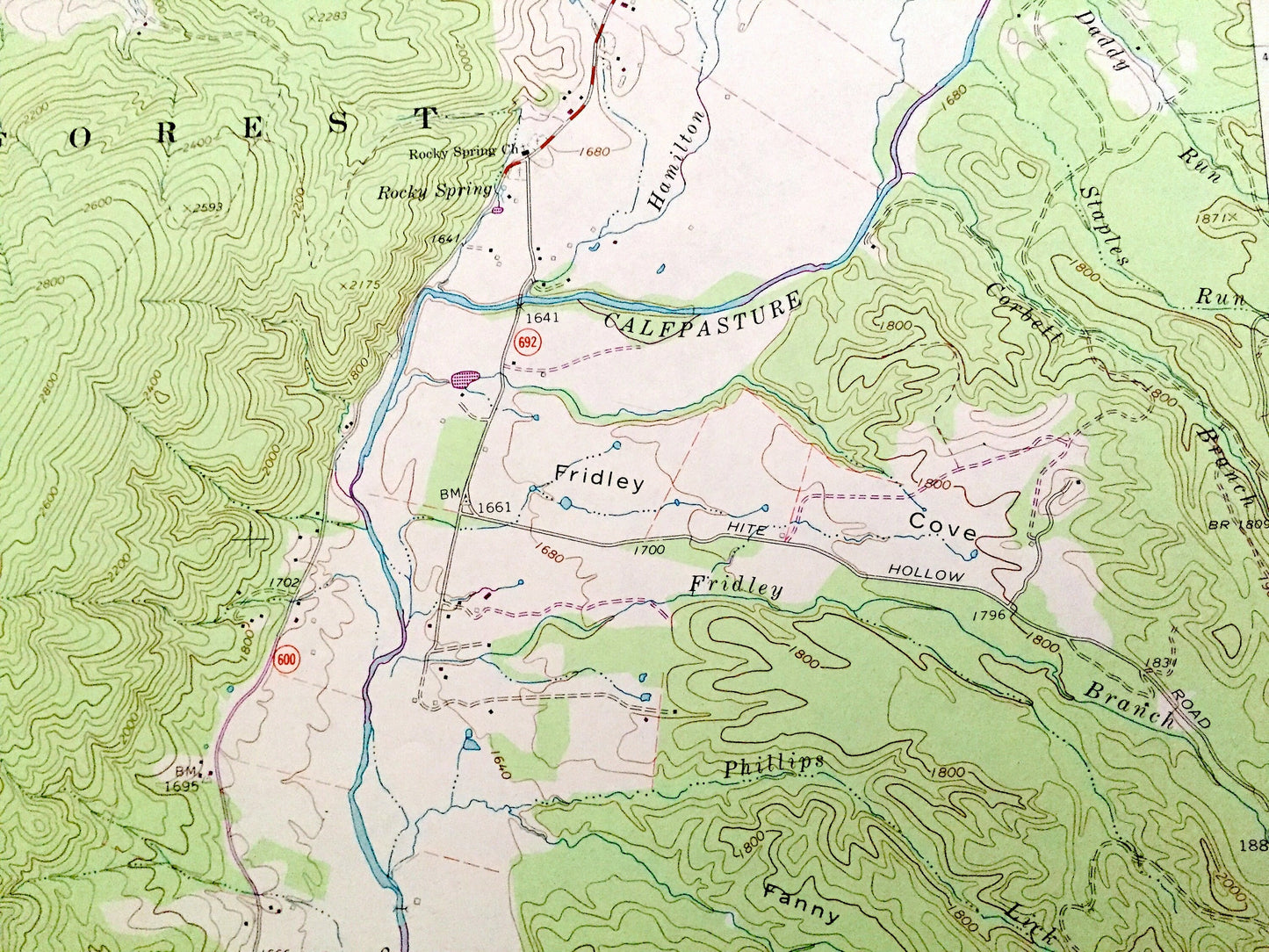
Antique Deerfield, Virginia 1967 US Geological Survey Topographic Map – August, Bath, Highland County, George Washington National Forest, VA
Antique Deerfield, Virginia 1967 US Geological Survey Topographic Map – August, Bath, Highland County, George Washington National Forest, VA
Beautiful, antique map of Deerfield, Virginia and surrounding Highland, Augusta & Bath County area. This is an authentic 1967 edition, 1985 print from the U.S. Geological Survey and NOT a computer reproduction.
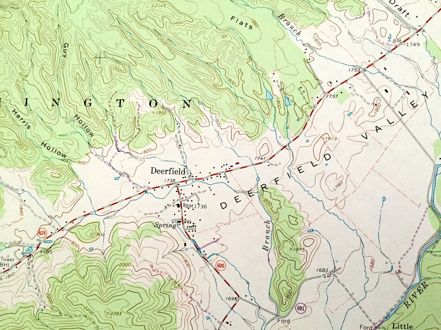
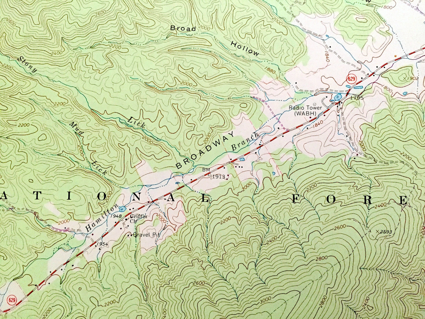
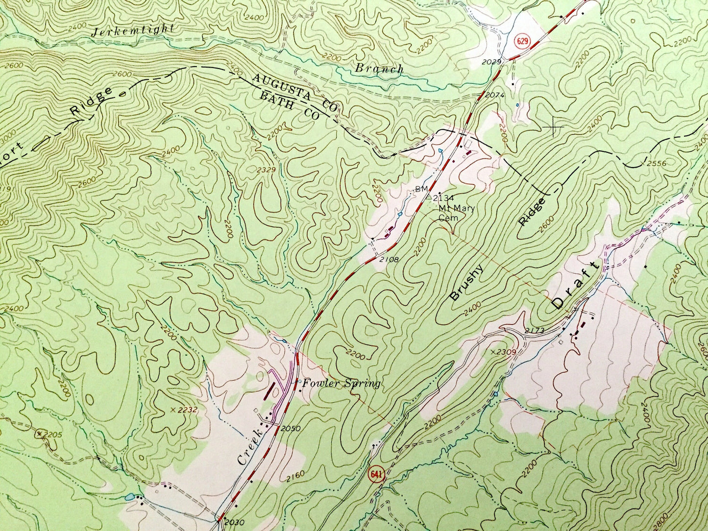
See what Virginia looked like over 55 years ago. Lots of intricate details and geological contours. Map even has little squares for every house that existed at the time. The USGS cartographers were very thorough back then!
Perfect for the historian, map-lover, the curious or just as a conversation starter. Wonderful and rare. Vintage maps such as these make great gifts.
Edition of 1967, printed 1985
Dimensions: 22" width x 27" height
----
Features
Cities & Towns: Deerfield, Little Baltimore, Marble Valley.
Points of Interest: Highland County, Augusta County, Bath County, George Washington National Forest, Shenandoah Mountain, Deerfield Valley, Calfpasture River, Hamilton Branch, Bettys Hill, Sideling Hill, Back Draft, Fridley Cove, Phillips Lick, Clayton Mill Creek, Mays Hollow, Holloway Draft, Brushy Ridge, Tizzle Flats, and many more hills, creek, ponds, houses, schools, churches and roads.
Condition: Very Good Vintage condition, commensurate with age. This map is in great shape for being over 35 years old. Has light edge-wear, but this will add to vintage character when framed.
----
We will happily adjust shipping price for multiple purchases. Maps are rolled up and shipped in sturdy mailing tubes, never folded.
Couldn't load pickup availability
Share