My Store
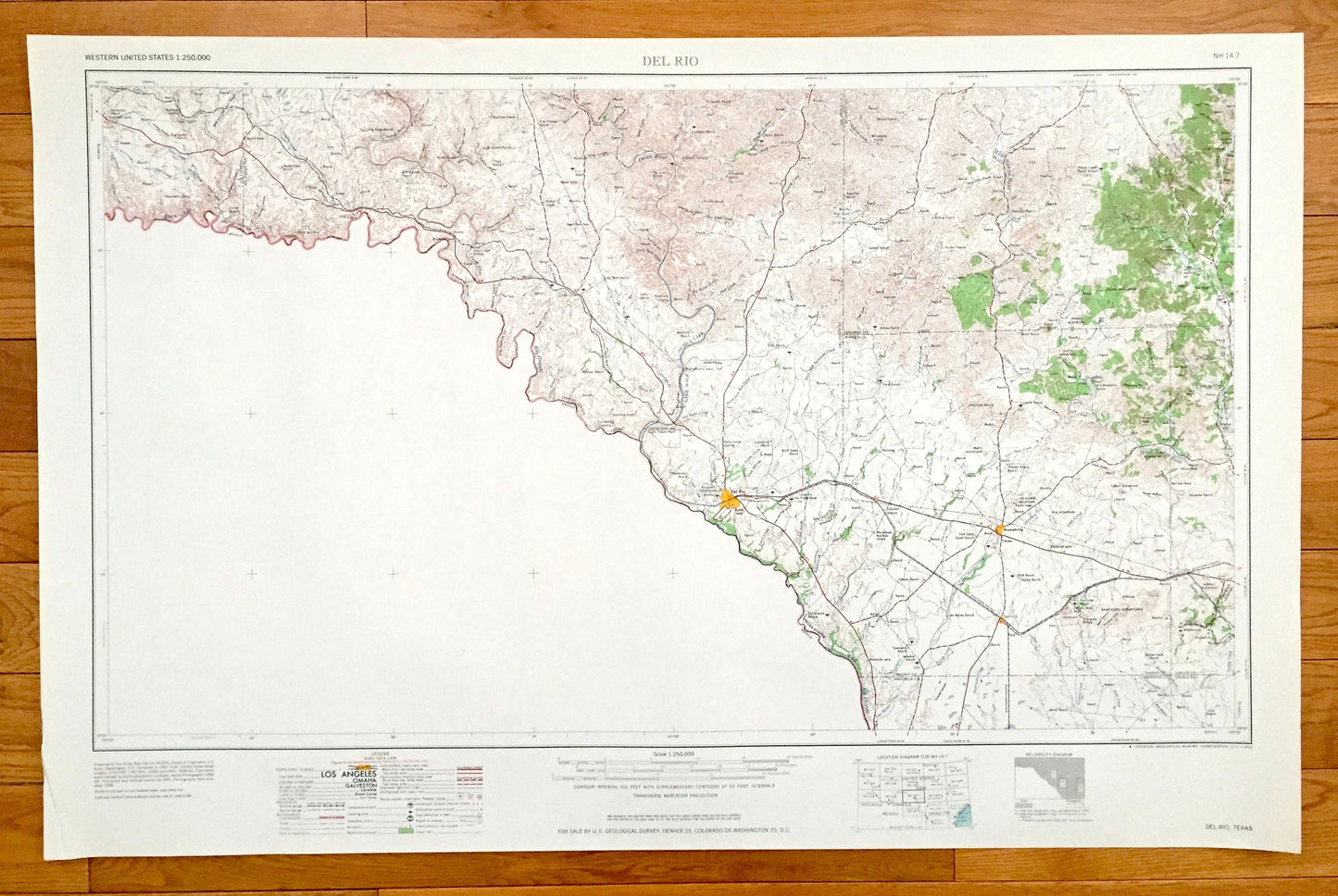
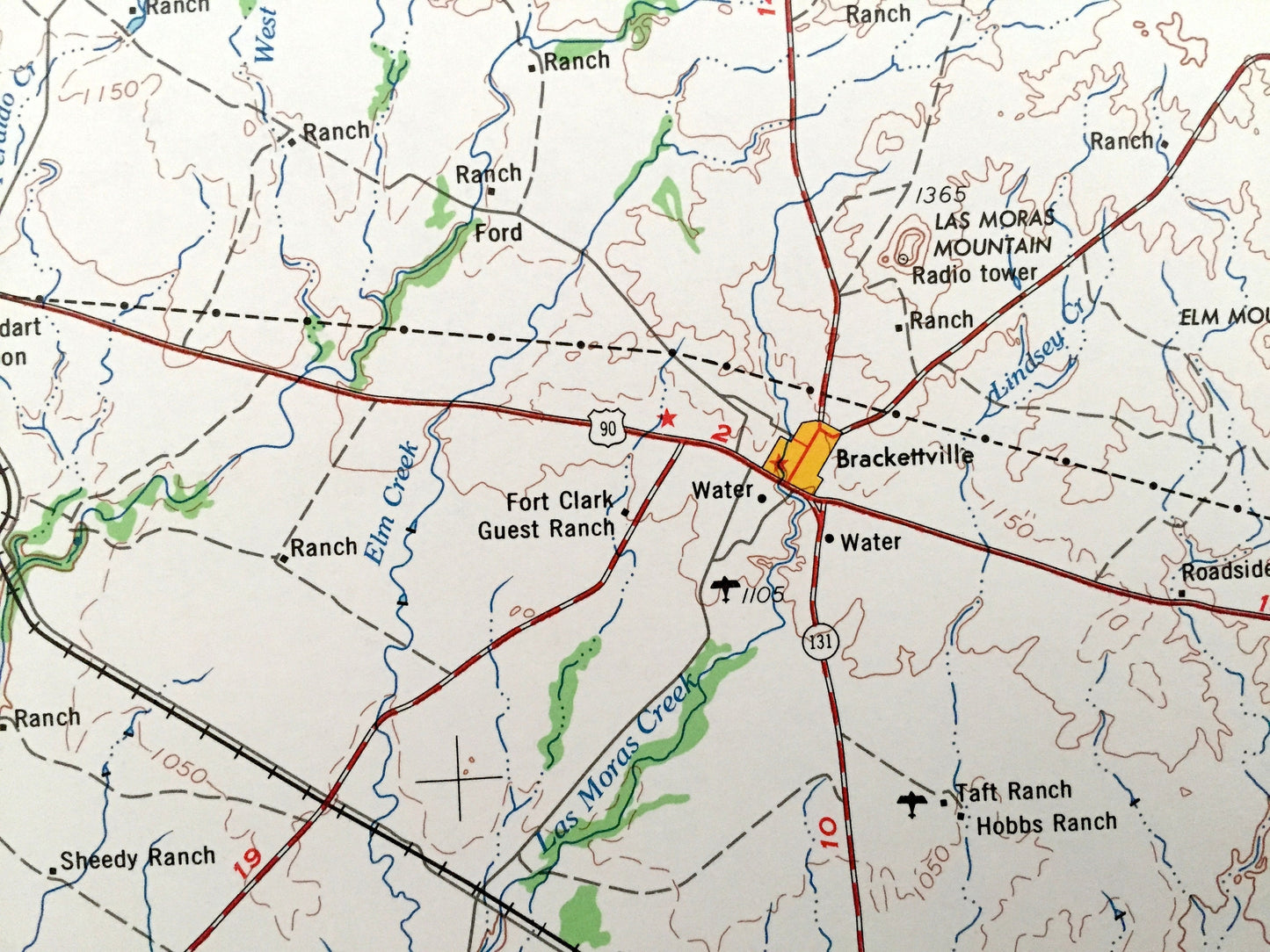
Antique Del Rio, Texas 1964 US Geological Survey Topographic Map – Brackettville, Spofford, Dabney, Cline, Comstock, Langtry, Camp Wood, TX
Antique Del Rio, Texas 1964 US Geological Survey Topographic Map – Brackettville, Spofford, Dabney, Cline, Comstock, Langtry, Camp Wood, TX
Beautiful, antique map of Del Rio, Texas and surrounding area. This is an authentic 1964 edition, 1964 print from the U.S. Geological Survey and NOT a computer reproduction.
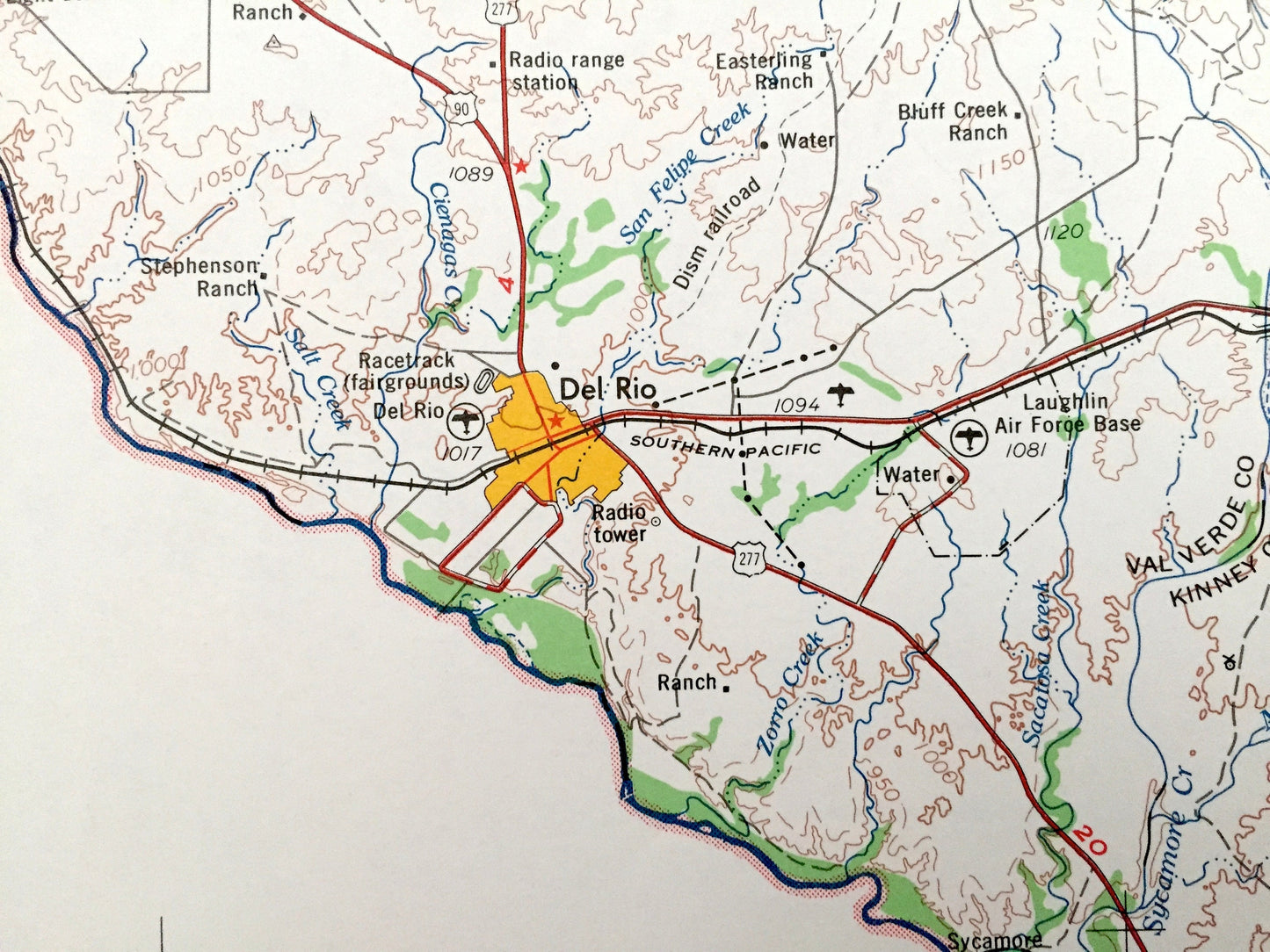
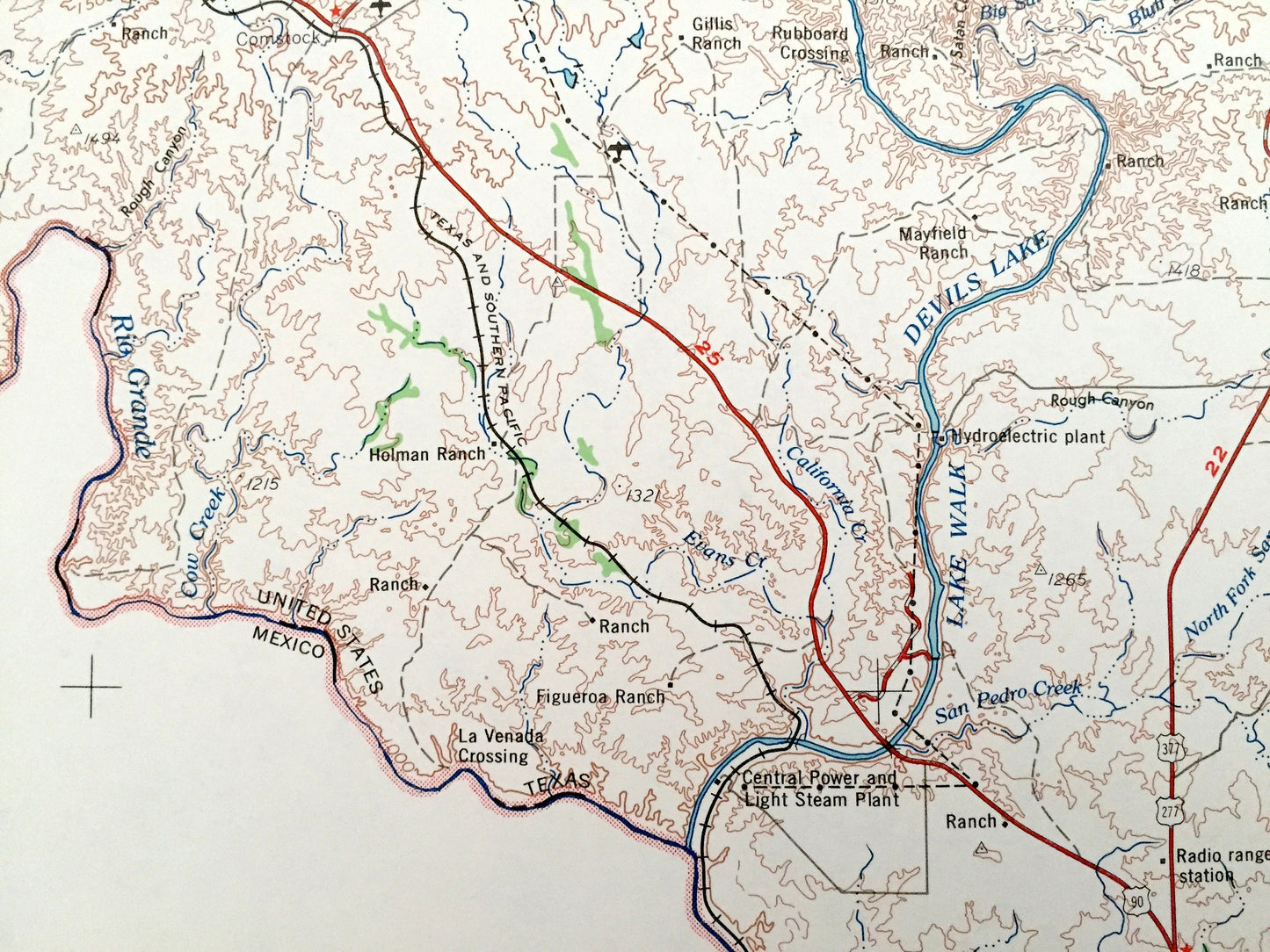
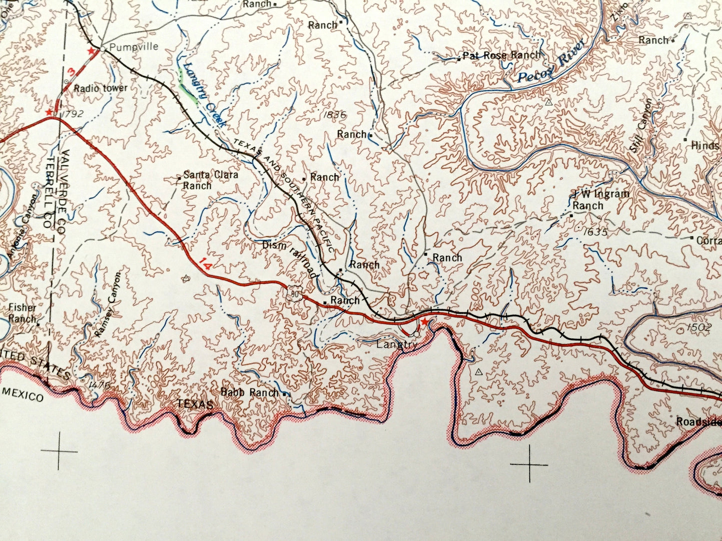
See what Texas looked like 60 years ago. Lots of intricate details and geological contours. Map is large and in the grand 1:250,000 scale. The USGS cartographers were very thorough back then!
Perfect for the historian, map-lover, the curious or just as a conversation starter. Wonderful and rare. Vintage maps such as these make great gifts.
Edition of 1964, printed 1964
Dimensions: 32" width x 22 1/2" height
----
Features
Cities & Towns: Del Rio, Pumpville, Brackettville, Spofford, Dabney, Cline, Comstock, Langtry, Camp Wood.
Points of Interest: Rio Grande, Amistad Reservoir, Devils River, Pecos River, West Nueces River, Las Moras Creek, Mud Creek, Pinto Creek, Mexico and lots more hills, mountains, rivers, lakes, creeks, roads, highways and railroads.
Condition: Very Good Vintage condition, commensurate with age. This map is in great shape for being about 60 years old. Has light edge-wear, all of which will read as vintage character when framed.
----
We will happily adjust shipping price for multiple purchases. Maps are rolled up and shipped in sturdy mailing tubes, never folded.
Couldn't load pickup availability
Share