My Store
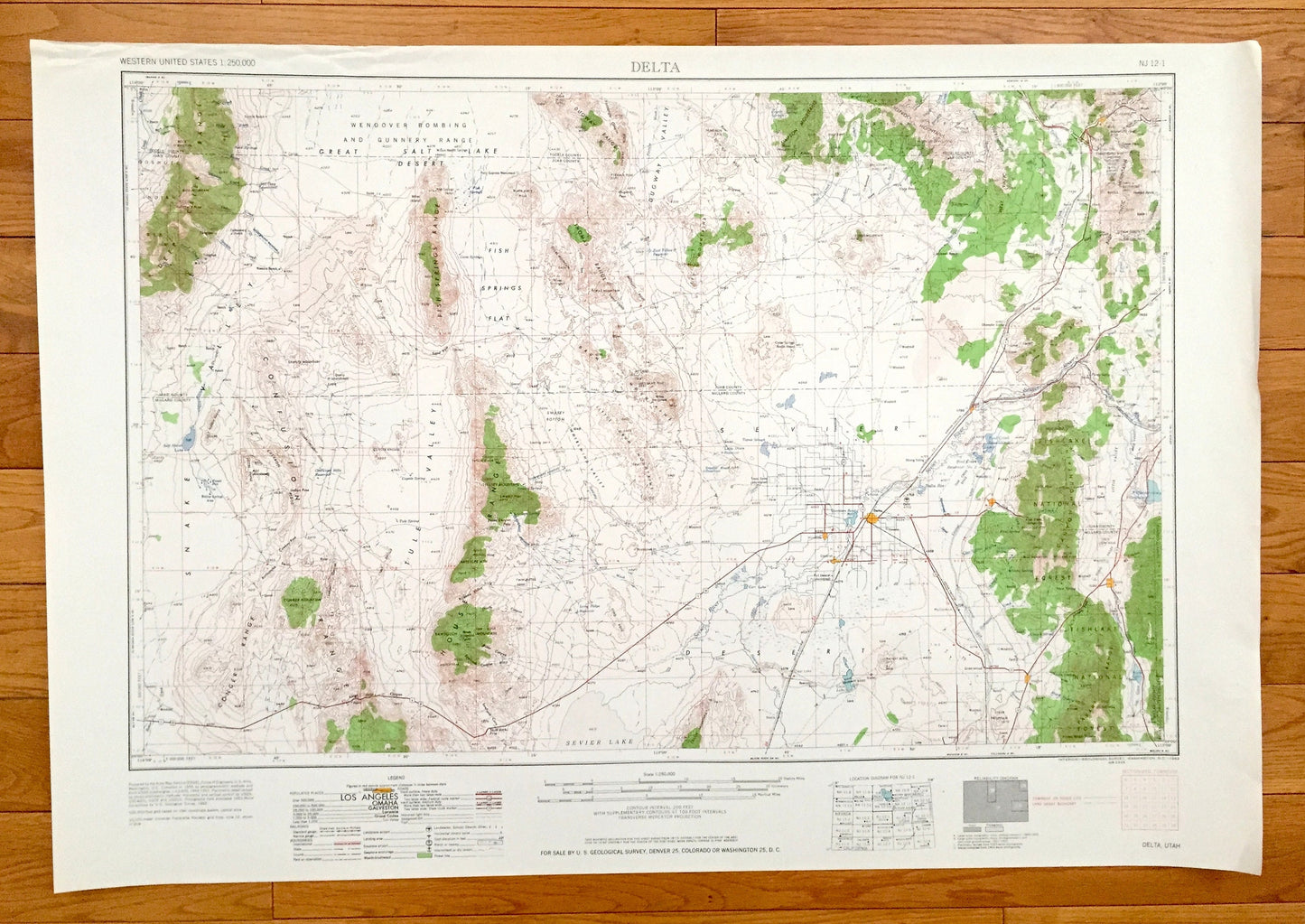
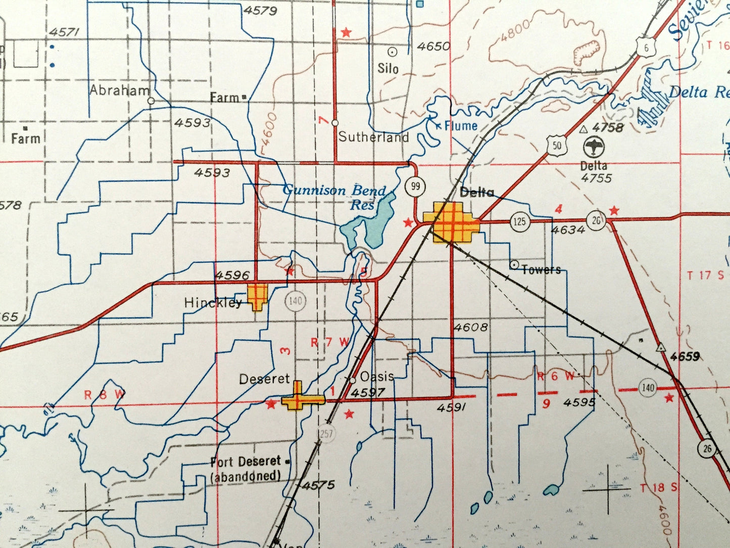
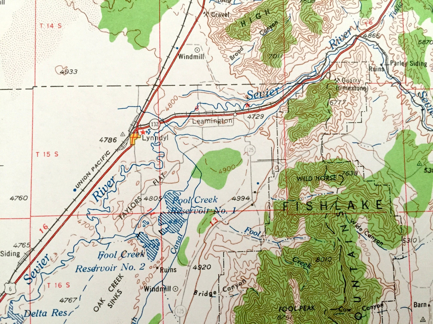
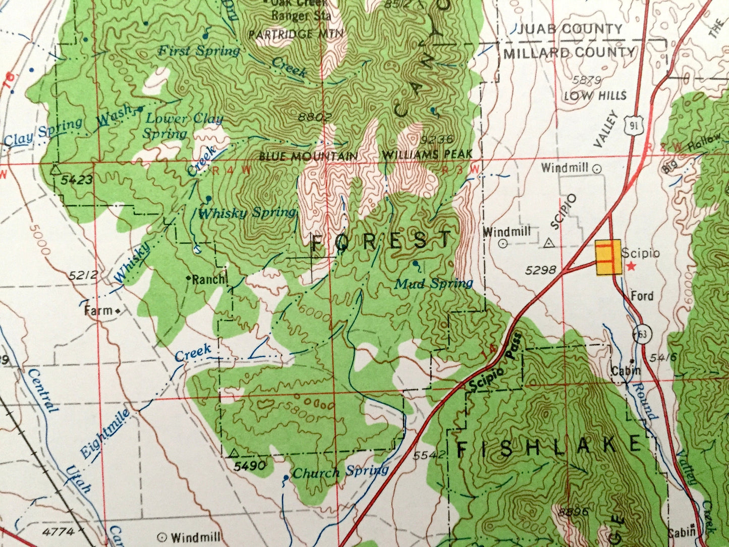
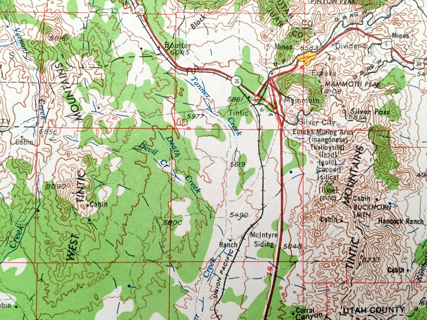
Antique Delta, Utah 1962 US Geological Survey Topographic Map – Oak City, Hinckley, Lynndyl, Holden, Scipio, Deseret, Dividend, Leamington
Antique Delta, Utah 1962 US Geological Survey Topographic Map – Oak City, Hinckley, Lynndyl, Holden, Scipio, Deseret, Dividend, Leamington
Beautiful, antique map of Delta, Utah and surrounding area. This is an authentic 1962 edition, 1962 print from the U.S. Geological Survey and NOT a computer reproduction.
See what Utah looked like over 55 years ago. Lots of intricate details and geological contours. Map is incredibly large and in the grand 1:250,000 scale. The USGS cartographers were very thorough back then!
Perfect for the historian, map-lover, the curious or just as a conversation starter. Wonderful and rare. Vintage maps such as these make great gifts.
Edition of 1962, printed 1962
Dimensions: 32" width x 22 1/2" height
----
Features
Cities & Towns: Delta, Oak City, Hinckley, Lynndyl, Holden, Scipio, Deseret, Dividend, Leamington.
Points of Interest: Fishlake National Forest, Fish Springs Flat, Great Salt Lake Desert, Snake Valley, Dugway Valley, Whirlwind Valley, Dugway Range, Deer Creek Range, Confusion Range, House Range, Canyon Mountains, Little Drum Mountains, Simpson Mountains, Sevier Lake, Clear Lake, Sevier River, Beaver River, Judd Creek, Baker Creek and lots more hills, mountains, rivers, lakes, creeks, roads, highways and railroads.
Condition: Very Good condition, commensurate with age. This map is in incredible shape for being over 55 years old. Has light edge-wear, all of which will read as vintage character when framed.
----
We will happily adjust shipping price for multiple purchases. Maps are rolled up and shipped in sturdy mailing tubes, never folded.
Couldn't load pickup availability
Share