My Store
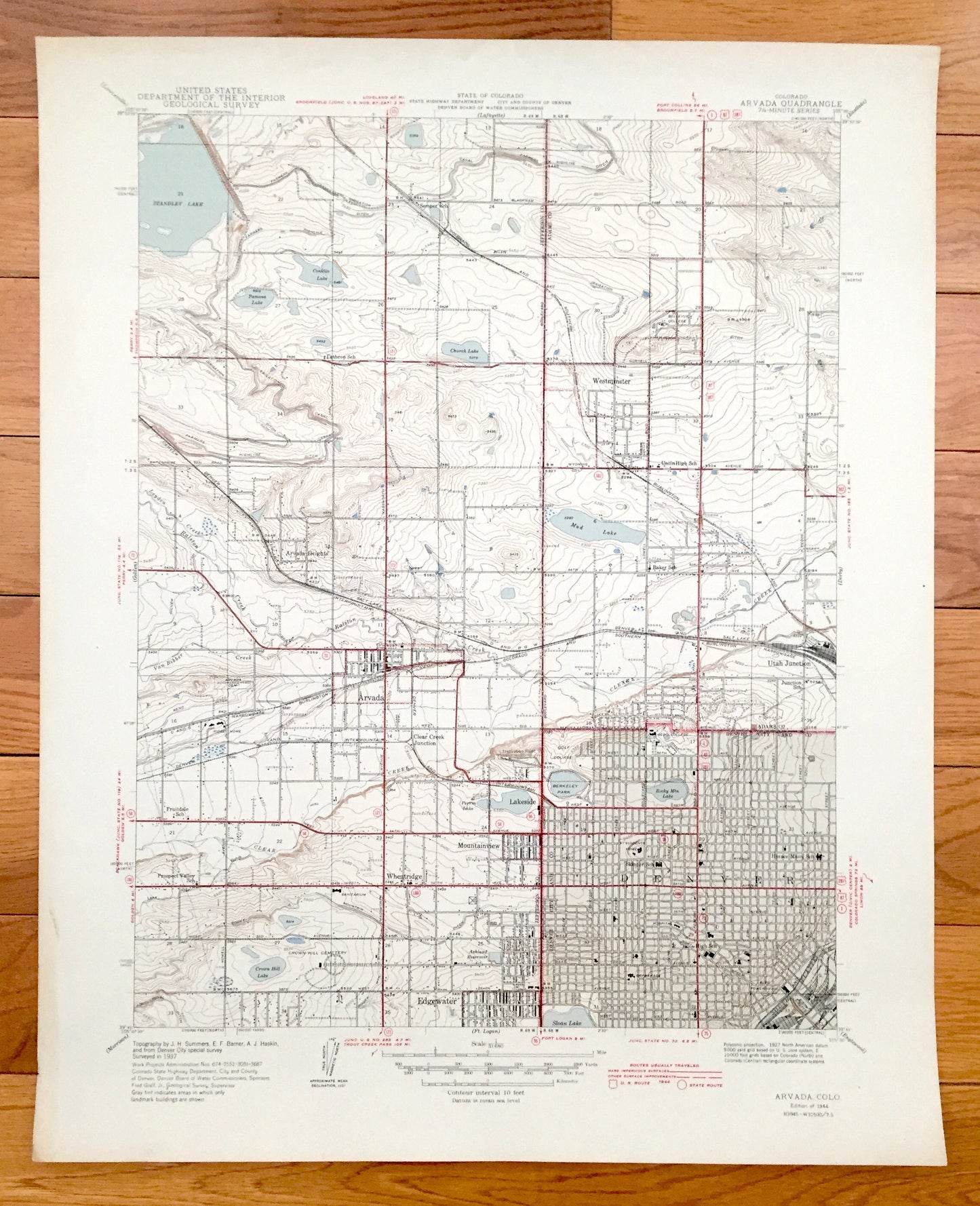
Antique Denver, Colorado 1944 US Geological Survey Topographic Map – Wheat Ridge, Arvada, Mountainview, Westminster, Edgewater, Standley, CO
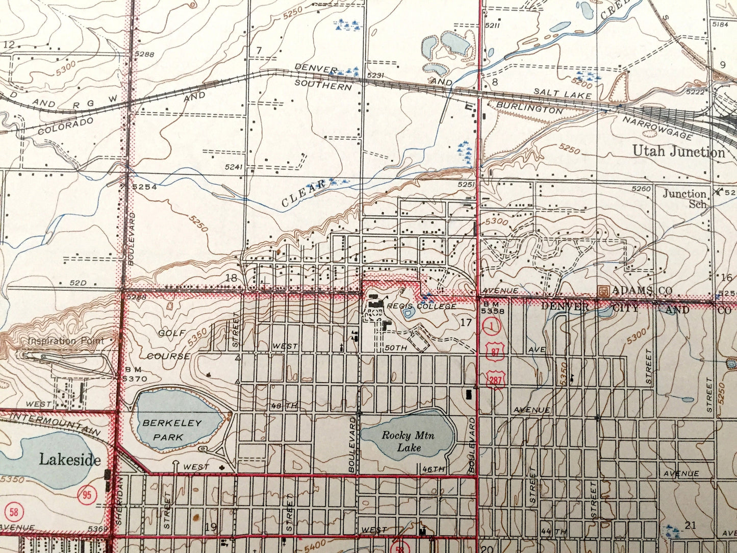
Antique Denver, Colorado 1944 US Geological Survey Topographic Map – Wheat Ridge, Arvada, Mountainview, Westminster, Edgewater, Standley, CO
Beautiful, antique map of Denver and Arvada, Colorado and surrounding Jefferson & Adams County area. This is an authentic 1944 print from the U.S. Geological Survey and not a computer reprint.
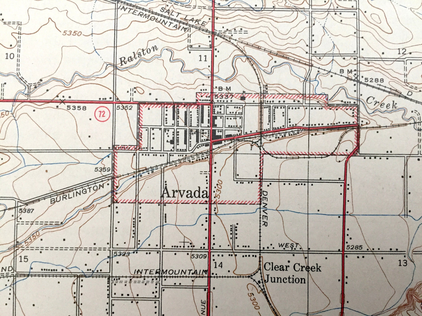
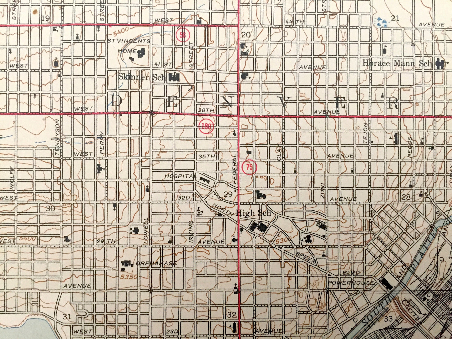
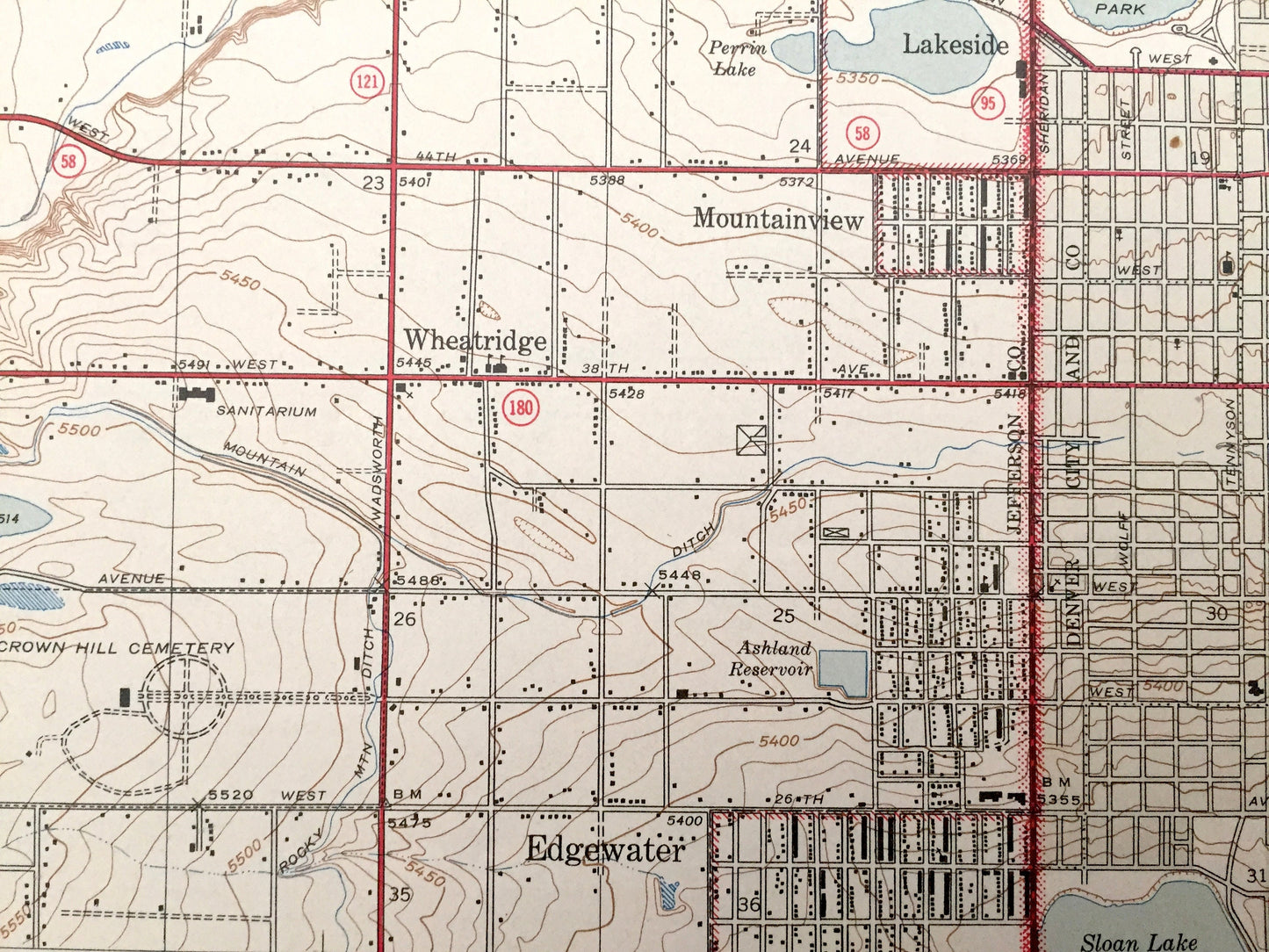
See what Colorado looked like over 75 years ago. Lots of intricate details and geological contours. Map even has little squares for every house that existed. The USGS cartographers were very thorough back then! On the back is a description of topographic symbols and map guide.
Perfect for the historian, map-lover, the curious or just as a conversation starter. Wonderful and rare. Vintage maps such as these make great gifts.
Edition of 1944, printed 1944
Dimensions: 17" width x 21" height
----
Features
Cities & Towns: Denver, Arvada, Arvada Heights, Westminster, Wheat Ridge, Mountainview, Edgewater, Lakeside, Utah Junction.
Points of Interest: Jefferson County, Adams County, Denver County, Clear Creek, Standley Lake, Pamona Lake, Conklin Lake, Church Lake, Mud Lake, Van Bibber Creek, Regis College, Sloan Lake, South Platte River, Berkeley Park, Rocky Mountain Lake, Bellevue College, and many more smaller ponds, streams, houses, schools, roads, churches and train tracks.
Condition: Very Good Vintage condition, commensurate with age. This map is in great shape for being more than 75 years old. Has light wear but this will add to vintage character when framed.
----
We will happily adjust shipping price for multiple purchases. Maps are rolled up and shipped in sturdy mailing tubes, never folded.
Couldn't load pickup availability
Share