My Store
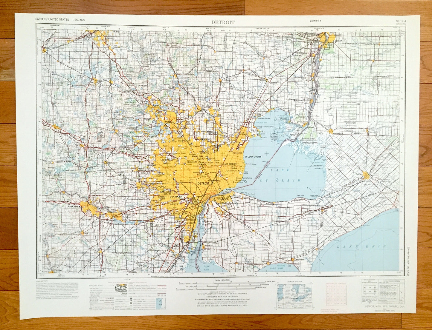
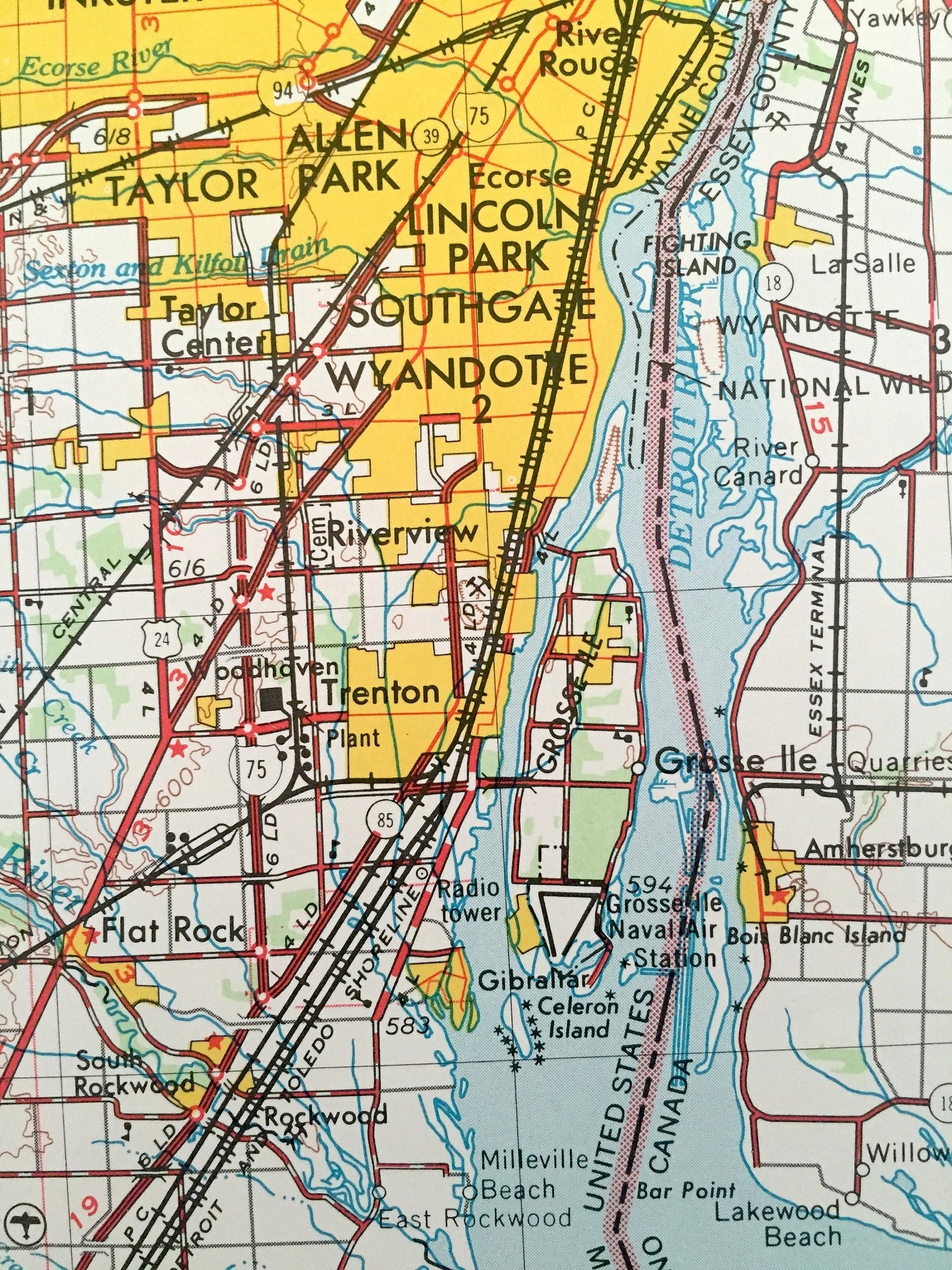
Antique Detroit, Michigan 1961 US Geological Survey Topographic Map – Ann Arbor, Lincoln Park, Grosse Pointe, Livonia, Pontiac, Flint, MI
Antique Detroit, Michigan 1961 US Geological Survey Topographic Map – Ann Arbor, Lincoln Park, Grosse Pointe, Livonia, Pontiac, Flint, MI
Beautiful, antique map of Detroit, Michigan and surrounding Ontario, Canada areas. This is an authentic 1961 edition, 1973 print from the U.S. Geological Survey and NOT a computer reproduction.
See what Michigan and Ontario, Canada looked like over 55 years ago. Lots of intricate details and geological contours. Map is incredibly large and in the grand 1:250,000 scale. The USGS cartographers were very thorough back then!
Perfect for the historian, map-lover, the curious or just as a conversation starter. Wonderful and rare. Vintage maps such as these make great gifts.
Edition of 1961, printed 1973
Dimensions: 32" width x 22 1/2" height
----
Features
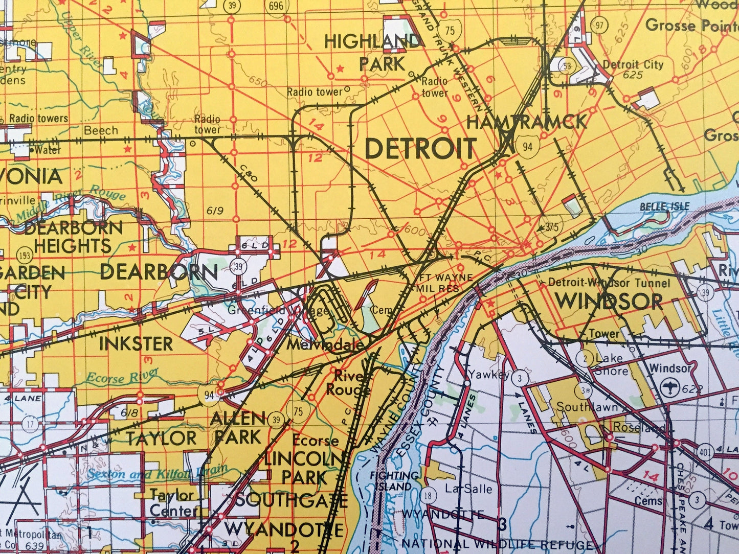
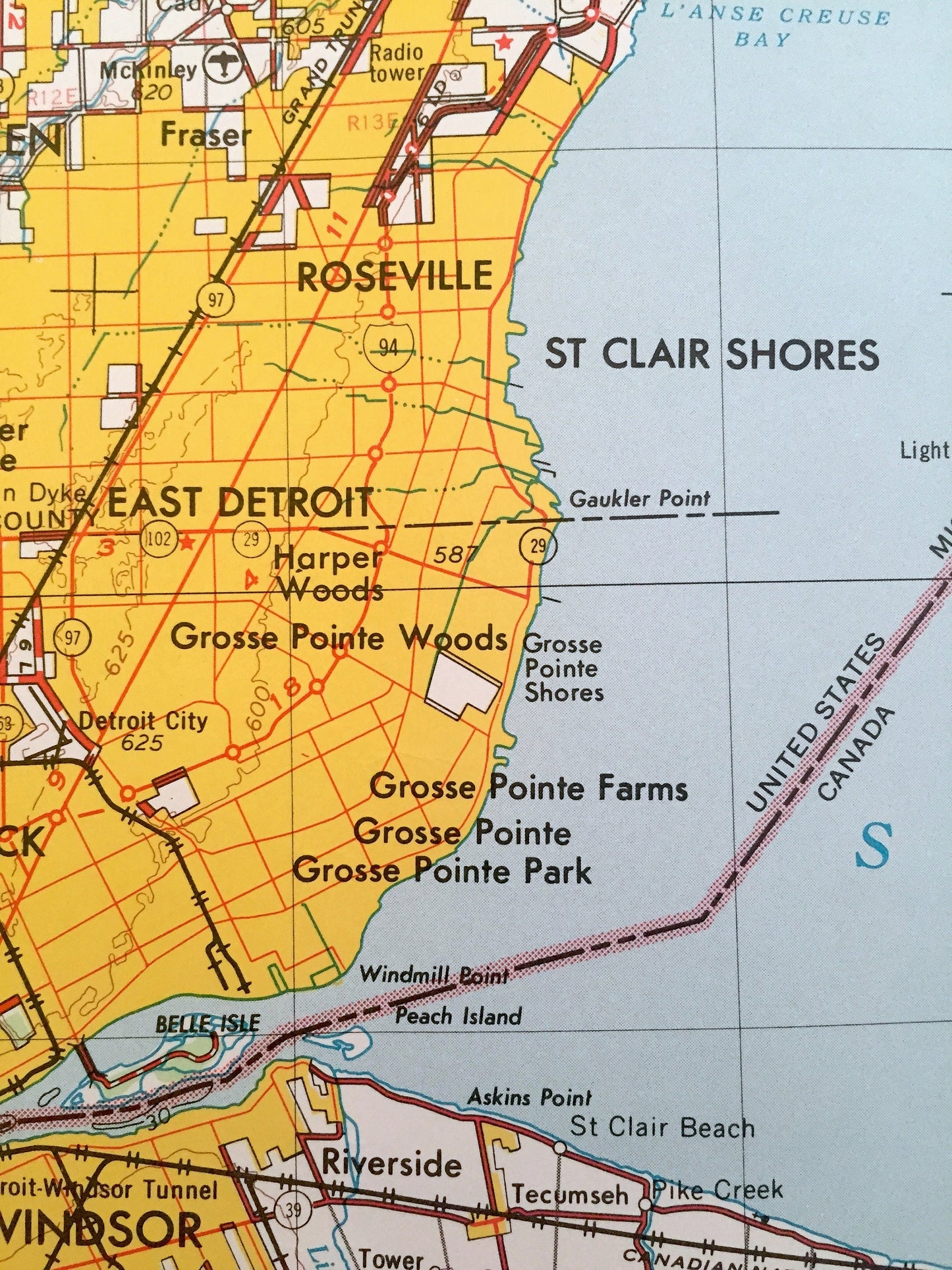
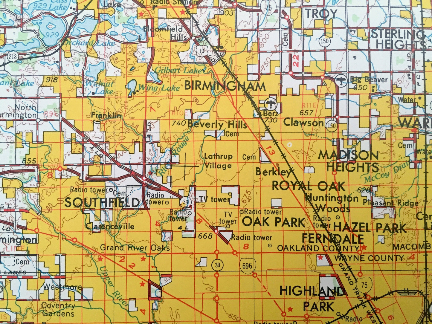
Cities & Towns: MICHIGAN - Detroit, East Detroit, Grosse Point, Hamtramck, Roseville, Highland Park, Allen Park, Oak Park, Southgate, Taylor, Riverview, Dearborn Heights, Ferndale, Westland, Farmington, Birmingham, Sterling Heights, Troy, Port Huron, Oxford, Fenton, Drayton Plaines, Howell, Tecumseh, Flat Rock, Plymouth, Warren, Fraser, St. Clair Shores.
ONTARIO, CANADA - Windsor, Riverside, Roseland, Harrow, Kingsville, Leamington, Chatham, Wallaceburg, Sarina, Dresdee, Petrolia, Blenheim, Wheatley, Belle River.
Points of Interest: MICHIGAN -Lake Erie, Lake St. Clair, Ford Lake, Orchard Lake, Detroit River, Belle River, Saline River, Haron River, St. Clair River, Pontiac Lake State Recreation Area, Bald Mountain State Recreation Area, Anchor Bay, L'anse Creuse Bay, Belle Isle and lots more hills, mountains, lakes, rivers, creeks, road, highways and railroads.
ONTARIO, CANADA - Lake Erie, Lake St. Clair, Detroit River, St. Clair River, Canard River, Thames River, Pigeon Bay, Mitchell Bay, Walpole Island, St. Anne Island, Tilbury Creek, Walpole Island Indian Reservation and lots more hills, mountains, lakes, rivers, creeks, road, highways and railroads.
Condition: Very Good condition, commensurate with age. This map is in incredible shape for being over 45 years old. Has light edge-wear, all of which will read as vintage character when framed.
----
We will happily adjust shipping price for multiple purchases. Maps are rolled up and shipped in sturdy mailing tubes, never folded.
Couldn't load pickup availability
Share