My Store
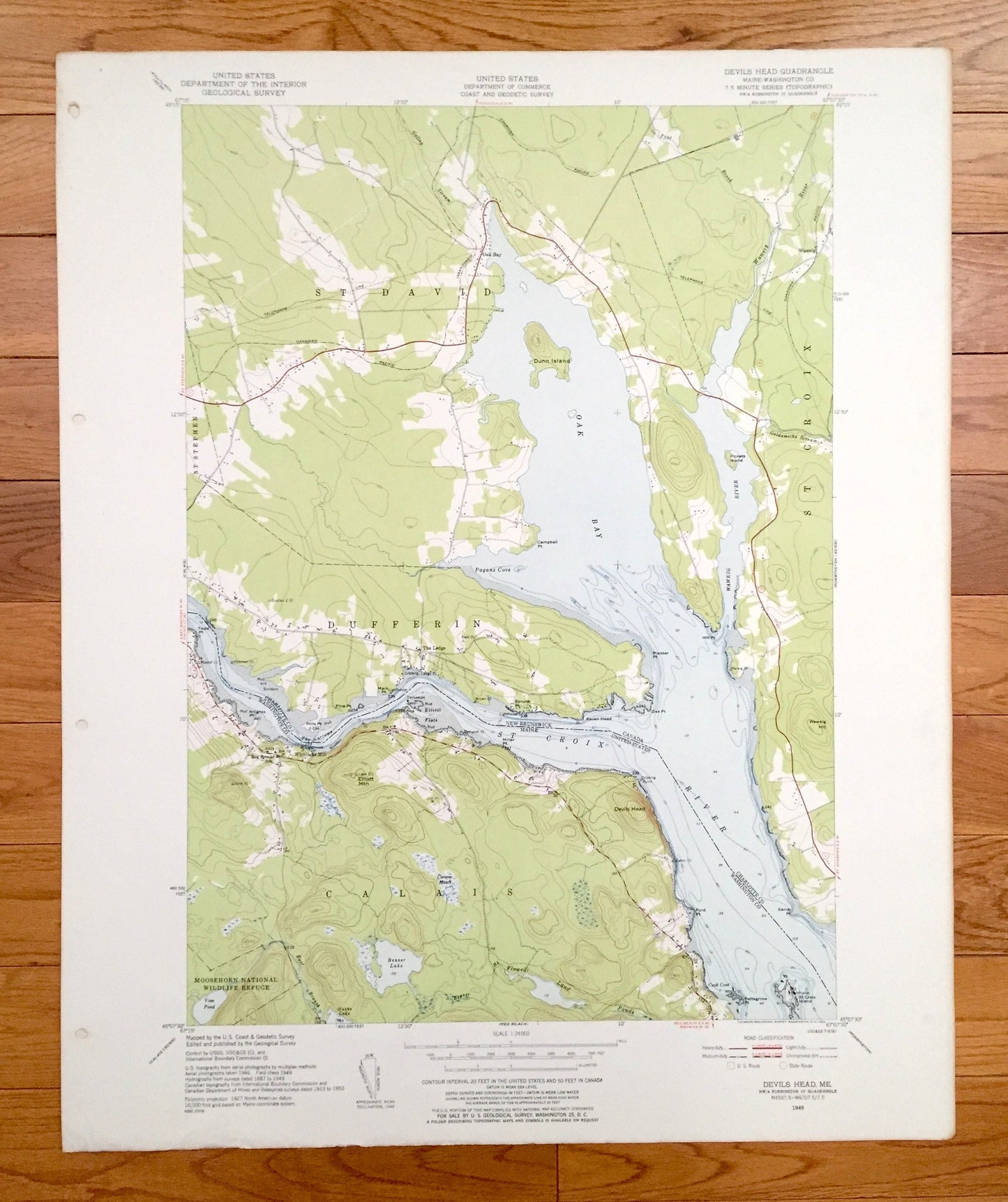
Antique Devils Head, Maine 1949 US Geological Survey Topographic Map – Washington County, Calais, ME, Charlotte County, New Brunswick
Antique Devils Head, Maine 1949 US Geological Survey Topographic Map – Washington County, Calais, ME, Charlotte County, New Brunswick
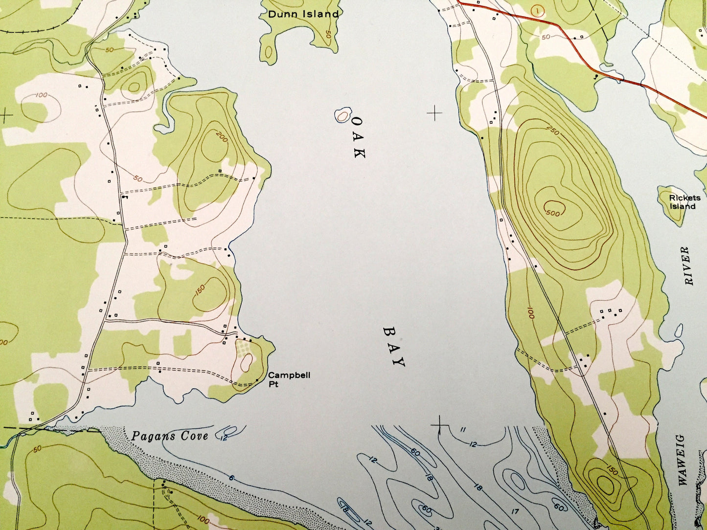
Beautiful, antique map of Devils Head, Maine and surrounding Washington County areas, including Canada’s Charlotte County. This is an authentic 1949 edition, 1952 print from the U.S. Geological Survey and NOT a computer reproduction.
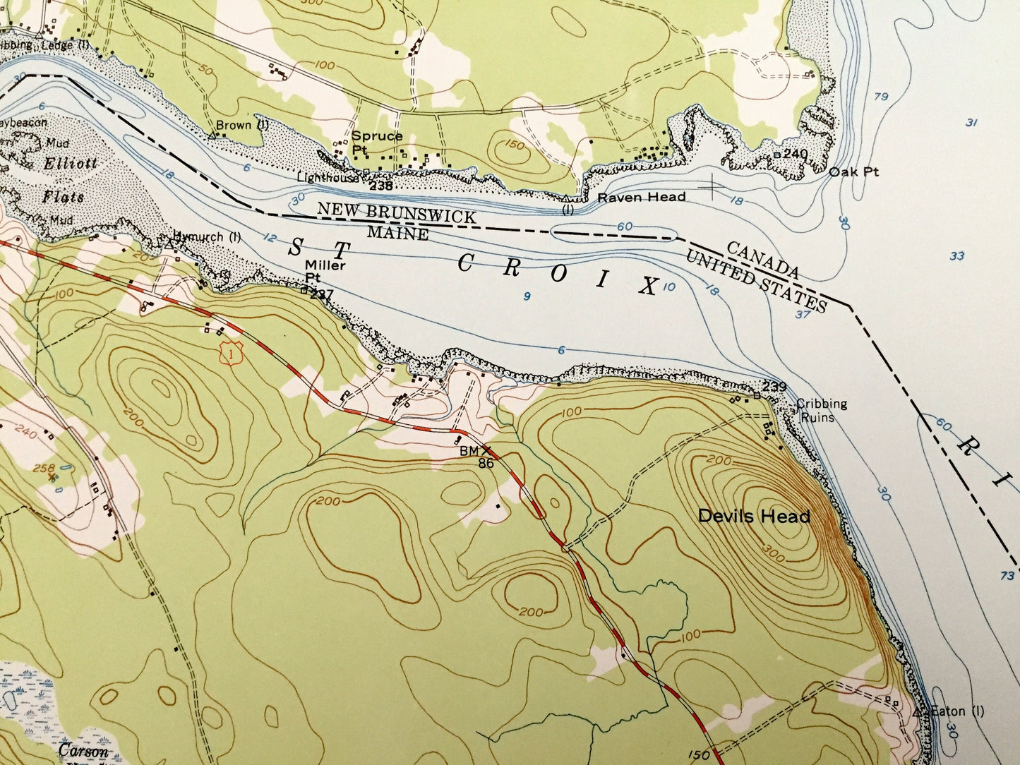
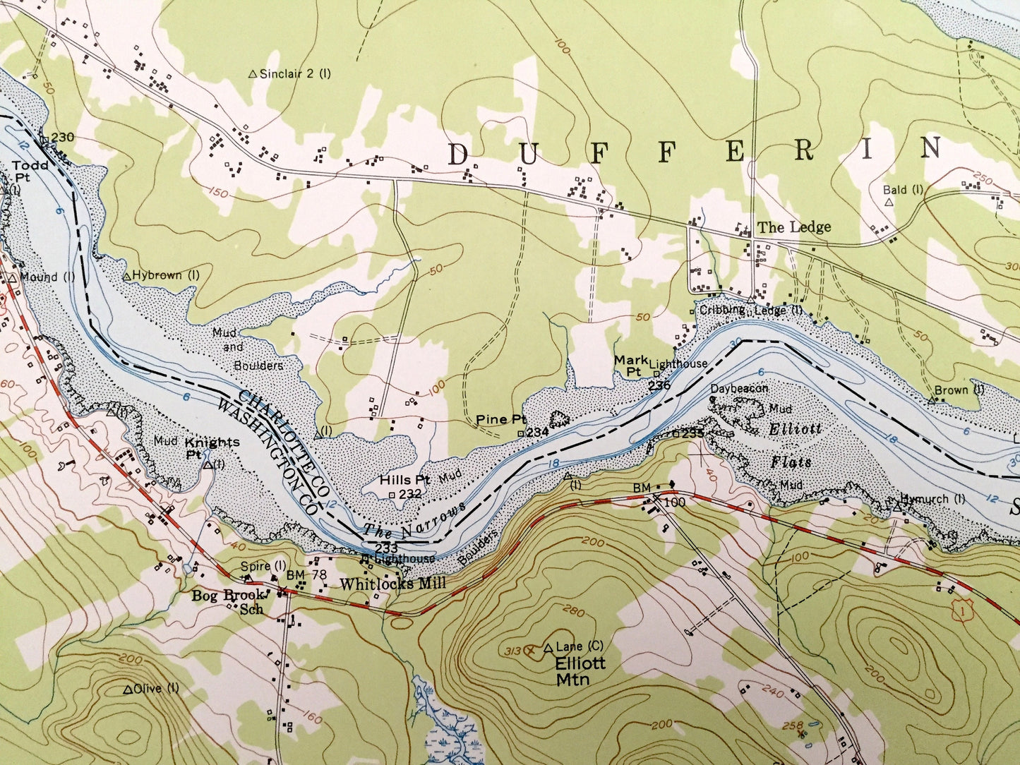
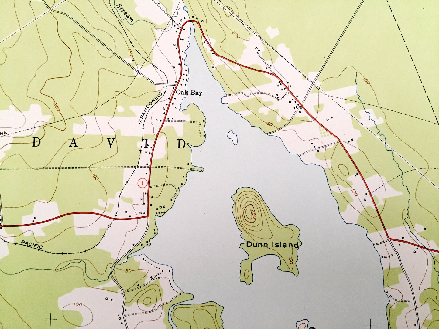
See what Maine looked like over 70 years ago. Lots of intricate details and geological contours. Map even has little squares for every house that existed at the time. The USGS cartographers were very thorough back then!
Perfect for the historian, map-lover, the curious or just as a conversation starter. Wonderful and rare. Vintage maps such as these make great gifts.
Edition of 1949, printed 1952
Dimensions: 22" width x 27" height
----
Features
Cities & Towns: MAINE: Calais, Whitlocks Mill.
CANADA (New Brunswick): St David, St Croix, St Stephen, Dufferin, Oak Bay, The Ledge, Waweig.
Points of Interest: Moosehorn National Wildlife Refuge, Dunn Island, Rickets Island, St Croix Island, Waweig Hill, Elliott Mountain, Vose Pond, Beaver Lake, Nashs Lake, Oak Bay, Waweig River, St Croix River, pagans Cove, Cook Cove, Flowed Land Ponds, and many more hills, streams, islands, ponds, houses, schools, railroads, churches and roads.
Condition: Very Good Vintage condition, commensurate with age. This map is in great shape for being over 65 years old. Has subtle edge-wear with some discoloration and a four-hole-punch on the left hand margin, all of which will read as character when framed.
----
We will happily adjust shipping price for multiple purchases.
Couldn't load pickup availability
Share