My Store
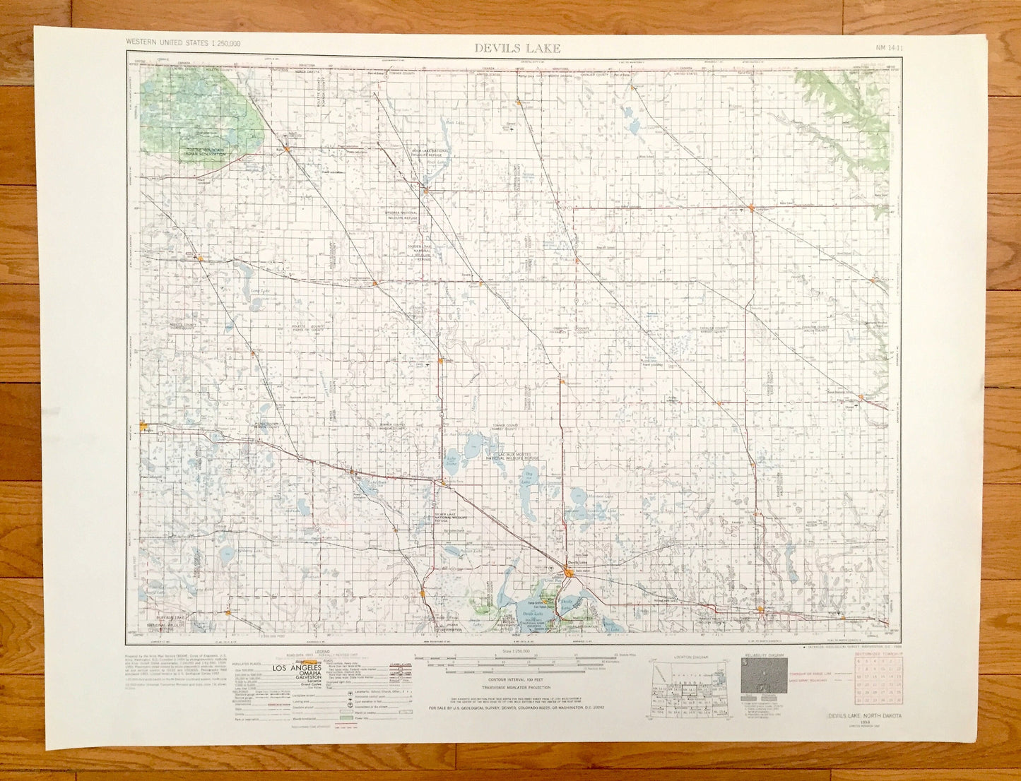
Antique Devils Lake, North Dakota 1953 US Geological Survey Topographic Map – Lakota, Cando, Rugby, Langdon, Rolla, Rolette, Bisbee, Egeland
Antique Devils Lake, North Dakota 1953 US Geological Survey Topographic Map – Lakota, Cando, Rugby, Langdon, Rolla, Rolette, Bisbee, Egeland
Beautiful, antique map of Devils Lake, North Dakota and surrounding area. This is an authentic 1953 edition, 1968 print from the U.S. Geological Survey and NOT a computer reproduction.
See what North Dakota looked like over 65 years ago. Lots of intricate details and geological contours. Map is incredibly large and in the grand 1:250,000 scale. The USGS cartographers were very thorough back then!
Perfect for the historian, map-lover, the curious or just as a conversation starter. Wonderful and rare. Vintage maps such as these make great gifts.
Edition of 1953, printed 1968
Dimensions: 32" width x 22 1/2" height
----
Features
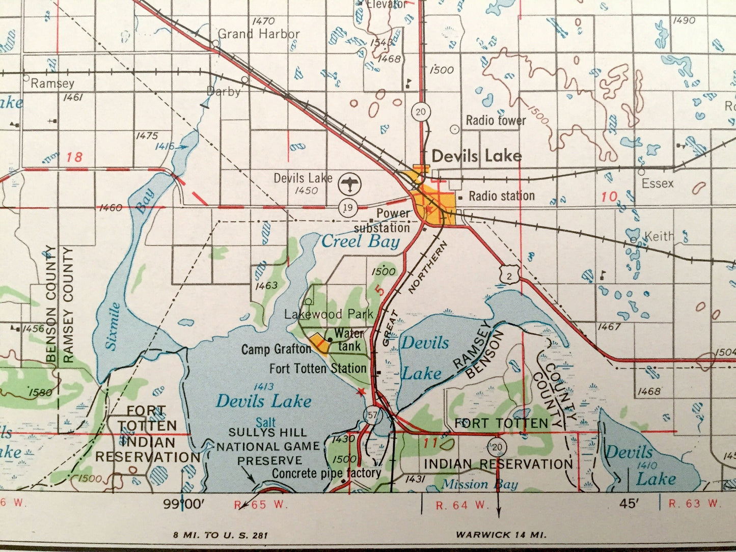
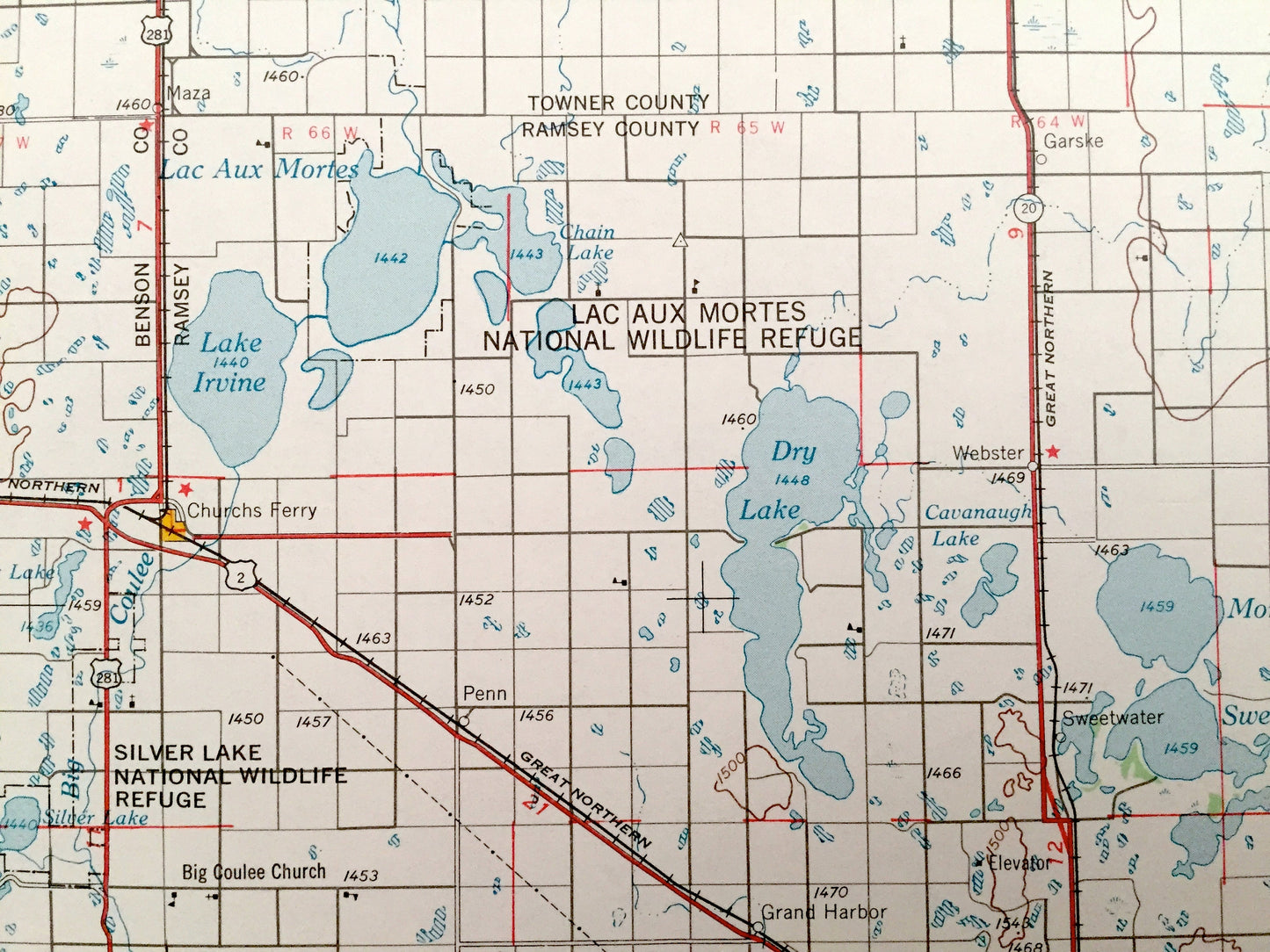
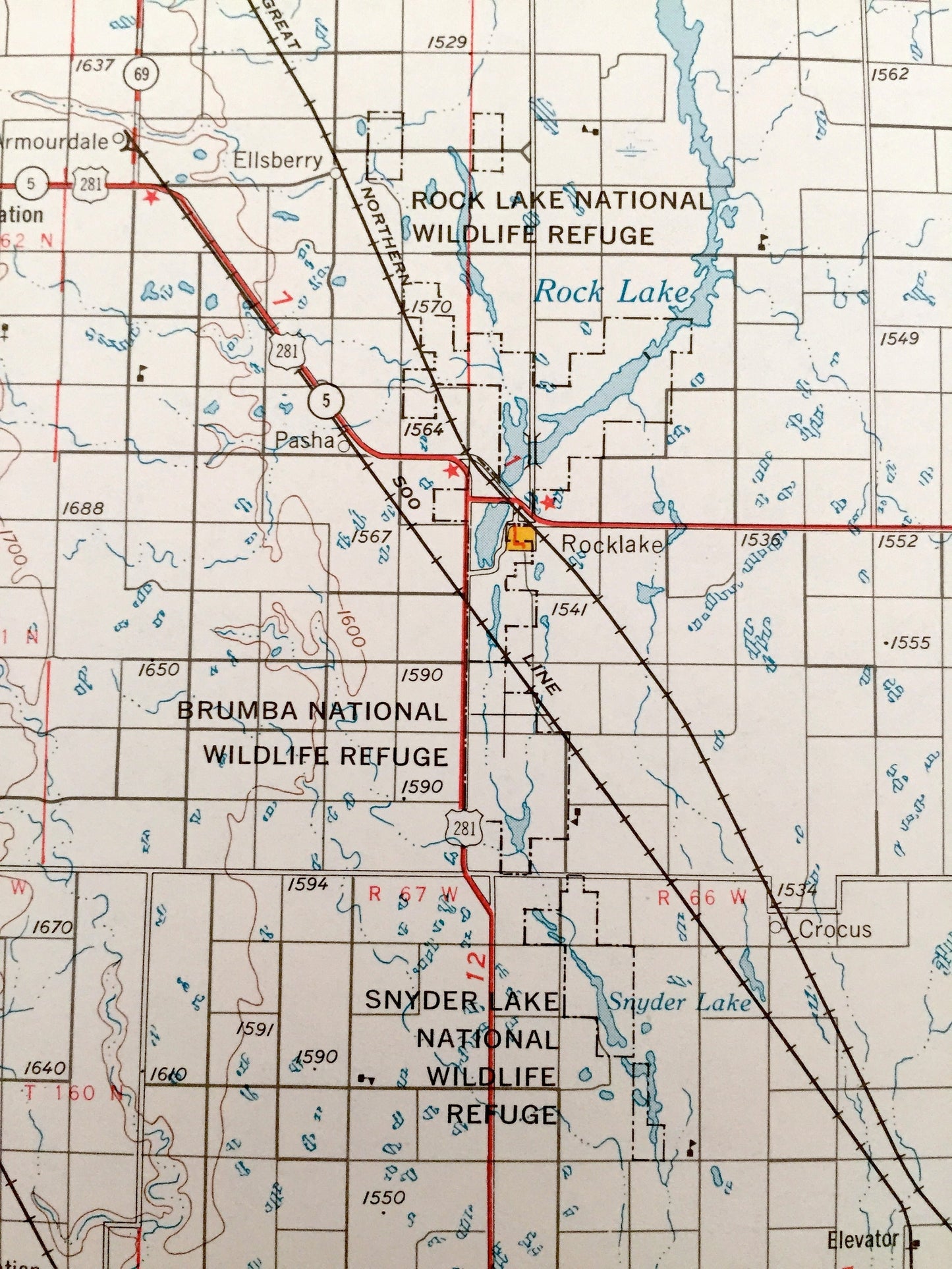
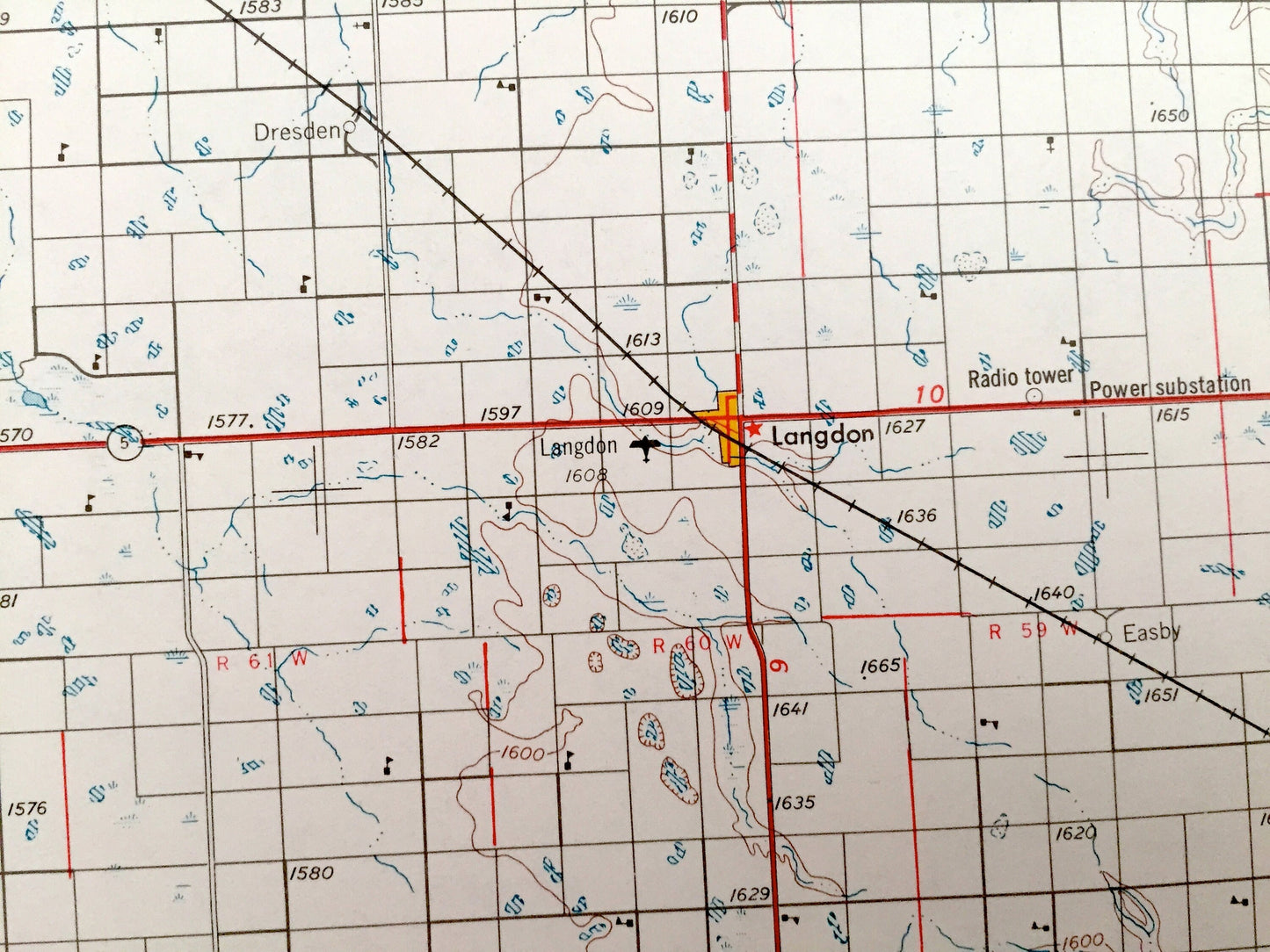
Cities & Towns: Devils Lake, Lakewood Park, Brocket, Edmore, Adams, Hampden, Starkweather, Olmstead, Sarles, Hannah, Lakota, Cando, Rugby, Langdon, Rolla, Rolette, Bisbee, Egeland.
Points of Interest: Devils Lake, Sweetwater Lake, Morrison Lake, Dry Lake, Lake Irvine, Pelican Lake, Lac Aux Mortes National Wildlife Refuge, Buffalo Lake National Wildlife Refuge, Turtle Mountain Indian Reservation, Fort Totten Indian Reservation, Silver Lake National Wildlife Refuge, Little South Pembina River, Mauvais Coulee and lots more hills, mountains, lakes, rivers, creeks, road, highways and railroads.
Condition: Very Good condition, commensurate with age. This map is in incredible shape for being over 50 years old. Has light edge-wear, all of which will read as vintage character when framed.
----
We will happily adjust shipping price for multiple purchases. Maps are rolled up and shipped in sturdy mailing tubes, never folded.
Couldn't load pickup availability
Share