My Store
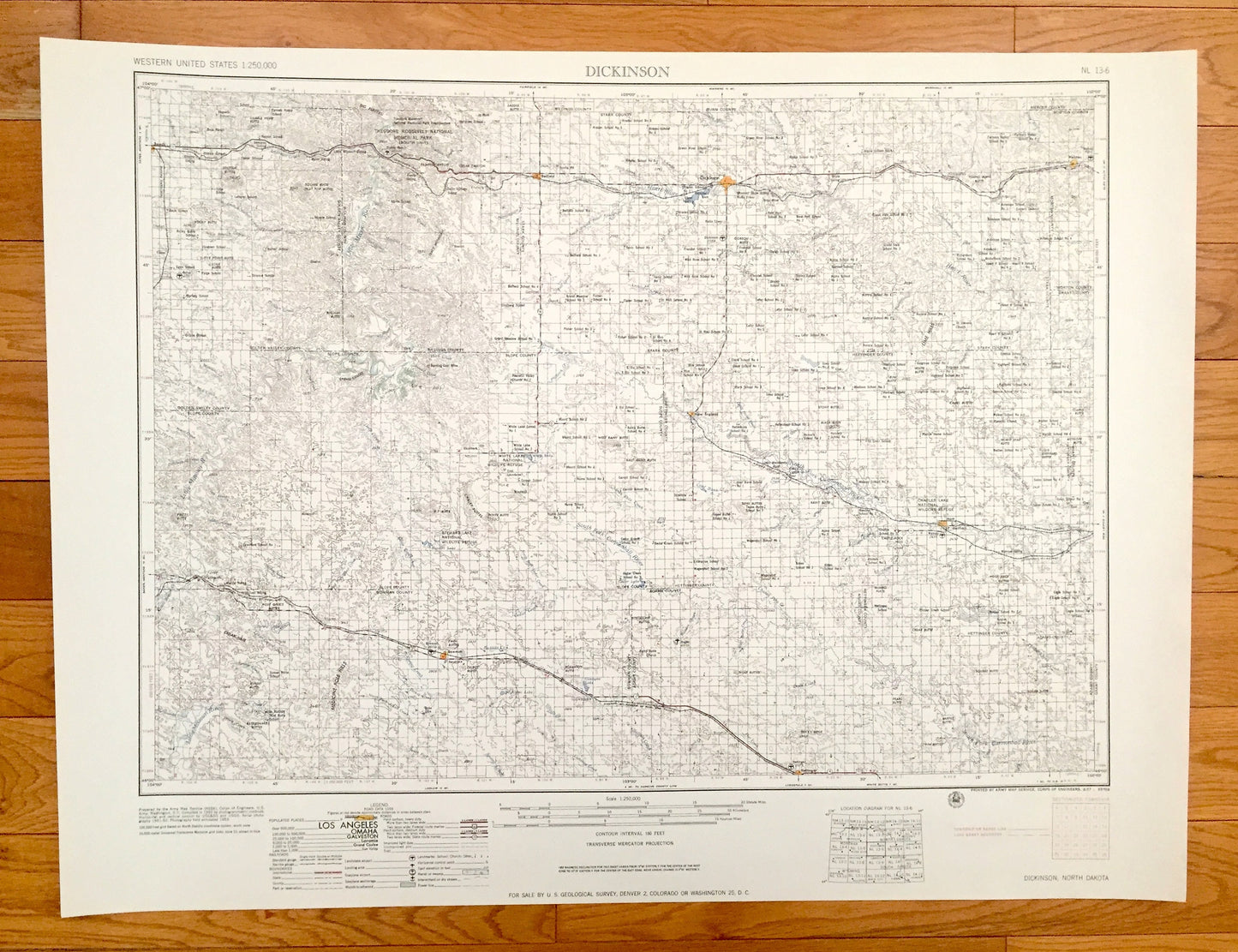
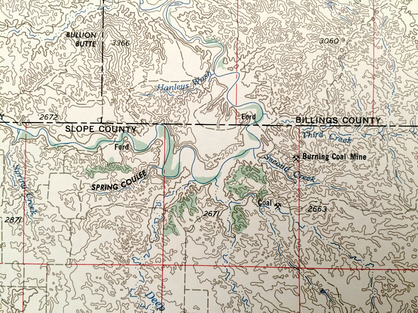
Antique Dickinson, North Dakota 1955 US Geological Survey Topographic Map – Belfield, Hebron, New England, Mott, Hettinger, Bowman, Beach
Antique Dickinson, North Dakota 1955 US Geological Survey Topographic Map – Belfield, Hebron, New England, Mott, Hettinger, Bowman, Beach
Beautiful, antique map of Dickinson, North Dakota and surrounding area. This is an authentic 1955 edition, 1955 print from the U.S. Geological Survey and NOT a computer reproduction.
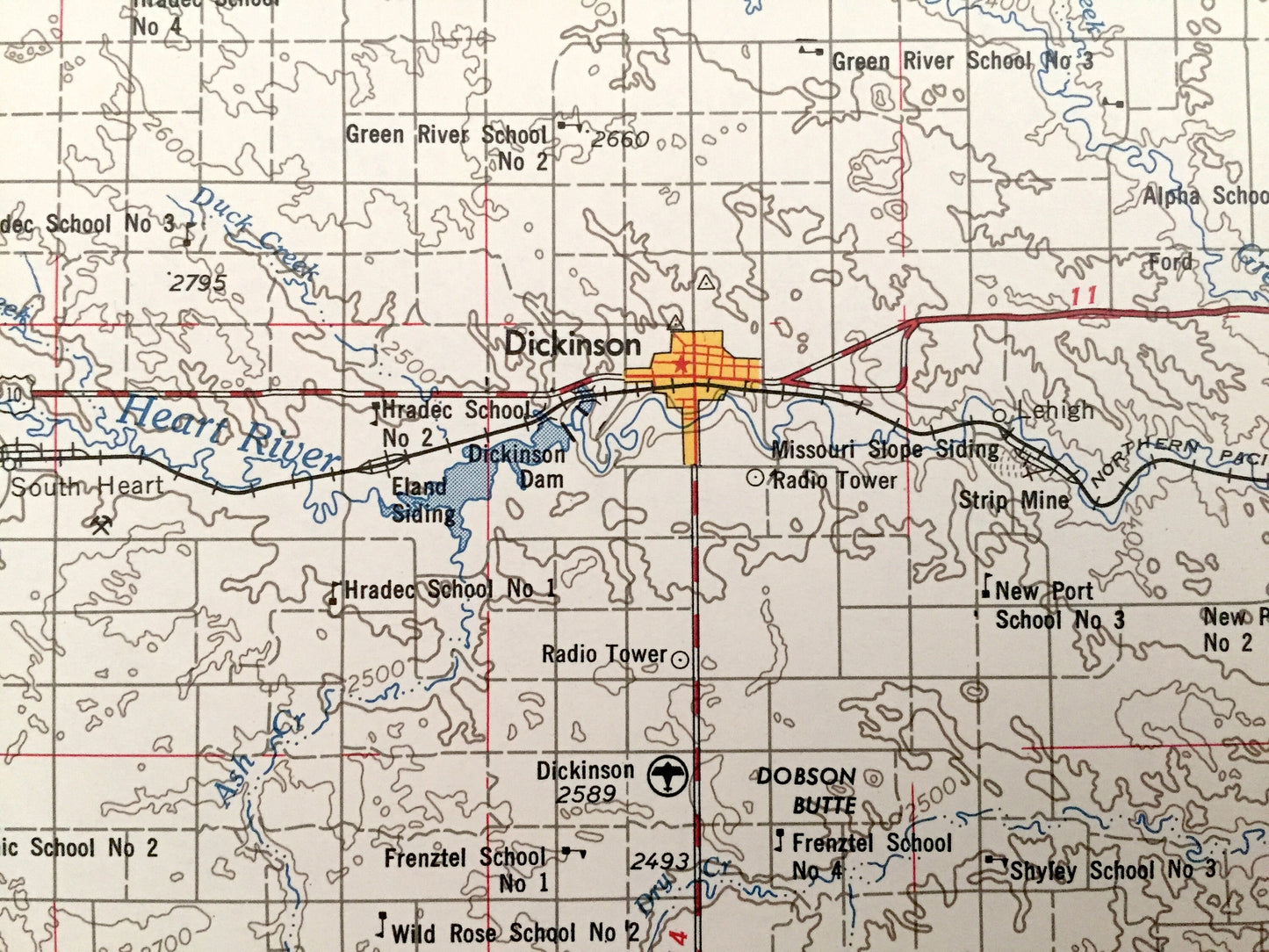
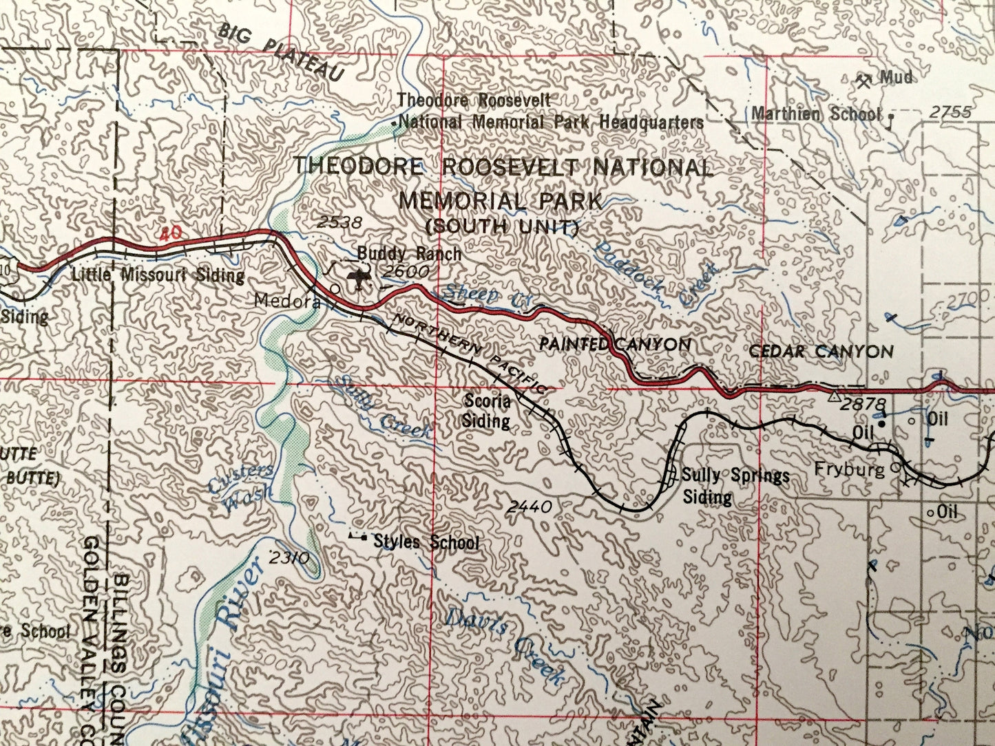
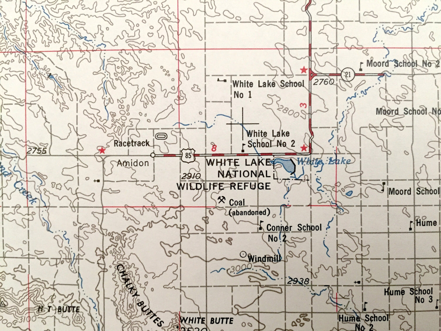
See what North Dakota looked like over 65 years ago. Lots of intricate details and geological contours. Map is incredibly large and in the grand 1:250,000 scale. The USGS cartographers were very thorough back then!
Perfect for the historian, map-lover, the curious or just as a conversation starter. Wonderful and rare. Vintage maps such as these make great gifts.
Edition of 1955, printed 1955
Dimensions: 32" width x 22 1/2" height
----
Features
Cities & Towns: Dickinson, Richardton, Odessa, Regent, Marmarth, Griffin, Belfield, Hebron, New England, Mott, Hettinger, Bowman, Beach.
Points of Interest: Heart River, North Fork Cannonball River, Little Missouri River, Thirty Mile Creek, Cedar Hills, Medicine Pole Hills, Stewart Lake National Wildlife Refuge, White Lake National Wildlife Refuge, Theodore Roosevelt National Memorial Park, Cedar Creek, Buffalo Creek and lots more hills, mountains, lakes, rivers, creeks, road, highways and railroads.
Condition: Very Good condition, commensurate with age. This map is in incredible shape for being over 65 years old. Has light edge-wear, all of which will read as vintage character when framed.
----
We will happily adjust shipping price for multiple purchases. Maps are rolled up and shipped in sturdy mailing tubes, never folded.
Couldn't load pickup availability
Share