My Store
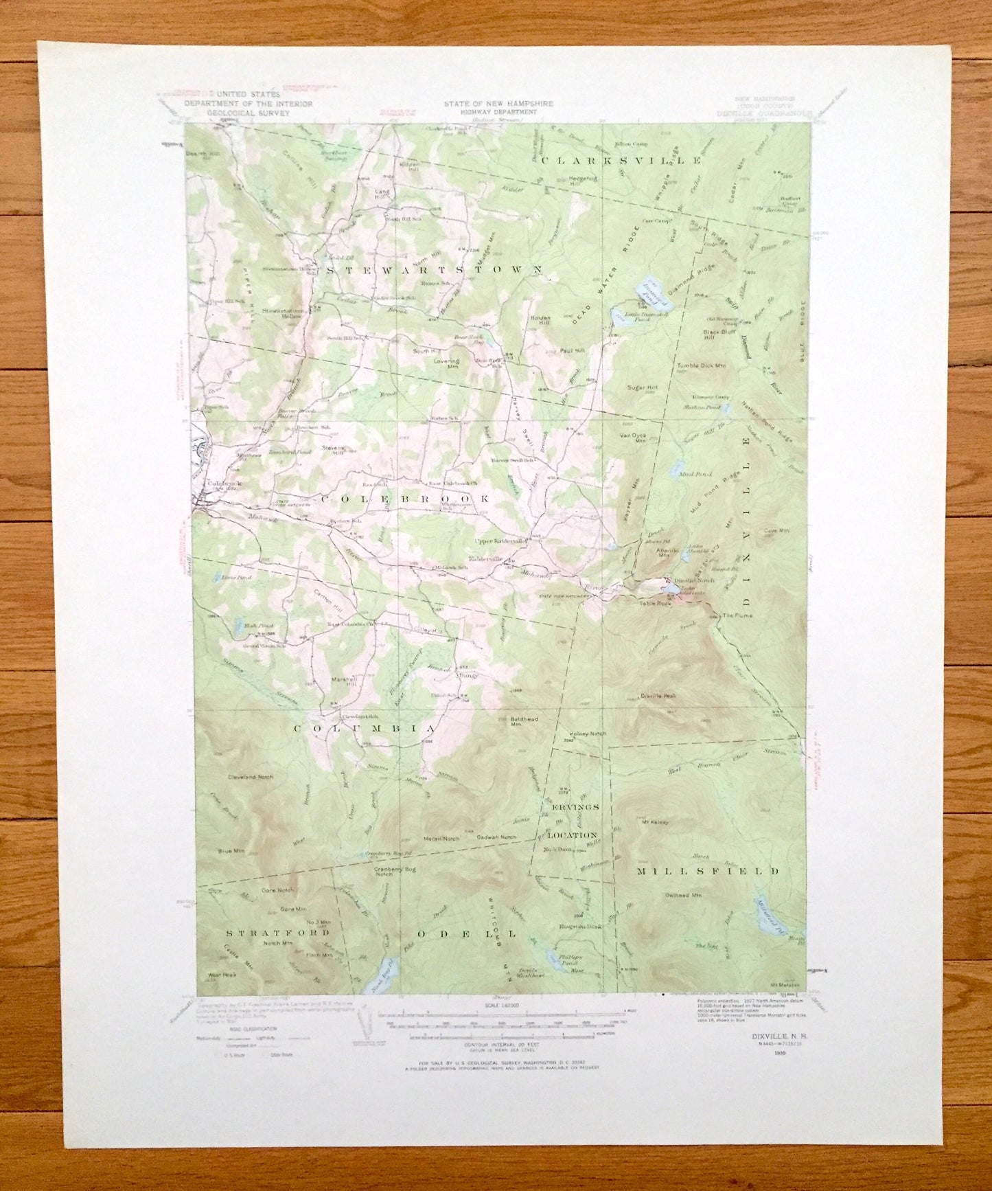
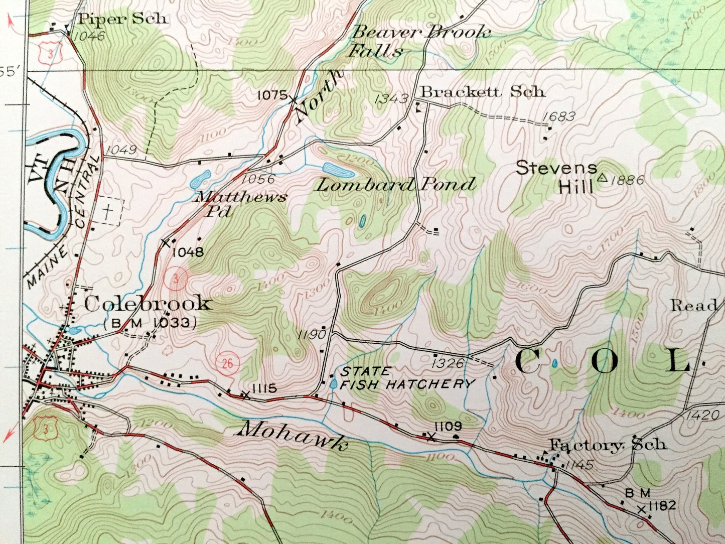
Antique Dixville Notch, New Hampshire 1930 US Geological Survey Topographic Map - Colebrook, Columbia, Stewartstown Stratford Clarksville NH
Antique Dixville Notch, New Hampshire 1930 US Geological Survey Topographic Map - Colebrook, Columbia, Stewartstown Stratford Clarksville NH
Beautiful, antique map of Dixville Notch, New Hampshire and surrounding Coos County area. This is an authentic 1930 edition, 1968 print from the U.S. Geological Survey and NOT a computer reproduction.
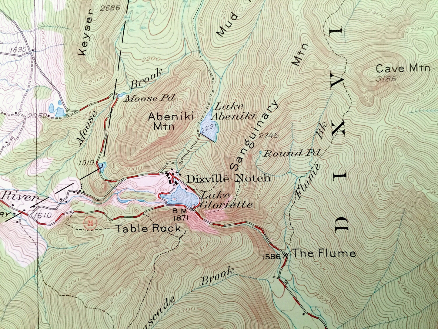
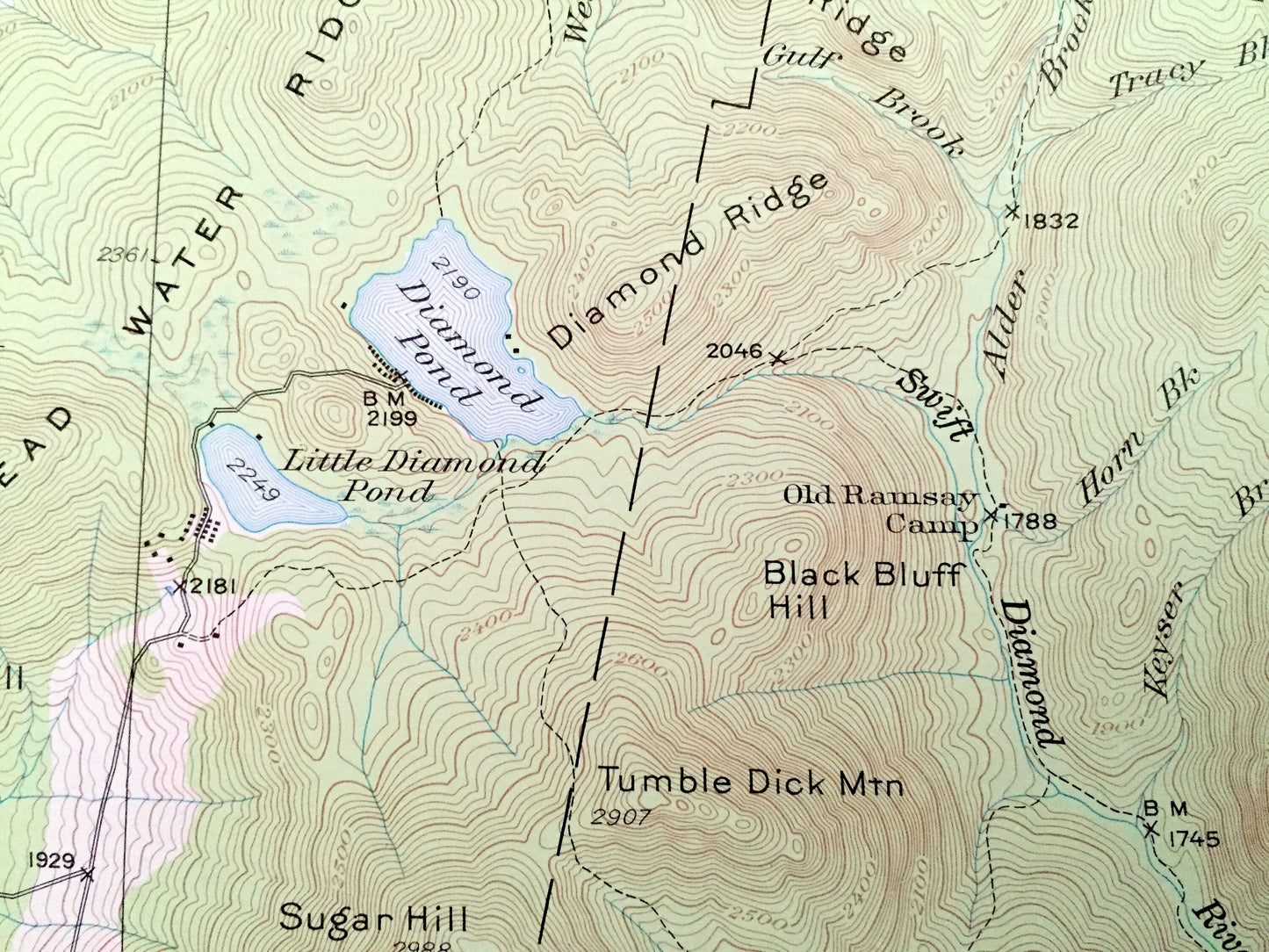
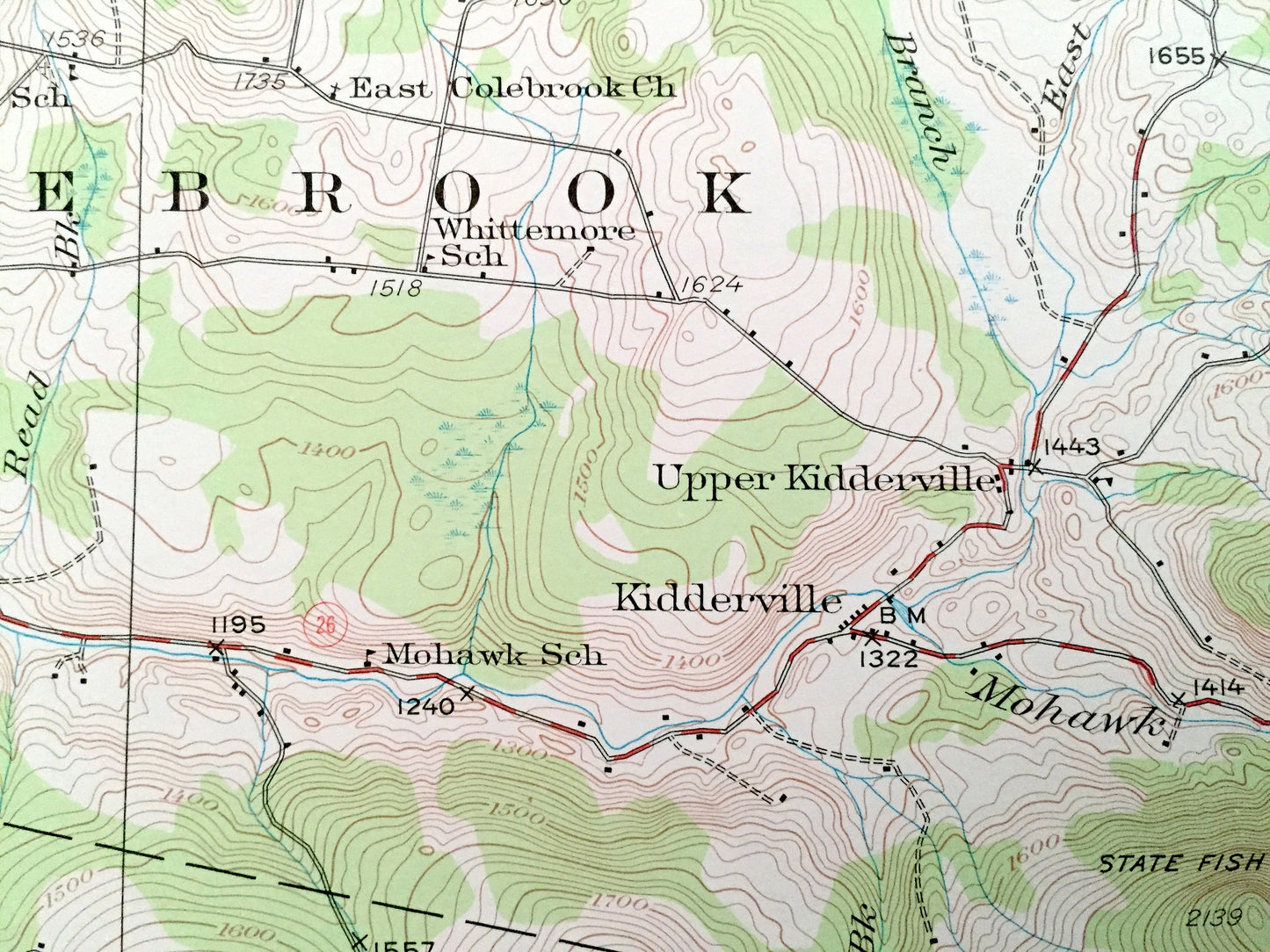
See what New Hampshire looked like 90 years ago. Lots of intricate details and geological contours. Map even has little squares for every house that existed at the time. The USGS cartographers were very thorough back then!
Perfect for the historian, map-lover, the curious or just as a conversation starter. Wonderful and rare. Vintage maps such as these make great gifts.
Edition of 1930, printed 1968
Dimensions: 18" width x 22" height
----
Features
Cities & Towns: Stewartstown, Clarksville, Colebrook, Dixville, Columbia, Ervings Location, Millsfield, Stratford, Odell, Kiddersville, Upper Kiddersville, Bungy, Dixville Notch.
Points of Interest: Dixville Notch, Mohawk River, Lake Gloriette, Lake Abeniki, Diamond Pond, Little Diamond Pond, Millsfield Pond, Phillips Pond, Nash Bog Pond, Mud Pond, Bishop Brook, Diamond River, Alder Brook, Blueberry Swamp, Simms Stream, Clear Stream, The Flume, Stewartstown Hollow, Dead Water Ridge, Piper Hill, Collins Hill, Hedgehog Hill, Dearth Hill, Mudget Mountain, Holden Hill, Diamond Ridge, South Ridge, Black Bluff Hill, Blue Ridge, Tumble Dick Mountain, Nathan Pond Ridge, Carlton Hill, State Fish Hatchery, Abeniki Mountain, Table Rock, Cave Mountain, Mud Pond Ridge, Sugar Hill, Van Dyck Mountain, Cleveland Notch, Blue Mountain, Gore Notch, Cranberry Bog Notch, Moran Natch, Gadwah Notch, Devils Washbowl, Kingston Dam, Mt. Kelsey, Owlhead Mountain, Mt. Metalak, Maine Central Railroad and lots more hills, mountains, streams, ponds, marshes, camps, roads.
Condition: Very Good condition, commensurate with age. This map is in incredible shape for being more than 50 years old.
----
We will happily adjust shipping price for multiple purchases. Maps are rolled up and shipped in sturdy mailing tubes, never folded.
Couldn't load pickup availability
Share