My Store
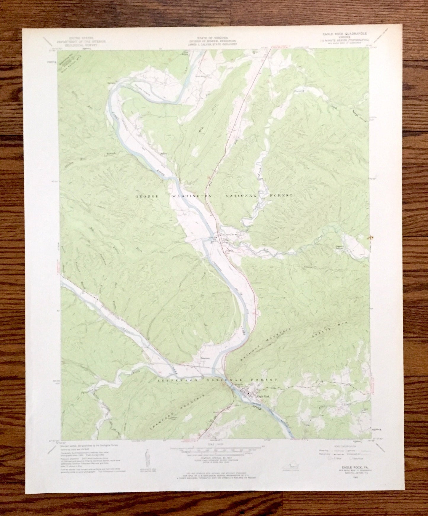
Antique Eagle Rock, Virginia 1962 US Geological Survey Topographic Map – Botetourt County, Jefferson, George Washington National Forest, VA
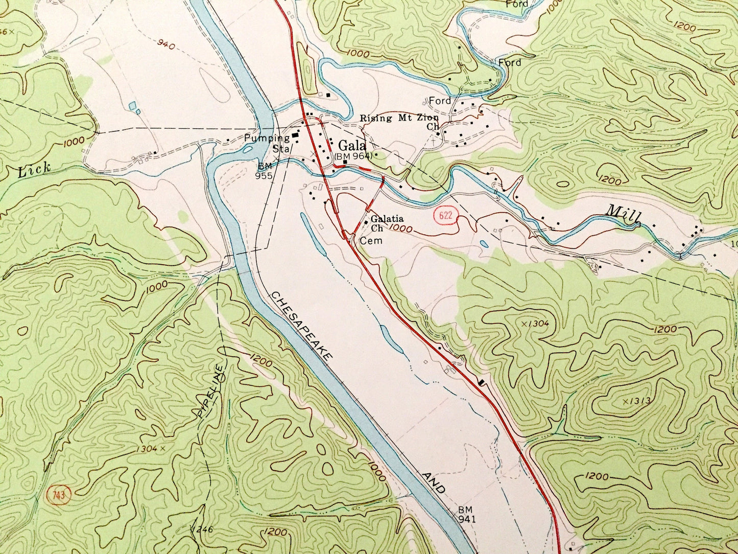
Antique Eagle Rock, Virginia 1962 US Geological Survey Topographic Map – Botetourt County, Jefferson, George Washington National Forest, VA
Beautiful, antique map of Eagle Rock, Virginia and surrounding Botetourt County area. This is an authentic 1962 edition, 1963 print from the U.S. Geological Survey and NOT a computer reproduction.
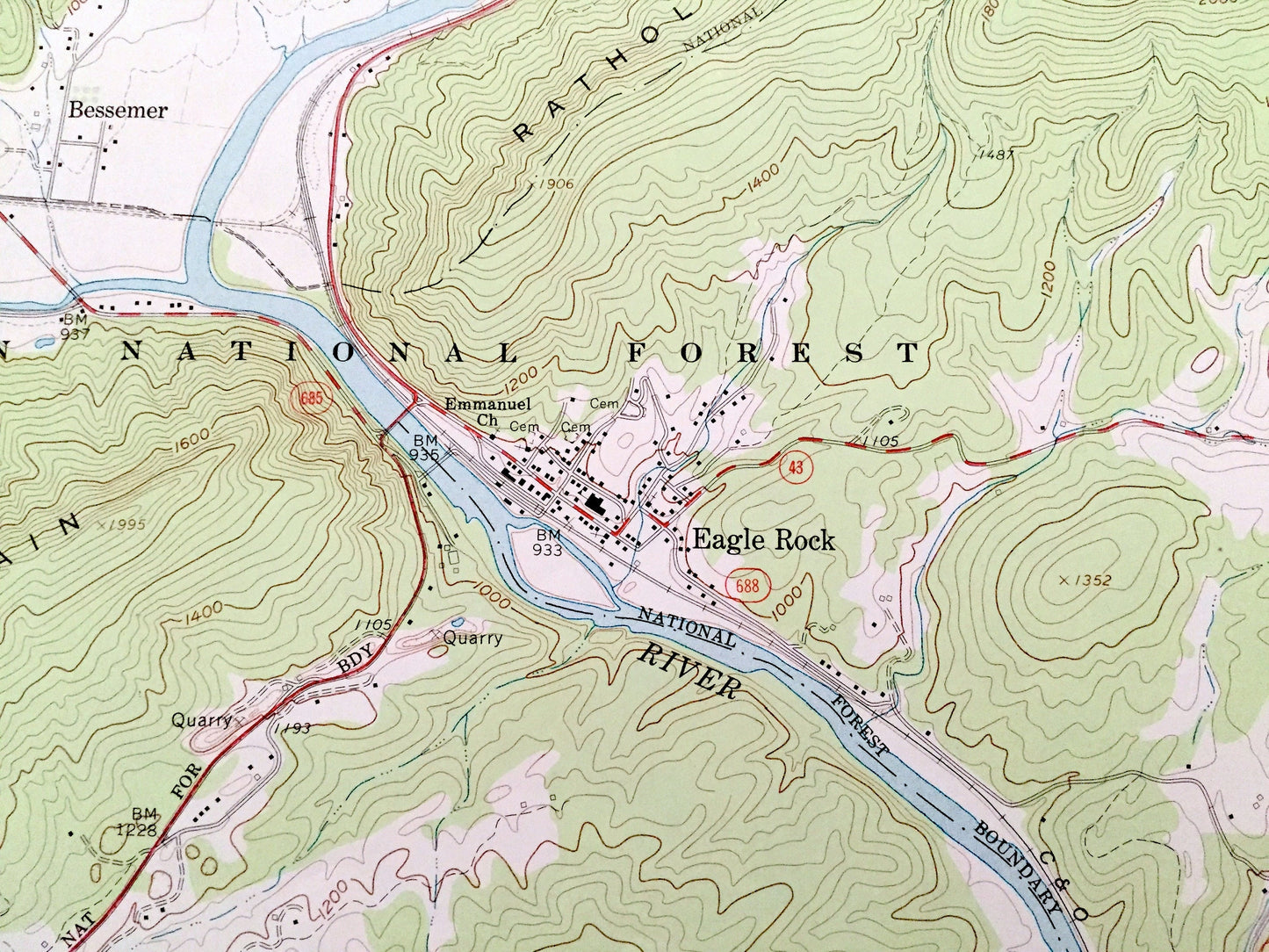
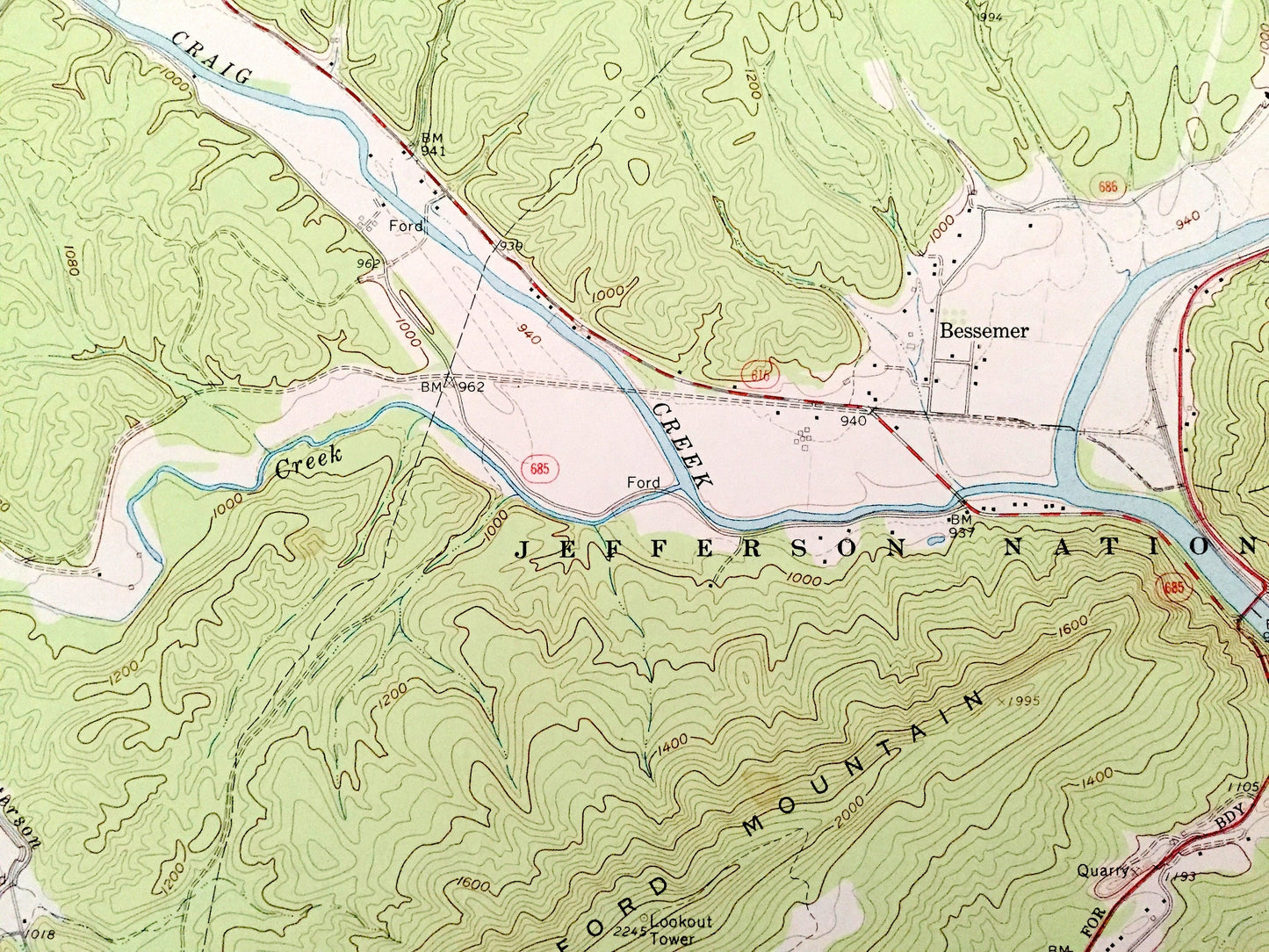
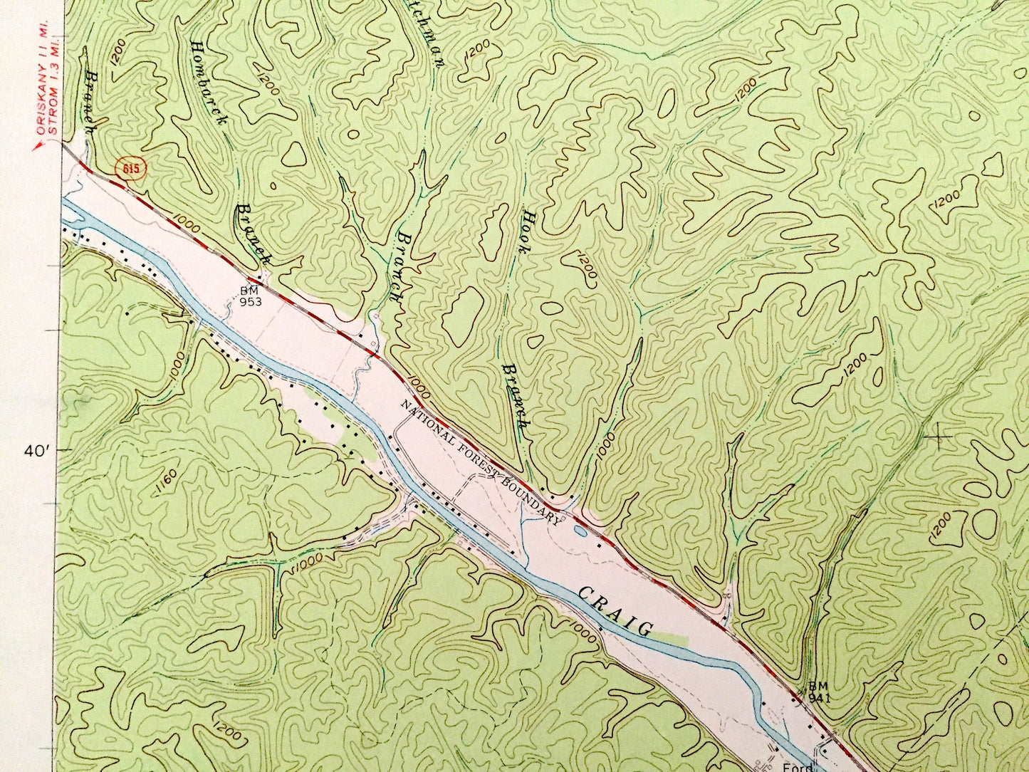
See what Virginia looked like 60 years ago. Lots of intricate details and geological contours. Map even has little squares for every house that existed at the time. The USGS cartographers were very thorough back then!
Perfect for the historian, map-lover, the curious or just as a conversation starter. Wonderful and rare. Vintage maps such as these make great gifts.
Edition of 1962, printed 1963
Dimensions: 22" width x 27" height
----
Features
Cities & Towns: Eagle Rock, Glen Wilton, Baldwin, Haden, Gala, Daggers Springs, Bessemer.
Points of Interest: Alleghany County, Botetourt County, George Washington National Forest, Jefferson National Forest, James River, James Creek, Sinking Creek, Mill Creek, Rich Patch Mountains, Rathole Mountain, Sheets Mountain, Crawford Mountain, Big Creek, Patterson Creek, Allen Creek, and many more creeks, hills, houses and roads.
Condition: Good Vintage condition, commensurate with age. This map is in great shape for being over 55 years old. Has light wear and toning, but this will read as vintage character when framed.
----
We will happily adjust shipping price for multiple purchases. Maps are rolled up and shipped in sturdy mailing tubes, never folded.
Couldn't load pickup availability
Share