My Store
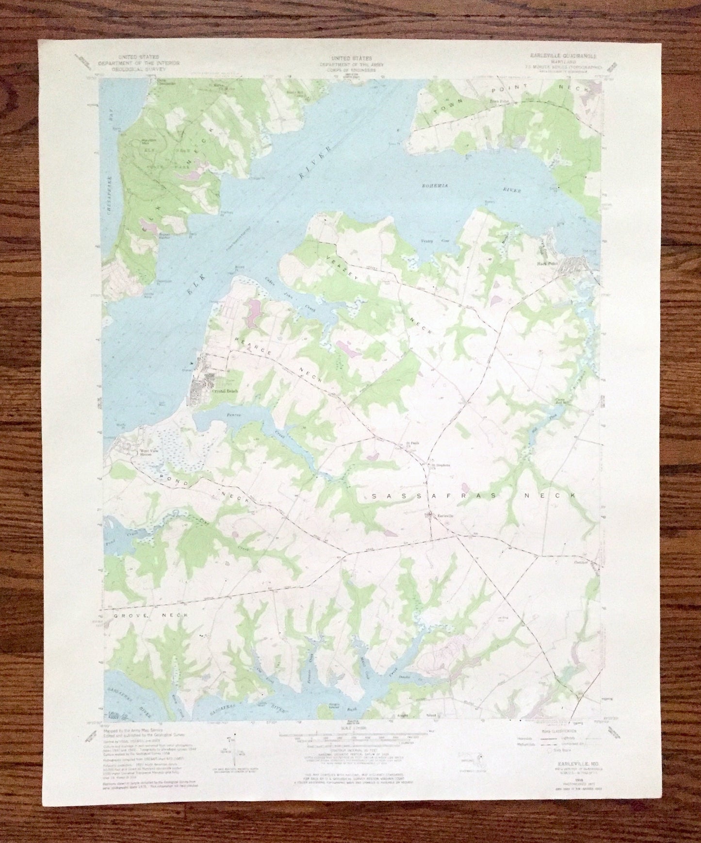
Antique Earleville, Maryland 1958 US Geological Survey Topographic Map – Cecil County, Town Point, Crystal Beach, West View Shores, MD
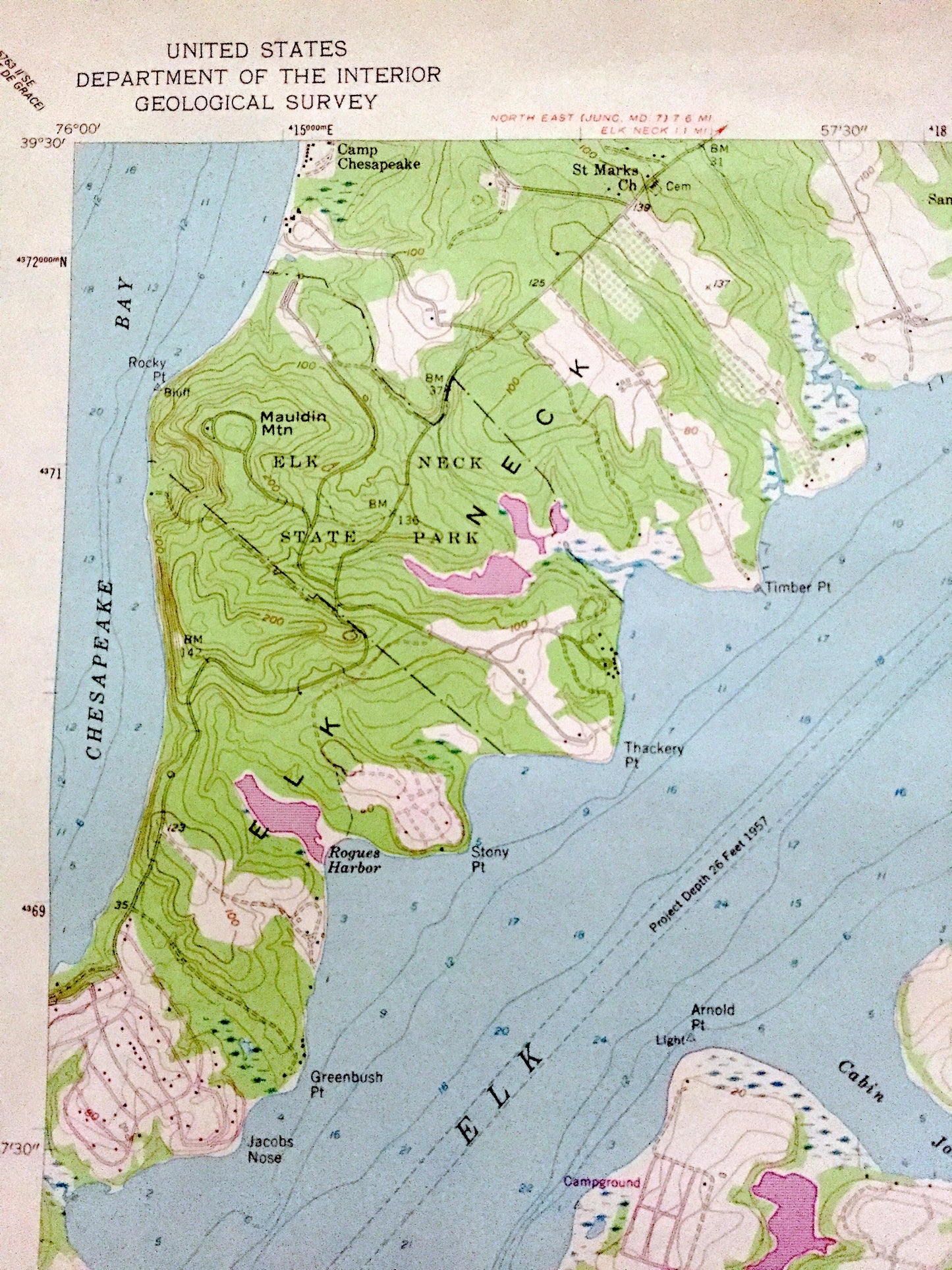
Antique Earleville, Maryland 1958 US Geological Survey Topographic Map – Cecil County, Town Point, Crystal Beach, West View Shores, MD
Beautiful, antique map of Earleville, Maryland and surrounding Cecil County area. This is an authentic 1958 edition, 1977 print from the U.S. Geological Survey and NOT a computer reproduction.
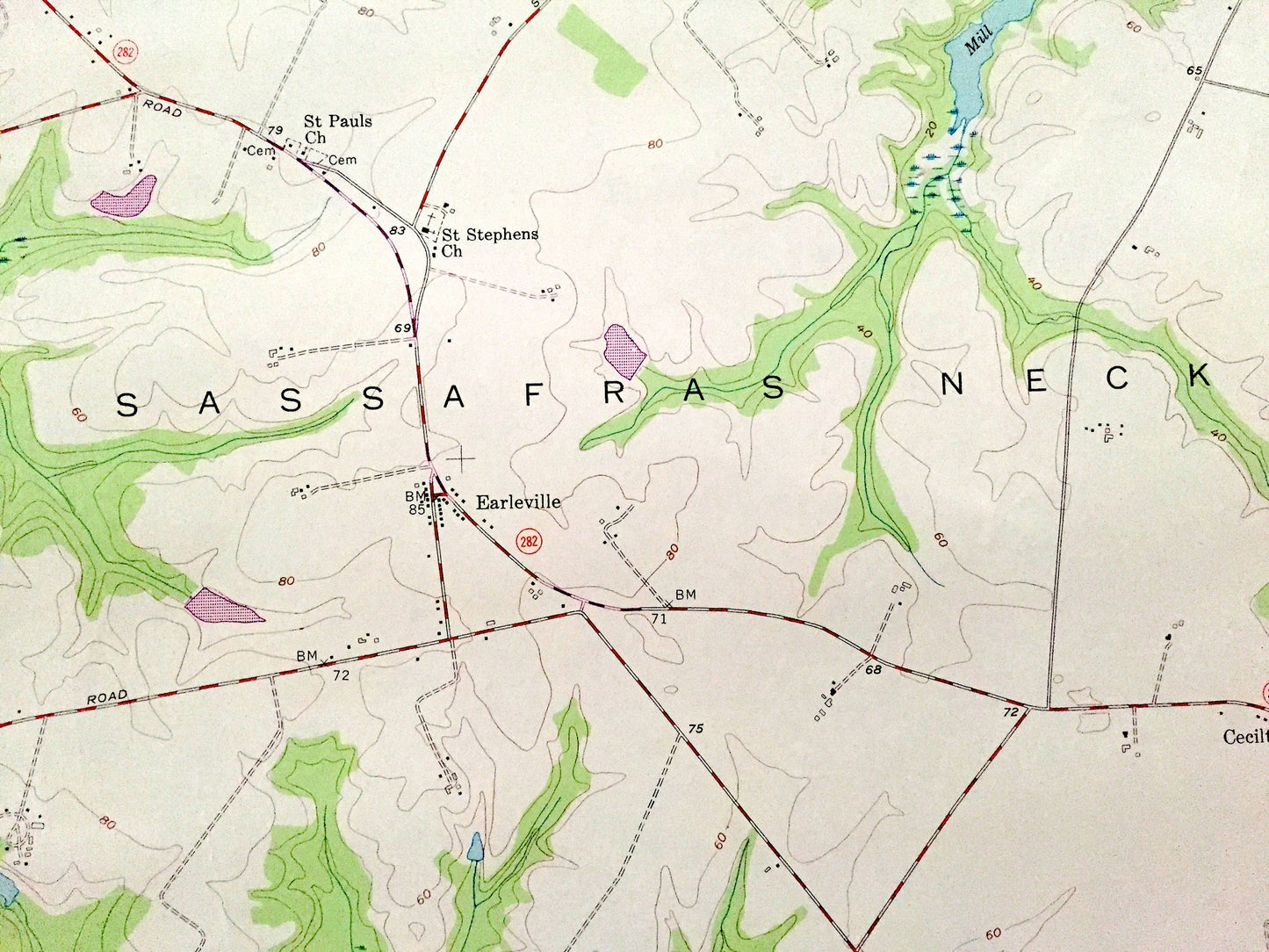
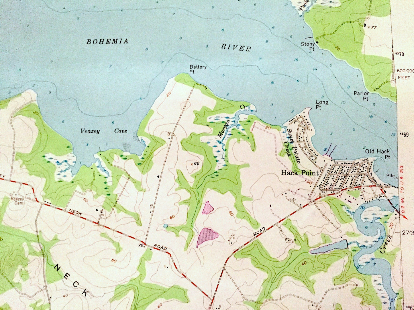
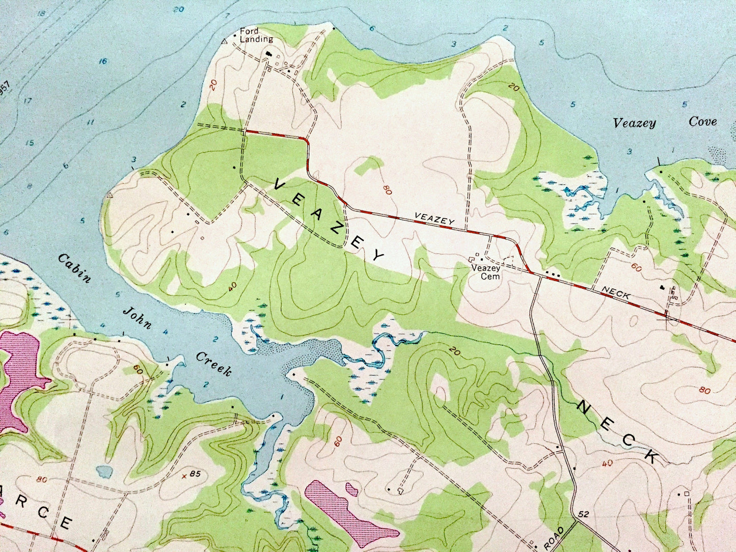
See what Maryland looked like over 60 years ago. Lots of intricate details and geological contours. Map even has little squares for every house that existed at the time. The cartographers were very thorough back then!
Perfect for the historian, map-lover, the curious or just as a conversation starter. Wonderful and rare. Vintage maps such as these make great gifts.
Edition of 1958, printed 1977
Dimensions: 22" width x 27" height
----
Features
Cities & Towns: Hack Point, Cecilton, Town Point, Crystal Beach, West View Shores.
Points of Interest: Elk Neck State Park, Mauldin Mountain, Elk Neck, Town Point Neck, Veazey Neck, Pearce Neck, Pond Neck, Sassafras Neck, Grove Neck, Knight Island, Camp Chesapeake, Sandy Hill Camp, Camp Red Mill, Elk River, Bohemia River, Sassafras River, Money Creek, Coz Creek, Foreman Creek, McGill Creek, Pearce Creek, Cabin John Creek, and many more hills, streams, ponds, houses, schools, railroads, churches and roads.
Condition: Good Vintage condition, commensurate with age. This map is in great condition for being over 45 years old. Has some edge-wear and toning, but this will all add to vintage character when framed.
----
We will happily adjust shipping price for multiple purchases. Maps are rolled up and shipped in sturdy mailing tubes, never folded.
Couldn't load pickup availability
Share