My Store
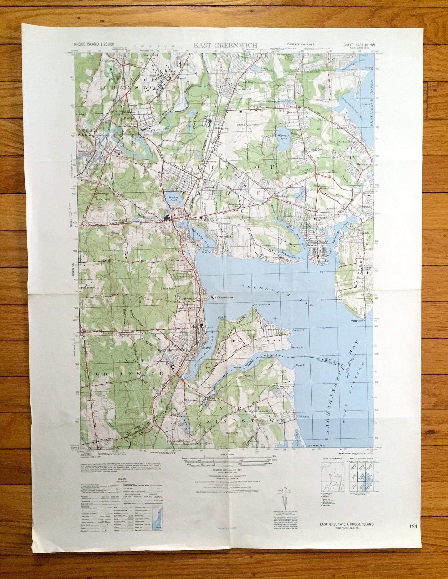
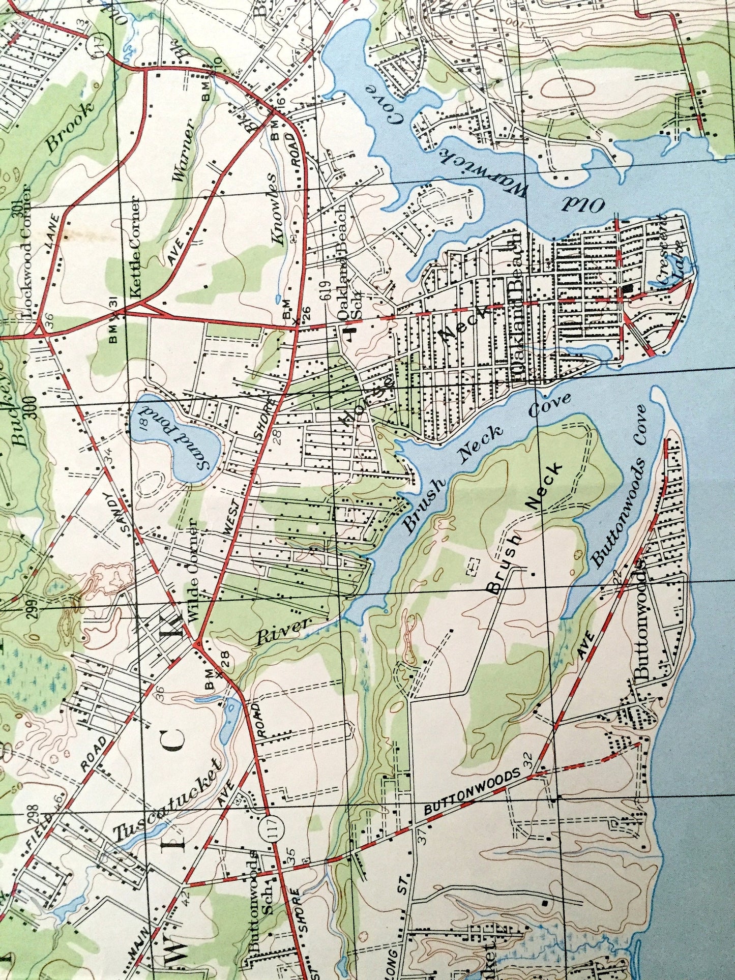
Antique East Greenwich, Rhode Island 1947 US Geological Survey Topographic Map – Kent County, Narragansett Bay, Warwick, North Kingstown, RI
Antique East Greenwich, Rhode Island 1947 US Geological Survey Topographic Map – Kent County, Narragansett Bay, Warwick, North Kingstown, RI
Beautiful, antique map of East Greenwich, Rhode Island and surrounding Kent, Providence, and Washington County area. This is an authentic 1947 print from the U.S. Geological Survey and US Army Corps of Engineers and is NOT a computer reproduction.
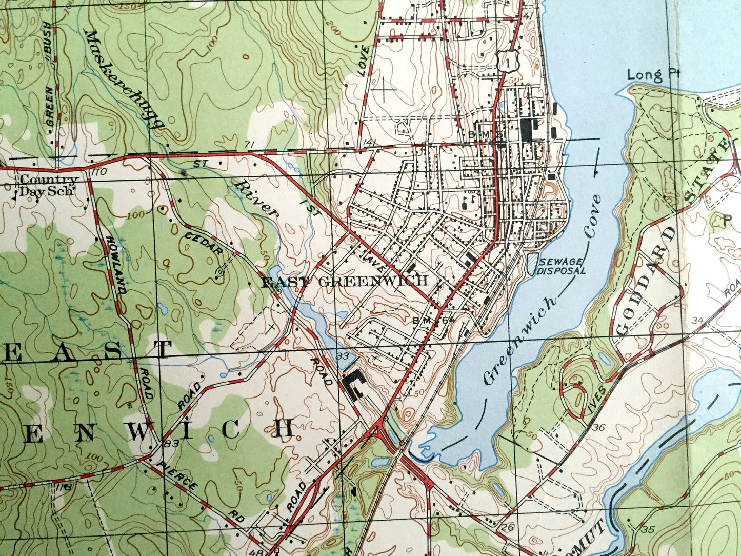
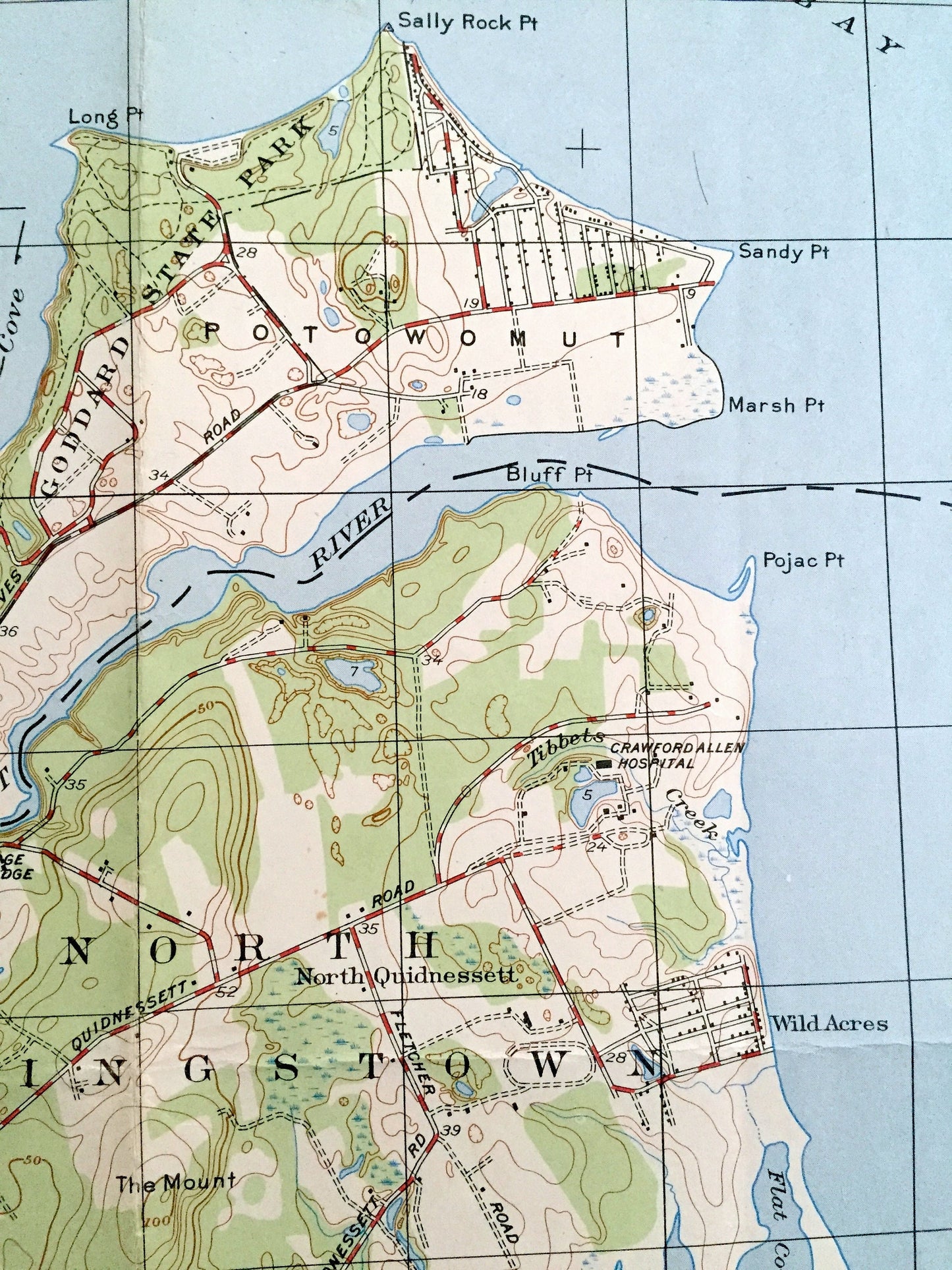
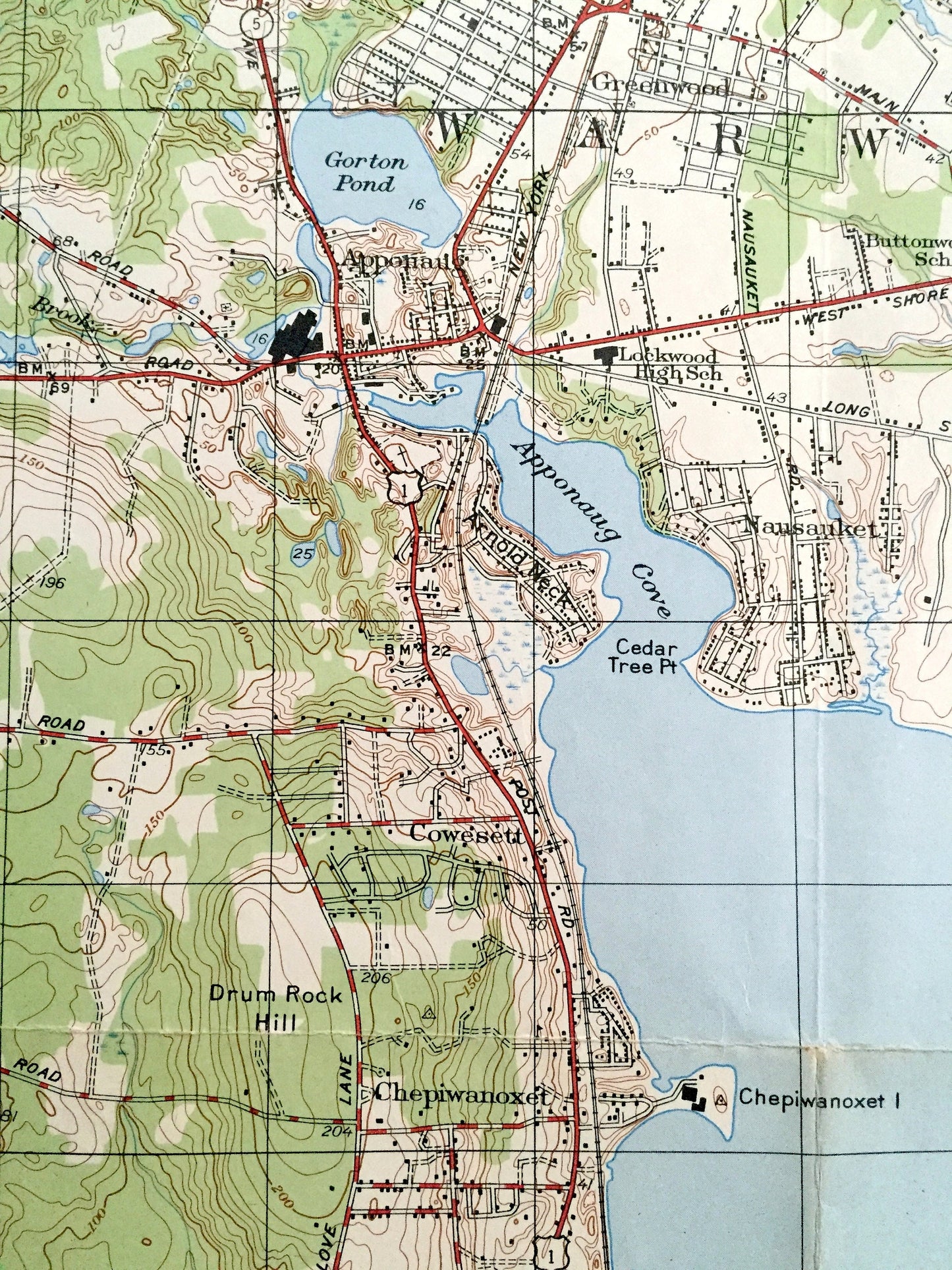
See what Rhode Island looked like over 75 years ago. Lots of intricate details and geological contours. Map even has little squares for every house that existed at the time. The USGS cartographers were very thorough back then!
Perfect for the historian, map-lover, the curious or just as a conversation starter. Wonderful and rare. Vintage maps such as these make great gifts.
Edition of 1947, printed 1947
Dimensions: 22" width x 29" height
----
Features
Cities & Towns: East Greenwich, Frenchtown, Quidnessett, Mount View, North Quidnessett, North Kingstown, Potowomut, Chepiwanoxet, Apponaug, West Warwick, Natick, East Natick, Oaklawn, Cranston, Howard, Greenwood, Hillsgrove, Norwood, Lincoln Park, Spring Green, Lakewood, Palace Garden, Coles, Conimicut, Shawomet, Bayside, Warwick, Kettle Corner, Hoxsie, Oakland Beach, Buttonwoods, Nausauket.
Points of Interest: Narragansett Bay, US Naval Reservation, Greenwich Bay, Potowomut River, The Mount, Potowomut Pond, New York New Haven and Hartford Railroad, Greenwich Cove, Drum Rock Hill, Spencer Hill, OK-Wa-Nessett Camp, Goddard State Park, Chepiwanoxet Island, Apponaug Cove, Gorton Pond, Bald Hill, Pawtuxet River, Sand Pond, Spring Green Pond, Occupessatuxet Cove, Greene Island, Providence River, Bayside Country Club, Warwick Neck, Old Warwick Cove, Light House, Warwick Country Club, Horse Neck, Brush Neck Cove, Buttonwoods Cove, Crescent Lake, Little Pond, Warwick Pond, Theodore Francis Green State Airport, and many more hills, streams, ponds, houses, schools, churches and roads.
Condition: Good Vintage condition, commensurate with age. This map is in great shape for being over 75 years old. Has some edge-wear, toning and folds as-issued, butt these will flatten easily and all of which will add to vintage character when framed.
----
We will happily adjust shipping price for multiple purchases. Maps are rolled up and shipped in sturdy mailing tubes, never folded.
Couldn't load pickup availability
Share