My Store
Antique Eastern Massachusetts 1906 George H Walker & Co Automobile Map – Boston, Lowell, Cape Ann Middlesex Essex Norfolk Plymouth County MA
Antique Eastern Massachusetts 1906 George H Walker & Co Automobile Map – Boston, Lowell, Cape Ann Middlesex Essex Norfolk Plymouth County MA
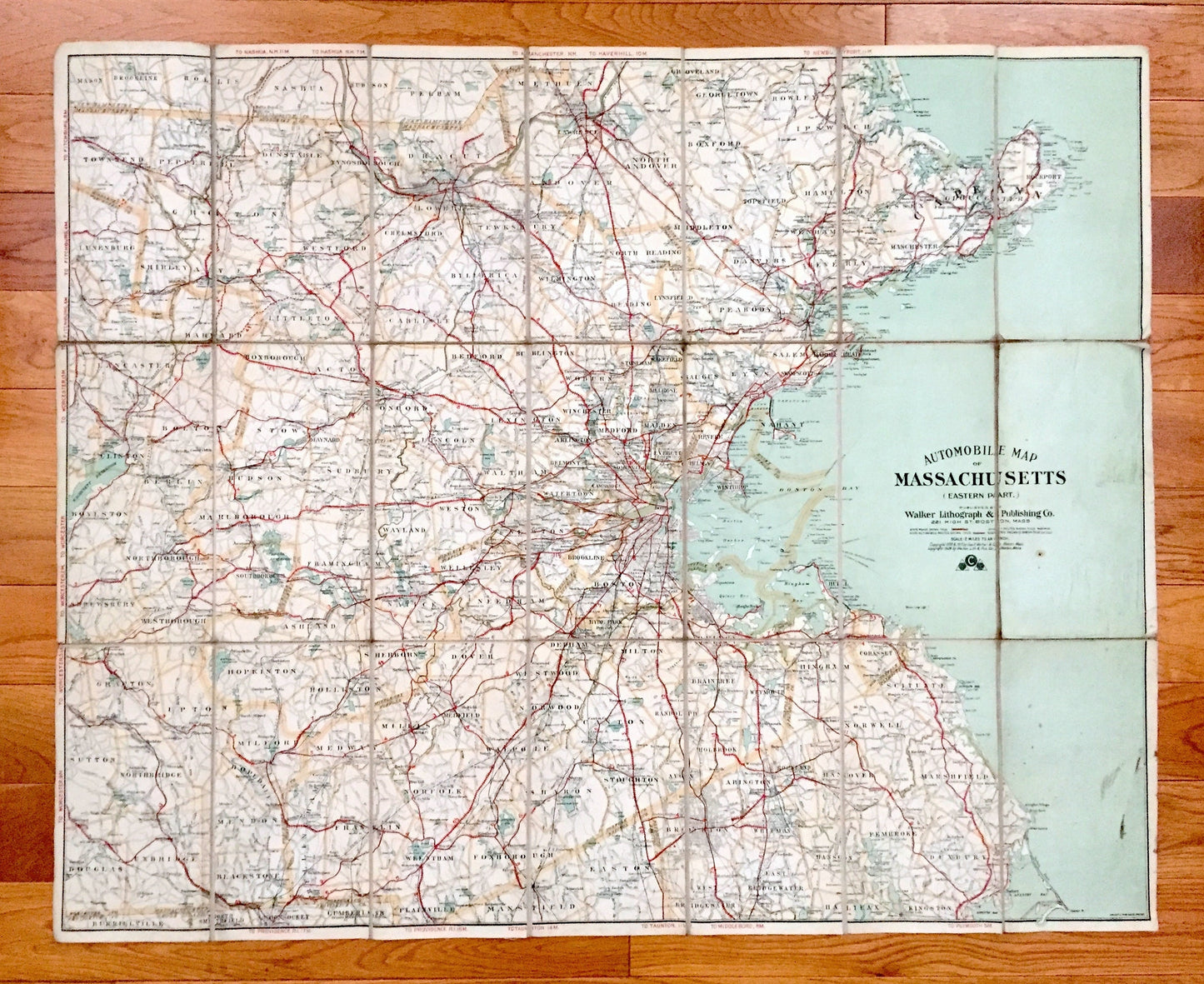
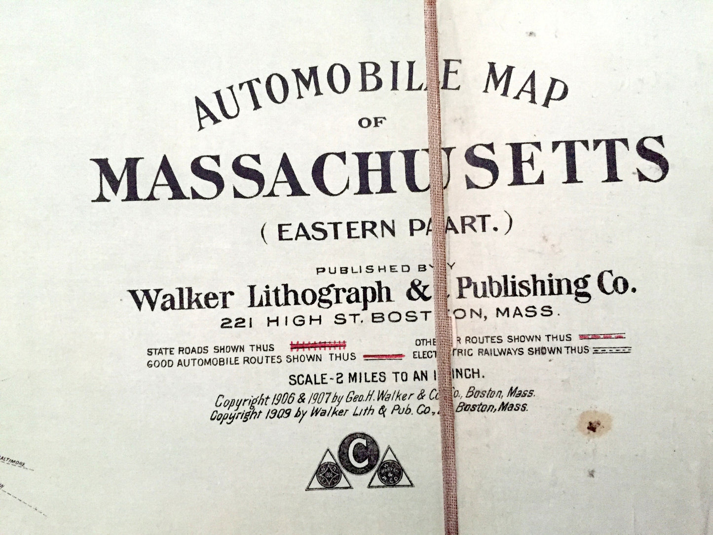
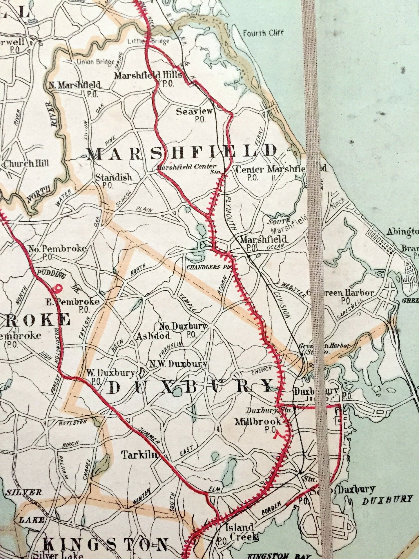
Beautiful, antique Automobile Club map of Eastern Massachusetts, from Boston to Wachusett Reservoir. This is an authentic 1906 edition, 1909 print from The Walker Lithograph & Publishing Co. and is NOT a computer reproduction. These maps are exceedingly rare.
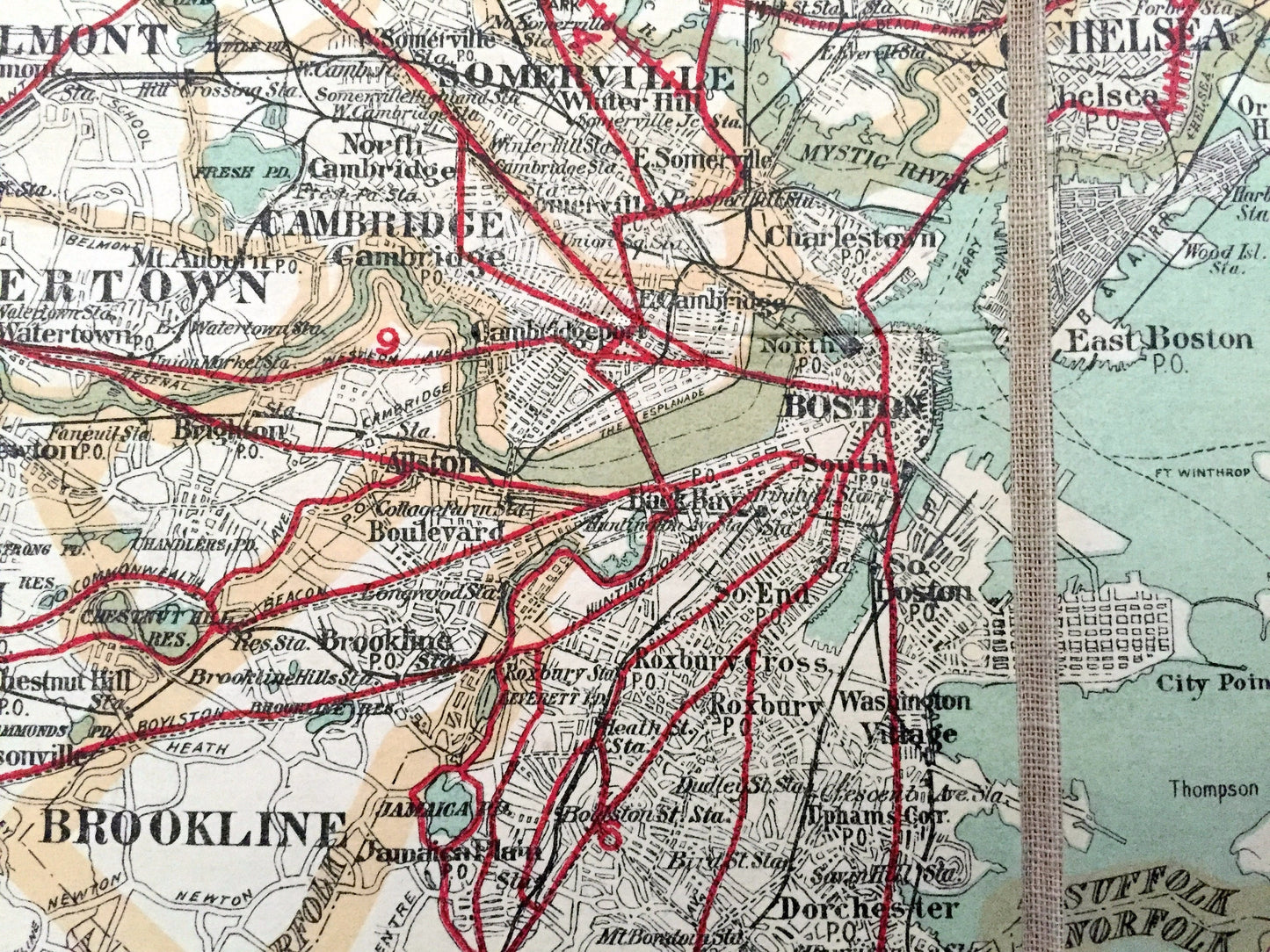
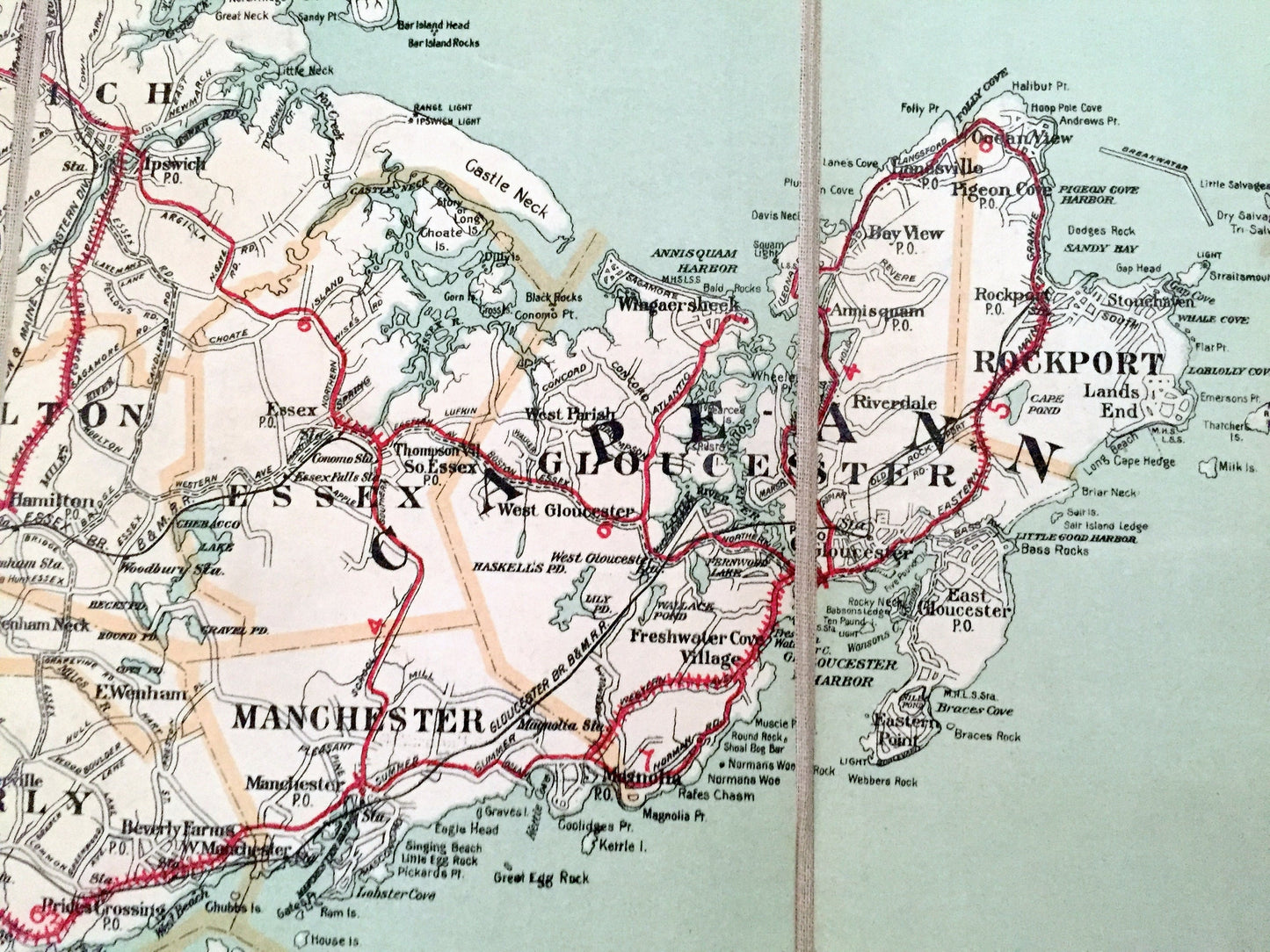
See what Massachusetts looked like almost 120 years ago. Lots of intricate details and geological contours. These maps by George H. Walker were designed specifically for the automobile traveler—a new phenomena of the time. The maps identify state roads, the best automobile routes in red, electric railways and other roads, streets & highways. The maps were split into 21 panels and backed with linen for durability and easy storage.
Perfect for the historian, map-lover, the curious or just as a conversation starter. Wonderful and rare. Vintage maps such as these make great gifts.
Edition of 1906, printed 1909
Dimensions: 34" width x 27 1/4" height
Condition: Good Vintage condition, commensurate with age. This map is in great shape for being over 110 years old. Has some foxing, toning and edge-wear but this will all add to vintage character when framed.
----
We will happily adjust shipping price for multiple purchases. Maps are rolled up and shipped in sturdy mailing tubes, never folded.
Couldn't load pickup availability
Share