My Store
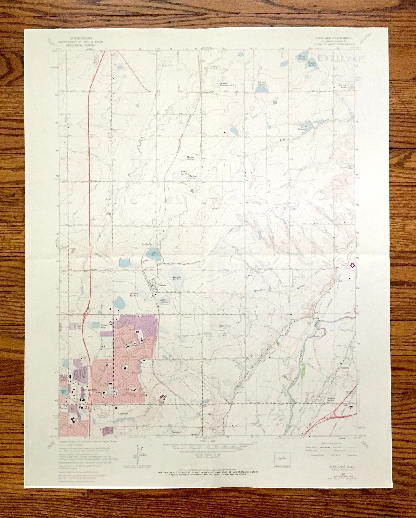
Antique Eastlake, Colorado 1965 US Geological Survey Topographic Map – Thornton, Riverdale, Darlow, Grange Creek, Northglen, Adams County CO
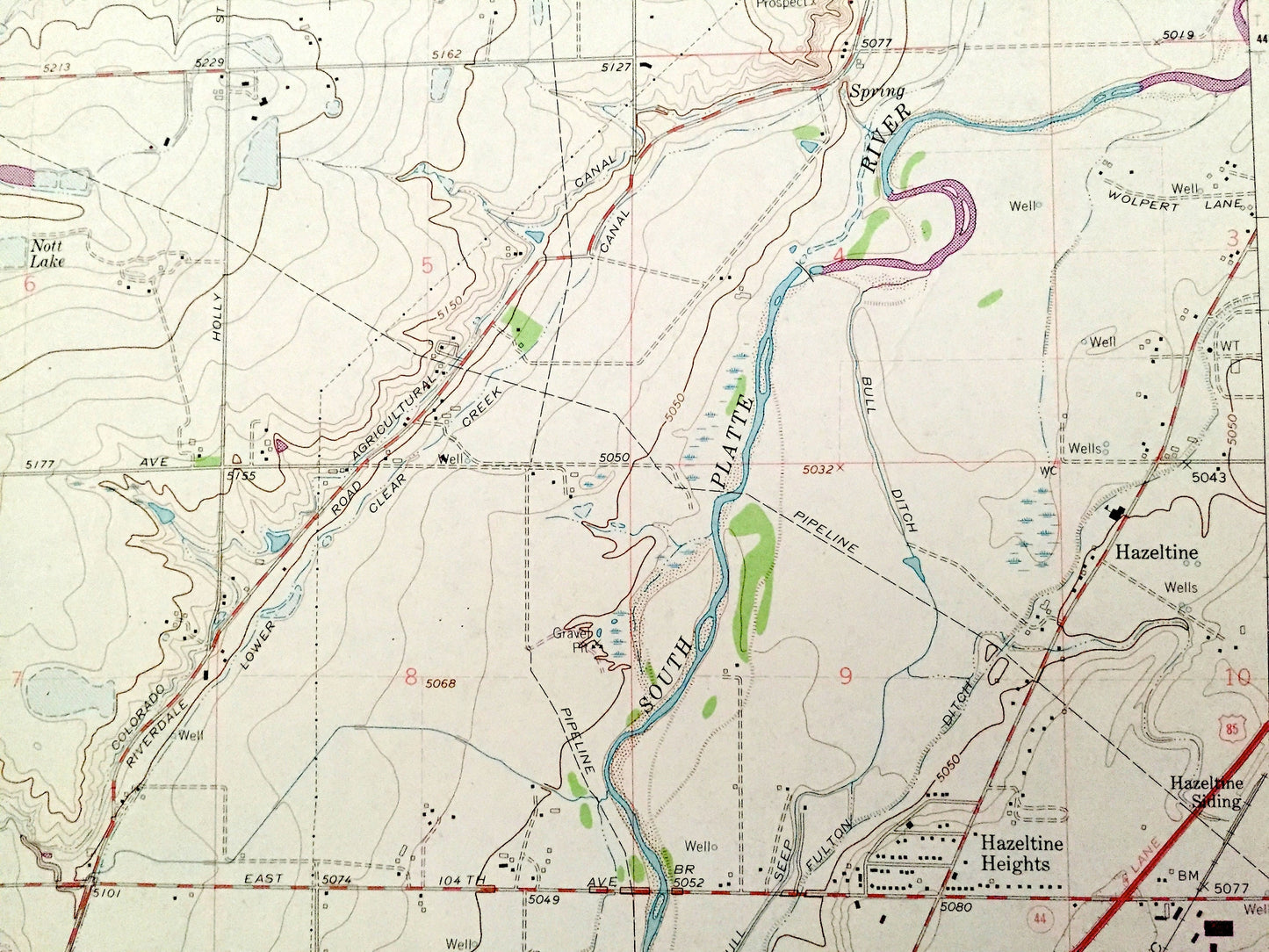
Antique Eastlake, Colorado 1965 US Geological Survey Topographic Map – Thornton, Riverdale, Darlow, Grange Creek, Northglen, Adams County CO
Beautiful, antique map of Eastlake, Colorado and surrounding Adams County area. This is an authentic 1965 edition, 1973 print from the U.S. Geological Survey and not a computer reprint.
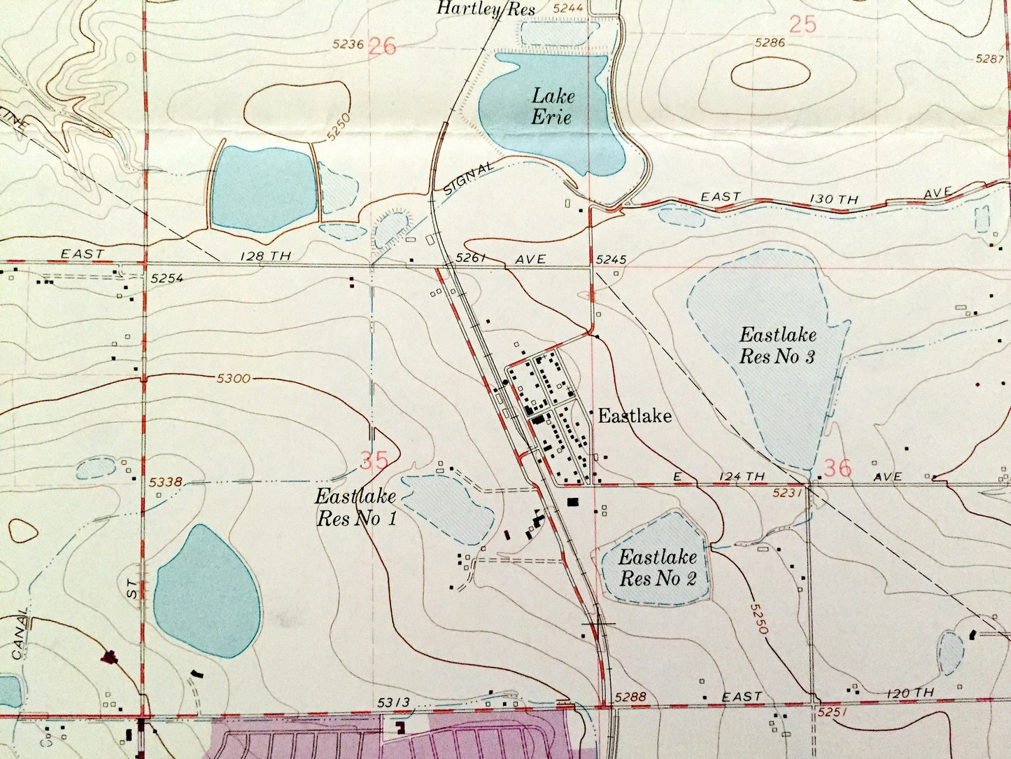
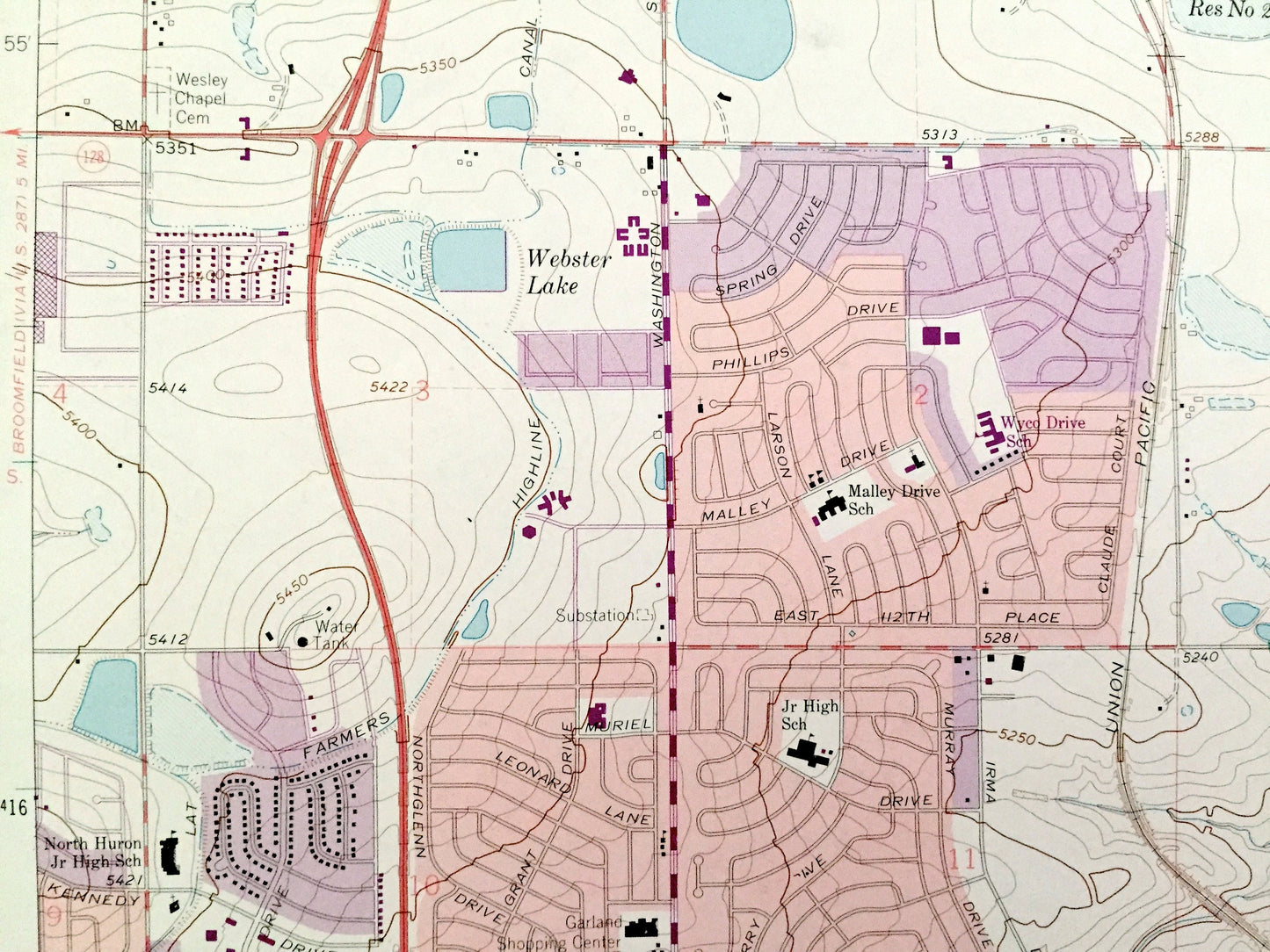
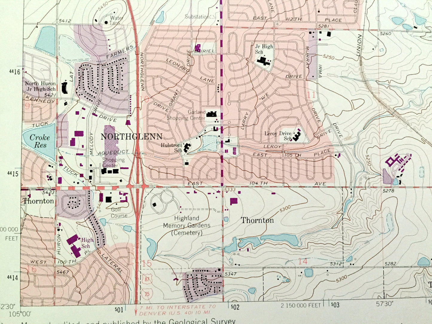
See what Colorado looked like over 55 years ago, before modern development. Lots of intricate details and geological contours. Map even has little squares for every house that existed. The USGS cartographers were very thorough back then!
Perfect for the historian, map-lover, the curious or just as a conversation starter. Wonderful and rare. Vintage maps such as these make great gifts.
Edition of 1965, printed 1973
Dimensions: 17" width x 21" height
----
Features
Cities & Towns: Darlow, Eastlake, Riverdale, Grange Creek, Thornton, Northglen, Hazeltine.
Points of Interest: Adams County, South Platte River, Lake Erie, Poitz Reservoir, Eastlake Reservoir, Smith Reservoir, Grange Hall, Colorado Agricultural Canal, Grange Hall Stream, Big Dry Creek, and many more smaller ponds, streams, houses, schools, roads, churches and train tracks.
Condition: Good Vintage condition, commensurate with age. This map is in great shape for being almost 50 years old. Has light wear and folds as-issued, but these will flatten easily and all will read as vintage character when framed.
----
We will happily adjust shipping price for multiple purchases. Maps are rolled up and shipped in sturdy mailing tubes, never folded.
Couldn't load pickup availability
Share