My Store
Antique Eastport, Maine 1961 US Geological Survey Topographic Map – Lubec, Machias, Jonesport, Moose Island Dennysville Washington County ME
Antique Eastport, Maine 1961 US Geological Survey Topographic Map – Lubec, Machias, Jonesport, Moose Island Dennysville Washington County ME
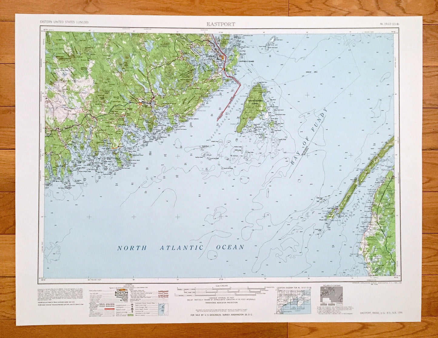
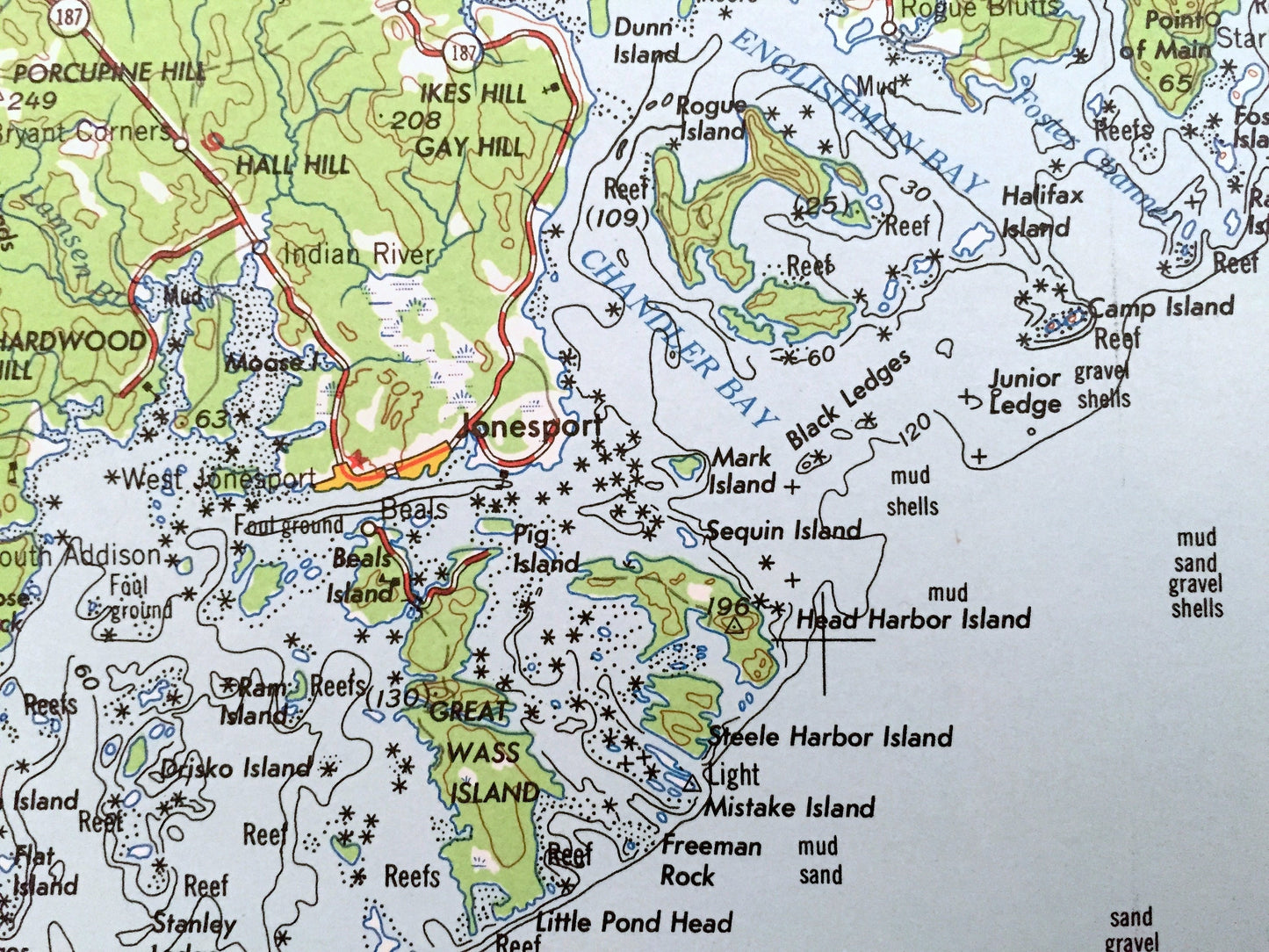
Beautiful, antique map of Eastport, Maine and surrounding Nova Scotia and New Brunswick, Canada areas. This is an authentic 1961 edition, 1961 print from the U.S. Geological Survey and NOT a computer reproduction.
See what Maine, Nova Scotia and New Brunswick, Canada looked like over 55 years ago. Lots of intricate details and geological contours. Map is incredibly large and in the grand 1:250,000 scale. The USGS cartographers were very thorough back then!
Perfect for the historian, map-lover, the curious or just as a conversation starter. Wonderful and rare. Vintage maps such as these make great gifts.
Edition of 1961, printed 1961
Dimensions: 32" width x 22 1/2" height
----
Features
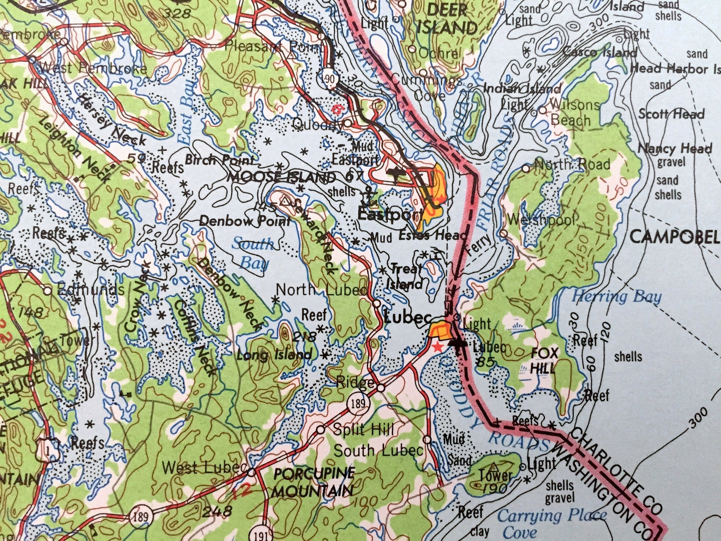
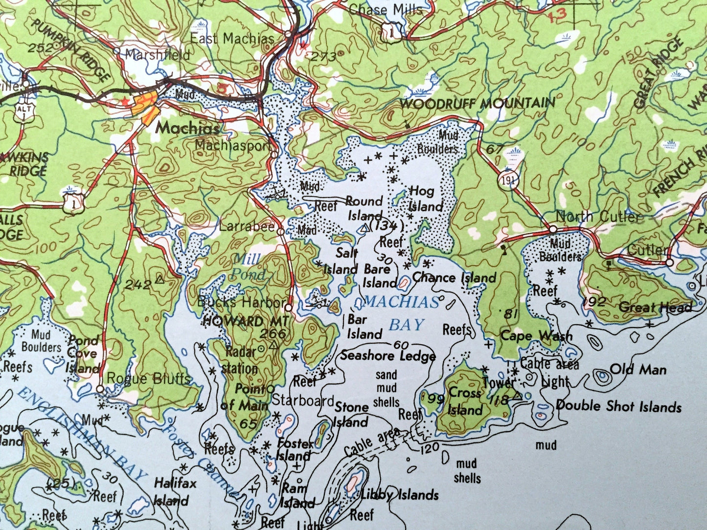
Cities & Towns: Eastport, South Prescott, South Lubec, North Lubec, Pleasant Point, Pembroke, West Pembroke, Cooper, Northfield, Marshfield, Machiasport, Whitneyville, Jacksonville, Harrington, Wyman, East Steuben, Smithville, Dorman, Lubec, Machias, Jonesport, Dennysville.
Points of Interest: MAINE - North Atlantic Ocean, Narraguagus Bay, Englishman Bay, Machias Bay, South Bay, Holmes Cove, Bog Brook Cove, Wallace Cove, Moose Island, Treat Island, Moosehorn National Wildlife Refuge, Pigeon Hill, Hardwood Hill, Carr Hill, Hawkins Ridge, Halls Ridge, Porcupine Mountain, Warren Meadows, Rocky Lake Ridge, Long Lake Ridge, Gardner Lake, Cathance Lake, Lilly Lake and lots more hills, mountains, lakes, rivers, creeks, islands, bays, roads, highways and railroads.
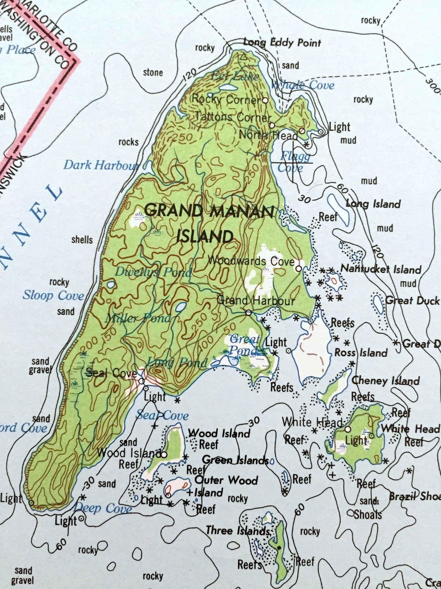
CANADA - New Brunswick, Nova Scotia, North Atlantic Ocean, Bay of Fundy, Grand Manan Channel, Saint Mary Bay, Grand Manan Island, Campobello Island, Long Island, Digby Neck, Belliveau Cove, Pero Jack Cove, Little River Cove, Gaspereau Lake, Long Eddy Point, Pelit Passage and lots more hills, mountains, lakes, rivers, creeks, islands, bays, roads, highways and railroads.
Condition: Very Good condition, commensurate with age. This map is in incredible shape for being over 55 years old. Has light edge-wear, all of which will read as vintage character when framed.
----
We will happily adjust shipping price for multiple purchases. Maps are rolled up and shipped in sturdy mailing tubes, never folded.
Couldn't load pickup availability
Share