My Store
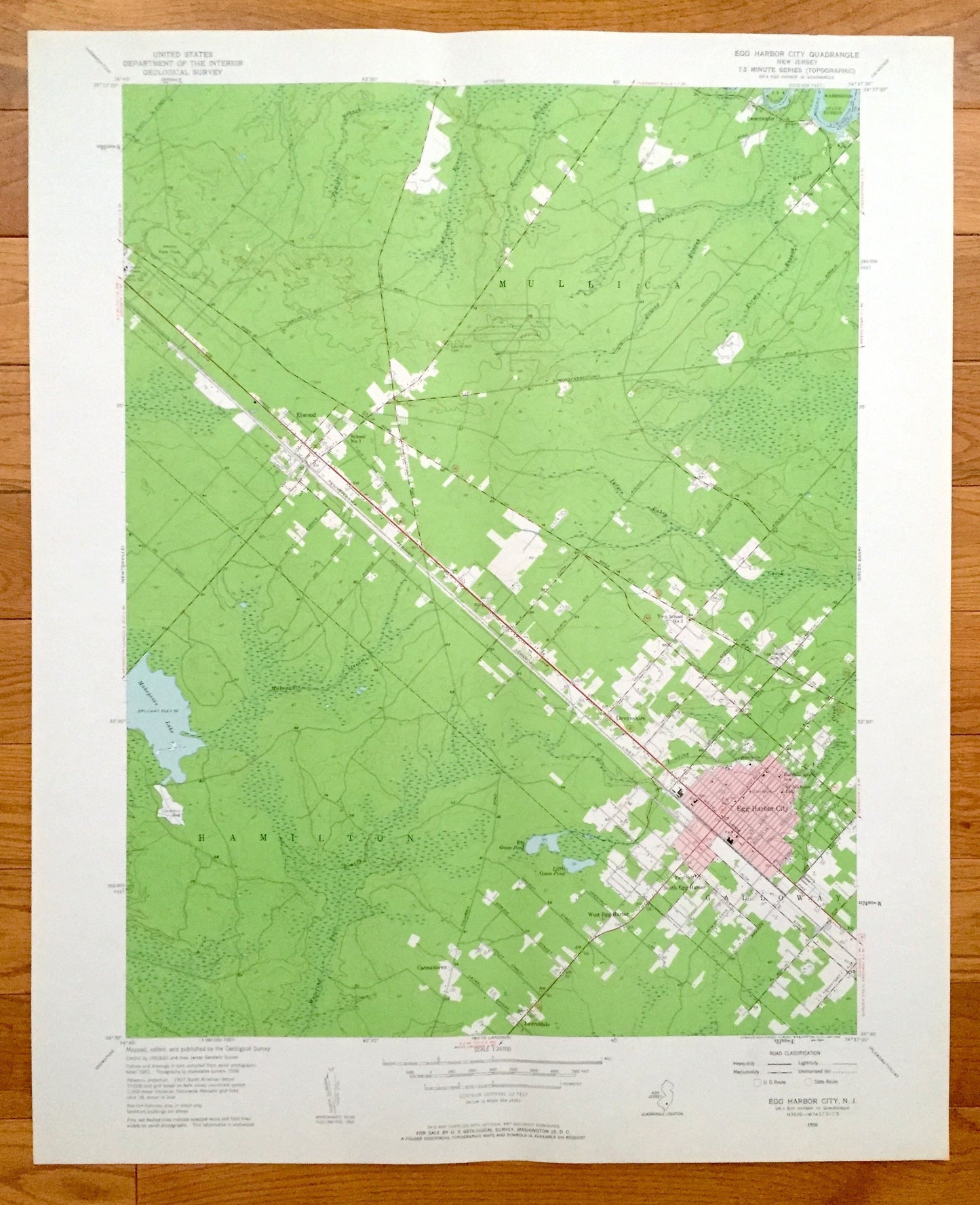
Antique Egg Harbor City, New Jersey 1956 US Geological Survey Topographic Map — Hamilton, Mullica, Galloway, Devonshire, Elwood
Antique Egg Harbor City, New Jersey 1956 US Geological Survey Topographic Map — Hamilton, Mullica, Galloway, Devonshire, Elwood
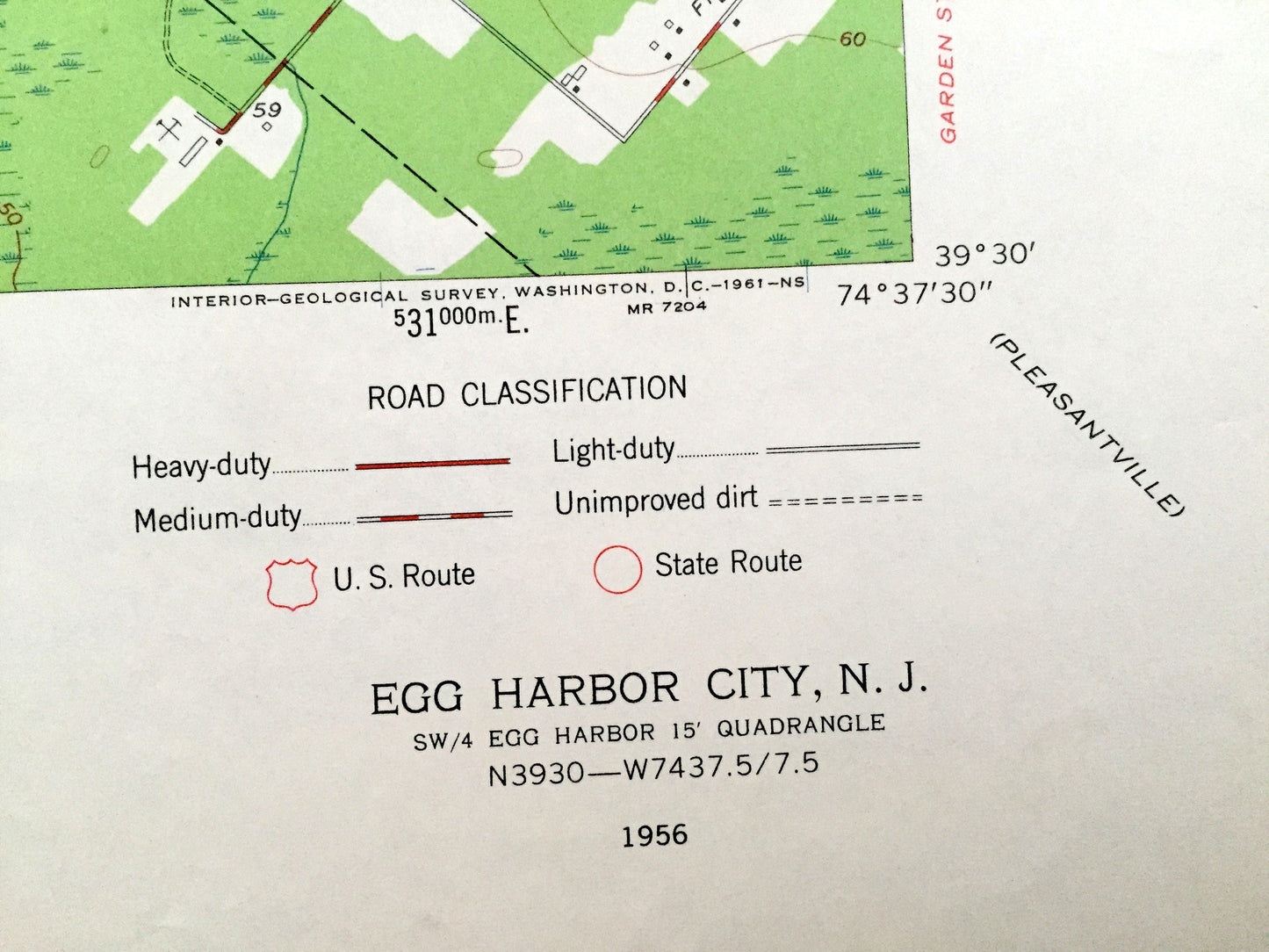
Beautiful, antique map of Egg Harbor City and the surrounding Atlantic County area. This is an authentic 1956 print from the U.S. Geological Survey and NOT a computer reproduction.
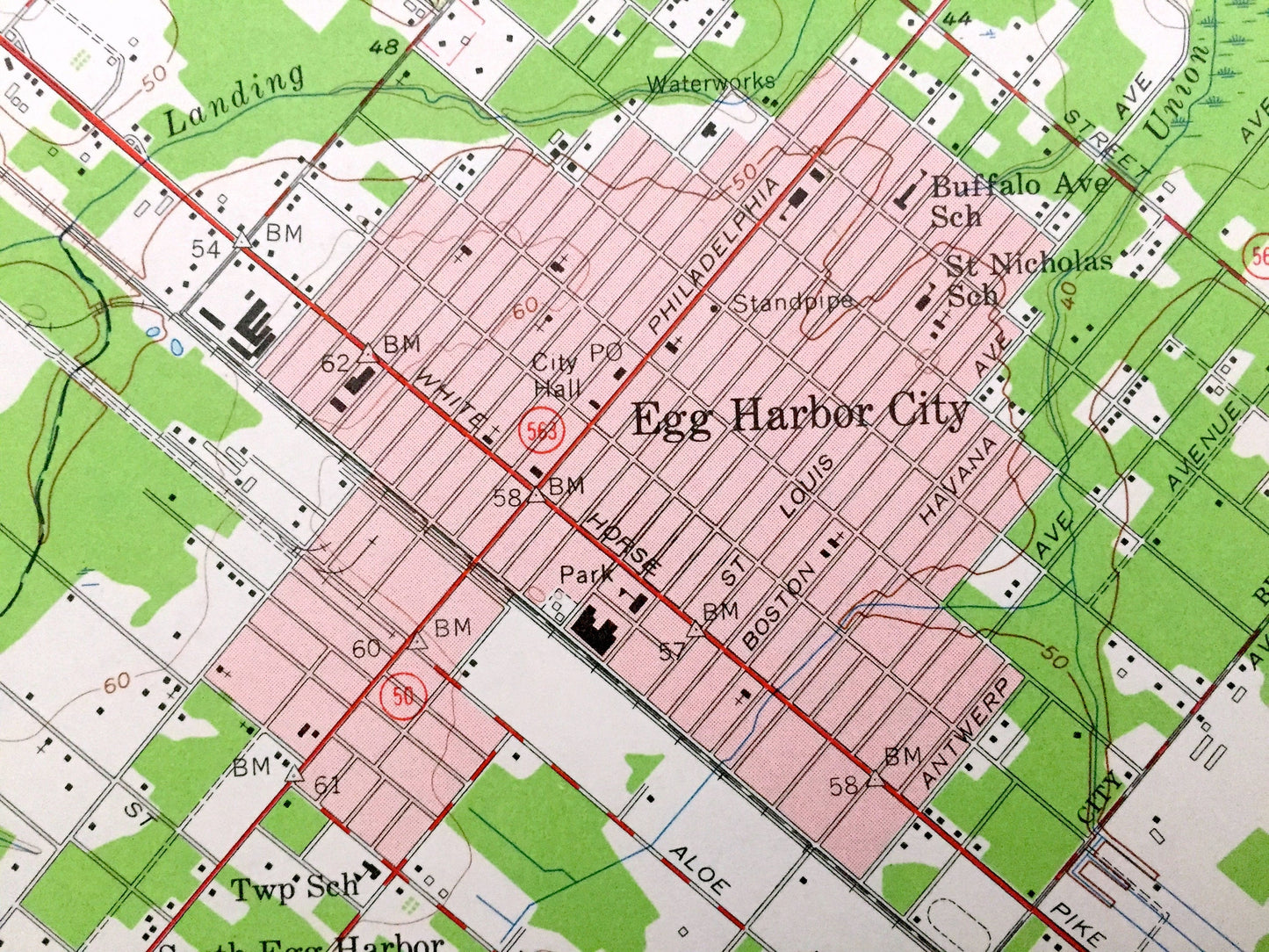
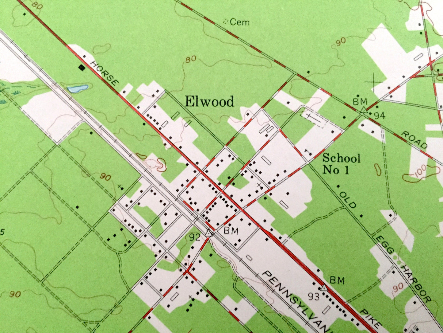
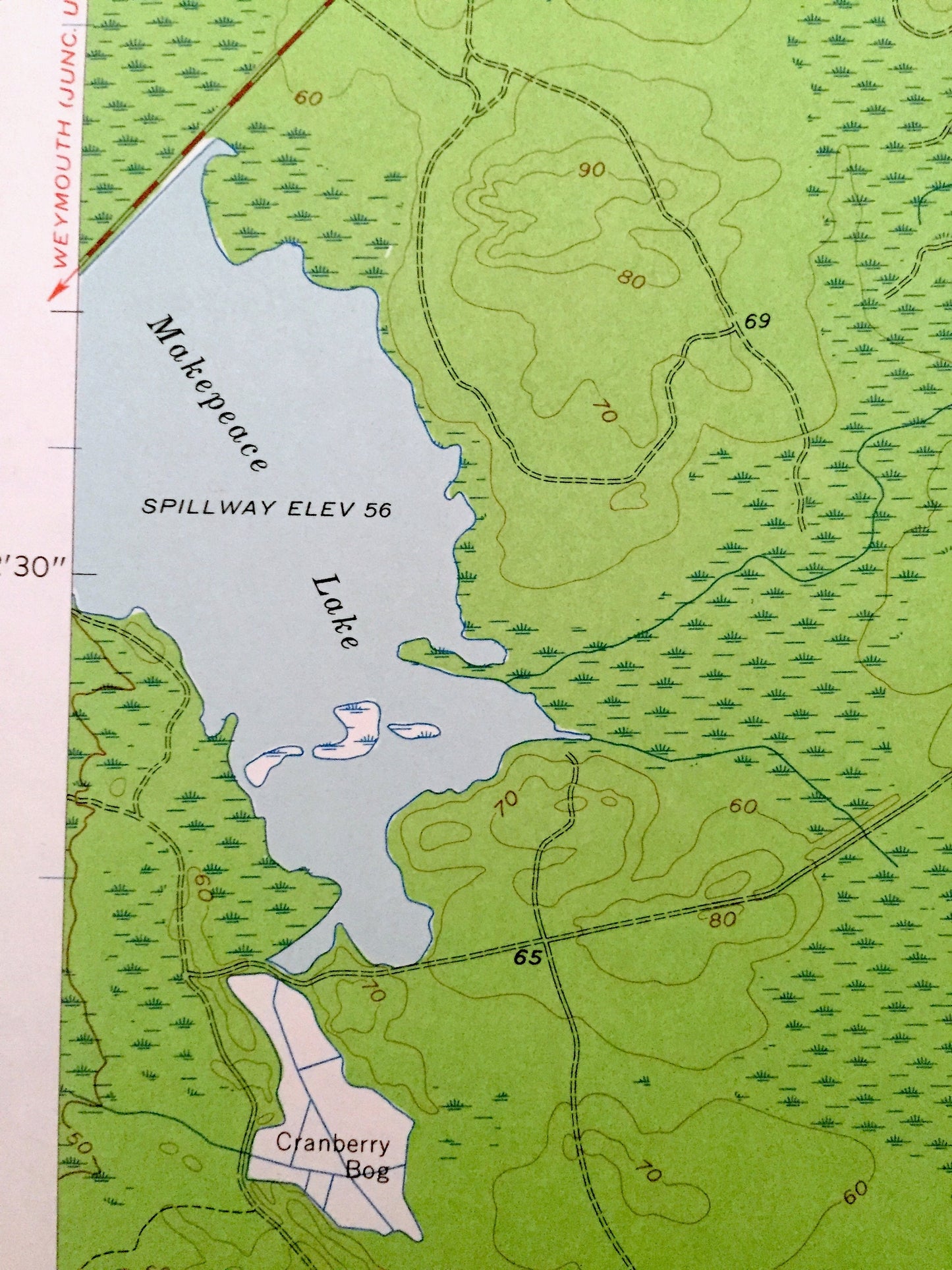
See what New Jersey looked like more than 60 years ago. Lots of intricate details and geological contours. Map even has little squares for every house that existed at the time. The USGS cartographers were very thorough back then! On the back is a description of topographic symbols and map guide.
Perfect for the historian, map-lover, the curious or just as a conversation starter. Wonderful and rare. Vintage maps such as these make great gifts.
Edition of 1956, printed 1956
Dimensions: 22" width x 27" height
----
Features
Cities & Towns: Carmantown, Hamilton, Mullica, Elwood, West Egg Harbor, Laureldale, South Egg Harbor, Galloway, Egg Harbor City, Devonshire, Sweetwater.
Points of Interest: Makepeace lake, Big Gose Pond, Little Goose Pond, Landing Creek, Indian Cabin Creek, Washington State Forest, Mullica River and more roads, houses, beaches, islands, rivers, inlets, marshes, lighthouses and creeks.
Condition: Very Good condition, commensurate with age. This map is in incredible shape for being 60 years old.
----
We will happily adjust shipping price for multiple purchases. Maps are rolled up and shipped in sturdy mailing tubes, never folded.
Couldn't load pickup availability
Share