My Store
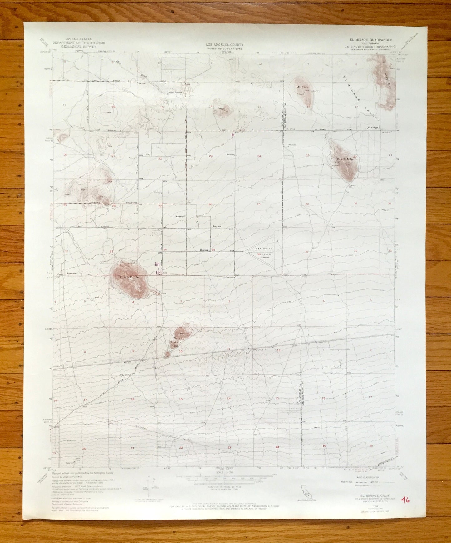
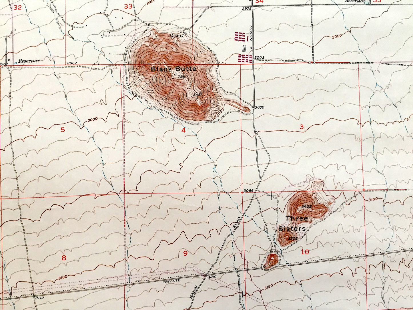
Antique El Mirage Valley, California 1956 US Geological Survey Topographic Map – Los Angeles, San Bernardino County, Black Butte, Gray, CA
Antique El Mirage Valley, California 1956 US Geological Survey Topographic Map – Los Angeles, San Bernardino County, Black Butte, Gray, CA
Beautiful, antique map of El Mirage, California and surrounding San Bernardino County & Los Angeles County area. This is an authentic 1956 edition, 1969 print from the U.S. Geological Survey and NOT a computer reproduction.
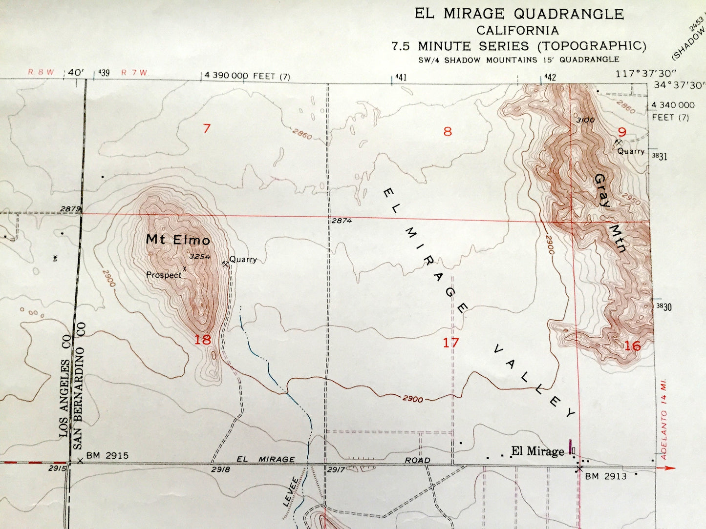
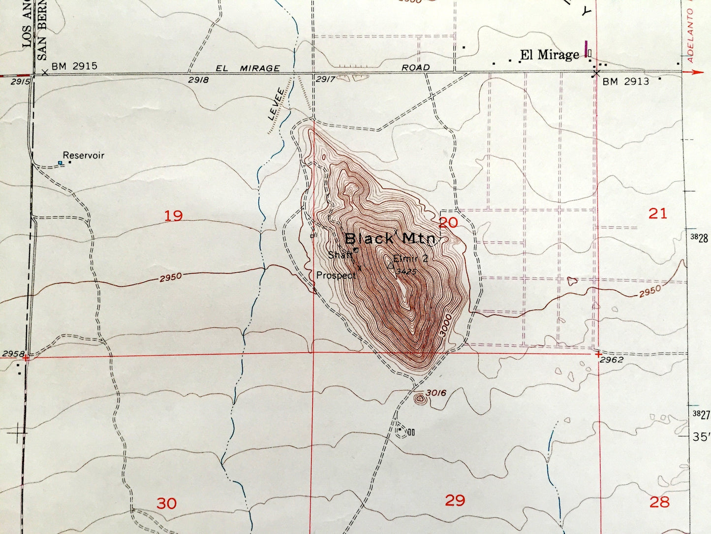
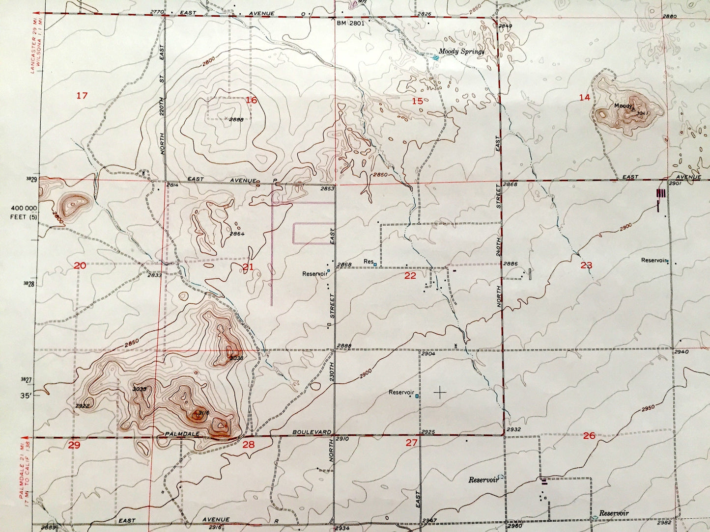
See what California looked like over 65 years ago. Lots of intricate details and geological contours. Map even has little squares for every house that existed at the time. The USGS cartographers were very thorough back then!
Perfect for the historian, map-lover, the curious or just as a conversation starter. Wonderful and rare. Vintage maps such as these make great gifts.
Edition of 1956, printed 1969
Dimensions: 22" width x 27" height
----
Features
Cities & Towns: El Mirage.
Points of Interest: El Mirage Valley, Gray Mountain, Mt Elmo, Black Mountain, Black Butte, Three Sisters, Carl O Gerhardy Wildlife Sanctuary, Theodore Payne Wildlife Sanctuary, Gray Butte Field Airport, and many more hills, ranches, houses, schools, churches and roads.
Condition: Very Good Vintage condition, commensurate with age. This map is in incredible shape for being over 50 years old. Has light wear and marker in bottom right corner, but this will add to vintage character when framed.
----
We will happily adjust shipping price for multiple purchases. Maps are rolled up and shipped in sturdy mailing tubes, never folded.
Couldn't load pickup availability
Share