My Store
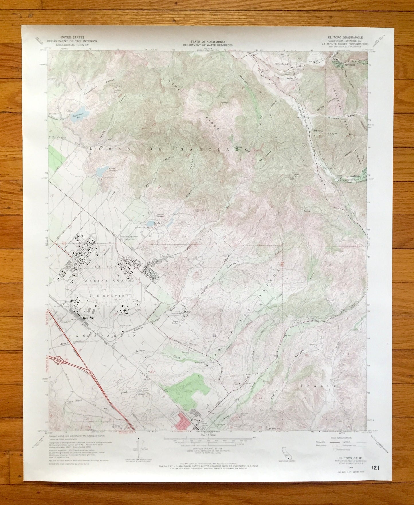
Antique El Toro, California 1968 US Geological Survey Topographic Map – Orange County, Marine Air Base, Irvine, Limestone Canyon Park, CA
Antique El Toro, California 1968 US Geological Survey Topographic Map – Orange County, Marine Air Base, Irvine, Limestone Canyon Park, CA
Beautiful, antique map of El Toro, California and surrounding Orange County. This is an authentic 1968 edition, 1970 print from the U.S. Geological Survey and NOT a computer reproduction.
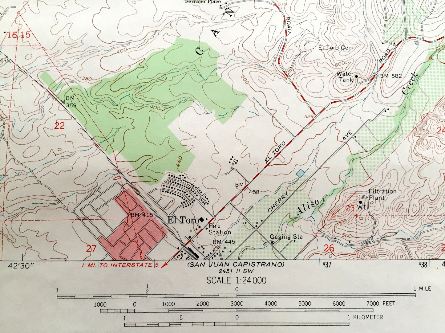
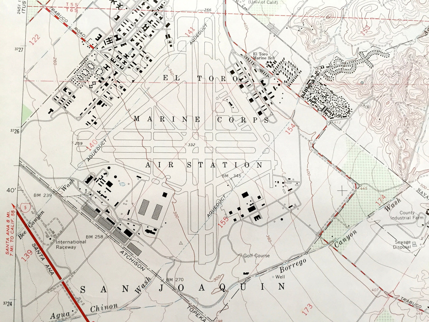
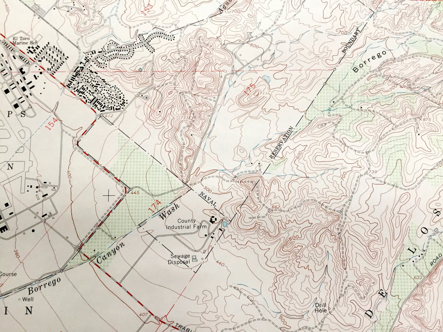
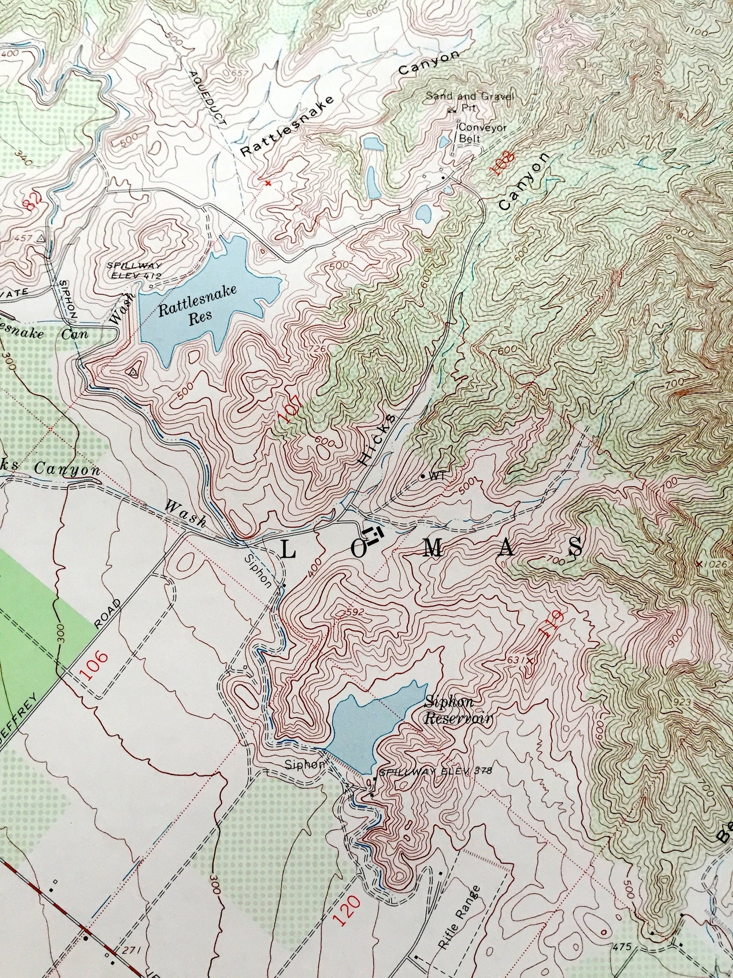
See what California looked like over 55 years ago. Lots of intricate details and geological contours. Map even has little squares for every house that existed at the time. The USGS cartographers were very thorough back then!
Perfect for the historian, map-lover, the curious or just as a conversation starter. Wonderful and rare. Vintage maps such as these make great gifts.
Edition of 1968, printed 1970
Dimensions: 22" width x 27" height
----
Features
Cities & Towns: El Toro, Lomas De Santiago, San Joaquin, Trabuco, Canada De Los Alisos, Silverado, Modjeska.
Points of Interest: Orange County, El Toro Marine Corps Air Station, Loma Ridge, Borrego Canyon, Cleveland National Forest, Aliso Creek, English Canyon, Rattlesnake Reservoir, Irvine Mesa, Limestone Canyon Regional Park, and lots more creeks, reservoirs, canyons, roads, schools and valleys.
Condition: Good Vintage condition, commensurate with age. This map is in great shape for being over 50 years old. Has light wear and marker in bottom right corner, but this will add to vintage character when framed.
----
We will happily adjust shipping price for multiple purchases. Maps are rolled up and shipped in sturdy mailing tubes, never folded.
Couldn't load pickup availability
Share