My Store
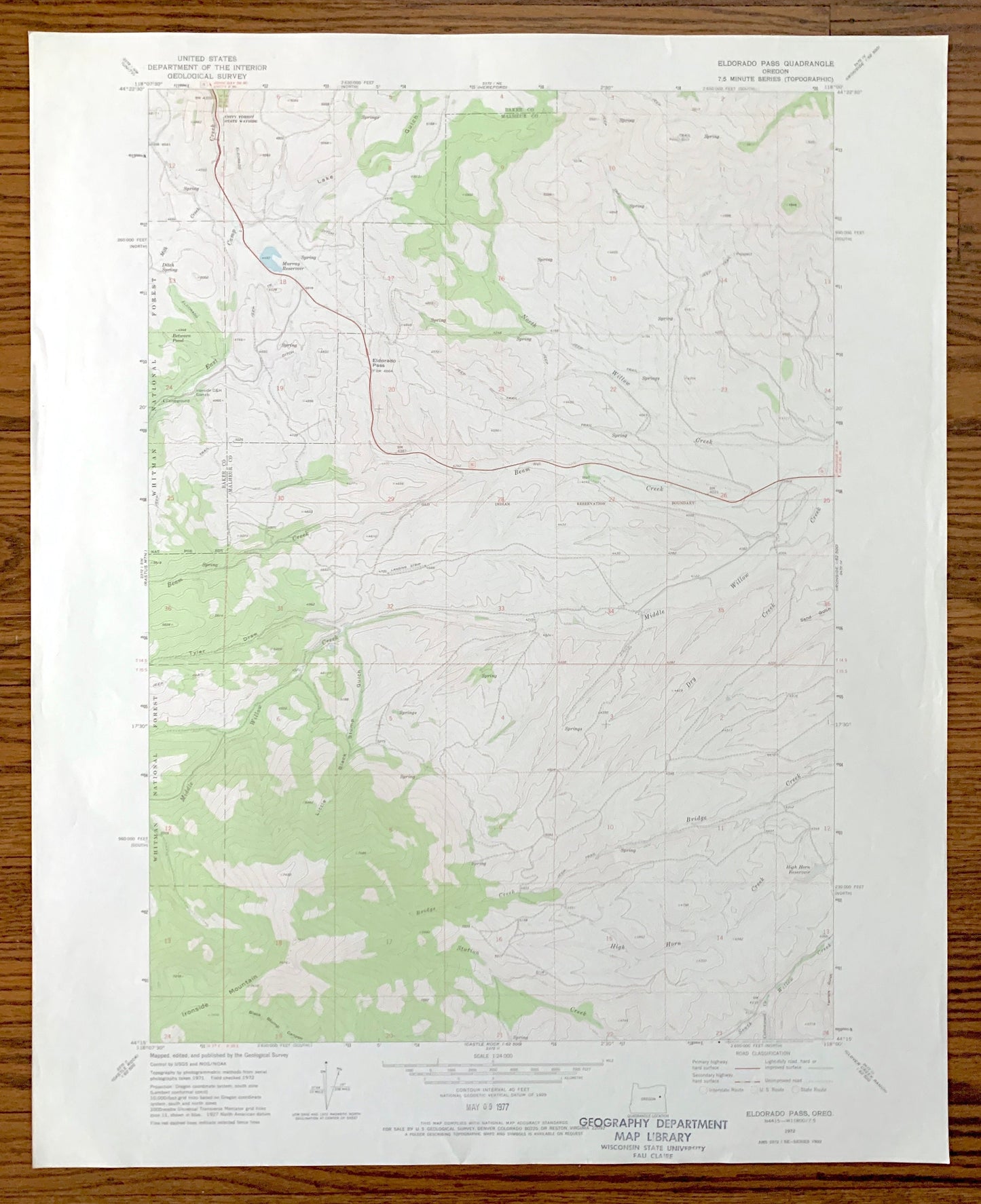
Antique Eldorado Pass, Oregon 1972 US Geological Survey Topographic Map – Baker, Malheur County, Whitman National Forest, OR
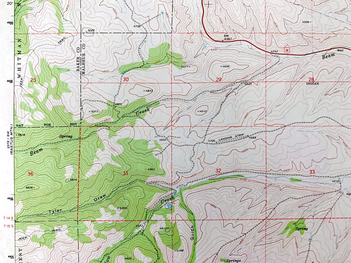
Antique Eldorado Pass, Oregon 1972 US Geological Survey Topographic Map – Baker, Malheur County, Whitman National Forest, OR
Beautiful, antique map of Eldorado Pass, Oregon and surrounding Baker County and Malheur County areas. This is an authentic 1972 edition, 1976 print from the U.S. Geological Survey and NOT a computer reproduction.
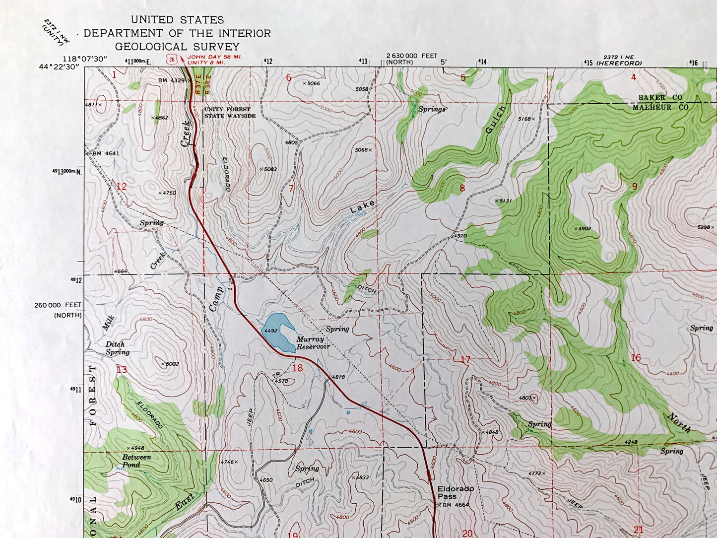
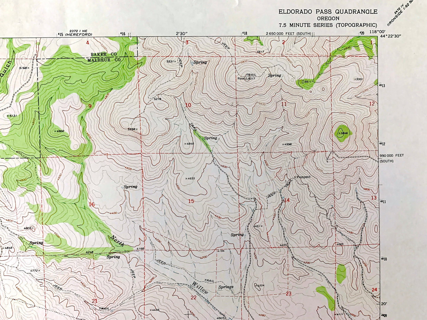
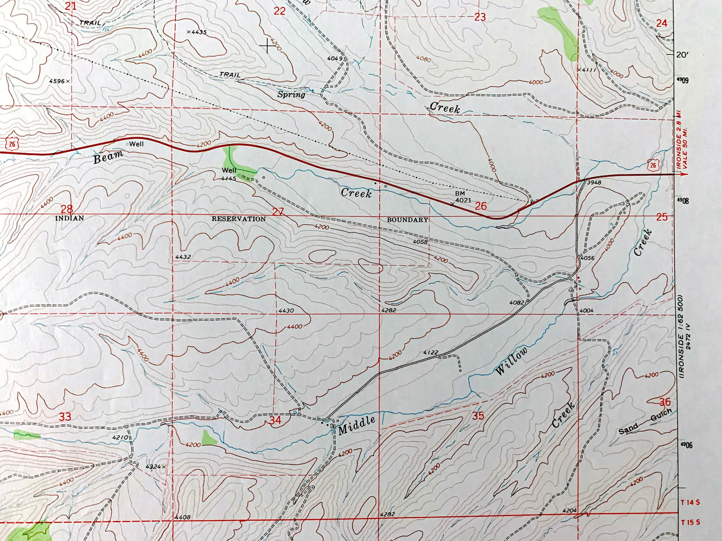
See what Oregon looked like over 50 years ago. Lots of intricate details and geological contours. Map even has little squares for every house that existed at the time. The USGS cartographers were very thorough back then!
Perfect for the historian, map-lover, the curious or just as a conversation starter. Wonderful and rare. Vintage maps such as these make great gifts.
Edition of 1972, printed 1976
Dimensions: 22" width x 27" height
----
Features
Points of Interest: Whitman National Forest, Unity Forest State Wayside, Lake Gulch, Tyler Draw, Little Black Stump Gulch, Ironsides Mountain, East Camp Creek, Beam Creek, Middle Willow Creek, Bridge Creek, North Willow Creek, Milk Creek, and many more hills, streams, ponds, houses, schools, railroads, churches and roads.
Condition: Very Good Vintage condition, commensurate with age. This map is in great shape for being over 45 years old. Has light edge-wear and a stamp on the front but will read as character when framed.
----
We will happily adjust shipping price for multiple purchases. Maps are rolled up and shipped in sturdy mailing tubes, never folded.
Couldn't load pickup availability
Share