My Store
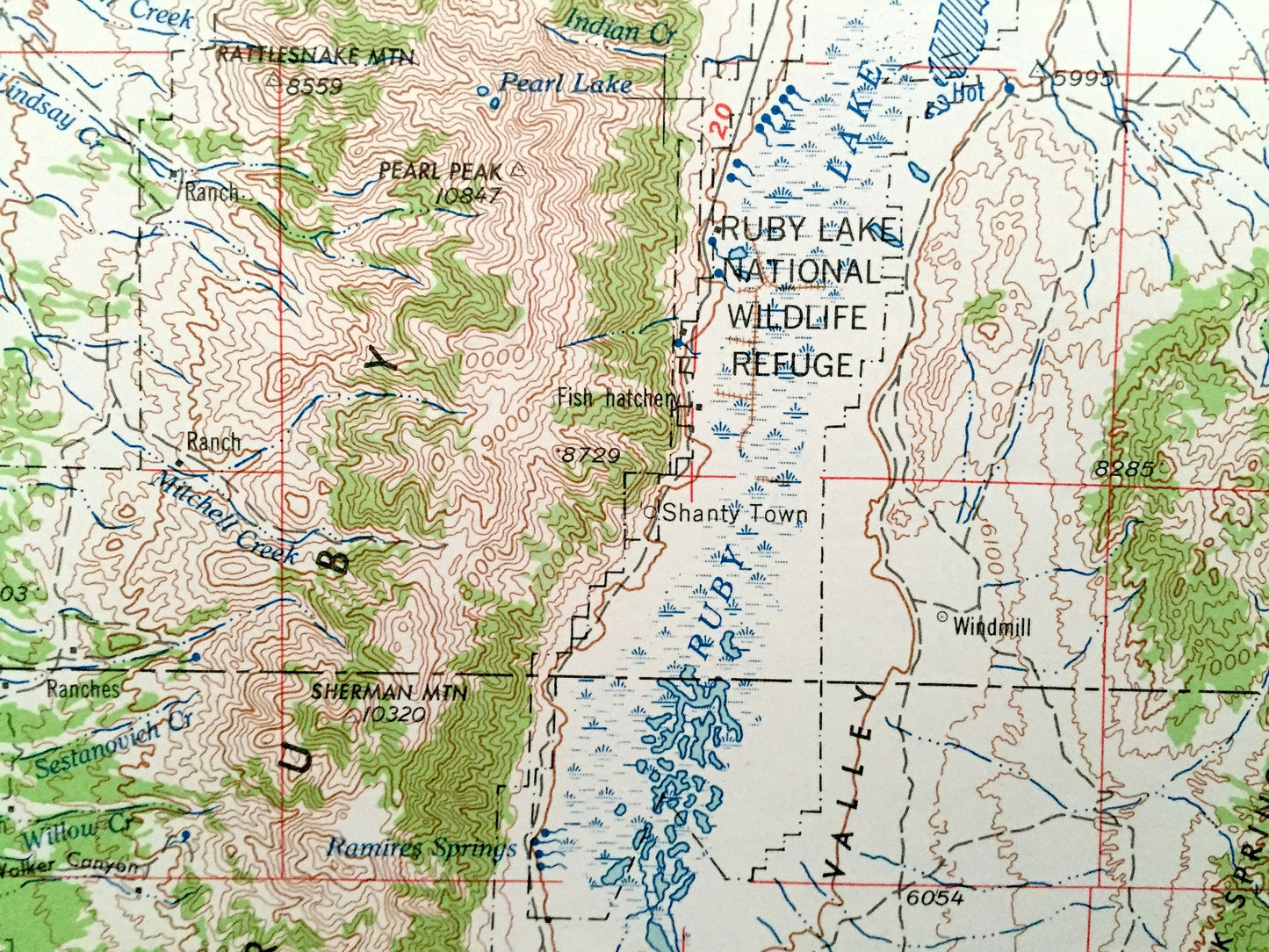
Antique Elko, Nevada 1962 US Geological Survey Topographic Map – Osino, Ryndon, Halleck, Humboldt National Forest, Adobe Range, Ruby Valley
Antique Elko, Nevada 1962 US Geological Survey Topographic Map – Osino, Ryndon, Halleck, Humboldt National Forest, Adobe Range, Ruby Valley
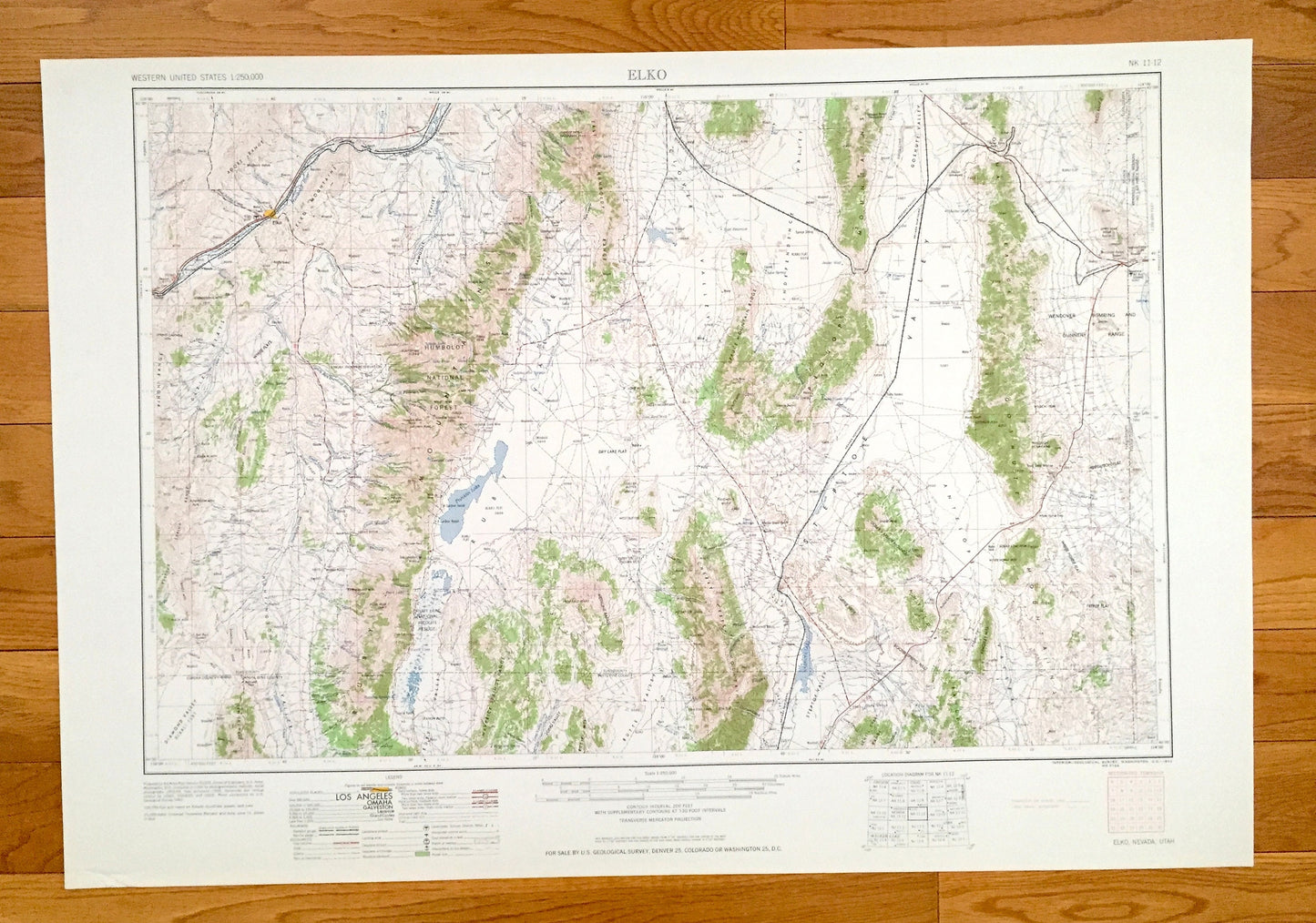
Beautiful, antique map of Elko, Nevada and surrounding Utah areas. This is an authentic 1962 edition, 1962 print from the U.S. Geological Survey and NOT a computer reproduction.
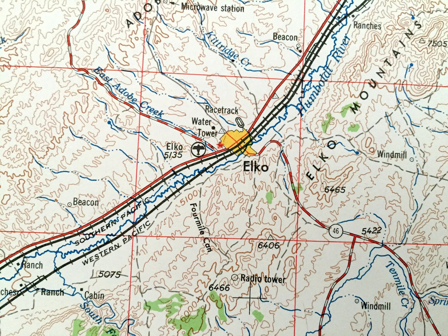
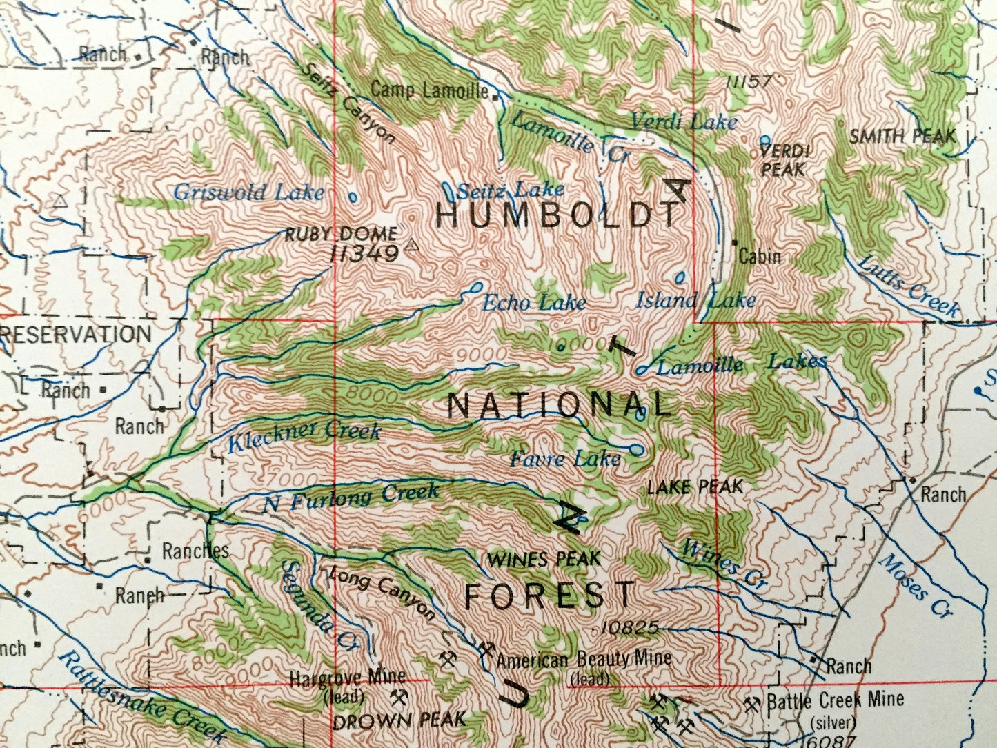
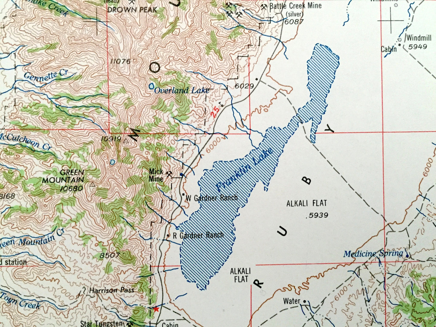
See what Nevada and Utah looked like over 55 years ago. Lots of intricate details and geological contours. Map is incredibly large and in the grand 1:250,000 scale. The USGS cartographers were very thorough back then!
Perfect for the historian, map-lover, the curious or just as a conversation starter. Wonderful and rare. Vintage maps such as these make great gifts.
Edition of 1962, printed 1962
Dimensions: 32" width x 22 1/2" height
----
Features
Cities & Towns: Elko, Osino, Ryndon, Halleck.
Points of Interest: NEVADA - Elko Hills, Dixie Flats, White Flats, Alkali Flat, Ferber Flat, Antelope Range, East Humboldt Range, Adobe Range, Maverick Springs Range, Diamond Valley, Ruby Valley, Butte Valley, Steptoe Valley, Antelope Valley, Independence Valley, Clover Valley, Ruby Mountains, Goshute Mountains, Ruby Lake National Wildlife Refuge, Wendover Bombing and Gunnery Range, Franklin Lake, Ruby Lake, Snow Water Lake and lots more hills, mountains, rivers, lakes, creeks, roads, highways and railroads.
UTAH - Tooele County, Salt Flats, Wendover Park, Blue Lake and lots more hills, mountains, rivers, lakes, creeks, roads, highways and railroads.
Condition: Very Good condition, commensurate with age. This map is in incredible shape for being over 55 years old. Has some light edge wear, all of which will read as vintage character when framed.
----
We will happily adjust shipping price for multiple purchases. Maps are rolled up and shipped in sturdy mailing tubes, never folded.
Couldn't load pickup availability
Share