My Store
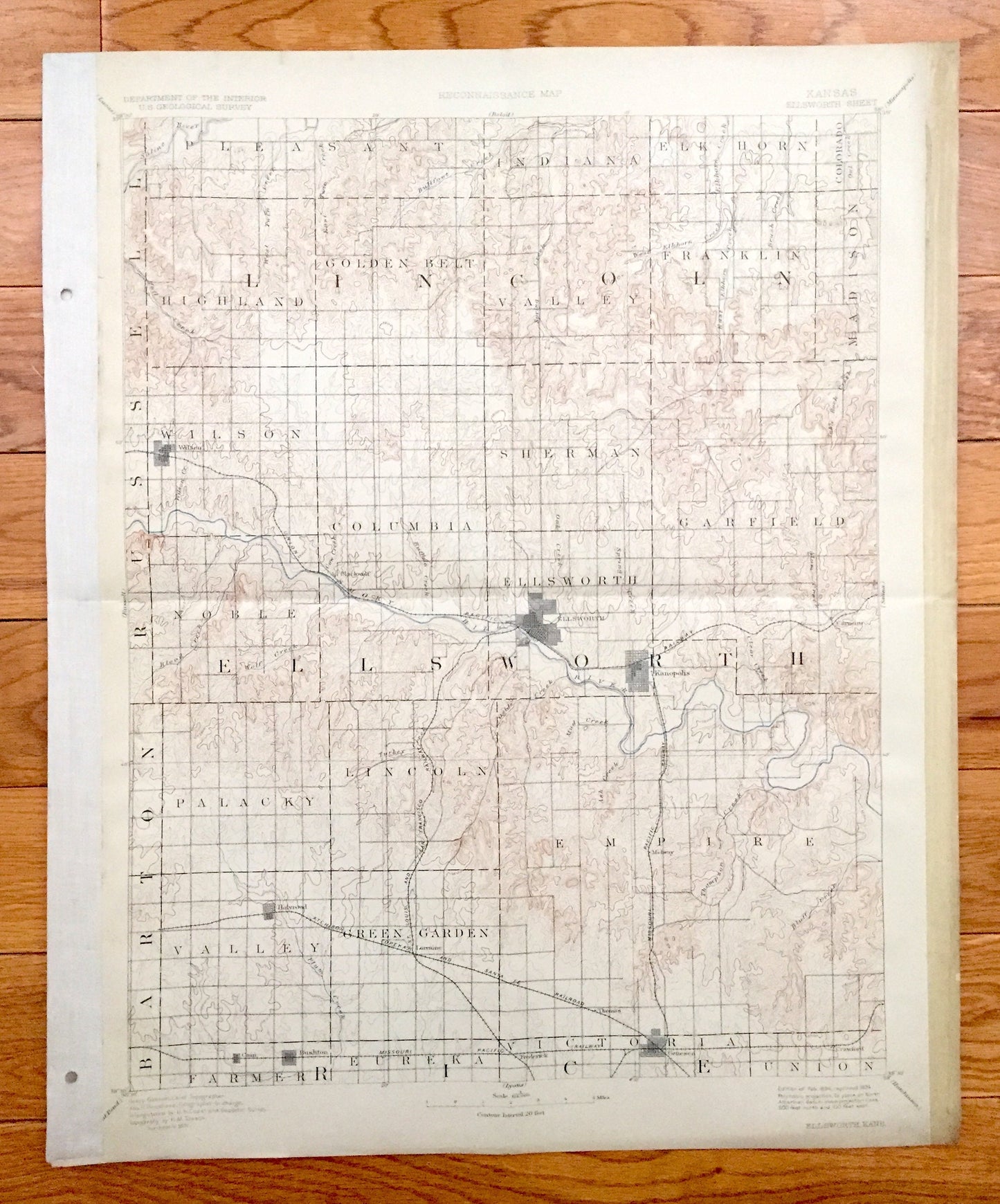
Antique Ellsworth, Kansas 1894 US Geological Survey Topographic Map – Lincoln, Rice County, Kanopolis, Wilson, Holyrood, Geneseo, Bushton KS
Antique Ellsworth, Kansas 1894 US Geological Survey Topographic Map – Lincoln, Rice County, Kanopolis, Wilson, Holyrood, Geneseo, Bushton KS
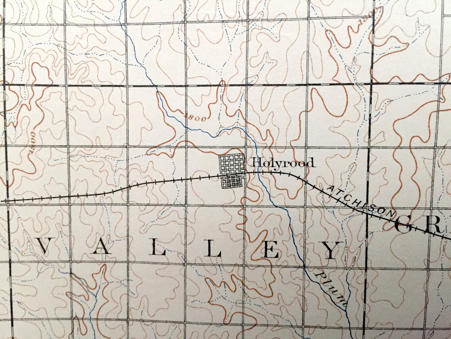
Beautiful, antique map of Ellsworth, Kansas and surrounding Ellsworth, Rice and Lincoln County areas. This is an authentic 1894 edition, 1924 print from the U.S. Geological Survey and NOT a computer reproduction.
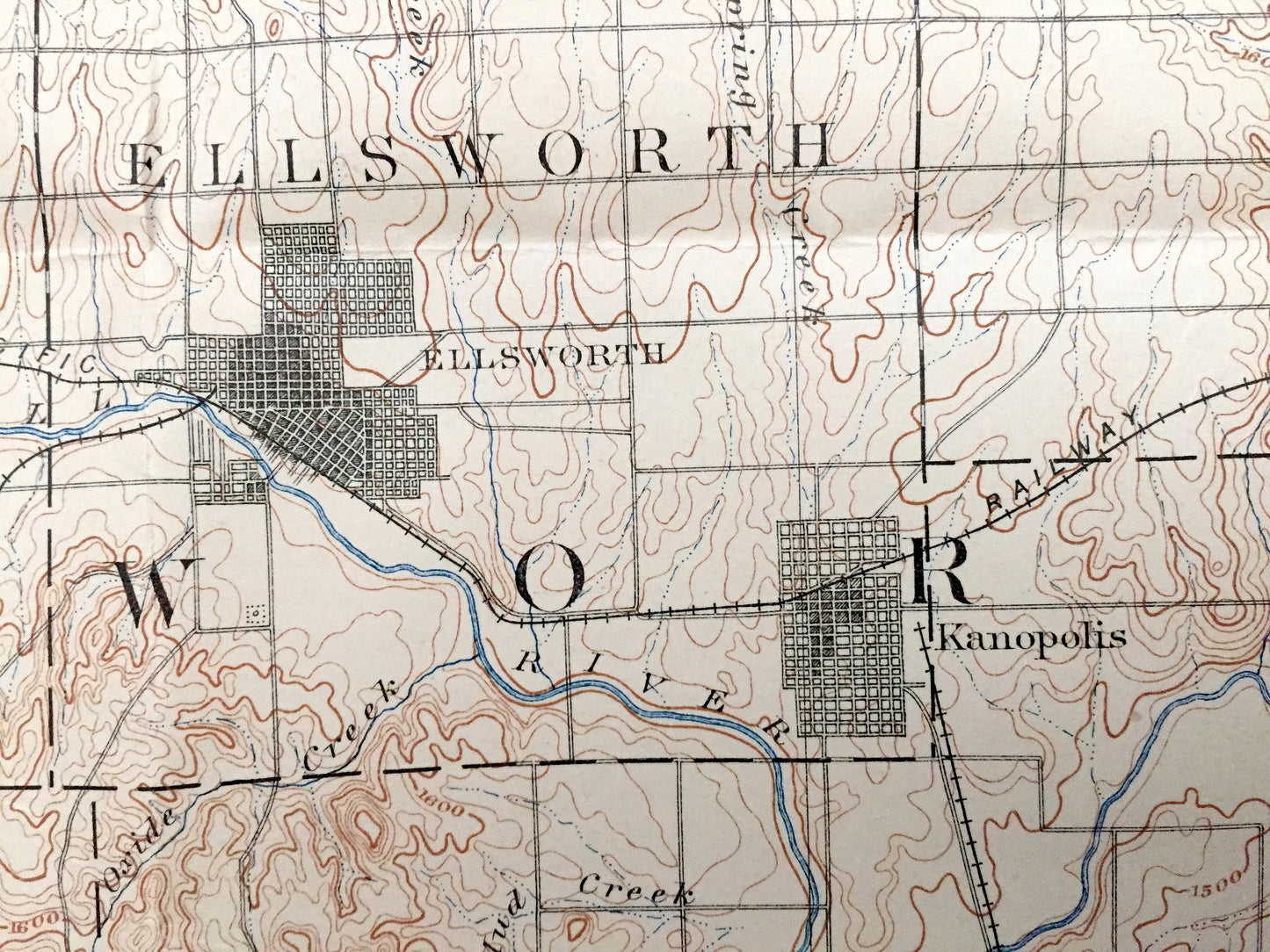
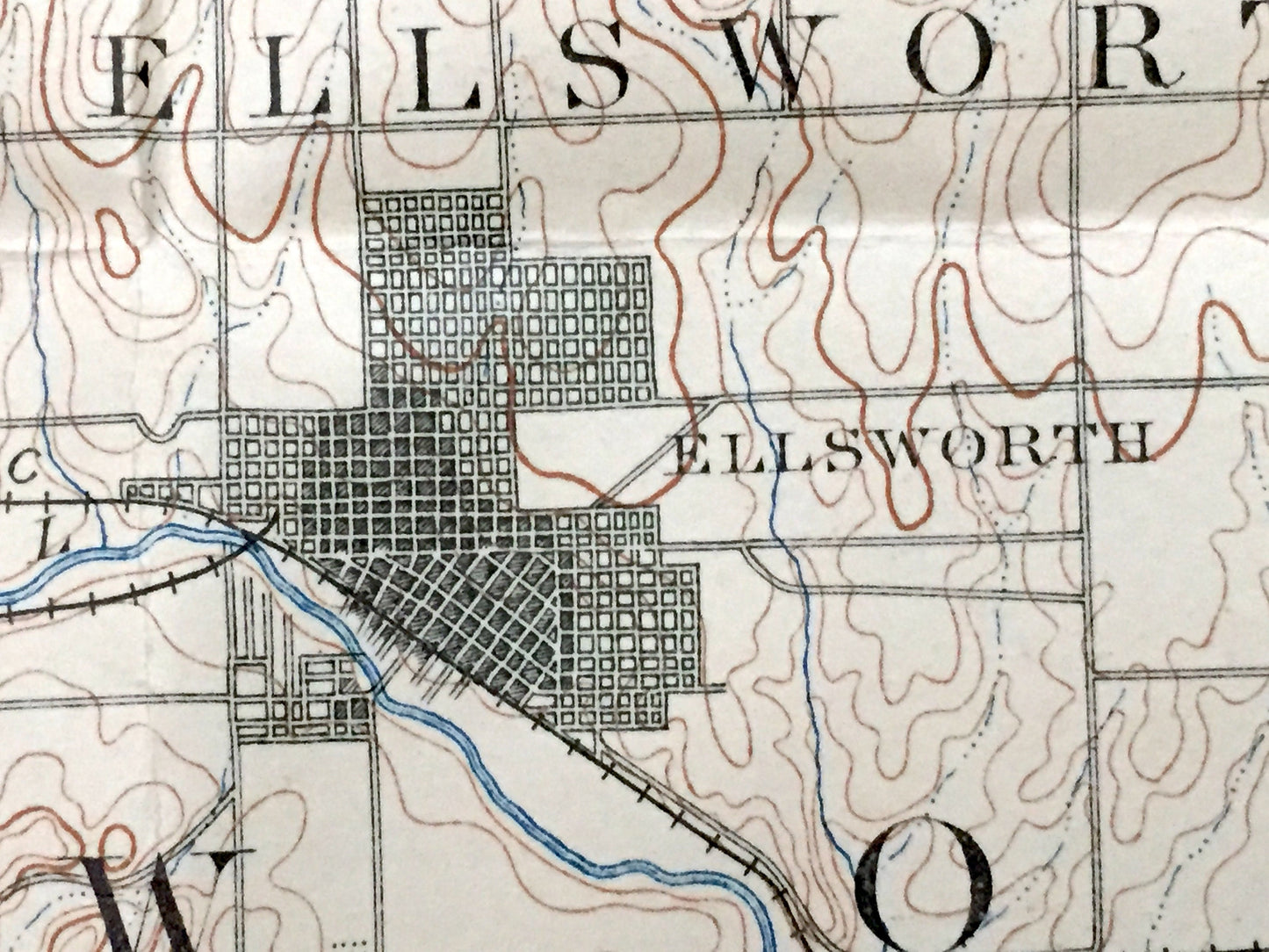
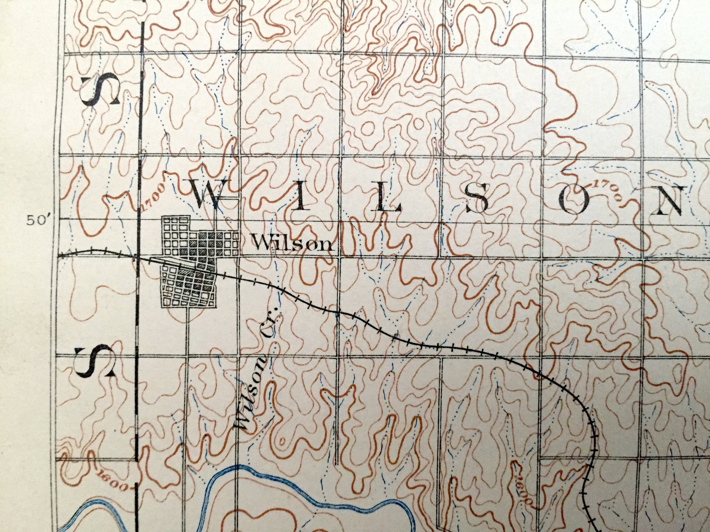
See what Kansas looked like more than 125 years ago. Lots of intricate details and geological contours. Map even has little squares for every house that existed at the time. The USGS cartographers were very thorough back then!
Perfect for the historian, map-lover, the curious or just as a conversation starter. Wonderful and rare. Maps such as these make great gifts.
Edition of 1894, printed 1924
Dimensions: 16" width x 20" height
----
Features
Cities & Towns: Ellsworth, Union, Crawford, Lorraine, Holyrood, Barton, Russell, Pleasant, Indiana, Elk Horn, Colorado, Madison, Franklin, Golden Belt, Highland, Wilson, Columbia, Sherman, Garfield, Kanopolis, Midway, Genesee, Blackwolf, Cain, Bushton, Frederick, Palacky, Lincoln, Empire, Valley, Green Garden, Farmer, Victoria.
Points of Interest: Ellsworth County, Rice County, Lincoln County, Smoky Hill River, Thompson Creek, Wolf Creek, Spring Creek, and lots more hills, creeks, lakes, towns, schools, churches, roads and train tracks.
Condition Good Vintage condition, commensurate with age. This map is in great shape for being over 95 years old. Has some wear, toning, tape application, punch holes along left margin and folds as-issued, but this will all add to vintage character when framed.
----
We will happily adjust shipping price for multiple purchases. Map will be shipped folded to preserve integrity.
Couldn't load pickup availability
Share