My Store
Antique Enfield, Connecticut 1944 US Geological Survey Topographic Map – Broad Brook, East Windsor, Ellington, Thompsonville, Suffield, CT
Antique Enfield, Connecticut 1944 US Geological Survey Topographic Map – Broad Brook, East Windsor, Ellington, Thompsonville, Suffield, CT
Beautiful, antique map of Broad Brook, East Windsor, Enfield, Connecticut and surrounding Hartford County area. This is an authentic 1944 print from the U.S. Geological Survey and NOT a computer reproduction.
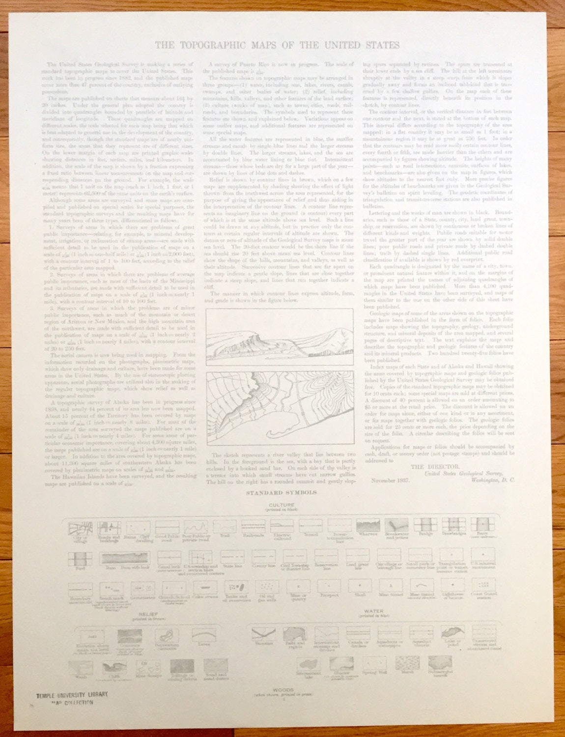
See what Enfield and surrounding area looked like about 80 years ago. Lots of intricate details and geological contours. Map even has little squares for every house that existed at the time. The cartographers were very thorough back then! On the back is a description of topographic symbols and map guide.
Perfect for the historian, map-lover, the curious or just as a conversation starter. Wonderful and rare. Maps such as these make great gifts.
Edition of 1944, printed 1944
Dimensions: 16 1/2" width x 20 1/2" height
----
Features
Cities & Towns: Enfield, Suffield, Windsor Locks, East Windsor, Ellington, Broad Brook, Windsorville, Hazardville, Thompsonville, Scantic, Somers, Warehouse Point.
Points of Interest: Connecticut River, Kings Island, Wallop School, Windsorville Pond, Scantic Church, King Street School, Scantic River, Buckhorn Brook, and lots more hills, mountains, creeks, towns, schools and roads.
Condition: Very Good Vintage condition, commensurate with age. This map is in great shape for being 80 years old.
----
We will happily adjust shipping price for multiple purchases. Maps are shipped rolled in sturdy cardboard tubes, never folded.
Couldn't load pickup availability
Share