My Store
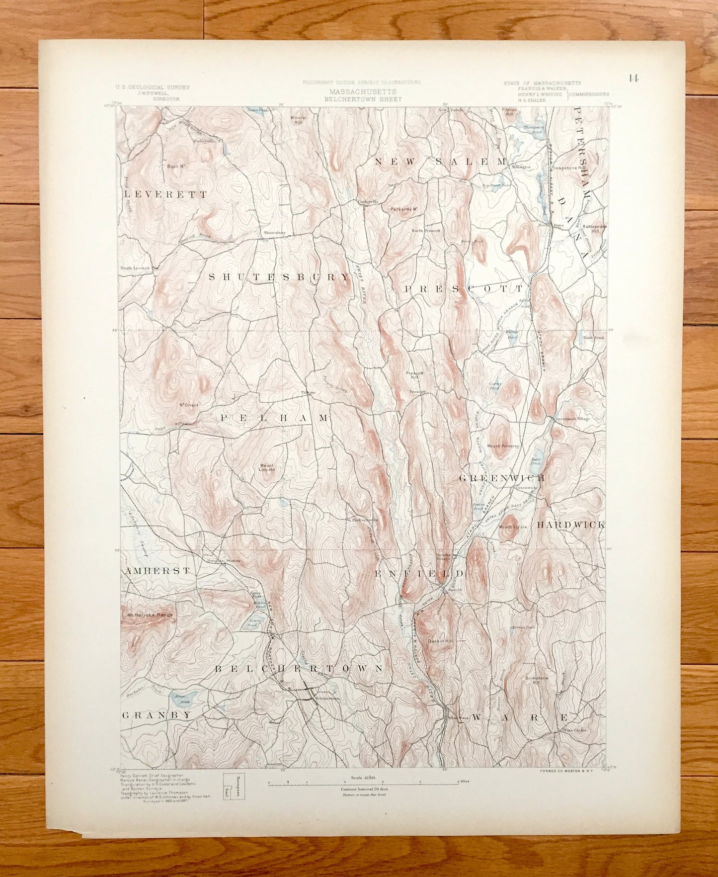
Antique Enfield, Massachusetts BEFORE Quabbin Reservoir 1885 US Geological Survey Topographic Map – Dana, Prescott Greenwich Ware Amherst MA
Antique Enfield, Massachusetts BEFORE Quabbin Reservoir 1885 US Geological Survey Topographic Map – Dana, Prescott Greenwich Ware Amherst MA
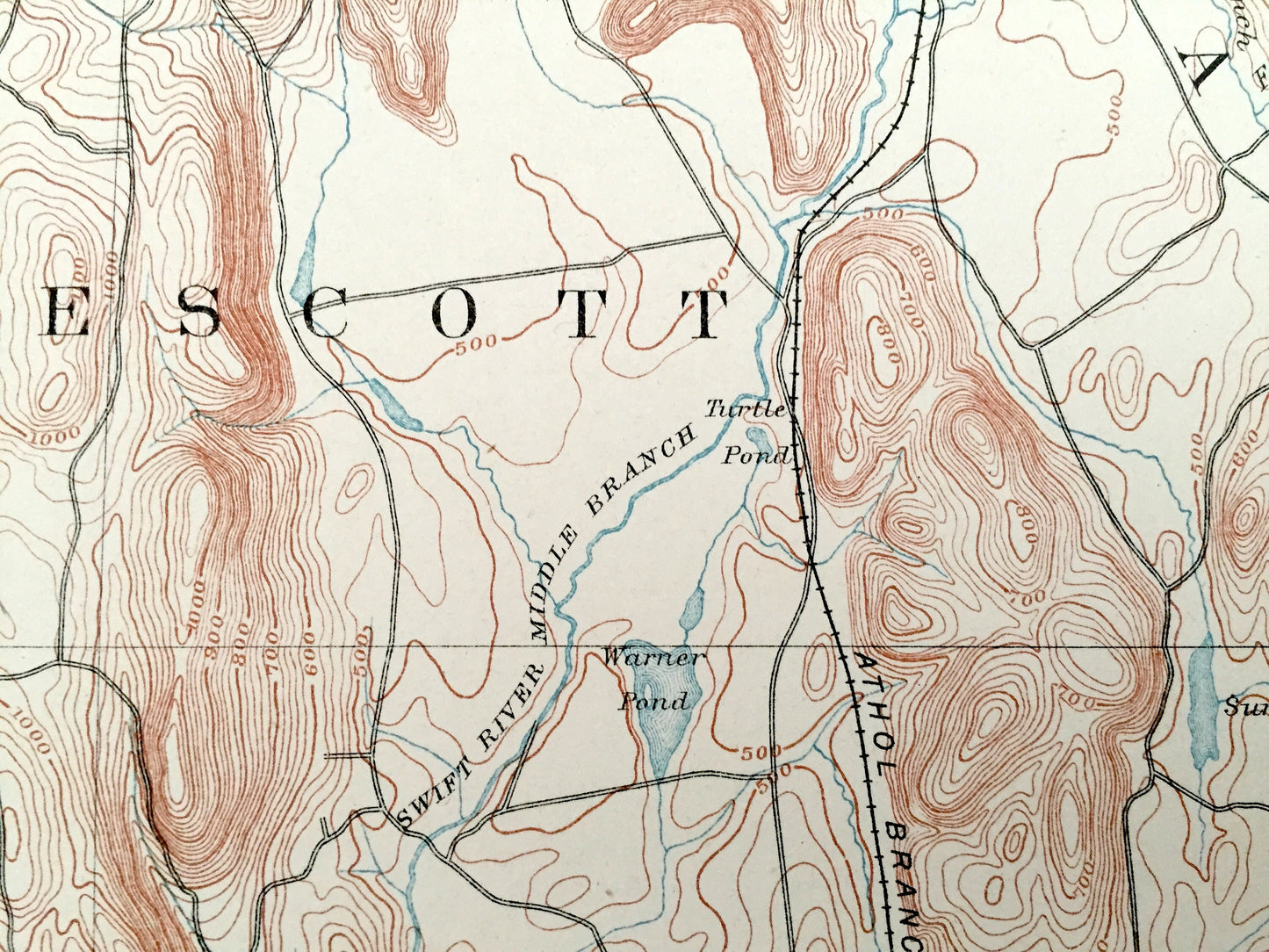
Beautiful, antique map of Central Massachusetts, before the Quabbin Reservoir was created. This is an authentic 1885 print from the U.S. Geological Survey and NOT a computer reproduction. It is an original, extremely rare printing of the very first preliminary sheet of the area.
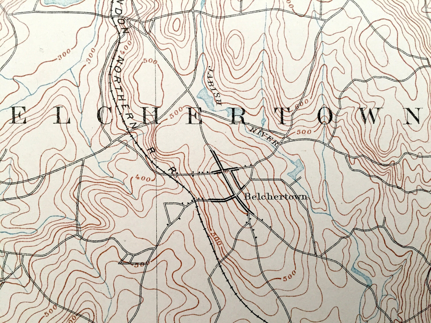
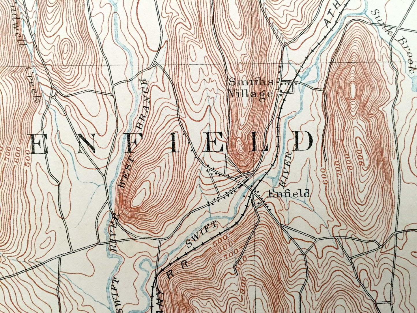
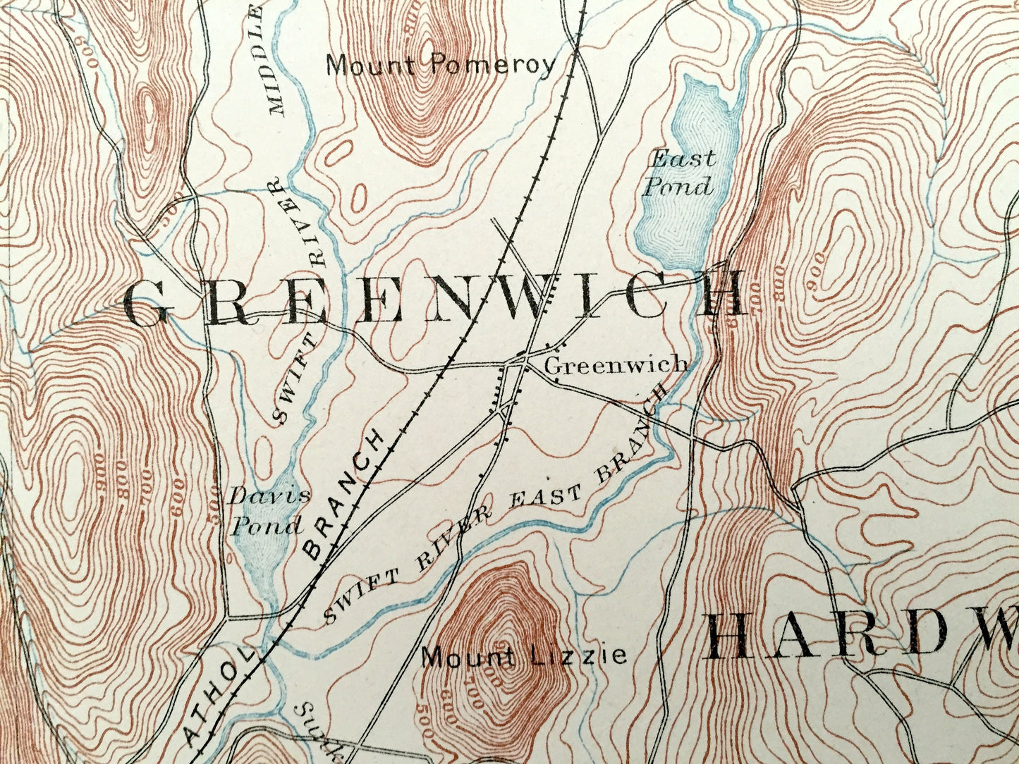
This special map includes the lost towns of Enfield, Dana, Prescott and Greenwich—before they were lost to the Quabbin Reservoir.
See what Worcester, Franklin & Hampshire Counties looked like over a century ago. Lots of intricate details and geological contours. Map even has little squares for every house that existed at the time. The USGS cartographers were very thorough back then!
Perfect for the historian, map-lover, the curious or just as a conversation starter. Wonderful and rare. Maps such as these make great gifts.
Edition of 1885, printed 1885
Dimensions: 17" width x 21" height
----
Features
Cities & Towns:
MASSACHUSETTS: Leverett, Shutesbury, New Salem, Petersham, Amherst, Pelham, Prescott, Dana, Granby, Belchertown, Enfield, Greenwich, Hardwick, Ware, Rattlesnake Gutter, Dudleyville, East Leverett, Cooleyville, North Prescott, Millington, North Dana, Parkardsville, Dwight, Smiths, West Ware, Ware Center.
Points of Interest: Quabbin Reservoir Location, Swift River, Thompson Pond, Neeseponset Pond, Hop Brook Pond, Forge Pond, Davis Pond, East Pond, Warner Pond, Mineral Hill, Packard Mountain, Russ Mountain, Mount L, Rattlesnake Hill, Soapstone Hill, Mr. Orient, Mount Lincoln, Prescott Hill, Mount Pomeroy, Mount Lizzie, Mount Boreas, Mt. Holyoke Range, Quabin Hill, Brimstone Hill, Lawrence Swampk Hampshire County, Worcester County, Franklin County, Hampshire County, Boston & Albany Railroad, and many more roads, houses, reservoirs, ponds, and hills, mountains and railroads.
Condition: Very Good Vintage condition, commensurate with age. This map is in incredible shape for being over 130 years old. Some edge-wear and toning, but this will add to vintage character when framed.
----
We will happily adjust shipping price for multiple purchases. Maps are rolled up and shipped in sturdy mailing tubes, never folded.
Couldn't load pickup availability
Share