My Store
Antique Englewood, Colorado 1965 US Geological Survey Topographic Map – Arapahoe County, Denver, Aurora, Glendale, Cherry Hills, Sullivan CO
Antique Englewood, Colorado 1965 US Geological Survey Topographic Map – Arapahoe County, Denver, Aurora, Glendale, Cherry Hills, Sullivan CO
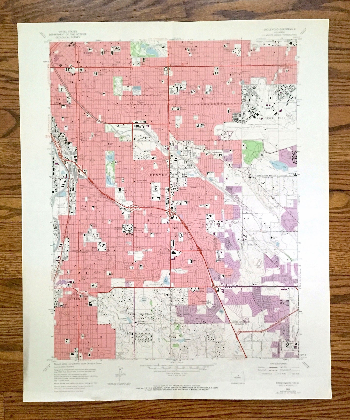
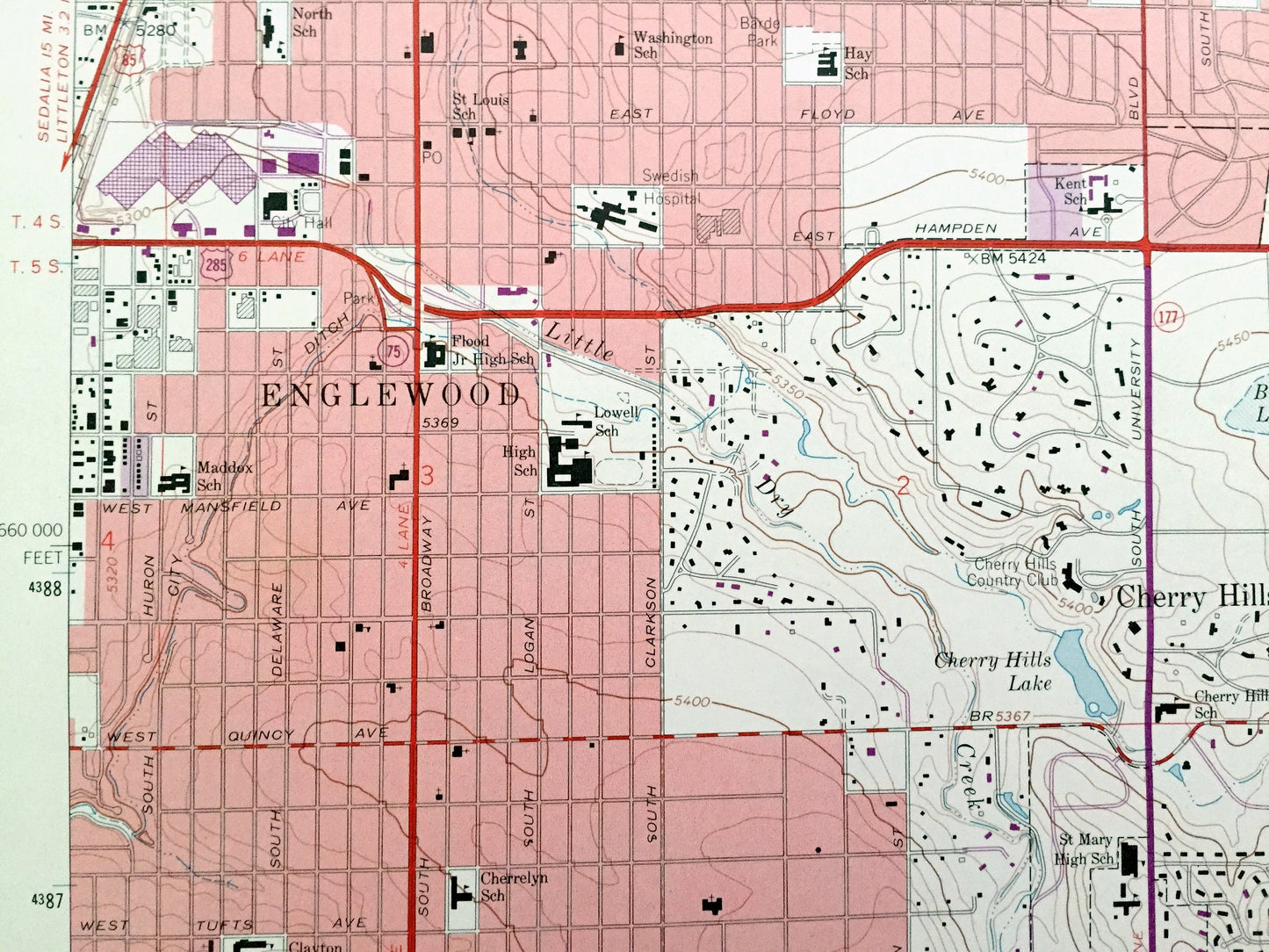
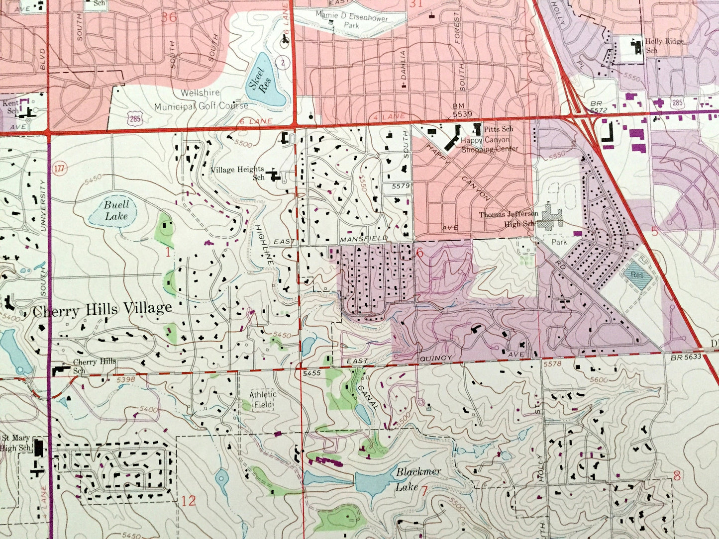
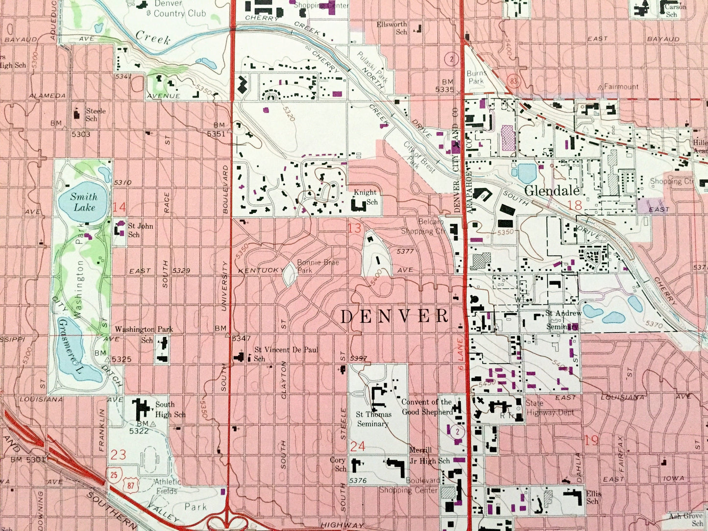
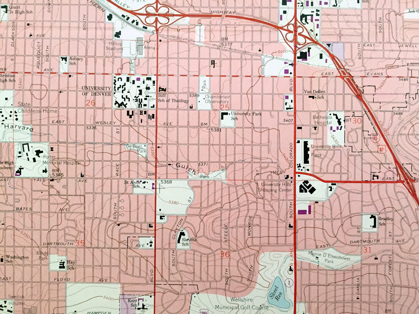
Beautiful, antique map of Englewood, Colorado and surrounding Arapahoe, Denver City and County, and Adams County area. This is an authentic 1965 edition, 1973 print from the U.S. Geological Survey and NOT a computer reproduction.
See what Colorado looked like over 55 years ago. Lots of intricate details and geological contours. Map even has little squares for every house that existed at the time. The USGS cartographers were very thorough back then!
Perfect for the historian, map-lover, the curious or just as a conversation starter. Wonderful and rare. Vintage maps such as these make great gifts.
Edition of 1965, printed 1973
Dimensions: 22" width x 27" height
----
Features
Cities & Towns: Englewood, Cherry Hills Village, Cherry Ridge, Sullivan, Glendale, Denver, Aurora, Denver.
Points of Interest: Cherry Creek, South Platte River, University of Denver, Washington Park, Highline Canal, Goldsmith Gulch, Lowry Air Force Base, Windsor Lake, Colorado Women's College, Buell Lake, and many more hills, streams, ponds, houses, schools, churches and roads.
Condition: Good Vintage condition, commensurate with age. This map is in great shape for being almost 50 years old. Has light wear, toning and folds as-issued, but these will flatten easily and all will read as vintage character when framed.
----
We will happily adjust shipping price for multiple purchases. Maps are rolled up and shipped in sturdy mailing tubes, never folded.
Couldn't load pickup availability
Share