My Store
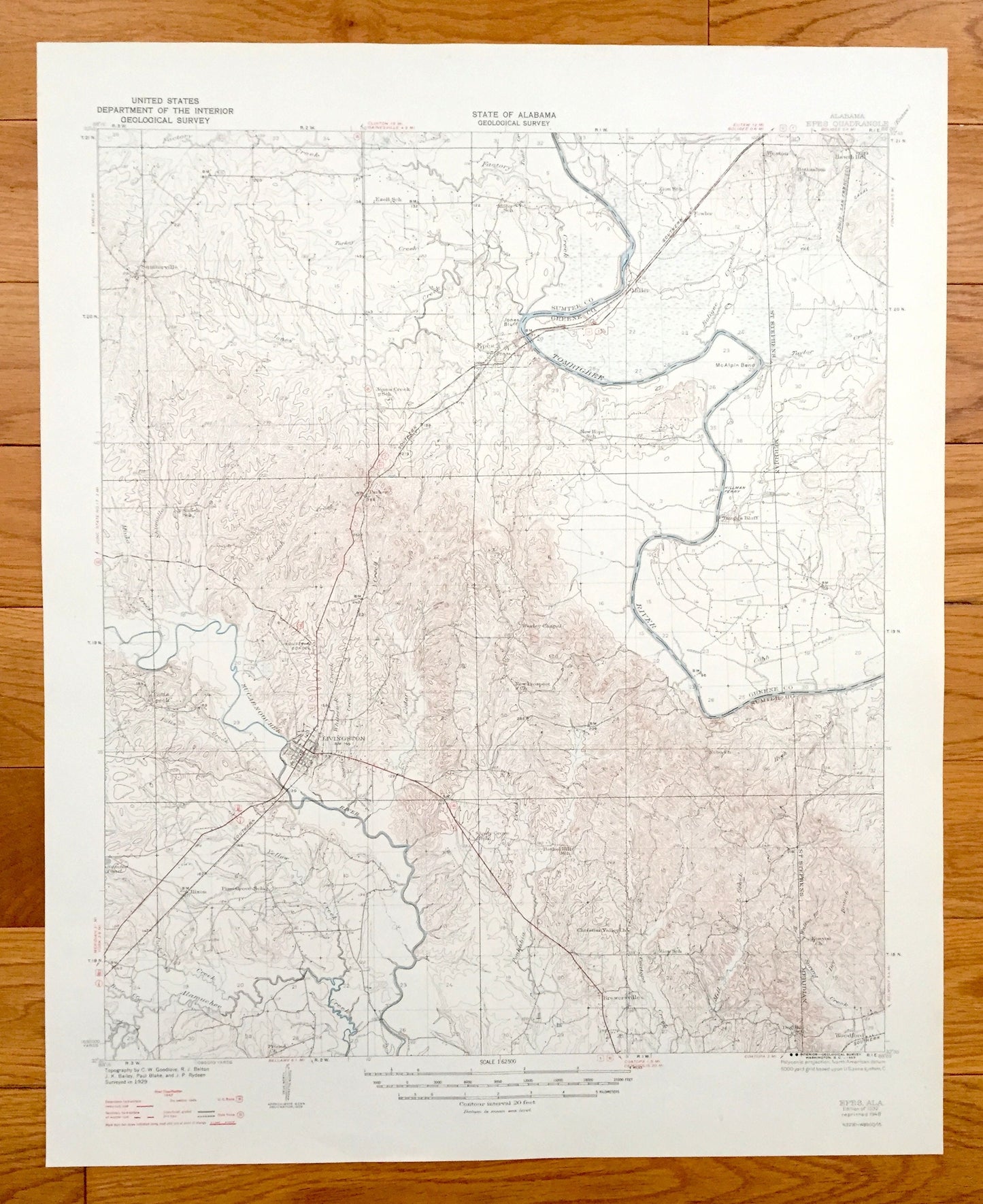
Antique Epes, Alabama 1932 US Geological Survey Topographic Map – Sumter County, Sumterville, Weston, Miller, Potts Creek, Hixon, Livingston
Antique Epes, Alabama 1932 US Geological Survey Topographic Map – Sumter County, Sumterville, Weston, Miller, Potts Creek, Hixon, Livingston
Beautiful, antique map of Epes, Alabama and surrounding Sumter and Greene County area. This is an authentic 1932 edition, 1948 print from the U.S. Geological Survey and NOT a computer reproduction.
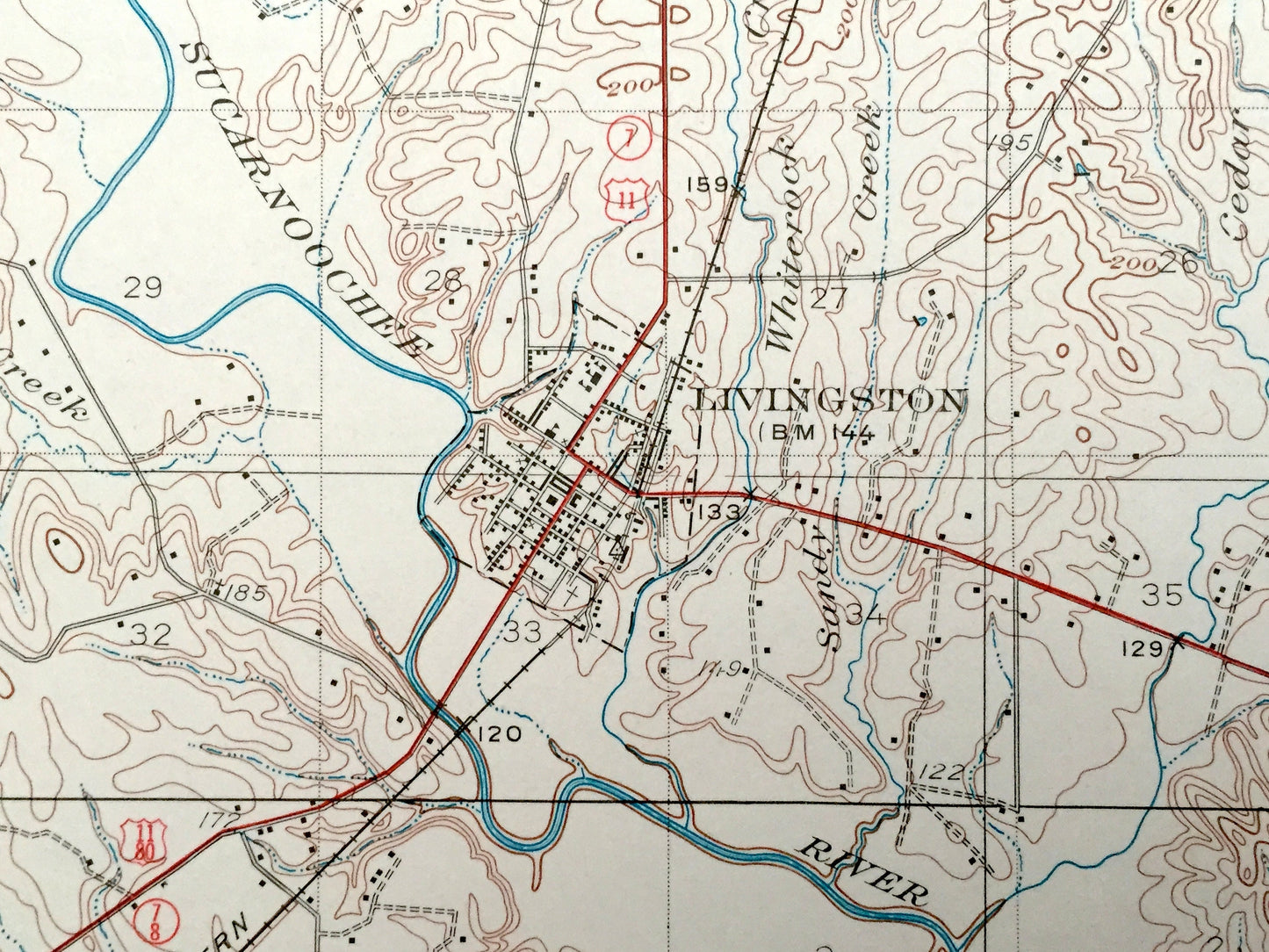
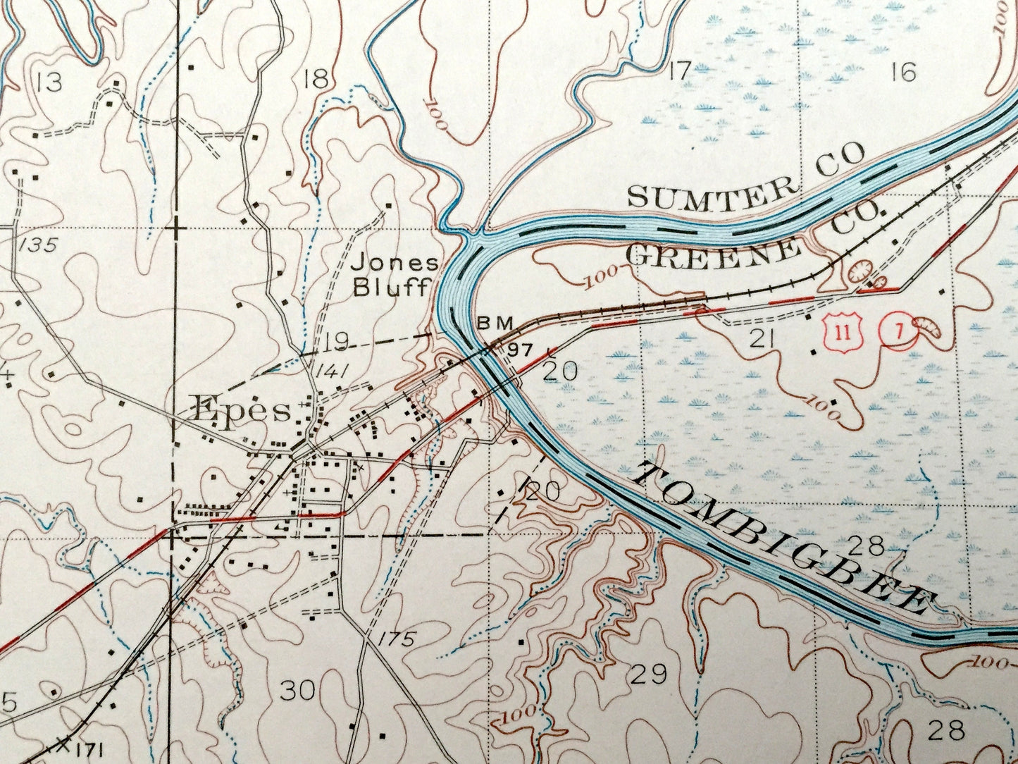
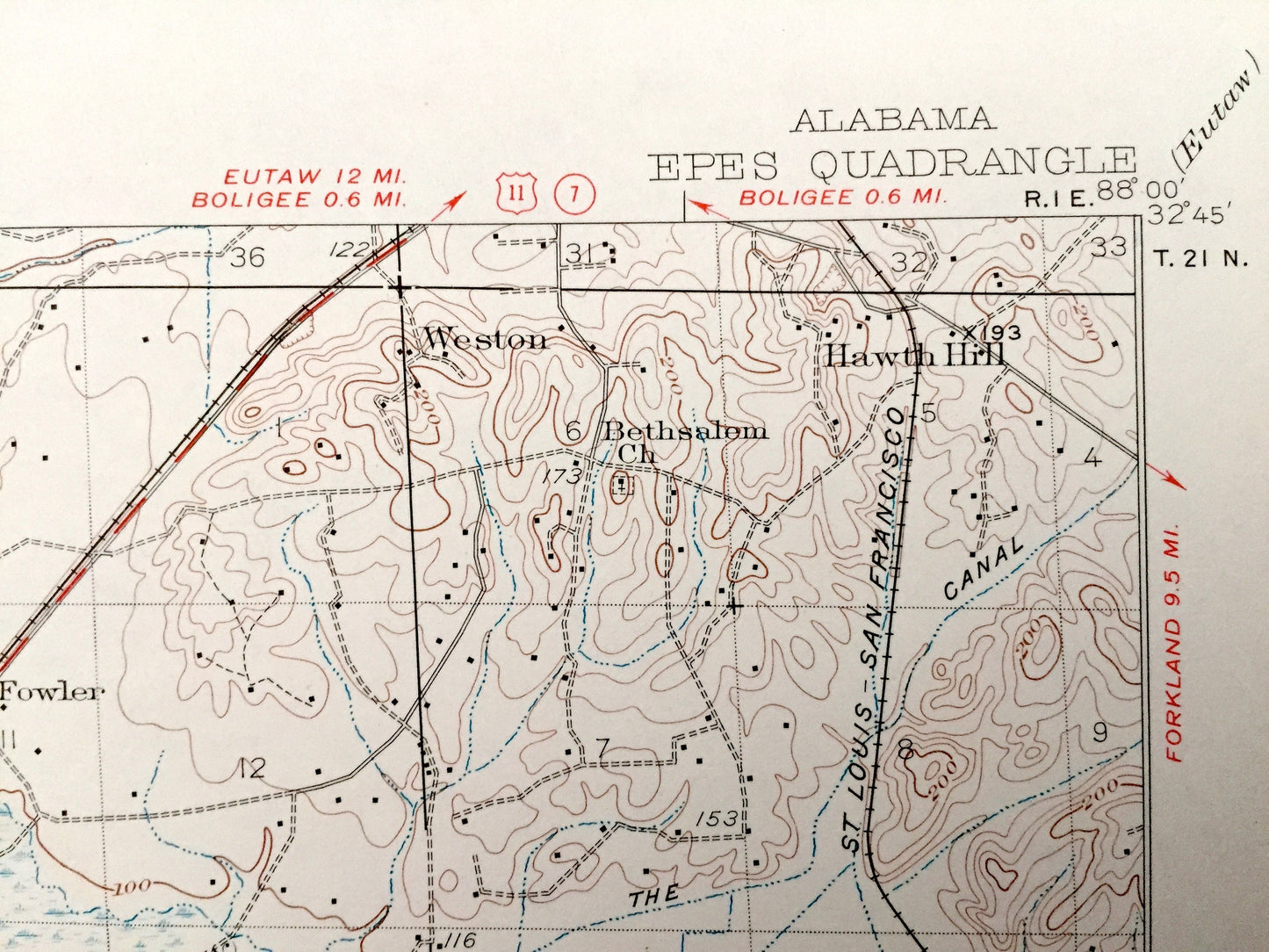
See what Alabama looked like over 80 years ago. Lots of intricate details and geological contours. Map even has little squares for every house that existed at the time. The USGS cartographers were very thorough back then!
Perfect for the historian, map-lover, the curious or just as a conversation starter. Wonderful and rare. Vintage maps such as these make great gifts.
Edition of 1932, printed 1948
Dimensions: 17" width x 21" height
----
Features
Cities & Towns: Epes, Sumterville, Weston, Miller, Hawth Hill, Potts Creek, Livingston, Braggs Bluff, Hixon, Woodford, Brewersville.
Points of Interest: Tombigbee River, Sucarnoochee River, Alamuchee Creek, Southern Railway, Factory Creek, McAlpin Bend, Jones Bluff, St. Louis-San Francisco Railway, and lots more hills, mountains, creeks, towns, roads and train tracks.
Condition: Very Good condition, commensurate with age. This map is in incredible condition for being 70 years old.
----
We will happily adjust shipping price for multiple purchases. Maps are rolled up and shipped in sturdy mailing tubes, never folded.
Couldn't load pickup availability
Share