My Store
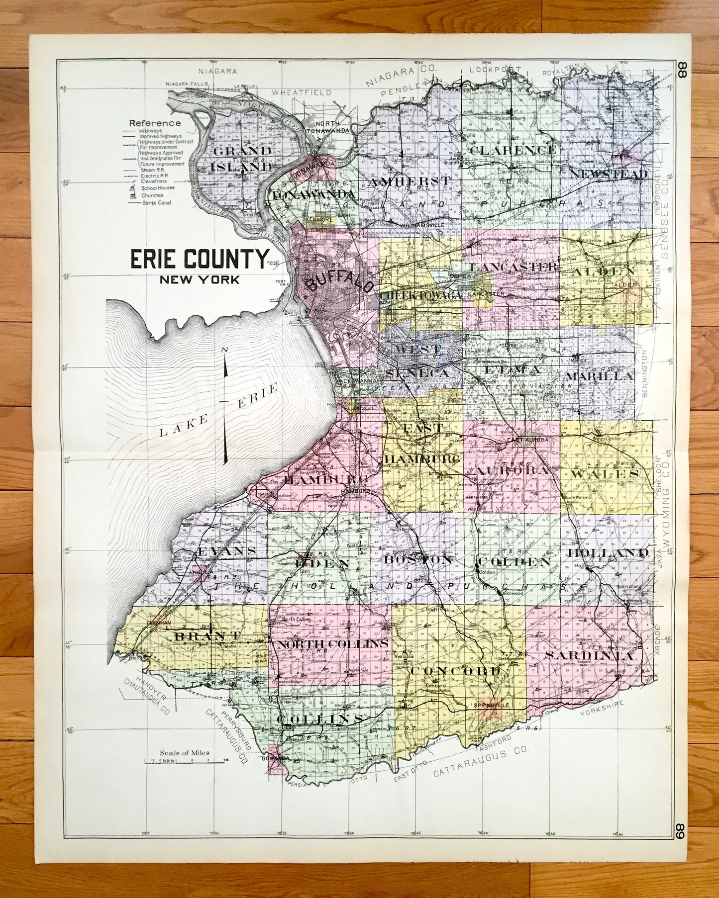
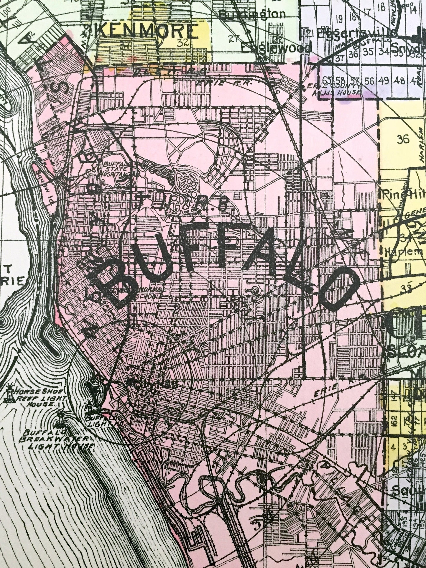
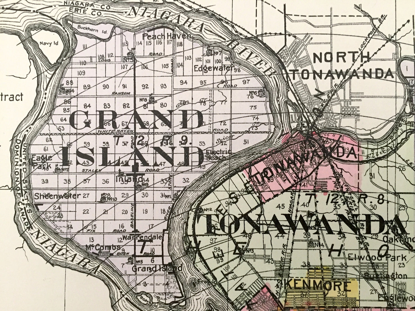
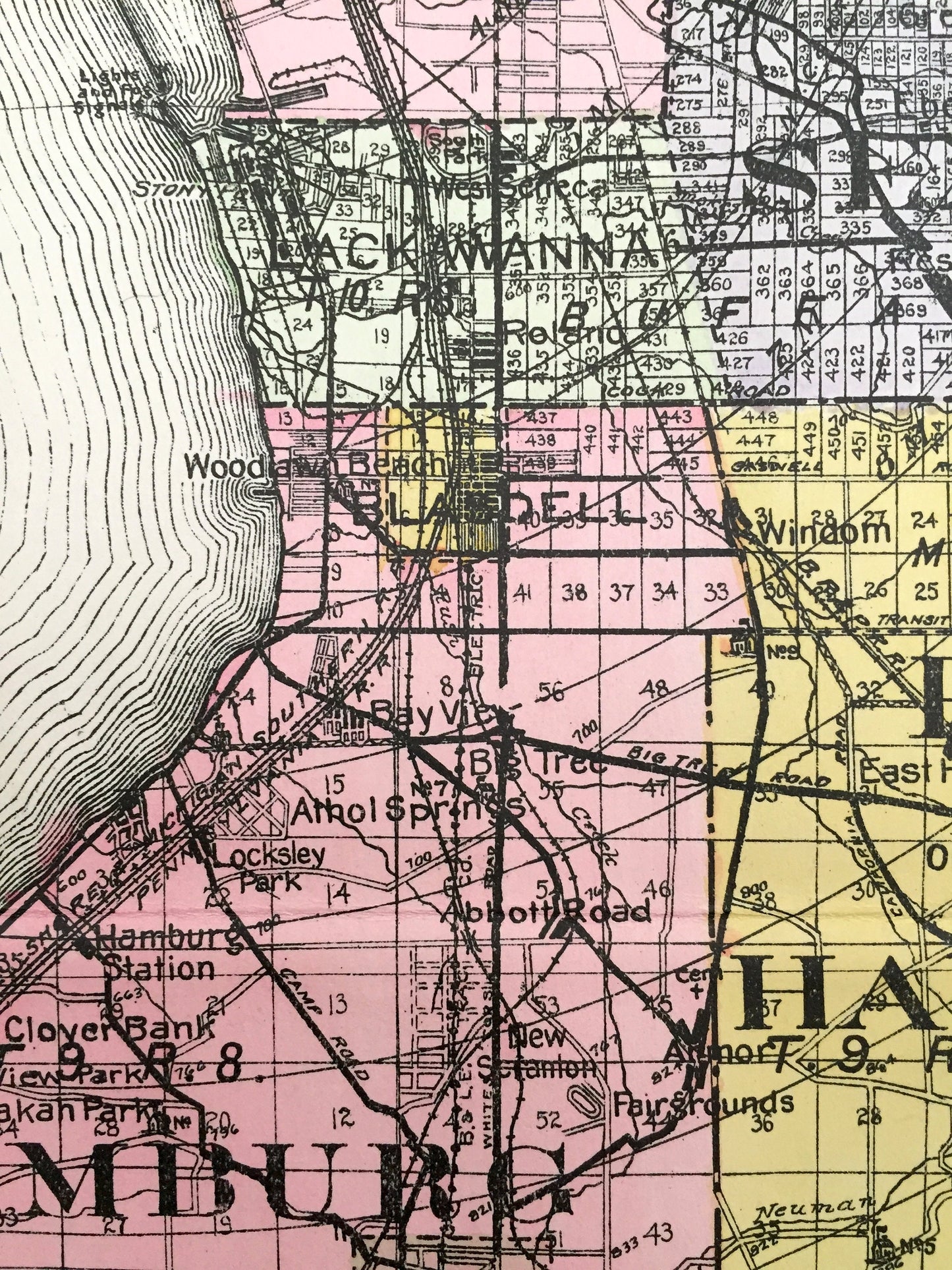
Antique Erie County, New York 1912 New Century Atlas Map – Buffalo, Cheektowaga, Seneca, Hamburg, Grand Island Aurora Evans Niagara Falls NY
Antique Erie County, New York 1912 New Century Atlas Map – Buffalo, Cheektowaga, Seneca, Hamburg, Grand Island Aurora Evans Niagara Falls NY
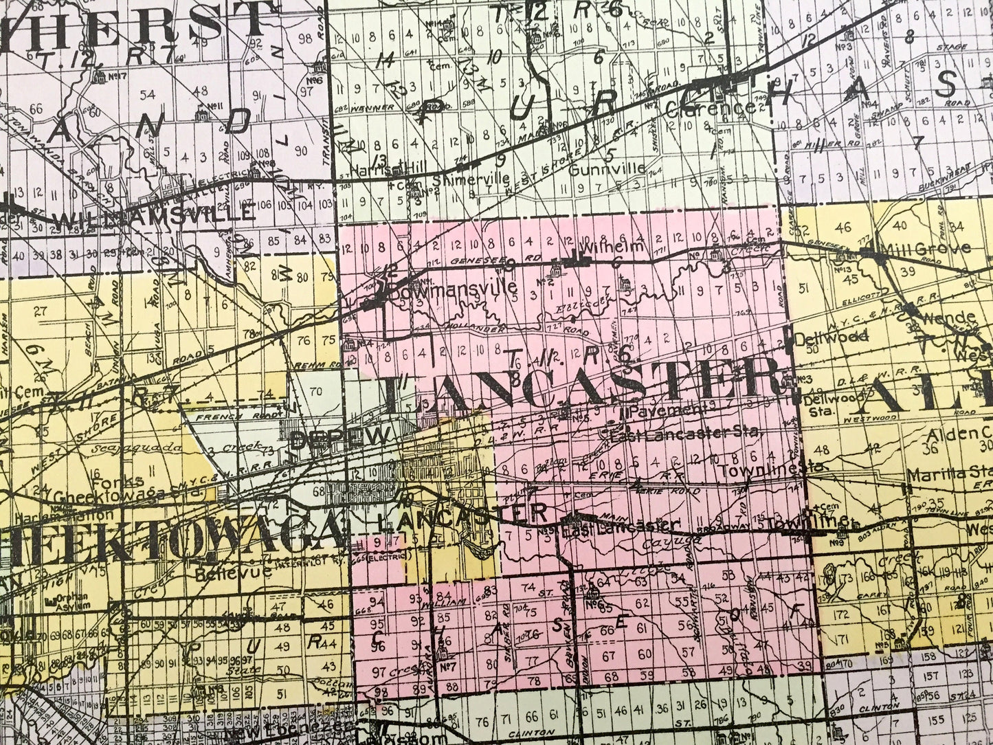
Beautiful, antique map of Erie County, New York, including Buffalo, Cheektowaga, Lackawanna, Seneca, Aurora and Niagara Falls. This is an authentic map taken from the rare New Century Atlas published in 1912 and NOT a computer reproduction.
See what Erie County looked like more than a century ago. Lots of charming, intricate details and contours, including land allotments, names of farms and manufacturing plants and geographical points of interest. It is a very large print and will be a showpiece wherever it is presented. Hand colored. Verso is blank.
Perfect for the historian, map-lover, the curious or just as a conversation starter. Wonderful and rare. Vintage maps such as these make great gifts.
Edition of 1912, printed 1912
Dimensions: 23 1/2" width x 30" height
----
Features
Cities & Towns: Grand Island, Tonawanda, Amherst, Clarence, Newstead, Buffalo, Cheektowaga, Lancaster, Alden, Lackawanna, West Seneca, Lima, Marilla, Hamburg, East Hamburg, Aurora, Wales, Evans, Eden, Boston, Colden, Holland, Brant, North Collins, Collins, Gowanda, Concord, Sardinia, North Towanda, Kenmore, Williamsville, Akfron, Getzville, Bowmansville, Blaisdell, Woodlawn, Orchard Park, South Brook, Porterville, Windom, Weyer, Walden Cliffs, North Evans, Water Valley, Athol Springs, Ellicott, Willink, Angola, Eden Valley, Glenwood, Langford, Marshfield, Fenton, Taylor Hollow, Bagdad, Fowlerville, Woodside, more.
Points of Interest: Niagara Falls, Lake Erie, Niagara River, Grand Island, Fort Erie, Tonawanda Creek, Erie Canal, Cattaraugus Indian Reservation, Cattaraugus Creek, Navy Island and many more ponds, lakes, creeks, rivers, roads, highways, railroads, farms, school houses and elevations.
----
Condition: Very Good condition, commensurate with age. This map is in incredible shape for being over 100 years old. A fold, as issued, and slight edge-toning, all of which will read as vintage character when framed. (Images of New Century Atlas cover and frontispiece for information only and not included.)
----
We will happily adjust shipping price for multiple purchases. Maps are rolled up and shipped in sturdy mailing tubes, never folded.
Couldn't load pickup availability
Share