My Store
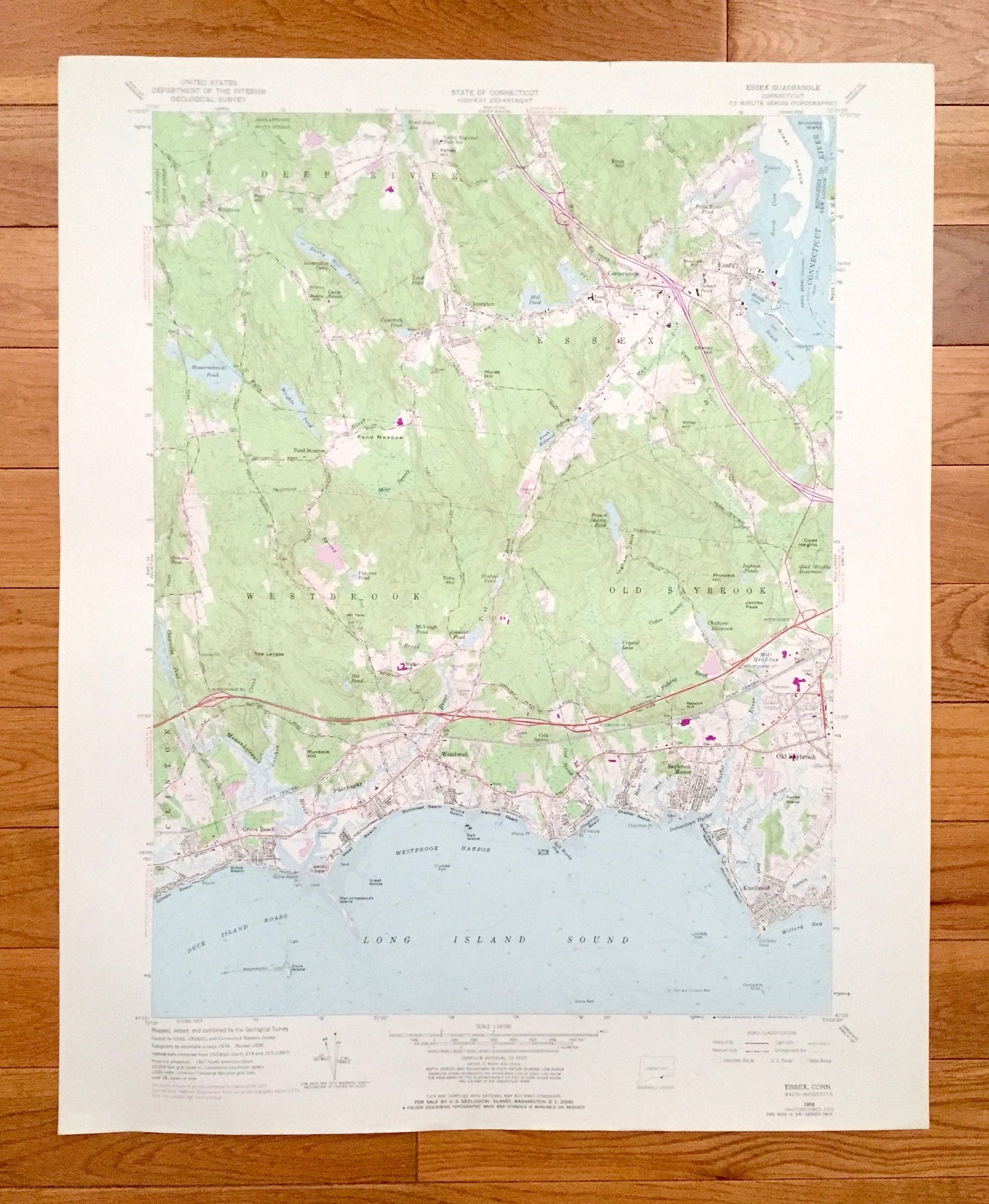
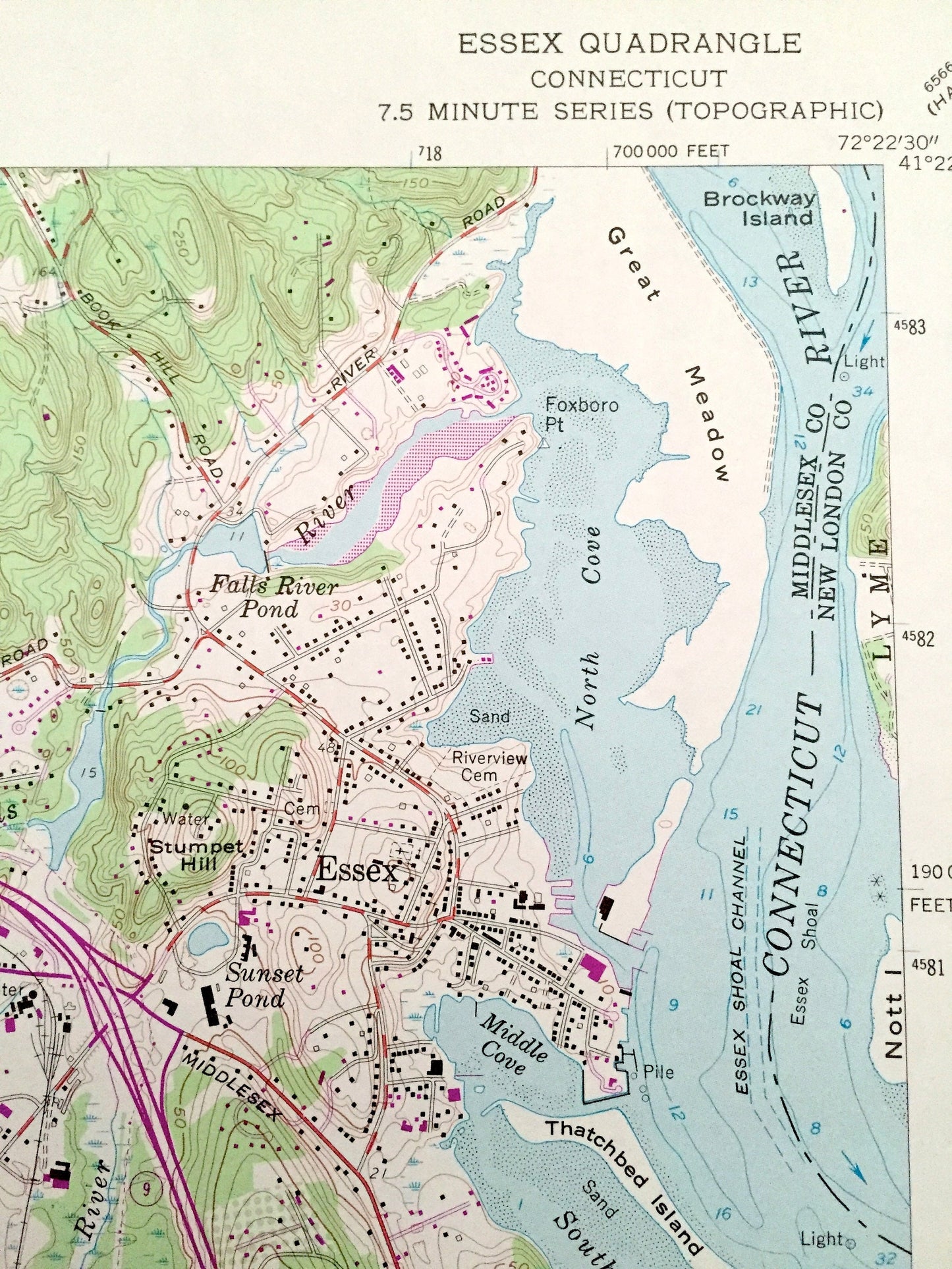
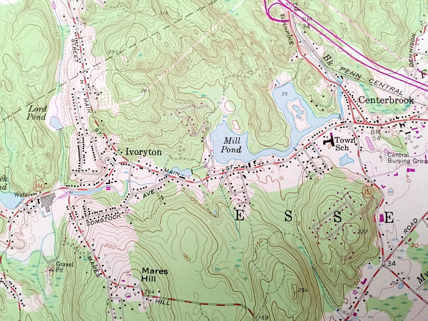
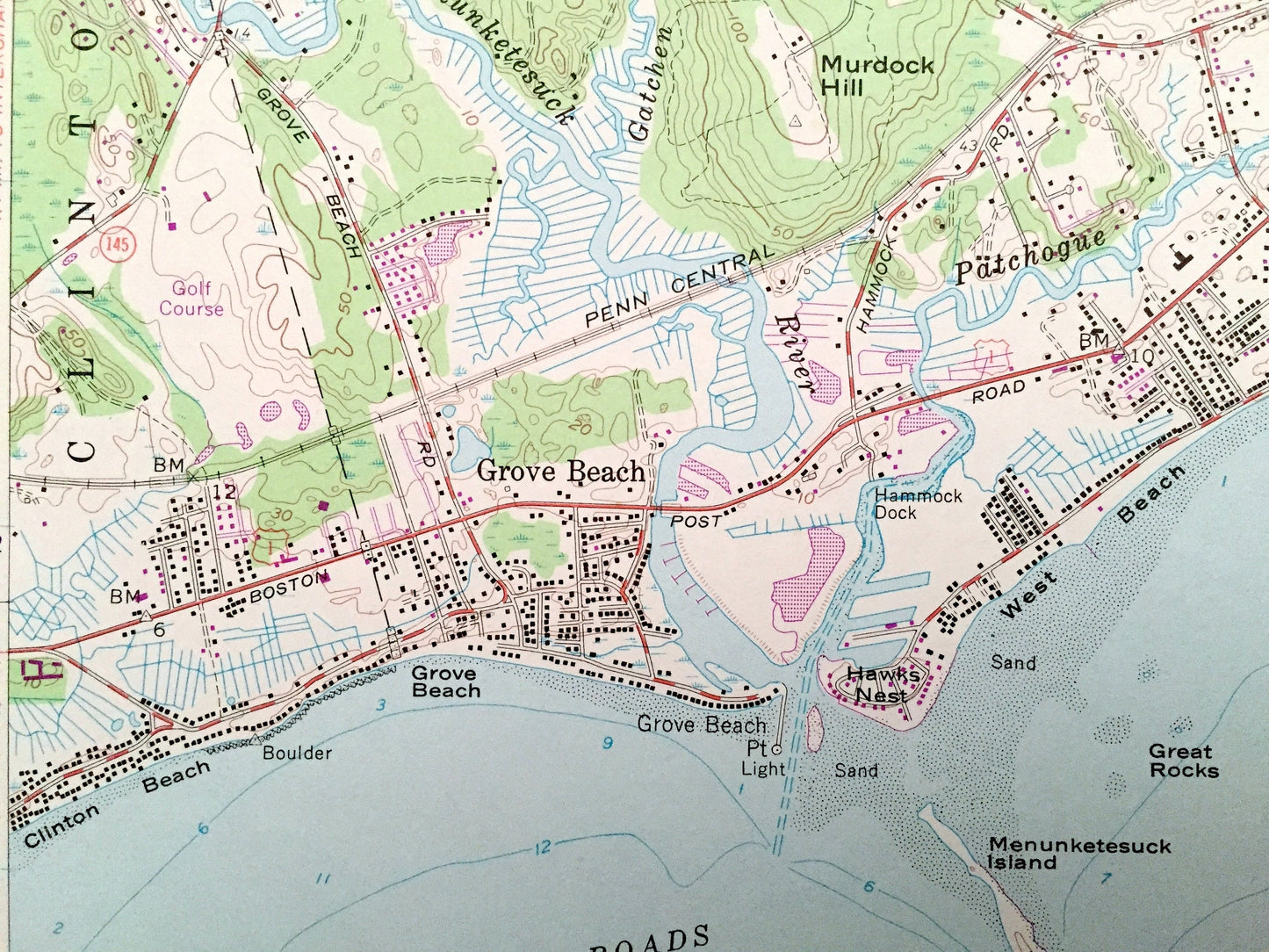
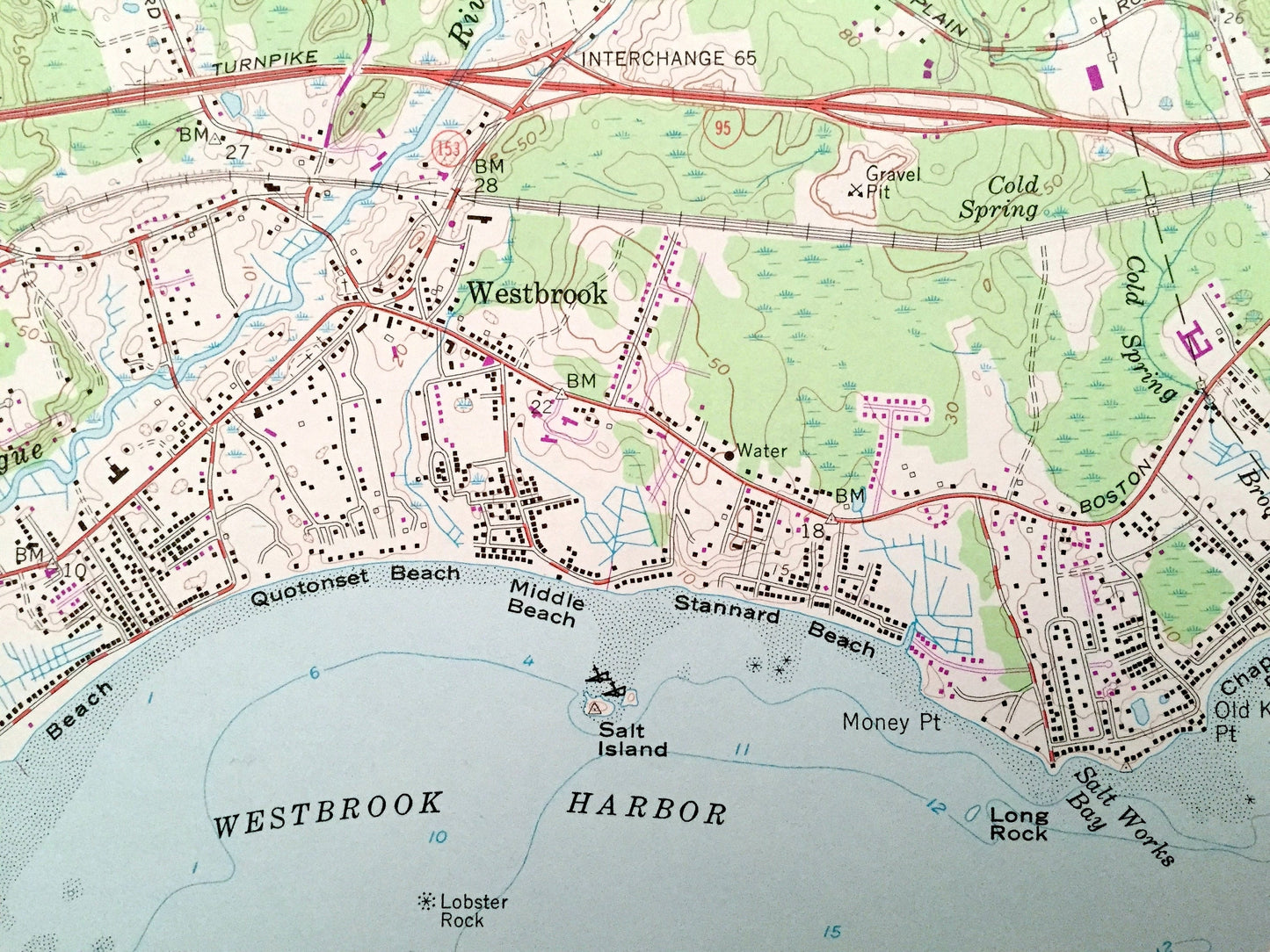
Antique Essex, Connecticut 1958 US Geological Survey Topographic Map – Middlesex County, Deep RIver, Westbrook, Old Saybrook, Winthrop, CT
Antique Essex, Connecticut 1958 US Geological Survey Topographic Map – Middlesex County, Deep RIver, Westbrook, Old Saybrook, Winthrop, CT
Beautiful, antique map of Essex, Connecticut and surrounding Middlesex County area. This is an authentic 1958 edition, 1971 print from the U.S. Geological Survey and NOT a computer reproduction.
See what Connecticut looked like over 60 years ago. Lots of intricate details and geological contours. Map even has little squares for every house that existed at the time. The USGS cartographers were very thorough back then!
Perfect for the historian, map-lover, the curious or just as a conversation starter. Wonderful and rare. Vintage maps such as these make great gifts.
Edition of 1958, printed 1971
Dimensions: 22" width x 27" height
----
Features
Cities & Towns: Lyme, Centerbrook, Ivoryton, Pond Meadow, Clinton, Grove Beach, Saybrook Manor, Knollwood.
Points of Interest: Cockaponset State Forest, Incarnation Camp, Camp Pequot, Great Meadow, Book Hill, Pond Meadow, Mares Hill, The Ledges, Prospect Hill, Obed Heights, Clinton Beach, West Beach, Quotonset Beach, Stannard Beach, Chalker Beach, Bushy Hill Pond, Messerschmidt Pond, Mill Pond, Connecticut River, Duck Island Roads, Long Island Sound, Westbrook Harbor, Falls River, Patchogue River, Oyster River, Connecticut Turnpike, and many more hills, streams, ponds, houses, schools, railroads, churches and roads.
Condition: Very Good Vintage condition, commensurate with age. This map is in great shape for being over 50 years old.
----
We will happily adjust shipping price for multiple purchases. Maps are rolled up and shipped in sturdy mailing tubes, never folded.
Couldn't load pickup availability
Share