My Store
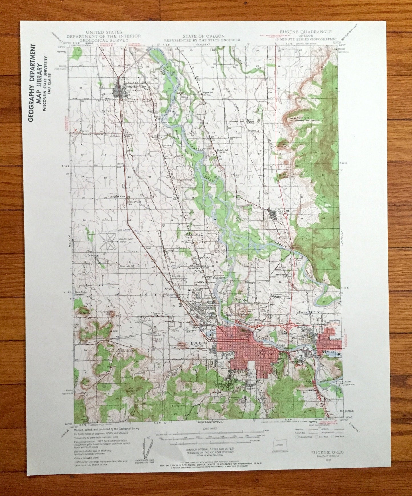
Antique Eugene, Oregon 1946 US Geological Survey Topographic Map – Linn, Lane County, Junction City, Coburg, Meadow View, Springfield, OR
Antique Eugene, Oregon 1946 US Geological Survey Topographic Map – Linn, Lane County, Junction City, Coburg, Meadow View, Springfield, OR
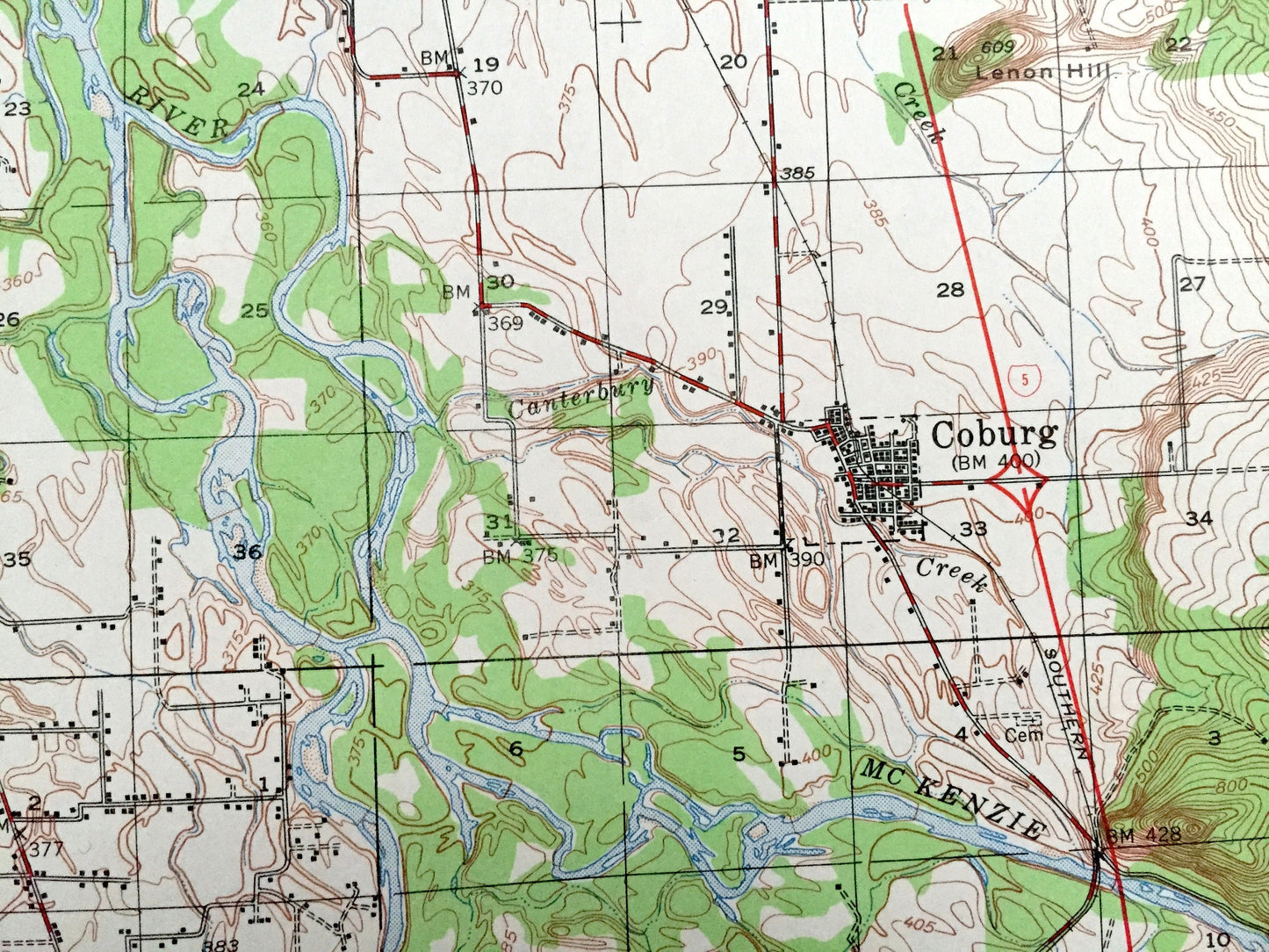
Beautiful, antique map of Eugene, Oregon and surrounding Linn County and Lane County areas. This is an authentic 1946 edition, 1963 print from the U.S. Geological Survey and NOT a computer reproduction.
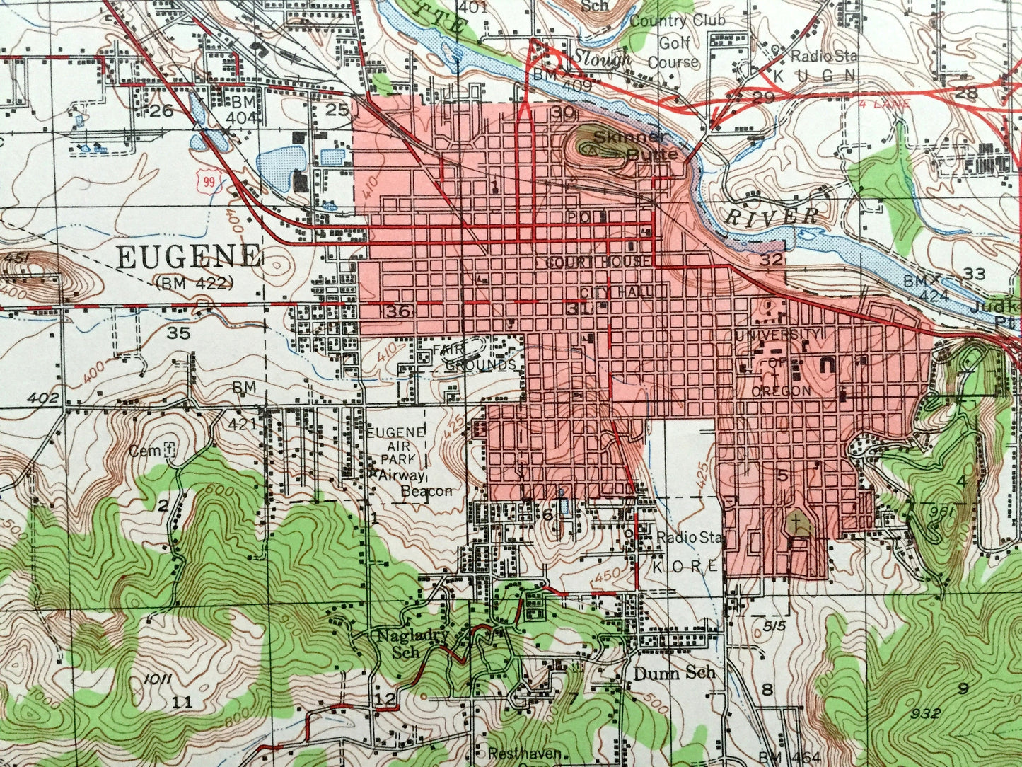
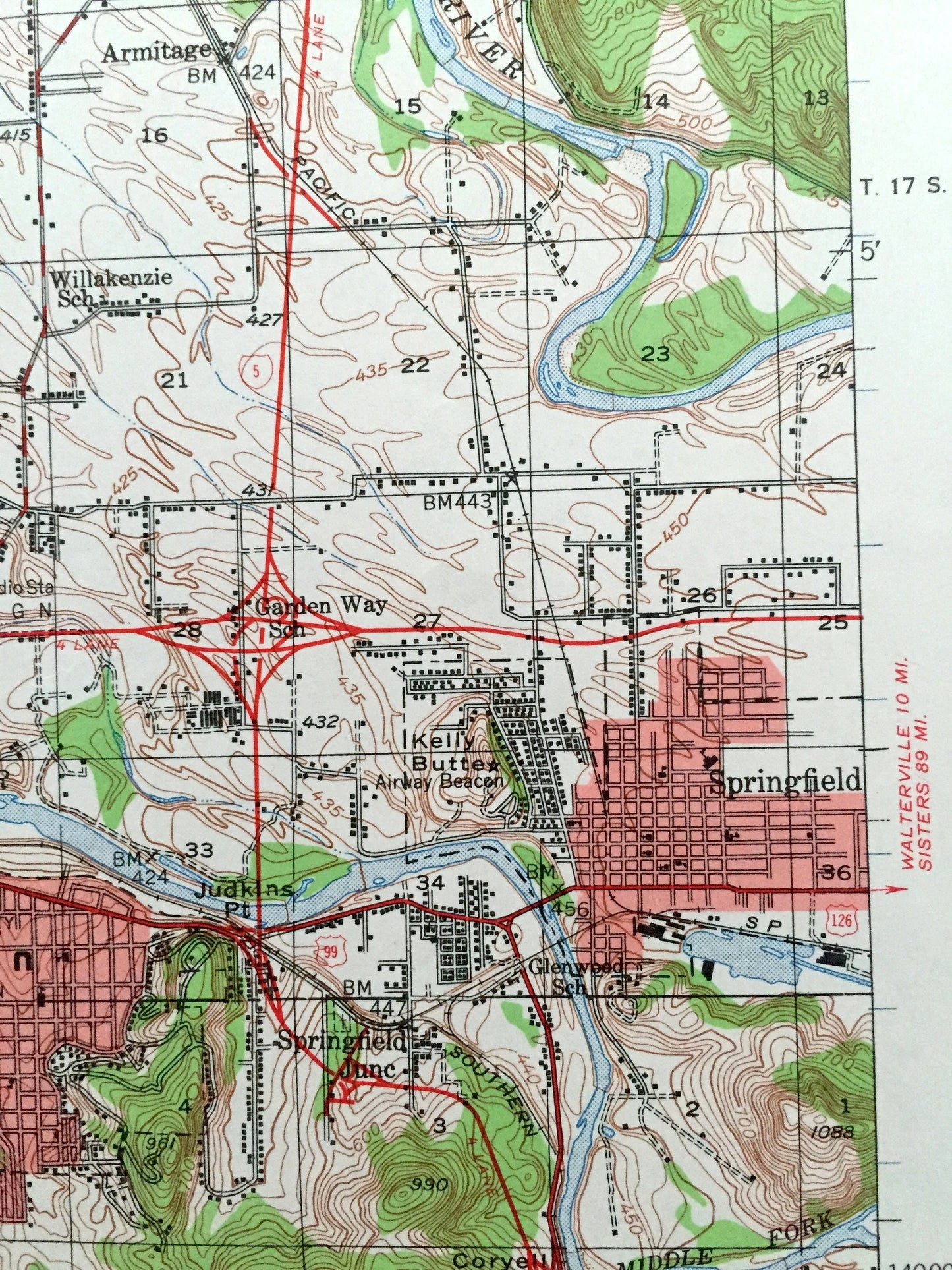
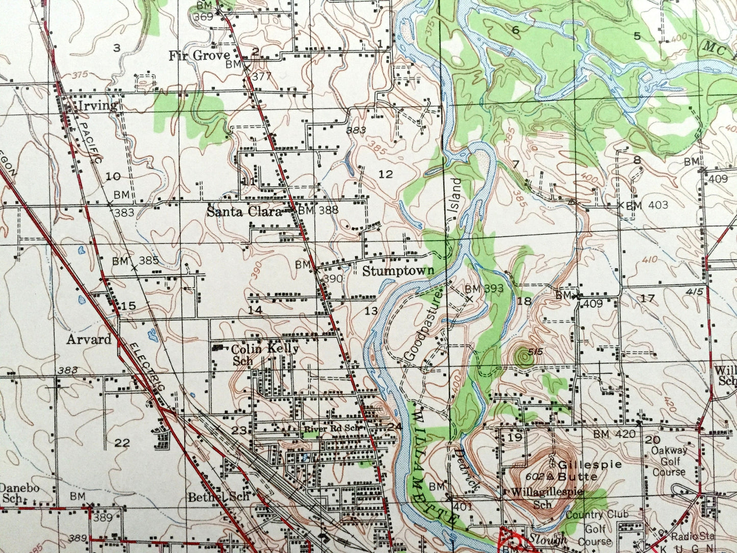
See what Oregon looked like over 75 years ago. Lots of intricate details and geological contours. Map even has little squares for every house that existed at the time. The USGS cartographers were very thorough back then!
Perfect for the historian, map-lover, the curious or just as a conversation starter. Wonderful and rare. Vintage maps such as these make great gifts.
Edition of 1946, printed 1963
Dimensions: 17" width x 21" height
----
Features
Cities & Towns: Junction City, Coburg, Meadow View, Springfield, Wilkins, Milorn, Awbrey, Fir Grove, Irving, Enid, Santa Clara, Armitage, Stumptown, Arvard, Springfield Junction, Danebo.
Points of Interest: University of Oregon, Eugene Air Park, Mahlon Sweet Airport, Court House, City Hall, Willamette River, McKenzie River, Middle Fork, Coast Fork, Canterbury Creek, Muddy Creek, and many more hills, streams, ponds, houses, schools, railroads, churches and roads.
Condition: Very Good Vintage condition, commensurate with age. This map is in great shape for being over 55 years old. Has a library stamp on the left border but all will read as character when framed.
----
We will happily adjust shipping price for multiple purchases. Maps are rolled up and shipped in sturdy mailing tubes, never folded.
Couldn't load pickup availability
Share