My Store
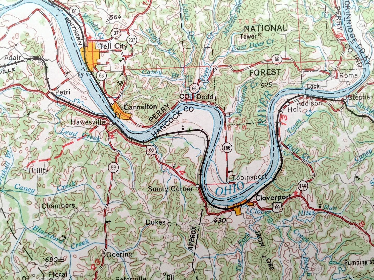
Antique Evansville, Indiana 1957 US Geological Survey Topographic Map – Howell, Mount Vernon, Newburgh, Rockport, Tell City, Cannelton, IN
Antique Evansville, Indiana 1957 US Geological Survey Topographic Map – Howell, Mount Vernon, Newburgh, Rockport, Tell City, Cannelton, IN
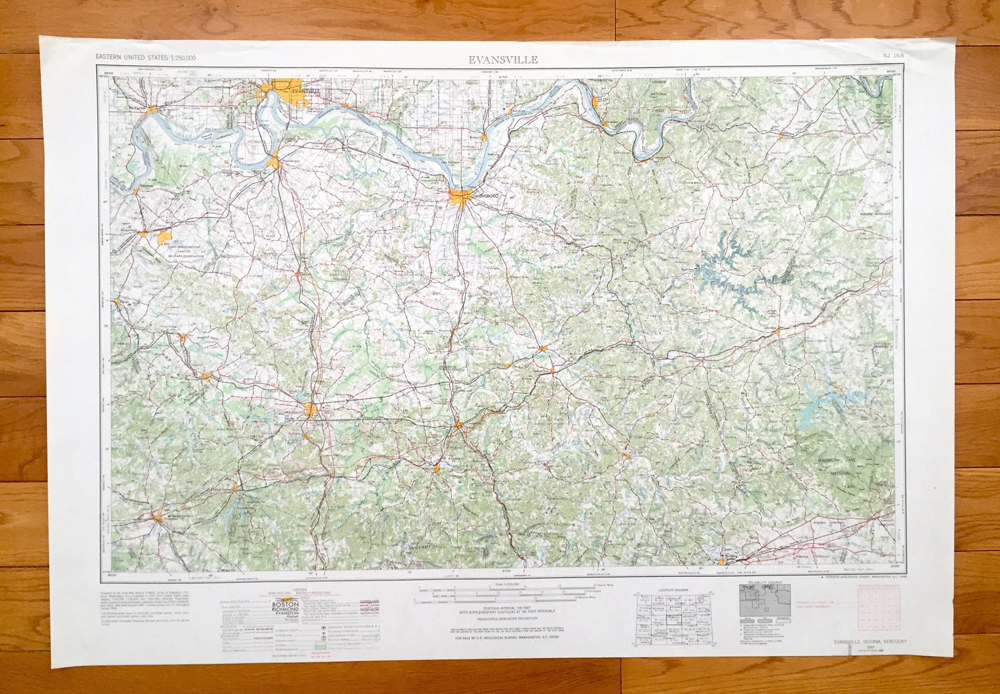
Beautiful, antique map of Evansville, Indiana and surrounding Kentucky areas. This is an authentic 1957 edition, 1969 print from the U.S. Geological Survey and NOT a computer reproduction.
See what Indiana and Kentucky looked like over 60 years ago. Lots of intricate details and geological contours. Map is incredibly large and in the grand 1:250,000 scale. The USGS cartographers were very thorough back then!
Perfect for the historian, map-lover, the curious or just as a conversation starter. Wonderful and rare. Vintage maps such as these make great gifts.
Edition of 1957, printed 1969
Dimensions: 32" width x 22 1/2" height
----
Features
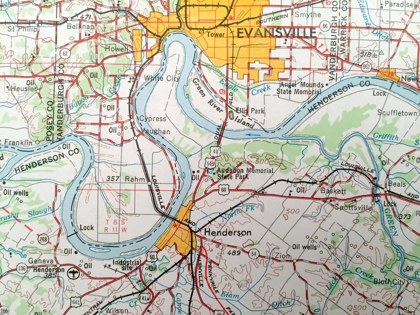
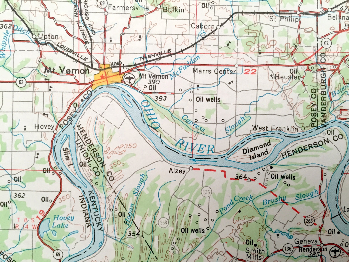
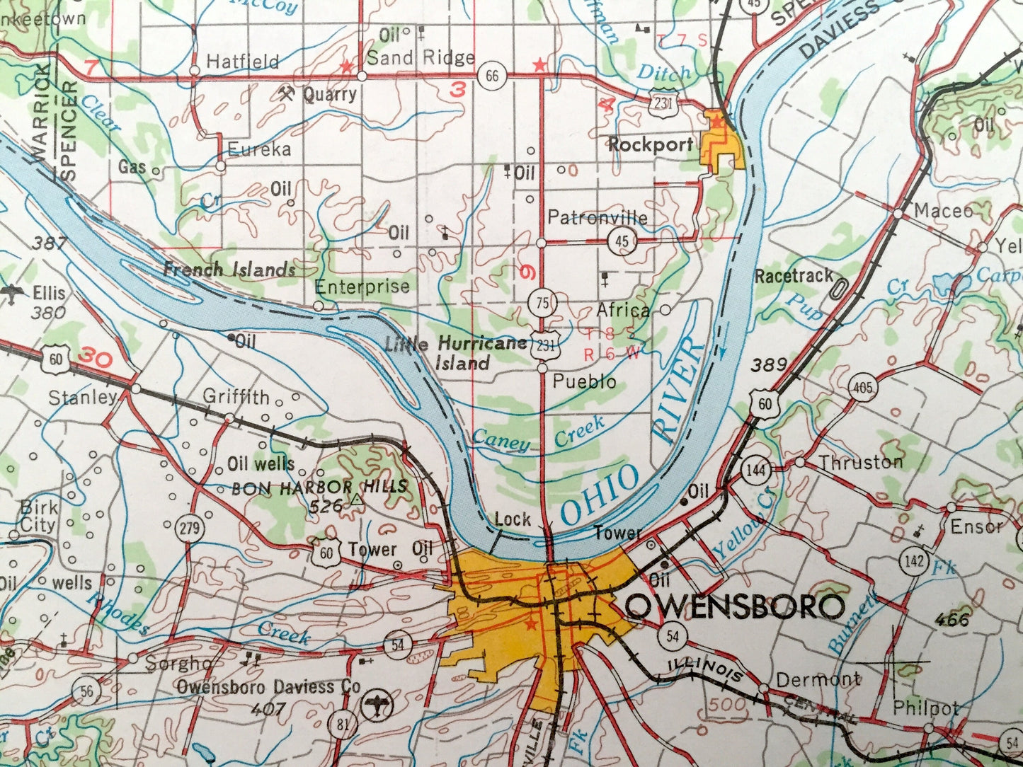
Cities & Towns: INDIANA - Evansville, Smythe, Dayville, Belknap, St. Phillip, Farmersville, Hovey, Bullocktown, Richland City, Patronville, Eureka, Enterprise, Tobinsport, Rome, Pelzer, Howell, Mount Vernon, Newburgh, Rockport, Tell City, Cannelton.
KENTUCKY - Owensboro, Henderson, Uniontown, Morganfield, Sturgis, Clay, Providence, Madisonville, Earlington, Dawson Springs, Princeton, Greenville, Bowling Green, Central City, Livermore, Hartford, Beaver Dam, Leitchfield, Irvington, Cloverport, Drakesboro.
Points of Interest: INDIANA - Ohio River, Hoosier National Forest, Eagle Creek, McFadden Creek, Hovey Lake and lots more hills, mountains, lakes, creeks, roads highways and railroads.
KENTUCKY - Ohio River, Green River, Rough River, Nolin River, Tradewater River, Mammoth Cave National Park, Camp Breckinridge Military Reservation, Fort Knox Military Reservation, Pennyrile State Forest, Walker Lake and lots more hills, mountains, lakes, creeks, roads, highways and railroads.
Condition: Very Good Vintage condition, commensurate with age. This map is in great shape for being over 50 years old. Has light edge-wear and tears, all of which will read as vintage character when framed.
----
We will happily adjust shipping price for multiple purchases. Maps are rolled up and shipped in sturdy mailing tubes, never folded.
Couldn't load pickup availability
Share