My Store
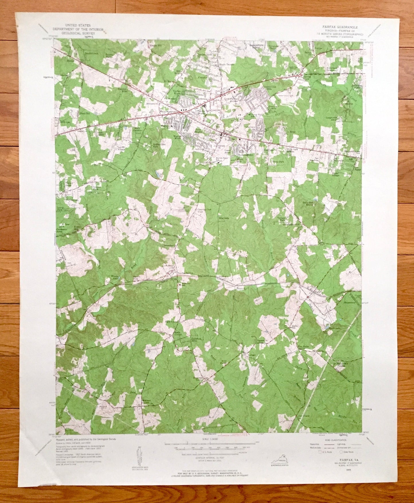
Antique Fairfax, Virginia 1955 US Geological Survey Topographic Map – County, Burke, Doveville, Ilda, Homewood, Little River Hills, VA
Antique Fairfax, Virginia 1955 US Geological Survey Topographic Map – County, Burke, Doveville, Ilda, Homewood, Little River Hills, VA
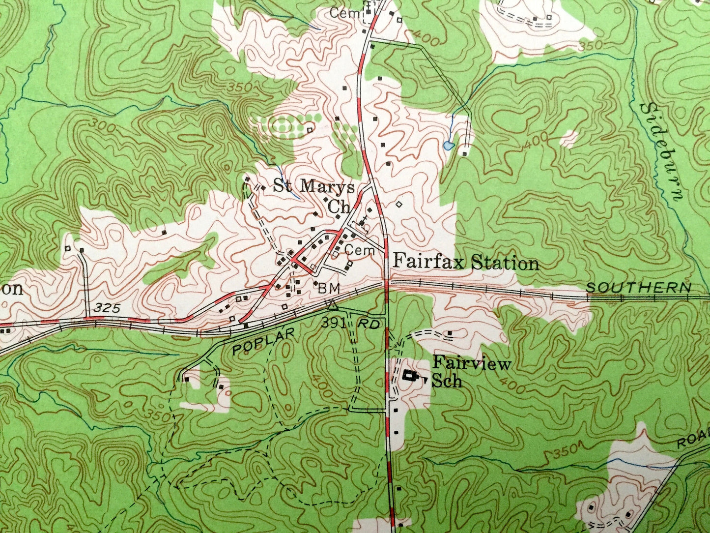
Beautiful, antique map of Fairfax, Virginia and surrounding Fairfax County area. This is an authentic 1955 print from the U.S. Geological Survey and NOT a computer reproduction.
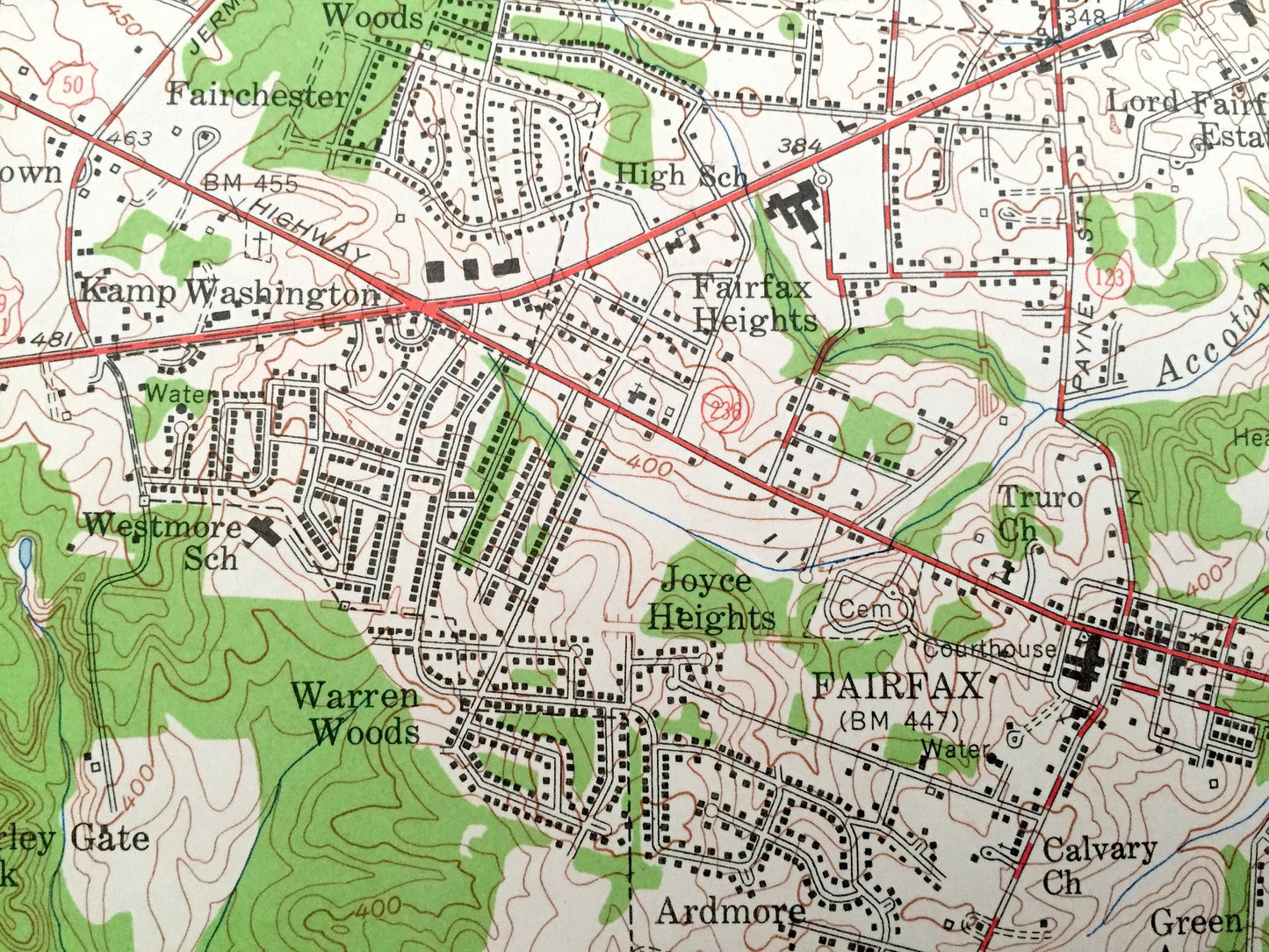
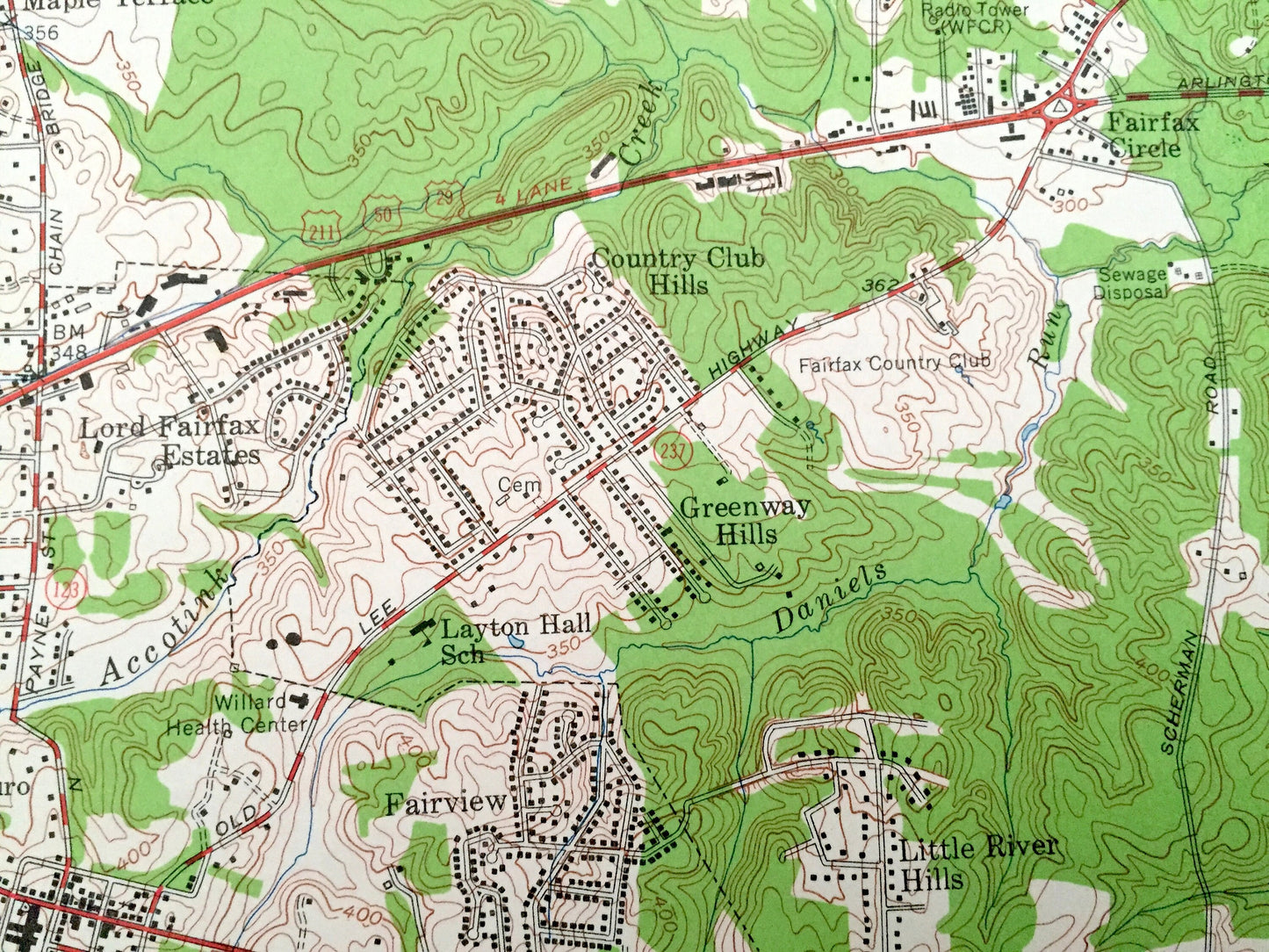
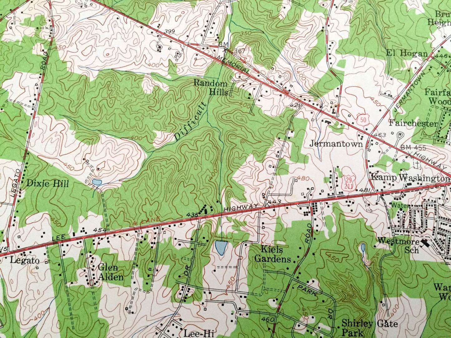
See what Virginia looked like over 65 years ago. Lots of intricate details and geological contours. Map even has little squares for every house that existed at the time. The USGS cartographers were very thorough back then!
Perfect for the historian, map-lover, the curious or just as a conversation starter. Wonderful and rare. Maps such as these make great gifts.
Edition of 1955, printed 1955
Dimensions: 17" width x 21" height
----
Features
Cities & Towns: Fairfax, Dixie Hill, Random Hills, Penderbrook, Bruin Heights, Cobbdale, Maple Terrace, Fairfax Circle, Mantua, Little River Hills, Fairview, Fairfax Heights, Warren Woods, Lee-Hi Village, Vannoy Acres, Glen Alden, Ardmore, Holly Park Estates, Doveville, Ilda, Vertain Park, Station Hills, Fairfax Station, Sideburn, Burke, Homewood, Five Forks, Belleair, Keene Mill Heights, Elgin Corner, Avon Forest, Donovans Corner, Makleys Corner.
Points of Interest: Popes Head Creek, Wendy Lake, Southern Railway, Hatch Lake, Accotink Creek, Courthouse Country Club, Fairfax County Club, and lots more streams, marshes, houses, roads and railroads.
Condition: Very Good Vintage condition, commensurate with age. This map is in great shape for being over 65 years old.
----
We will happily adjust shipping price for multiple purchases. Maps are rolled up and shipped in sturdy mailing tubes, never folded.
Couldn't load pickup availability
Share