My Store
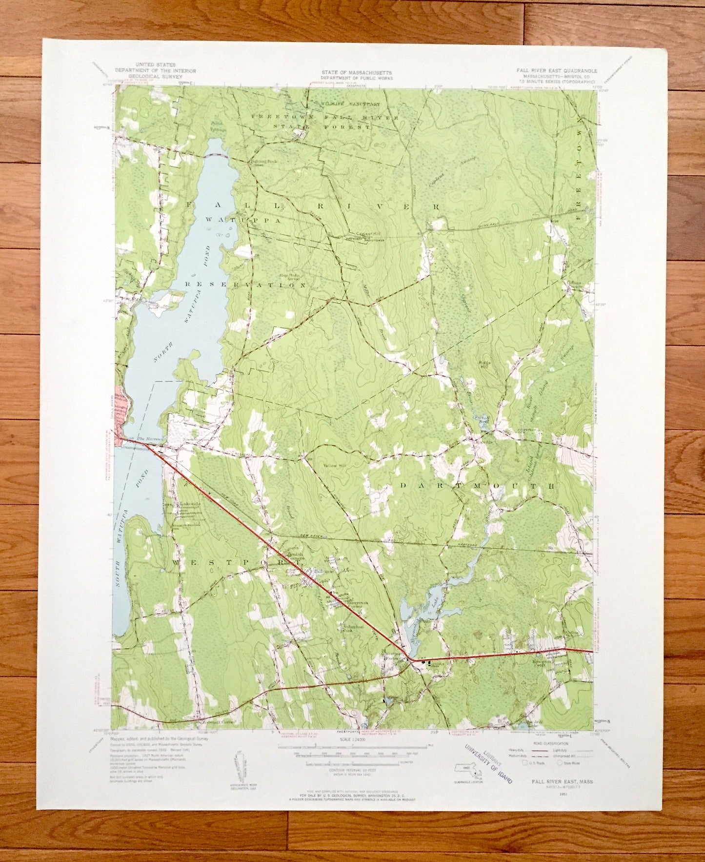
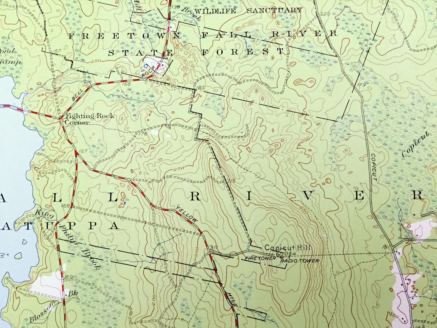
Antique Fall River East, Massachusetts 1951 US Geological Survey Topographic Map – Bristol County, Freetown, Dartmouth, Westport, MA
Antique Fall River East, Massachusetts 1951 US Geological Survey Topographic Map – Bristol County, Freetown, Dartmouth, Westport, MA
Beautiful, antique map of Fall River East, Massachusetts surrounding Bristol County area. This is an authentic 1951 edition, 1958 print from the U.S. Geological Survey and NOT a computer reproduction.
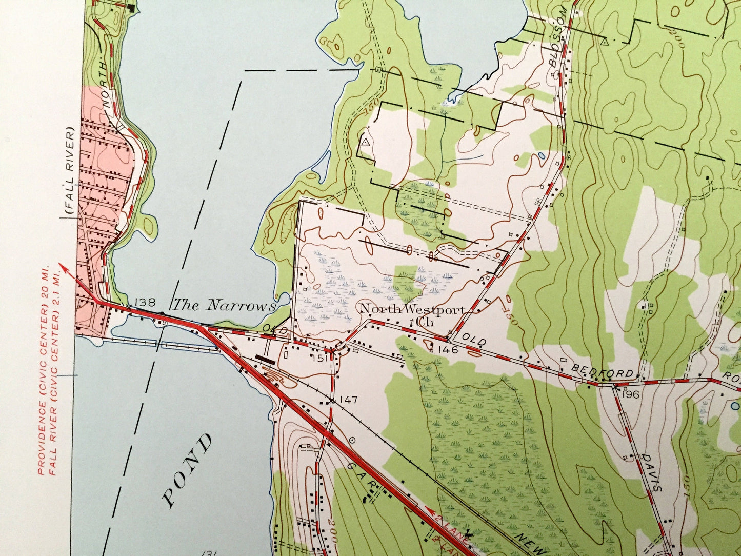
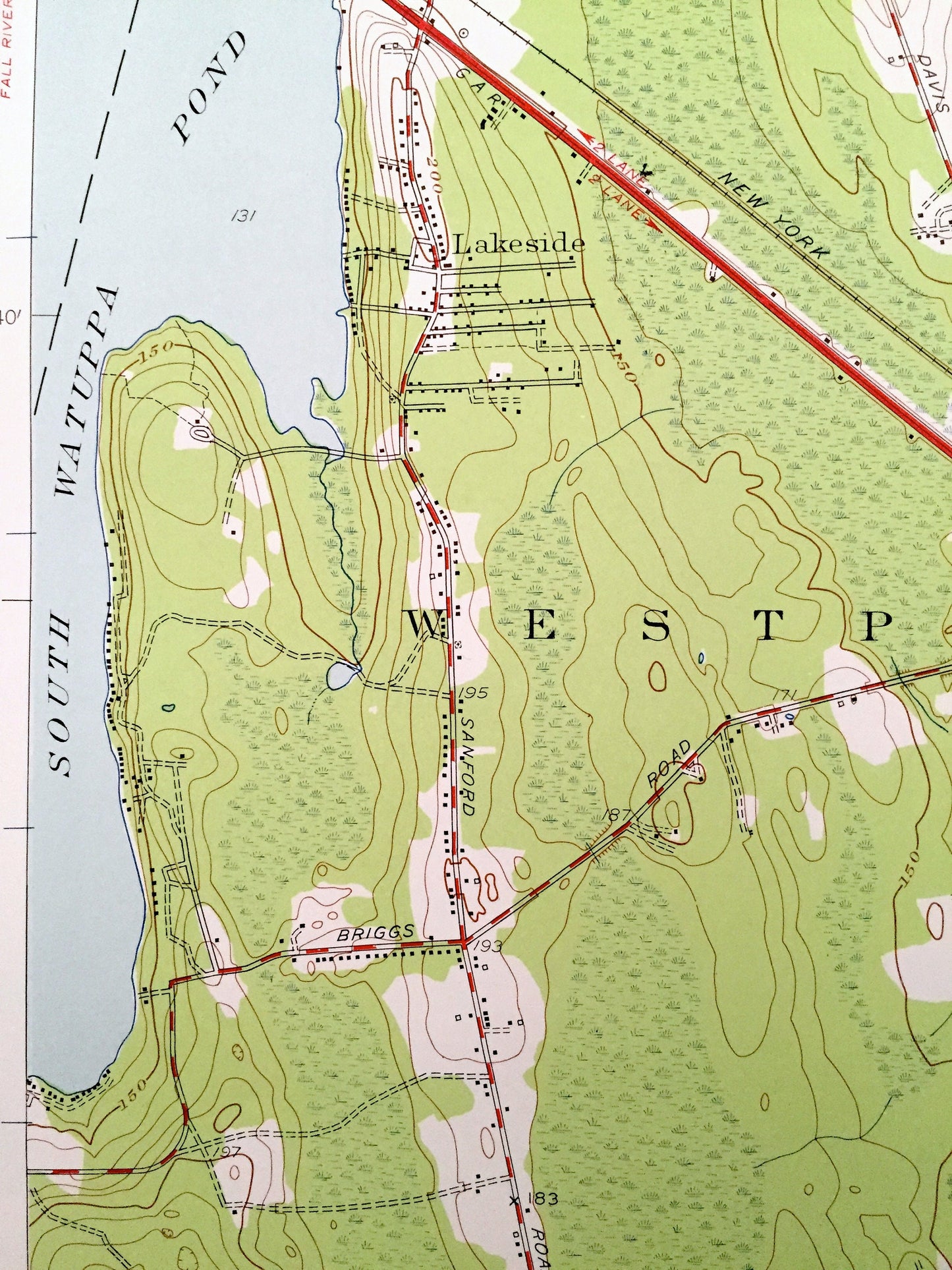
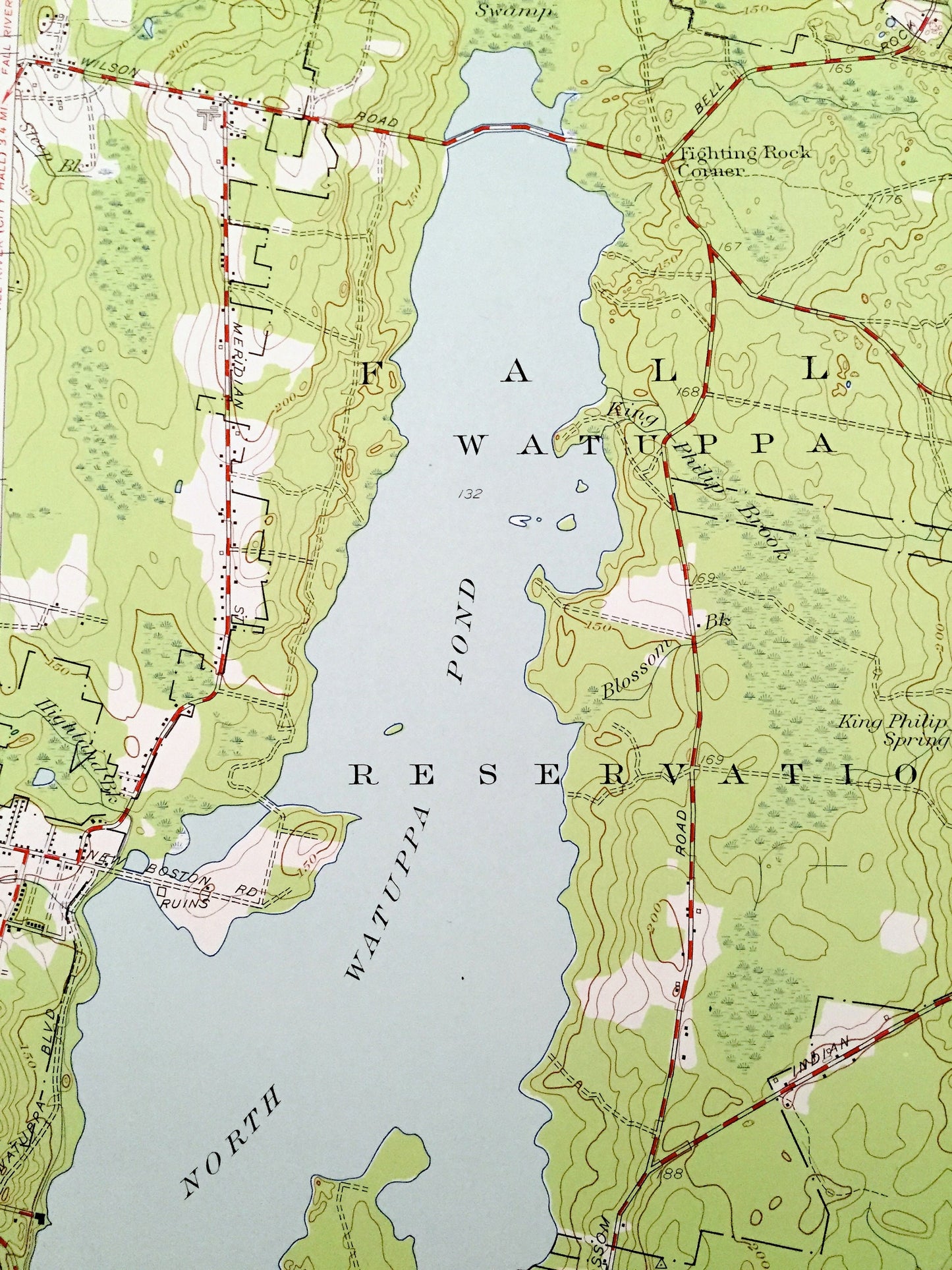
See what Massachusetts looked like over 70 years ago. Lots of intricate details and geological contours. Map even has little squares for every house that existed at the time. The USGS cartographers were very thorough back then!
Perfect for the historian, map-lover, the curious or just as a conversation starter. Wonderful and rare. Vintage maps such as these make great gifts.
Edition of 1951, printed 1958
Dimensions: 22" width x 27" height
----
Features
Cities & Towns: Freetown, Dartmouth, Westport, Fighting Rock Corner, Collins Corner, Hixville, Lakeside, Brewnell Corner, Beulah Corners, Hillcrest, Berryman Corner, Westport Factory, Kempton Croft, Suburban Park.
Points of Interest: Freetown Fall River State Forest, Wildlife Sanctuary, Watuppa Reservation, Copicut Hill, Ridge Hill, Yellow Hill, Lincoln Park, South Watuppa Pond, North Watuppa Pond, Noquochoke Lake, Cedar Dell Lake, Cornell Pond, Copicut River, Shingle River, Miller Brook, and many more hills, streams, ponds, houses, schools, railroads, churches and roads.
Condition: Very Good Vintage condition, commensurate with age. This map is in great shape for being over 60 years old.
----
We will happily adjust shipping price for multiple purchases. Maps are rolled up and shipped in sturdy mailing tubes, never folded.
Couldn't load pickup availability
Share