My Store
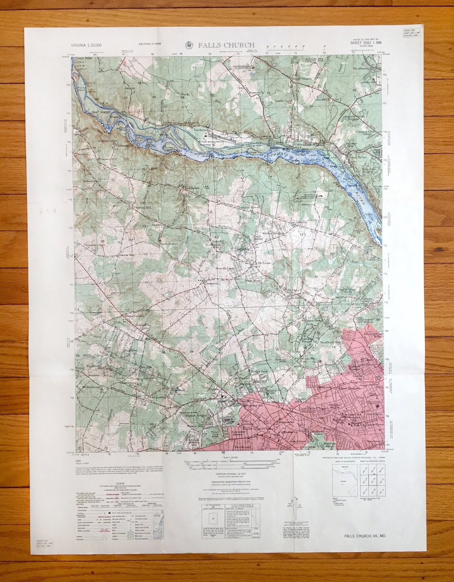
Antique Falls Church, Virginia 1949 US Geological Survey Topographic Map – Fairfax County, McLean, Cabin John, Vienna, Glen Echo Maryland VA
Antique Falls Church, Virginia 1949 US Geological Survey Topographic Map – Fairfax County, McLean, Cabin John, Vienna, Glen Echo Maryland VA
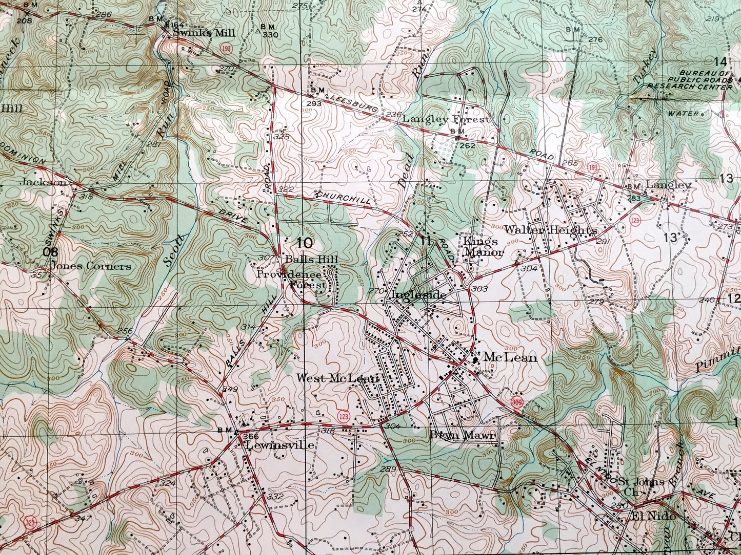
Beautiful, antique map of Falls Church, Virginia and Maryland and surrounding Fairfax, Montgomery & Arlington County area. This is an authentic 1949 edition, 1951 print from the Army Map Service, Corps of Engineers U.S. Geological Survey and is NOT a computer reproduction.
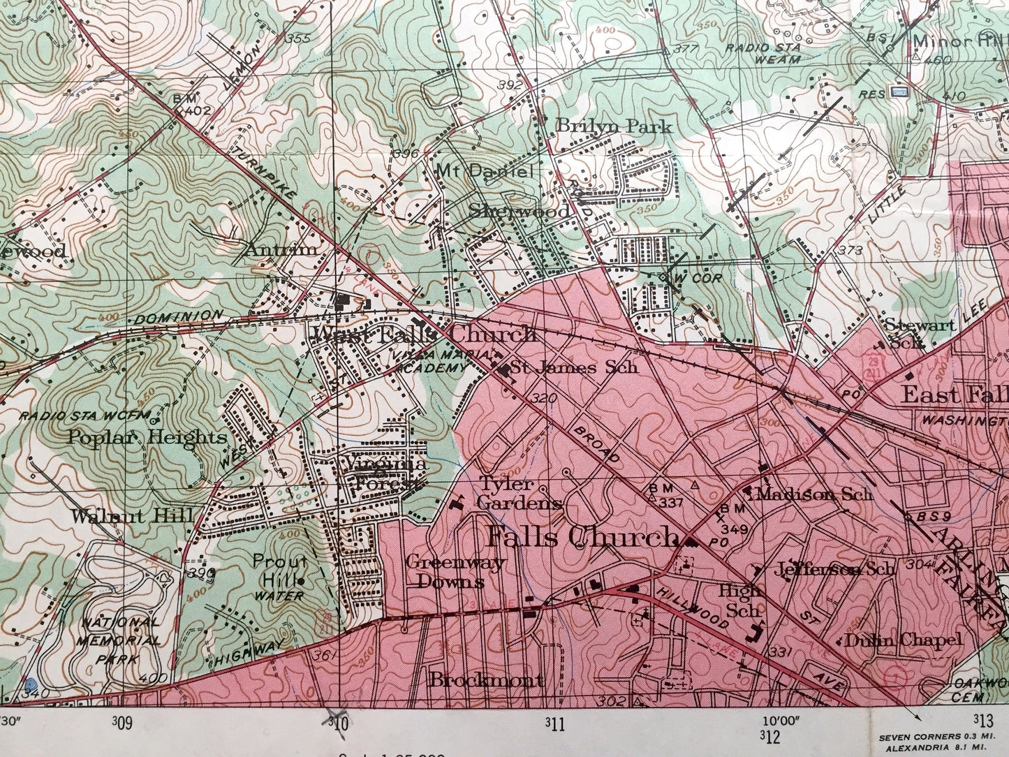
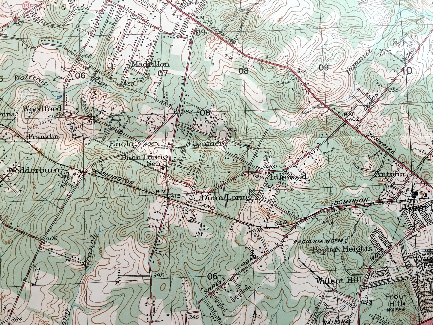
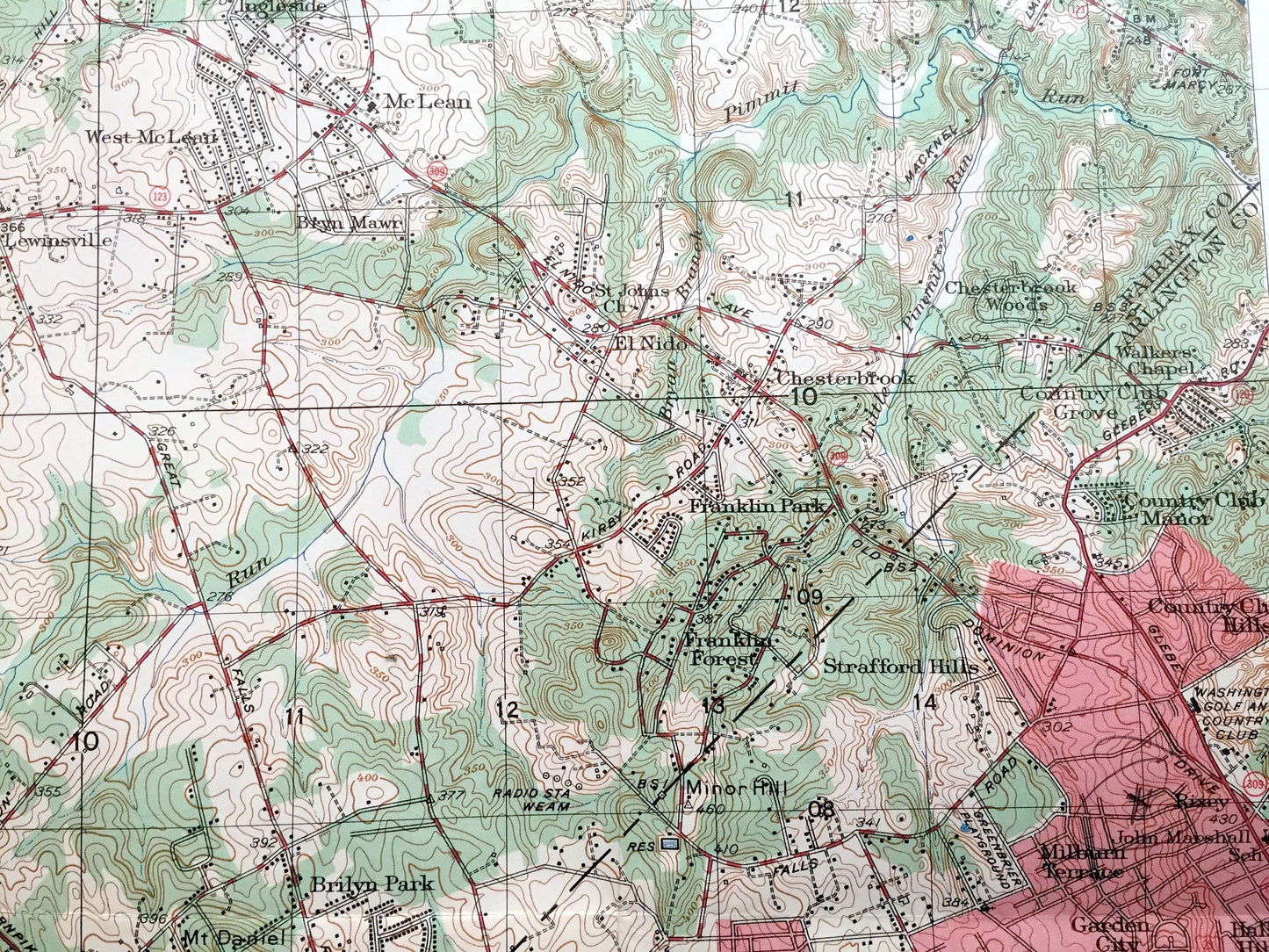
See what Virginia and Maryland looked like over 70 years ago. Lots of intricate details and geological contours. Map even has little squares for every house that existed at the time. The USGS cartographers were very thorough back then!
Perfect for the historian, map-lover, the curious or just as a conversation starter. Wonderful and rare. Maps such as these make great gifts.
Edition of 1949, printed 1951
Dimensions: 21 3/4" width x 29" height
----
Features
Cities & Towns: Falls Church, West Falls Church, East Falls Church, Falls Hill, Poplar Heights, Walnut Hill, Highland Park, Dominion Hills, Milburn Terrace, Williamsburg Village, Kent Gardens, Pimmit Hills, McLean, Vienna, Madrillon, Belle Forest, Idylwood, Moss Crest, Lewinsville, Brookhaven, Pimmit Heights, Kings Manor, Langley Forest, Langley, Cropley, Carderock, Cabin John, Bannockburn, Fairway Hills, Glen Echo, Lybrook, Landon Village, Mohican Hills.
Points of Interest: Potomac River, Chesapeake and Ohio Canal, US Naval Reservation, Bear Island, Sherwin Island, Prospect Hill, Offutt Island, Yellow Falls, Vaso Island, Turkey Island, Stubblefield Falls, Plummer Island, Swainson Island, Wades Island, Cabin John Island, Chautauqua Island, Grantt Hill, Freedom Hill, Prout Hill, Washington and Old Dominion Railroad, and lots more streams, marshes, houses, roads and railroads.
Condition: Good Vintage condition, commensurate with age. This map is in great shape for being over 70 years old. Has light edge-wear, pencil in margin and folds as-issued, but these will flatten easily and all will add to vintage character when framed.
----
We will happily adjust shipping price for multiple purchases. Maps are rolled up and shipped in sturdy mailing tubes, never folded.
Couldn't load pickup availability
Share