My Store
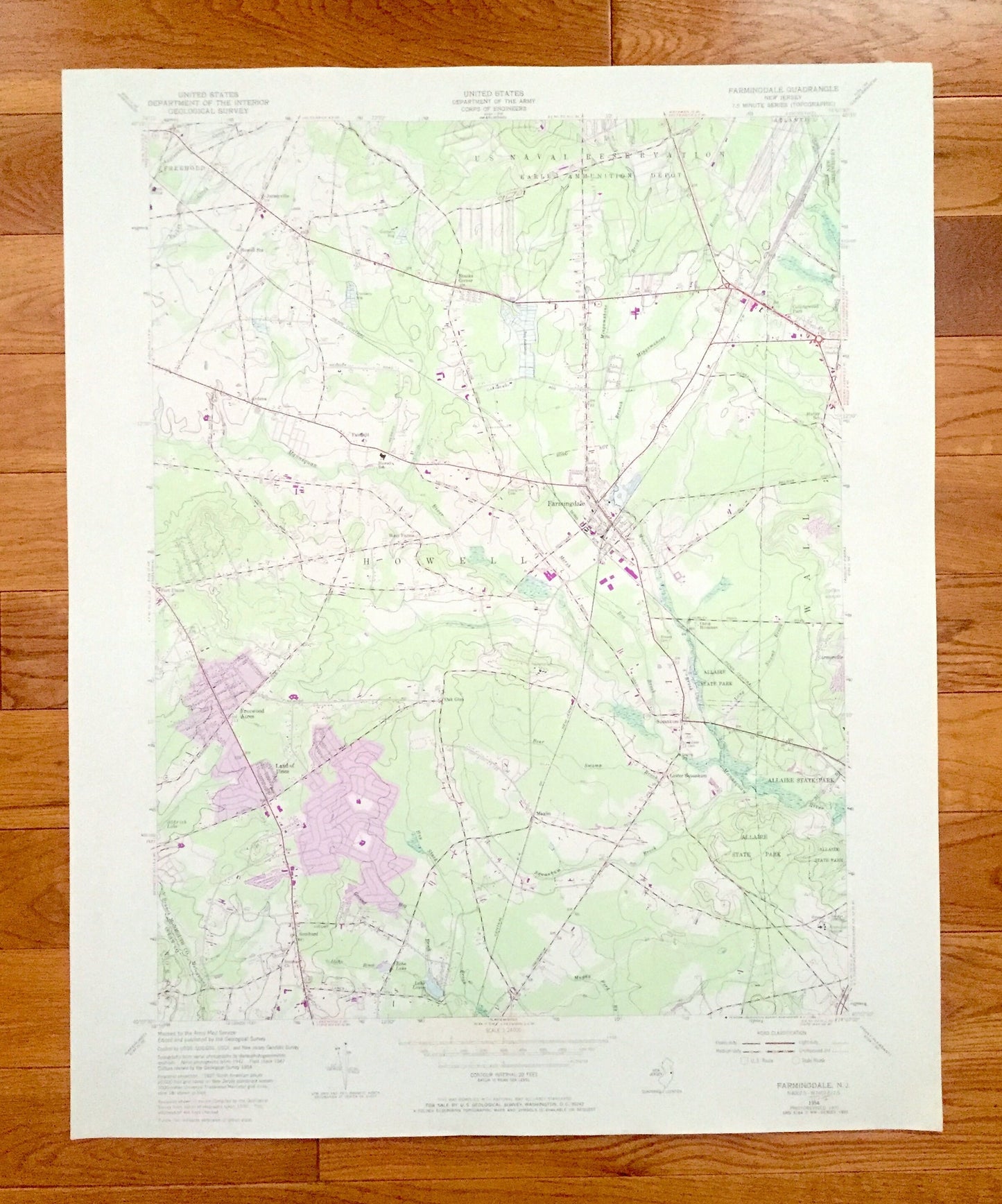
Antique Farmingdale, New Jersey 1954 US Geological Survey Topographic Map - Ocean, Monmouth County, Howell, Wall, New Shrewsbury, Jackson NJ
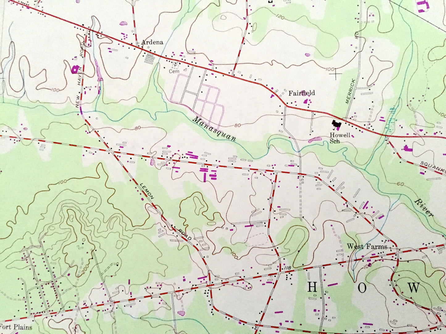
Antique Farmingdale, New Jersey 1954 US Geological Survey Topographic Map - Ocean, Monmouth County, Howell, Wall, New Shrewsbury, Jackson NJ
Beautiful, antique map of Farmingdale, New Jersey and surrounding Monmouth and Ocean County areas. This is an authentic 1954 edition, 1985 print from the U.S. Geological Survey and NOT a computer reproduction.
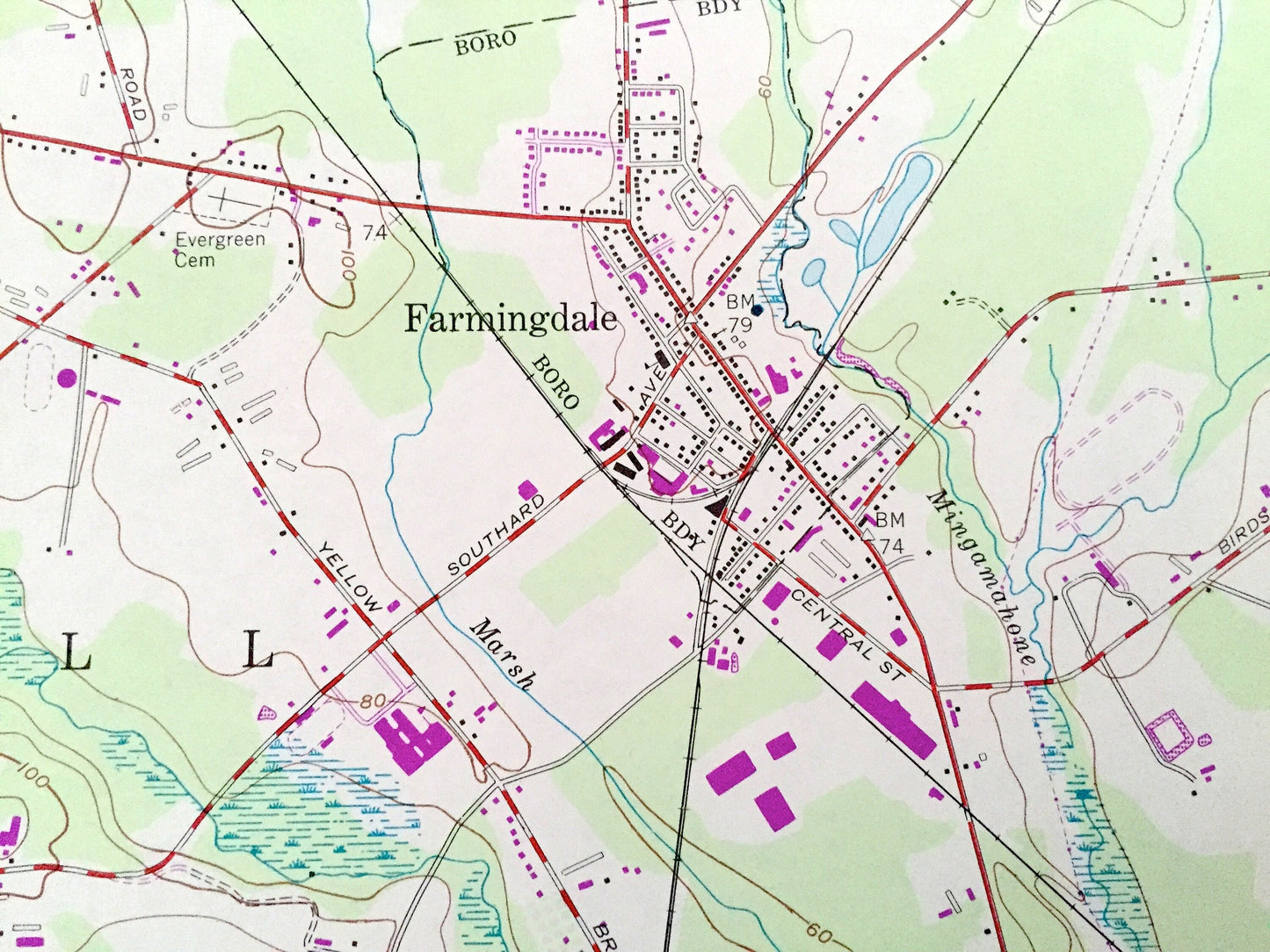
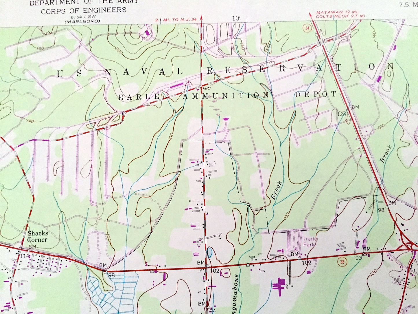
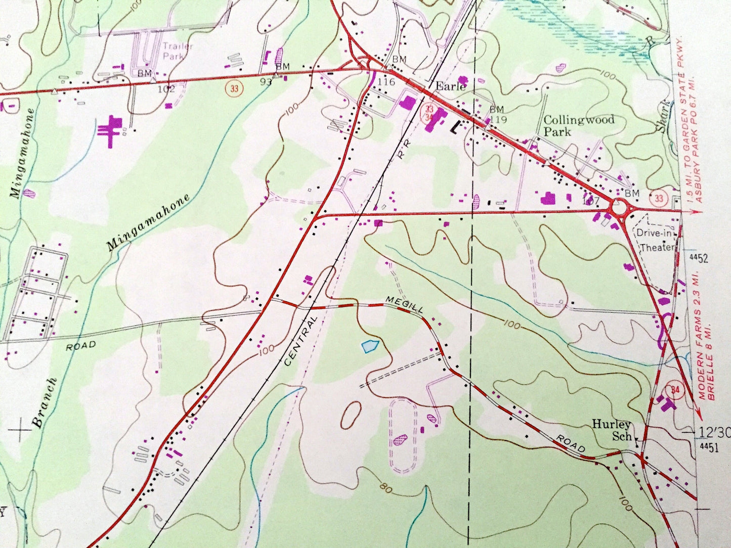
See what New Jersey looked like over 65 years ago. Lots of intricate details and geological contours. Map even has little squares for every house that existed at the time. The USGS cartographers were very thorough back then!
Perfect for the historian, map-lover, the curious or just as a conversation starter. Wonderful and rare. Vintage maps such as these make great gifts.
Edition of 1954, printed 1985
Dimensions: 22” width x 27" height
----
Features
Cities & Towns: Freehold, Jerseyville, Shacks Corner, Ardena, Fairfield, Freewood Acres, Land of Pines, Oak Glen, Squankum, Lower Squankum, Earle, Carmerville, Maxim, Fort Plains
Points of Interest: U.S. Navy Reservation Earle Ammunition Depot, Penn Central, Allaire State Park, Garden State Parkway, Central Railroad of New Jersey, cranberry bogs, cemeteries, Camp Housman, golf courses, county airport, Applegates Creek, Aldrich Lake, Hay Stack Brook, Dicks Brook, Echo Lake, Lake Louise, Bear Swamp Brook, Squankum Brook, Muddy Ford Brook, Mingamahone Brook, Manasquan River, Shark River, Burks Creek, and many more hills, streams, ponds, houses, schools, railroads, churches and roads.
Condition: Very Good Vintage condition, commensurate with age. This map is in great shape for being over 35 years old. Has light edge-wear, and a few pencil markings, but this will add to vintage character when framed.
----
We will happily adjust shipping price for multiple purchases. Maps are rolled up and shipped in sturdy mailing tubes, never folded.
Couldn't load pickup availability
Share