My Store
Antique Fire Island, New York 1903 US Geological Survey Topographic Map – Long Island, Babylon, Bay Shore, Islip, Sayville Suffolk County NY
Antique Fire Island, New York 1903 US Geological Survey Topographic Map – Long Island, Babylon, Bay Shore, Islip, Sayville Suffolk County NY
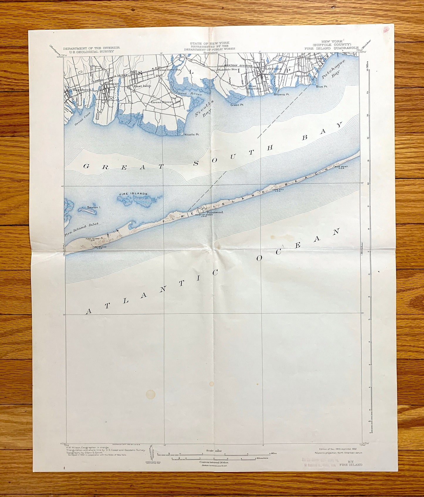
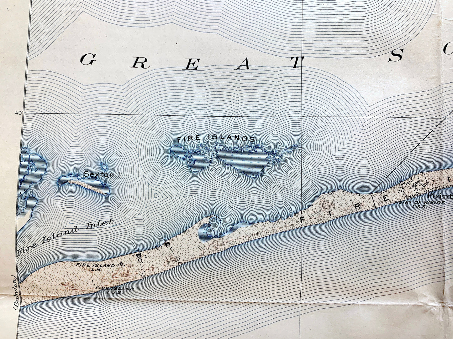
Beautiful, antique map of Fire Island, New York and surrounding Suffolk County area of Long Island. This is an authentic 1903 edition, 1932 print from the U.S. Geological Survey and NOT a computer reproduction.
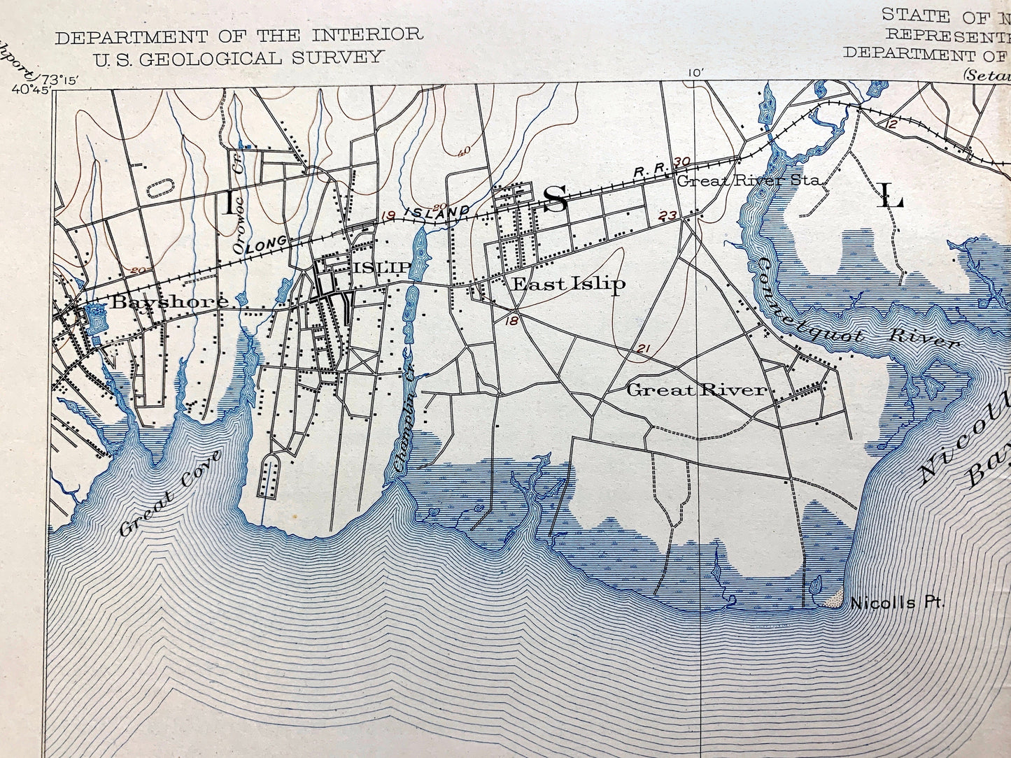
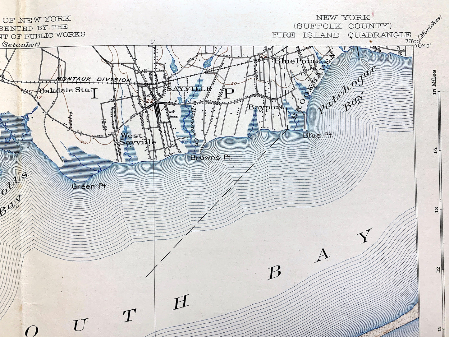
See what Long Island looked like 120 years ago. Lots of intricate details and geological contours. Map even has little squares for every house that existed at the time. The USGS cartographers were very thorough back then! On the back is a description of topographic symbols and map guide.
Perfect for the historian, map-lover, the curious or just as a conversation starter. Wonderful and rare. Maps such as this make great gifts.
Edition of 1903, printed 1932
Dimensions: 16 1/2" width x 20" height
----
Features
Cities & Towns: Fire Island, Islip, Brookhaven, Bayshore (Bay Shore), East Islip, Great River, Oakdale, West Sayville, Sayville, Blue Point, Pointwood.
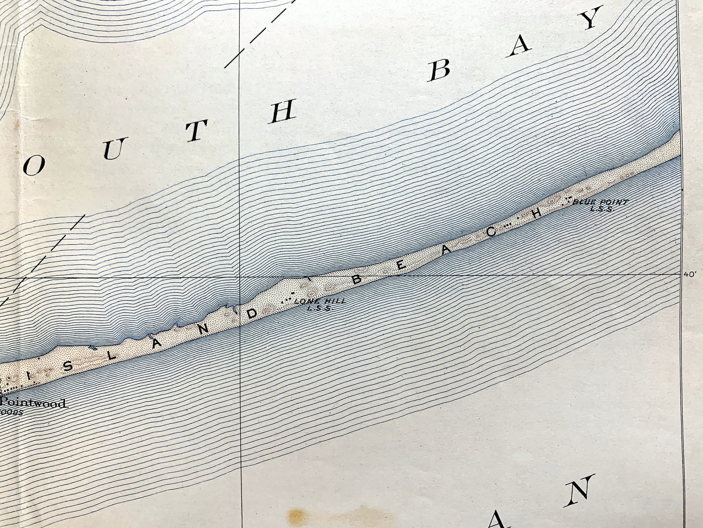
Points of Interest: Suffolk County, Atlantic Ocean, Fire Islands, Fire Island Beach, Great South Bay, Great Cove, Nicolls Bay, Connetquot River, Patchogue Bay, Sexton Island, Fire Island Inlet, Point of Woods Lighthouse, Lone Hill, Blue Point, and many more small towns, schools, train tracks, roads, hills and creeks.
Condition: Good Vintage condition, commensurate with age. This map is in great shape for being over 90 years old. Has some edge-wear foxing, toning, light staining, as well as folds as-issued, but these will flatten easily and all will read as vintage character when framed.
----
We will happily adjust shipping price for multiple purchases. Maps are rolled up and shipped in sturdy mailing tubes, never folded.
Couldn't load pickup availability
Share