My Store
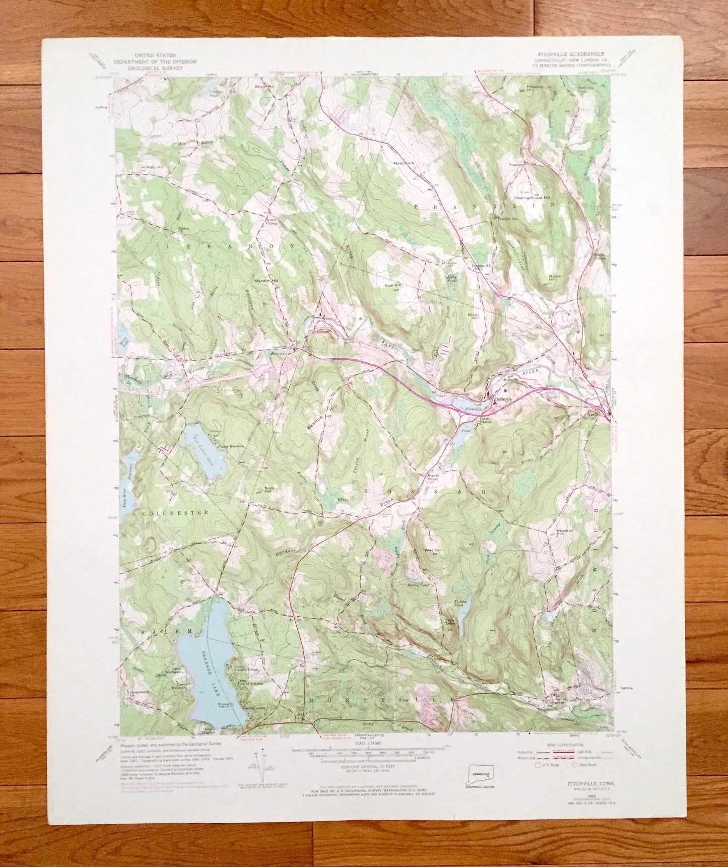
Antique Fitchville, Connecticut 1953 US Geological Survey Topographic Map – New London County, Lebanon, Franklin, Colchester, Montville, CT
Antique Fitchville, Connecticut 1953 US Geological Survey Topographic Map – New London County, Lebanon, Franklin, Colchester, Montville, CT
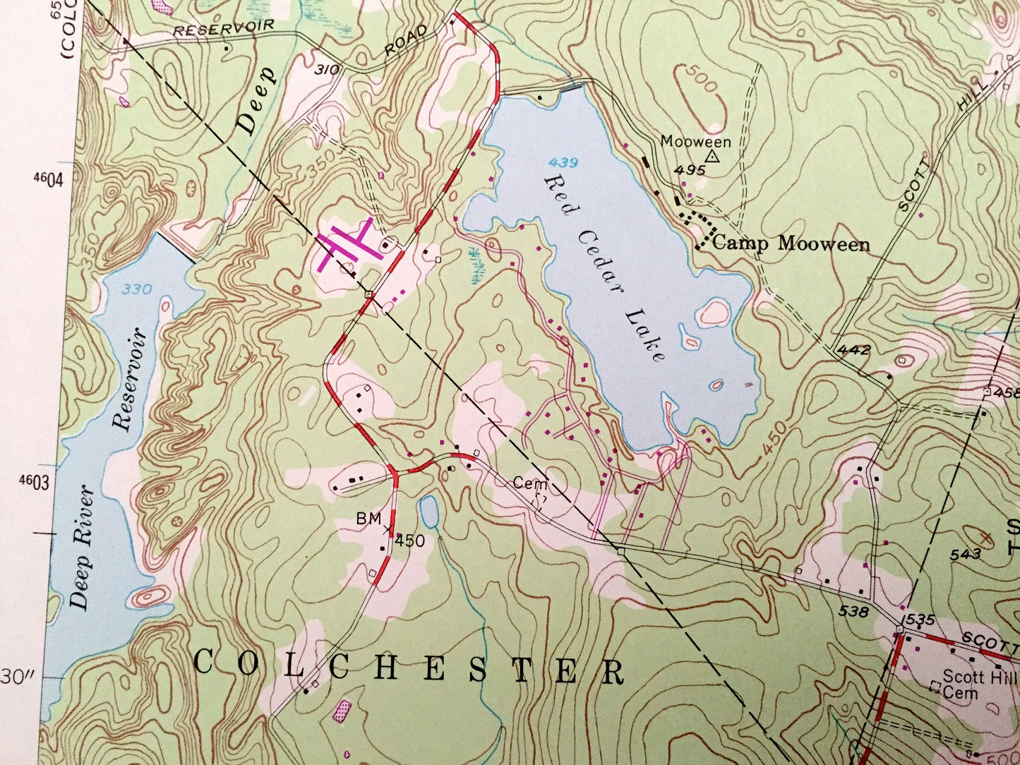
Beautiful, antique map of Fitchville, Connecticut and surrounding New London County area. This is an authentic 1953 edition, 1971 print from the U.S. Geological Survey and NOT a computer reproduction.
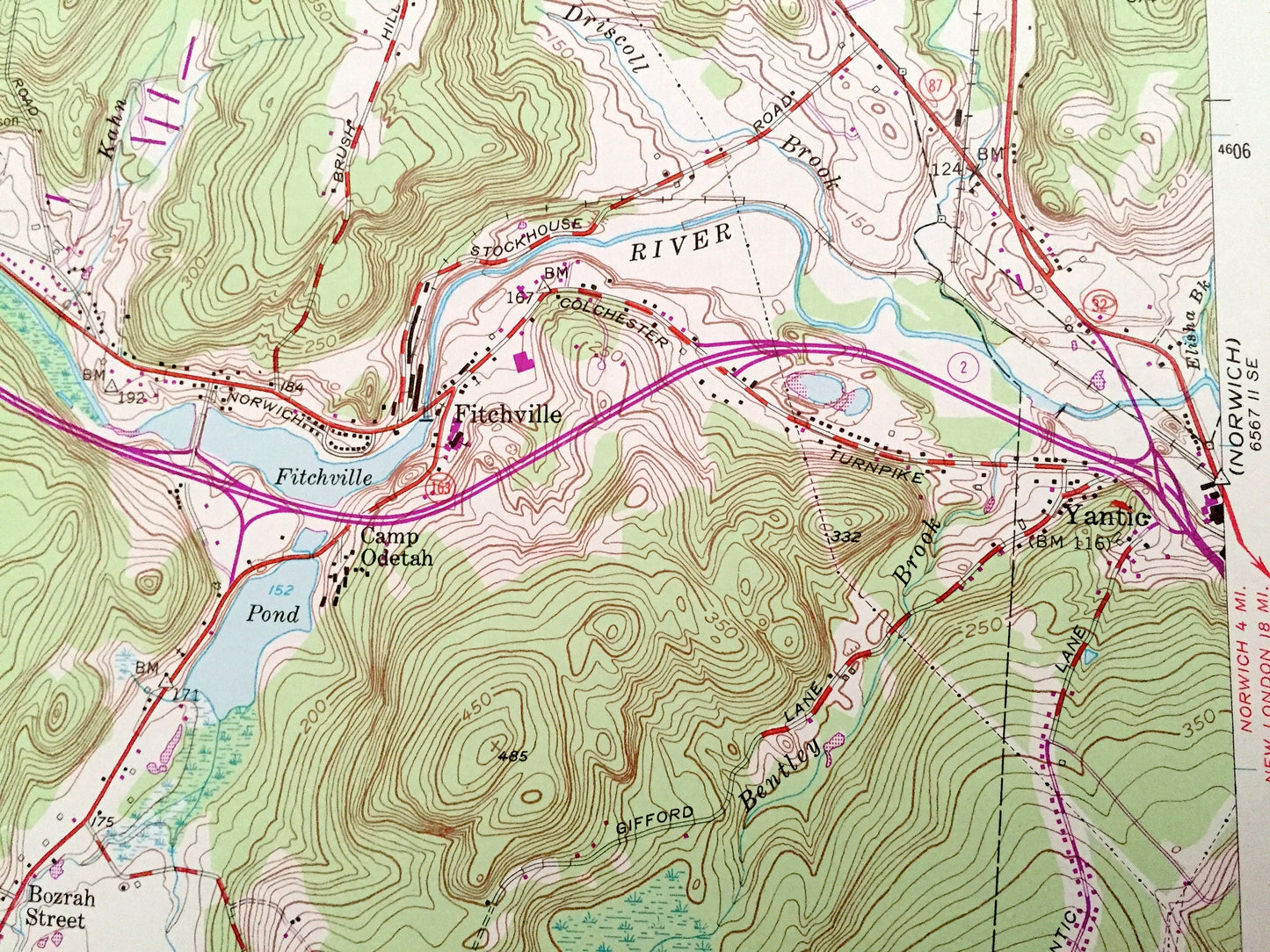
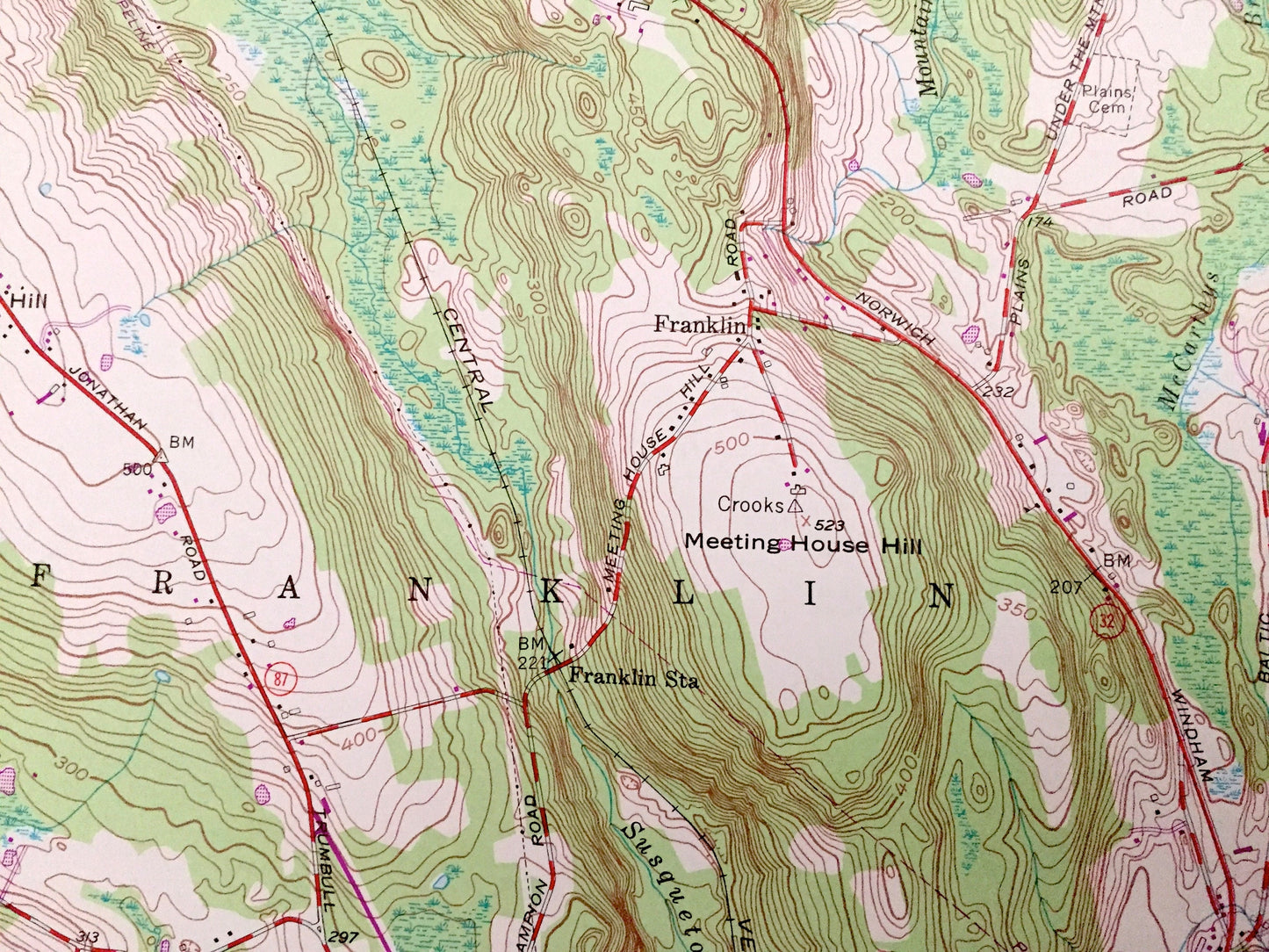
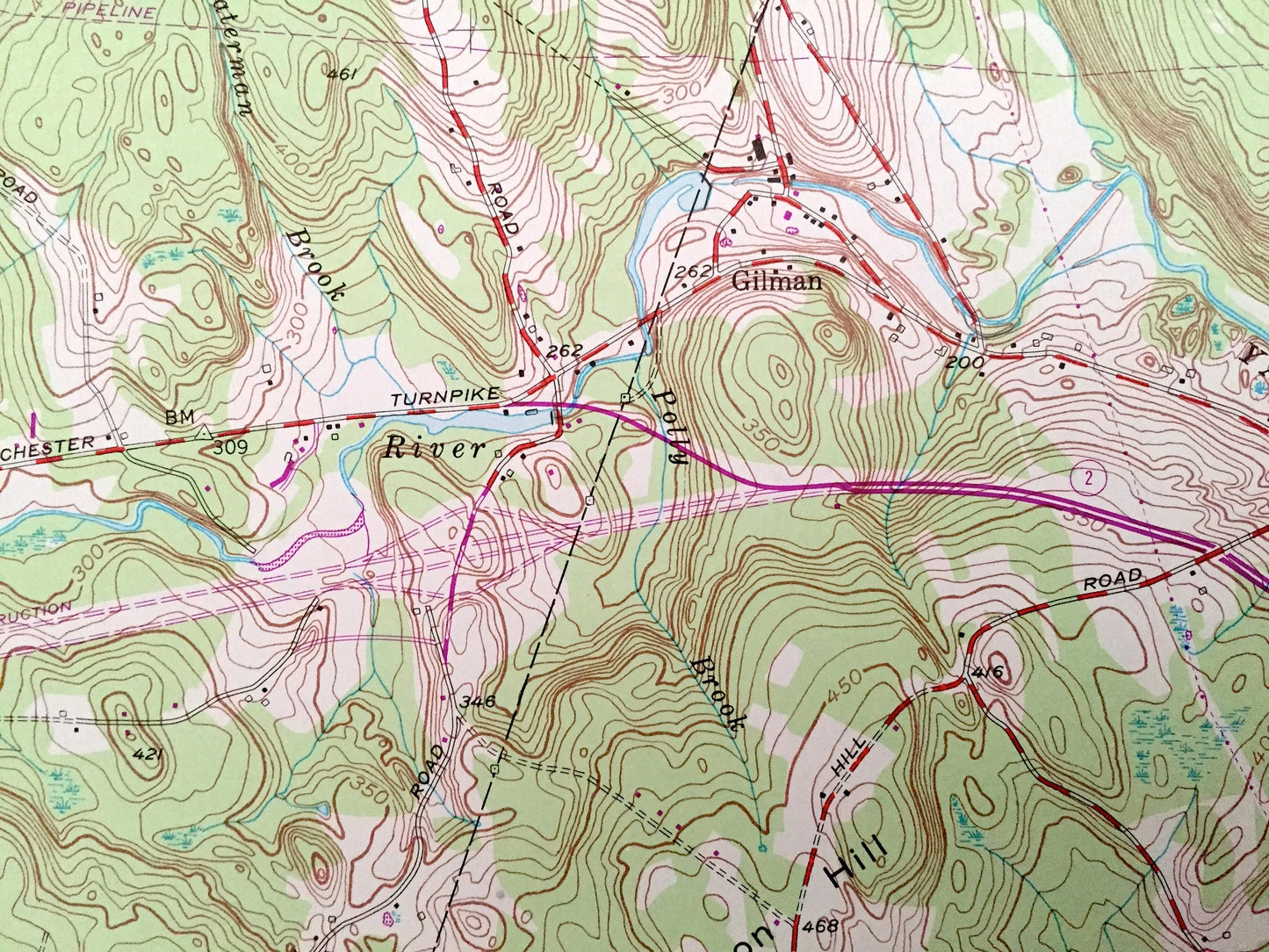
See what Connecticut looked like over 65 years ago. Lots of intricate details and geological contours. Map even has little squares for every house that existed at the time. The USGS cartographers were very thorough back then!
Perfect for the historian, map-lover, the curious or just as a conversation starter. Wonderful and rare. Vintage maps such as these make great gifts.
Edition of 1953, printed 1971
Dimensions: 22" width x 27" height
----
Features
Cities & Towns: Bozrah, Norwich, Salem, Avery Corner, Yantic, Bozrah Street, Gilman, Smith Corner.
Points of Interest: Yantic River, Fitchville Pond, Red Cedar Pond, Deep River Reservoir, Gardner Brook, Stony Brook, Misery Hill, Blue Hill, Pleasure Hill, Mason Hill, Deep River, Meeting House Hill, Camp Odetah, Camp Cadaho Tohaci, Camp Juanita Adajuan, Camp Wetonaw, Paugwaunk Church, Leffingwell School, Camp Moween, Red Cedar Pond, Gardner Lake, Lebanon Road School, Camp Odetah and many more hills, streams, ponds, houses, schools, railroads, churches and roads.
Condition: Very Good Vintage condition, commensurate with age. This map is in great shape for being over 50 years old. Has light edge-wear but will read as character when framed.
----
We will happily adjust shipping price for multiple purchases. Maps are rolled up and shipped in sturdy mailing tubes, never folded.
Couldn't load pickup availability
Share