My Store
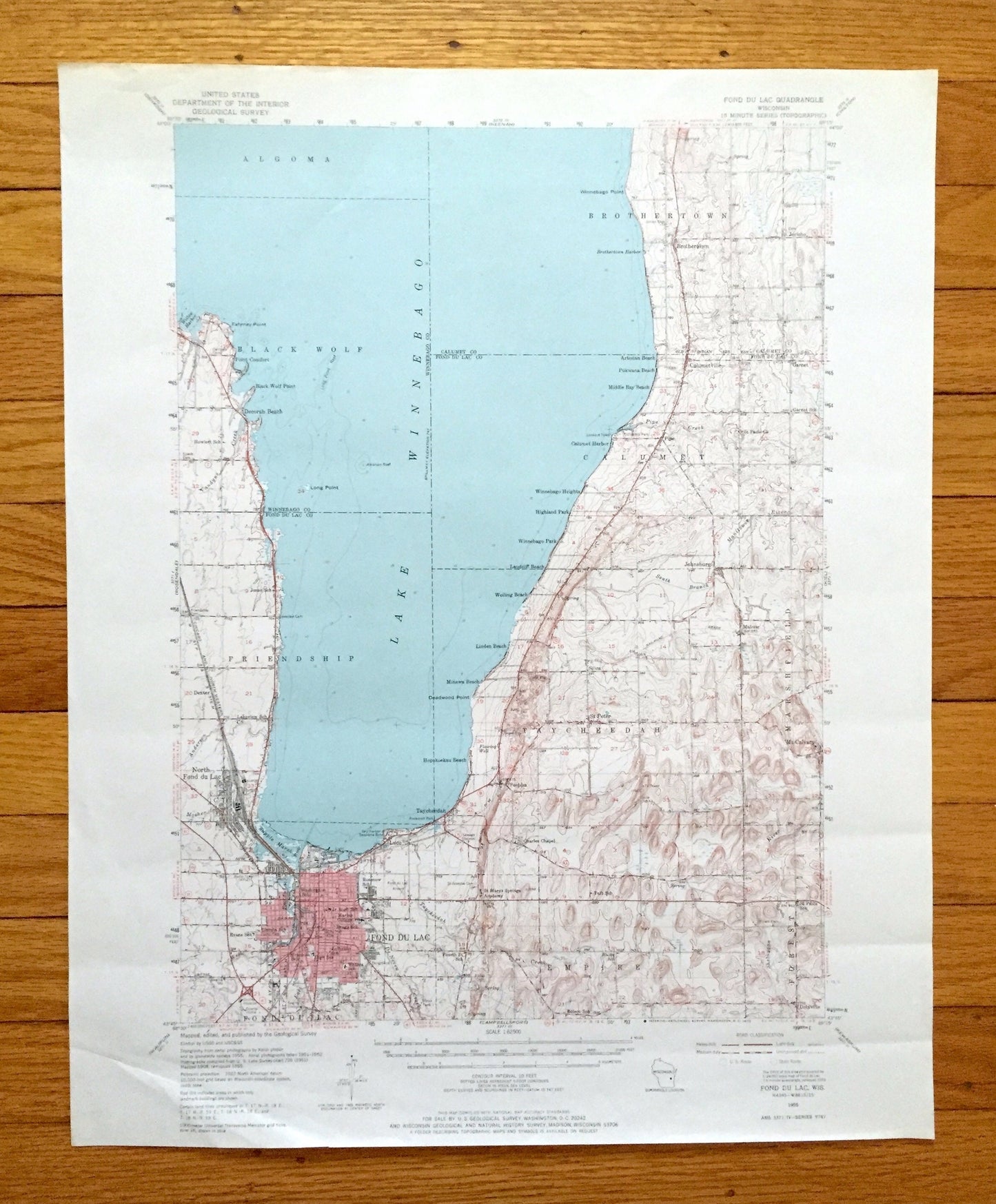
Antique Fond Du Lac, Wisconsin 1955 US Geological Survey Topographic Map – Winnebago, Calumet County, Lake, Oshkosh Taycheedah Black Wolf WI
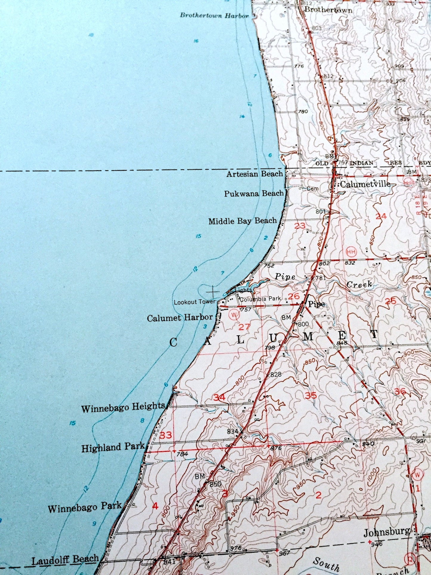
Antique Fond Du Lac, Wisconsin 1955 US Geological Survey Topographic Map – Winnebago, Calumet County, Lake, Oshkosh Taycheedah Black Wolf WI
Beautiful, antique map of Fond Du Lac, Wisconsin and surrounding Winnebago, Calumet & Fond Du Lac County area on Lake Winnebago. This is an authentic 1955 edition, 1971 print from the U.S. Geological Survey and NOT a computer reproduction.
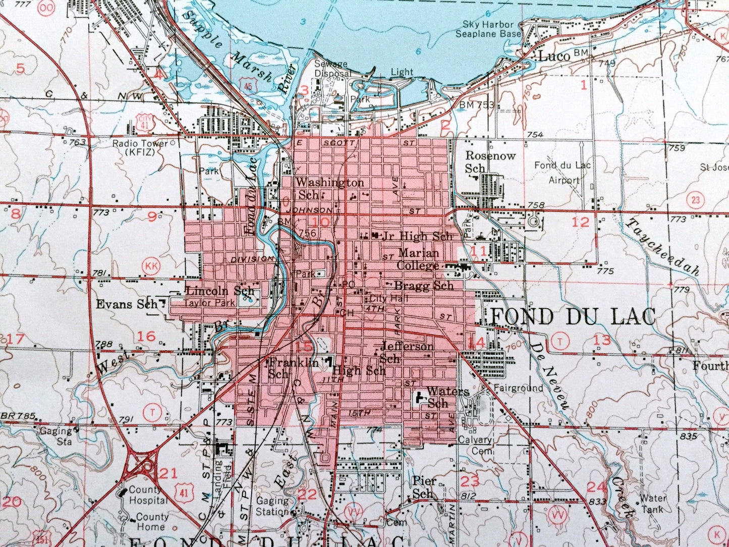
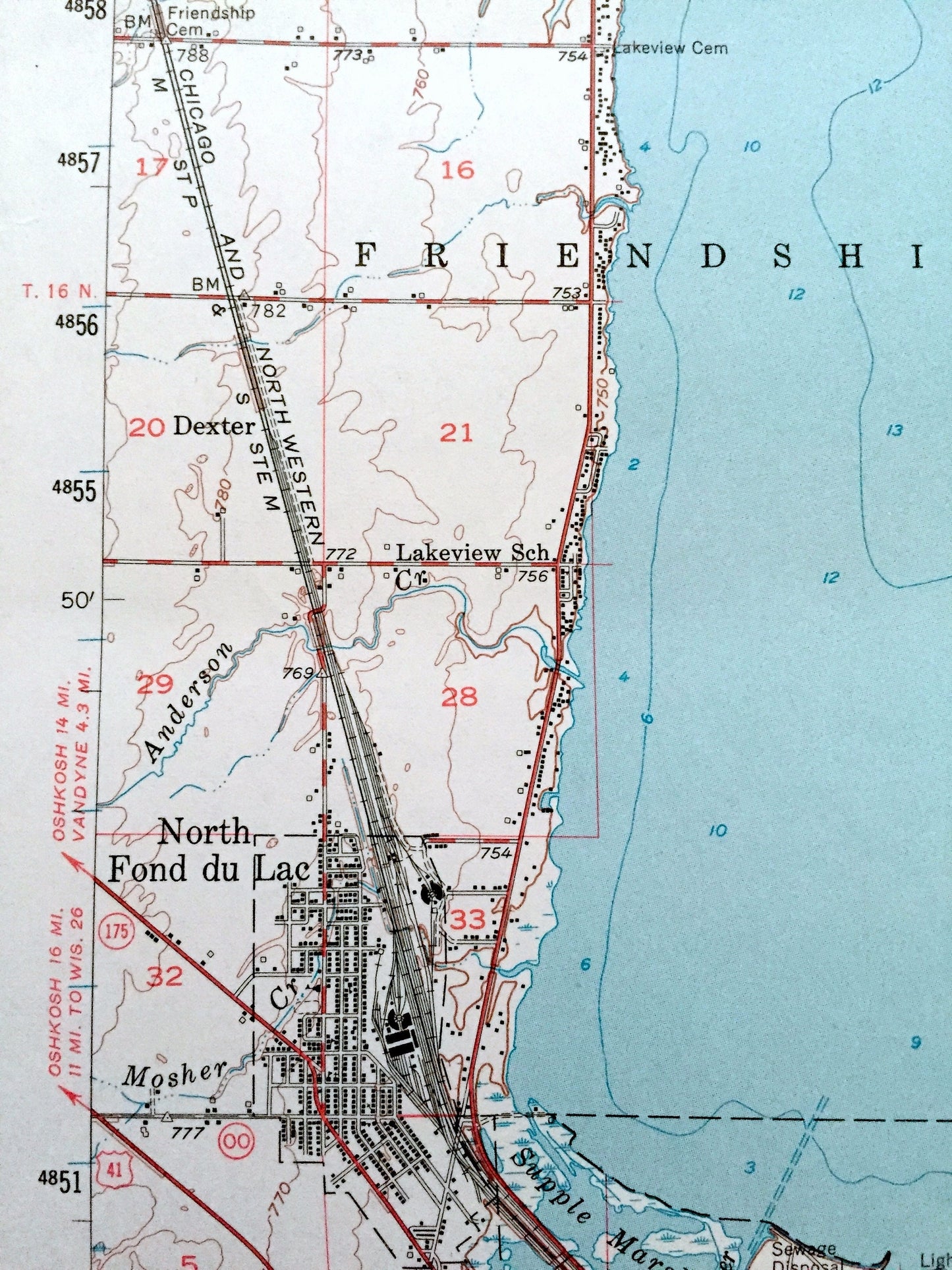
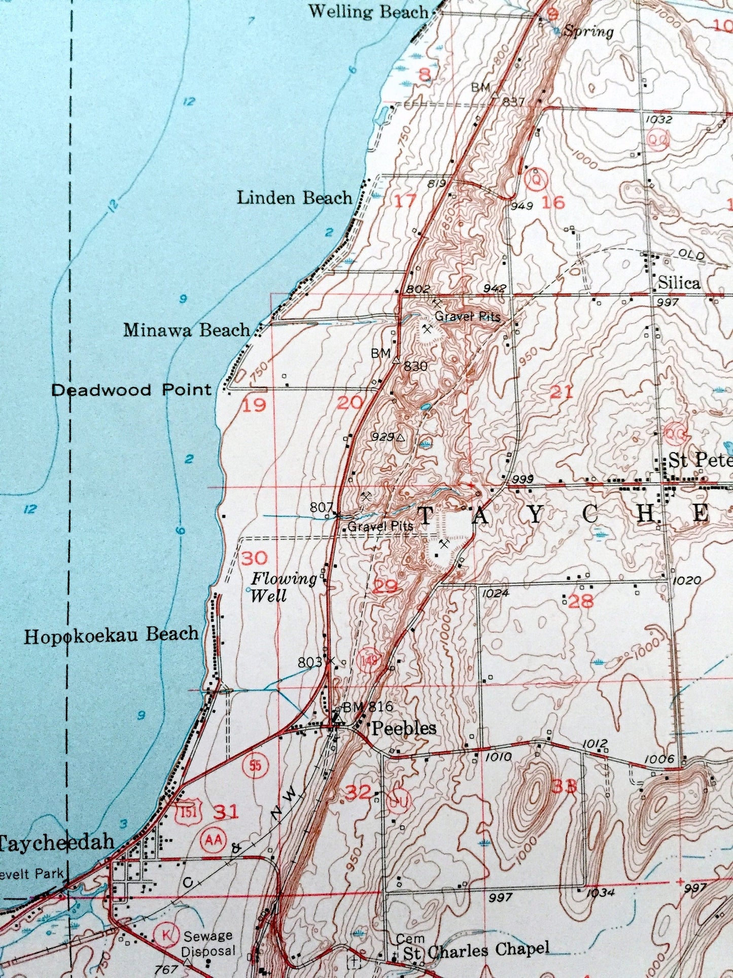
See what Wisconsin looked like over 65 years ago. Lots of intricate details and geological contours. Map even has little squares for every house that existed at the time. The USGS cartographers were very thorough back then!
Perfect for the historian, map-lover, the curious or just as a conversation starter. Wonderful and rare. Maps such as these make great gifts.
Edition of 1955, printed 1971
Dimensions: 16 1/4" width x 17 1/2" height
----
Features
Cities & Towns: Fond Du Lac, Oshkosh, Algoma, Black Wolf, Friendship, Brothertown, Calumet, Taycheedah, Empire, Marshfield, Forest, Stony Beach, Pankotuk, Vandyne, Twin Crossing, North Fond Du Lac, Lakewood Beach, Peebles, Dotyville, Mt Calvary, Malone, Johnsburg, Calumet Harbor, Winnebago Park, Garnet, Luco.
Points of Interest: Winnebago County, Fond Du Lac County, Calumet County, Lake Winnebago, Randall Point, Long Point, Deadwood Point, Taycheedah Creek, and lots more hills, creeks, towns, schools, churches, roads and train tracks.
Condition: Good Vintage condition, commensurate with age. This map is in great shape for being over 50 years old. Has light wear and creases, but these will flatten easily and all will add to vintage character when framed.
----
We will happily adjust shipping price for multiple purchases. Map will be shipped folded to preserve integrity.
Couldn't load pickup availability
Share