My Store
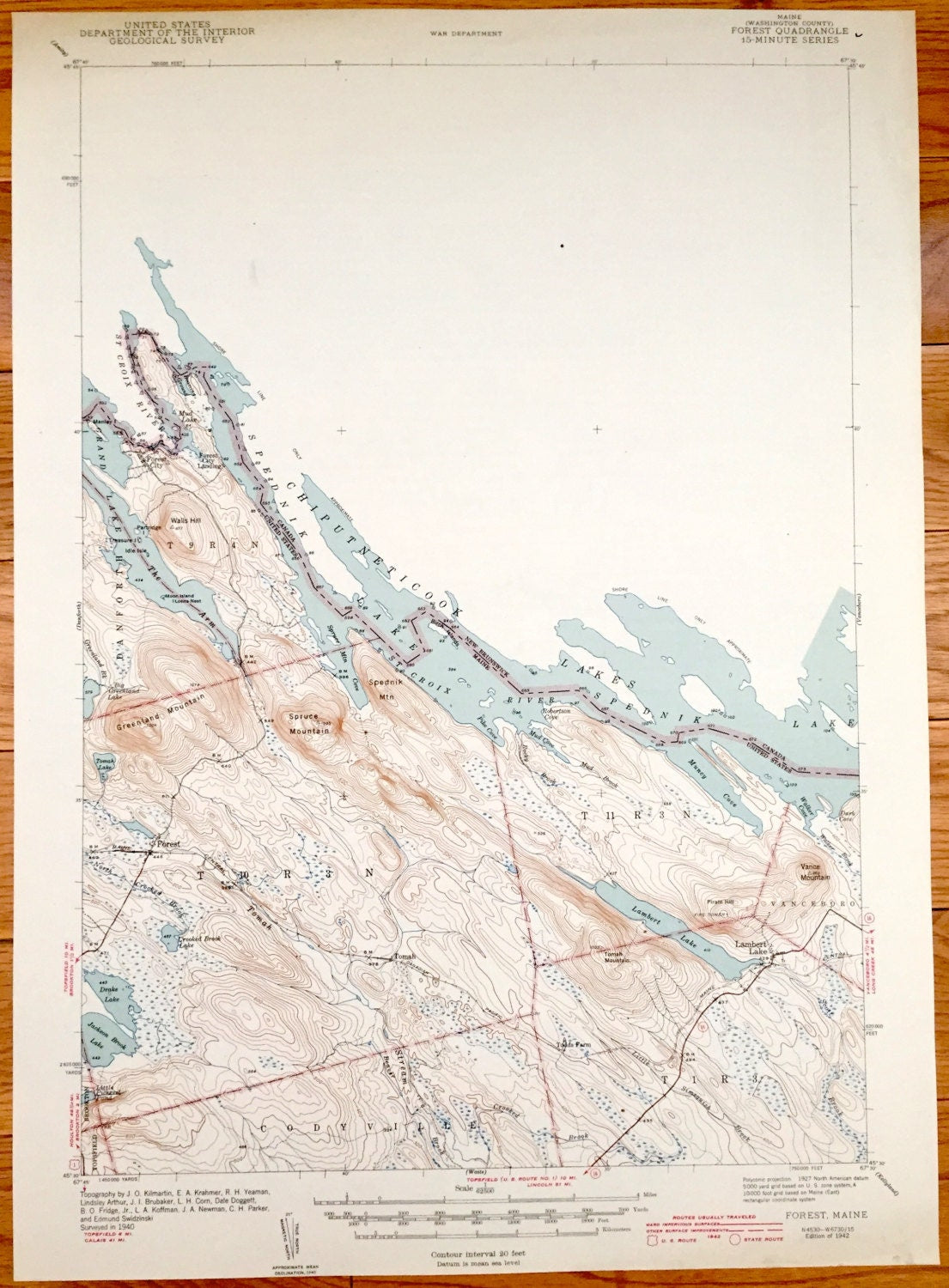
Antique Forest, Maine 1927 US Geological Survey Topographic Map – Chiputneticook Lakes, Forest City, Vanceboro, Codyville, Spednik Lake, ME
Antique Forest, Maine 1927 US Geological Survey Topographic Map – Chiputneticook Lakes, Forest City, Vanceboro, Codyville, Spednik Lake, ME
Beautiful, antique map of Forest, Maine and surrounding Chiputneticook Lakes area, just south of Canada. This is an authentic 1942 print of 1927 data from the U.S. Geological Survey and NOT a computer reproduction.
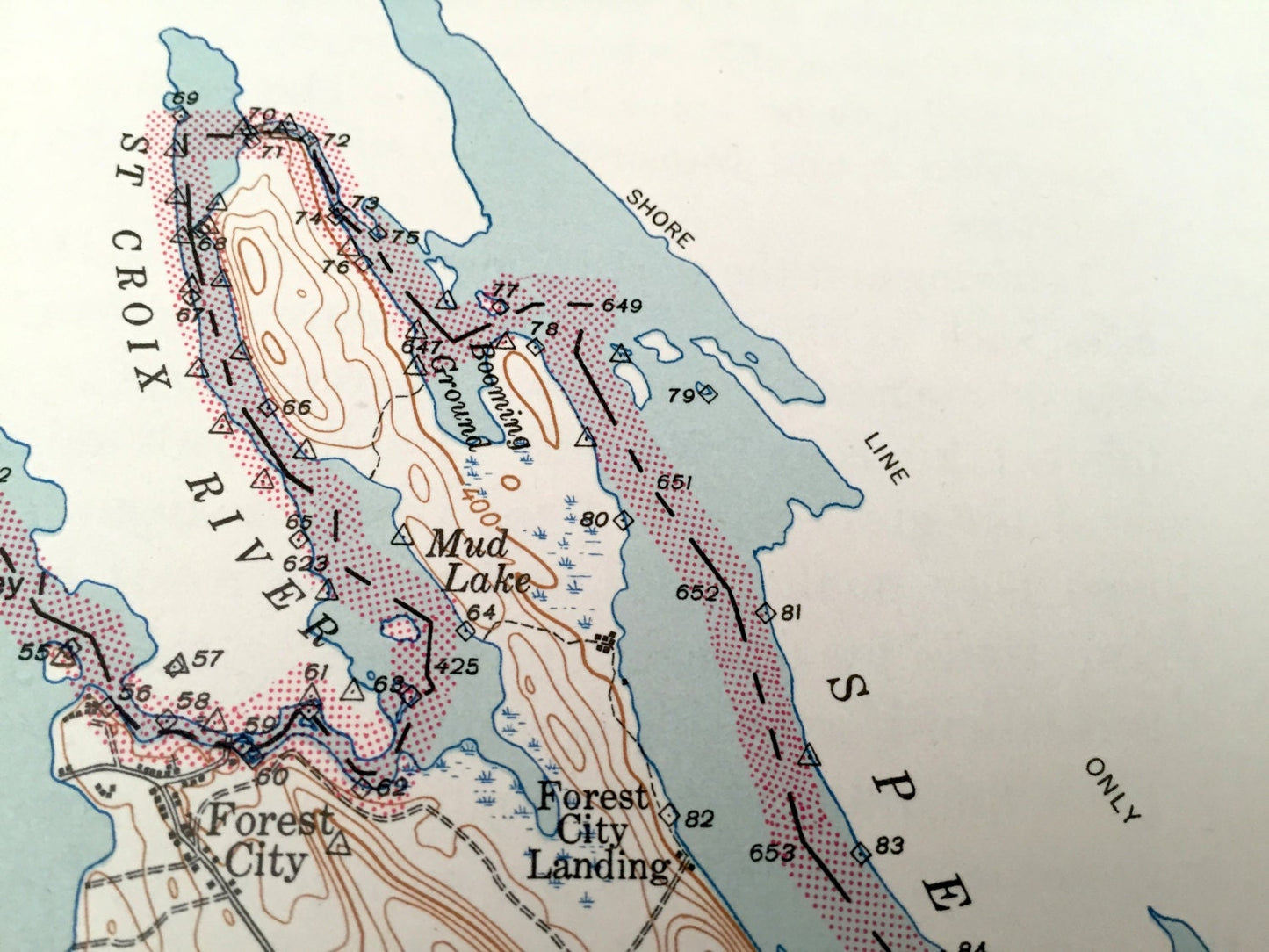
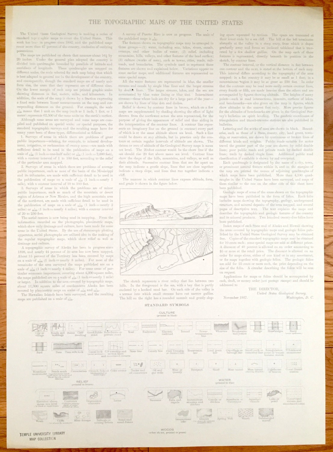
See what Gardner Lake looked like almost 100 years ago, when parts of Maine were still unincorporated or unnamed. Lots of intricate details and geological contours. Map even has little squares for every house that existed at the time. The USGS cartographers were very thorough back then! On the back is a description of topographic symbols and map guide.
Perfect for the historian, map-lover, the curious or just as a conversation starter. Wonderful and rare. Vintage maps such as these make great gifts.
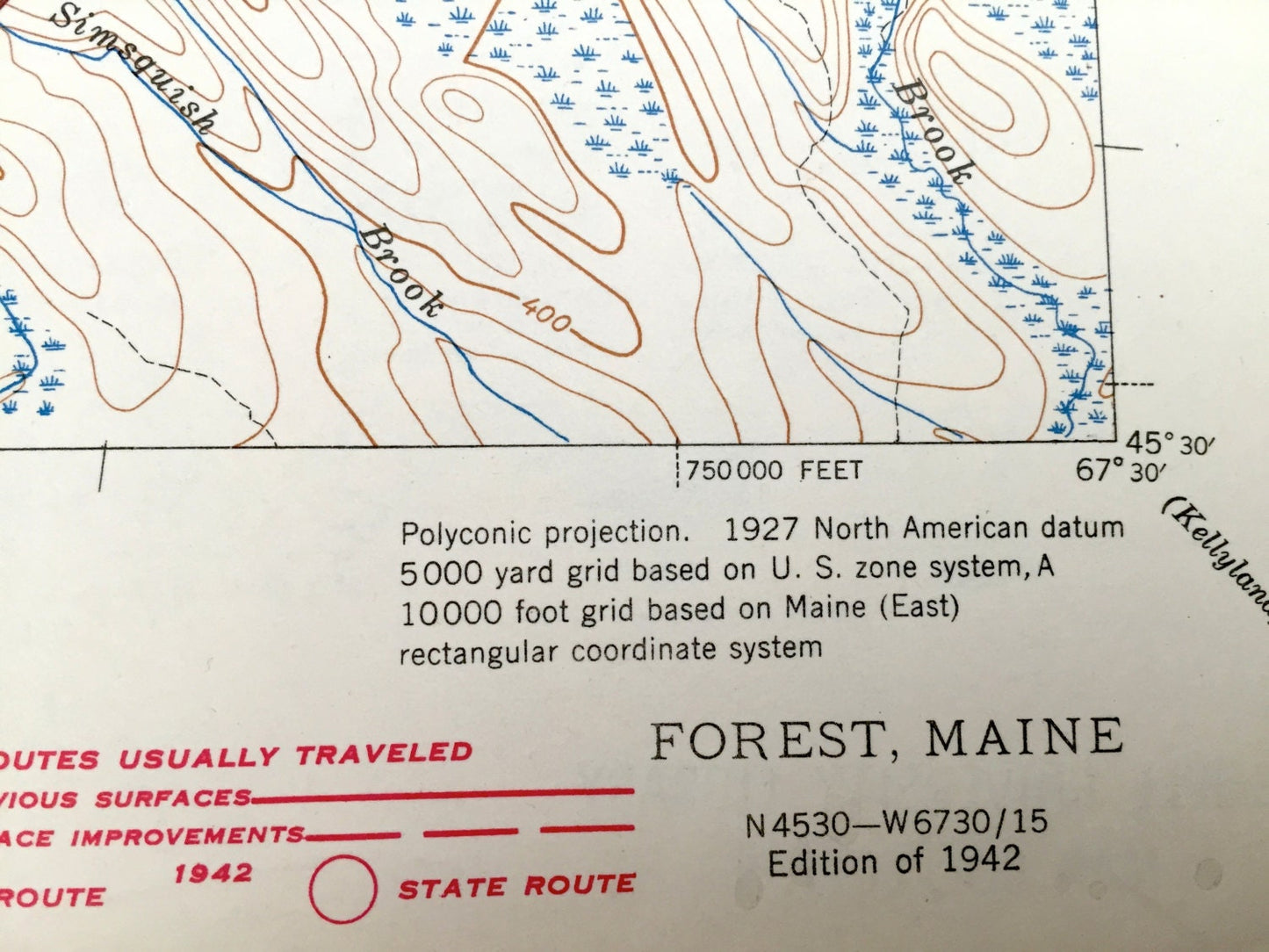
Edition of 1927, printed 1942
Dimensions: 14 1/2" width x 20" height
----
Features
Cities & Towns: Forest, Forest City, Forest City Township, T9R4N, T 10 R 3 N, T 11 R 3N, Vanceboro, Codyville, T 1 R 3.
Points of Interest: Chiputneticook Lakes, Spednik Lake, Grand Lake, Spednik Mountain, Vance Mountain, The Arm, Lambert Lake, Drake Lake, Jackson Brook Lake, Greenland Mountain, Spruce Mountain, St. Croix river, and many more streams, ponds, villages and mountains.
Condition: Good Vintage condition, commensurate with age. This map is in great shape for being over 80 years old. Has some wear and ex-libris stamp, but this will all add to vintage character when framed.
----
We will happily adjust shipping price for multiple purchases. Maps are rolled up and shipped in sturdy mailing tubes, never folded.
Couldn't load pickup availability
Share