My Store
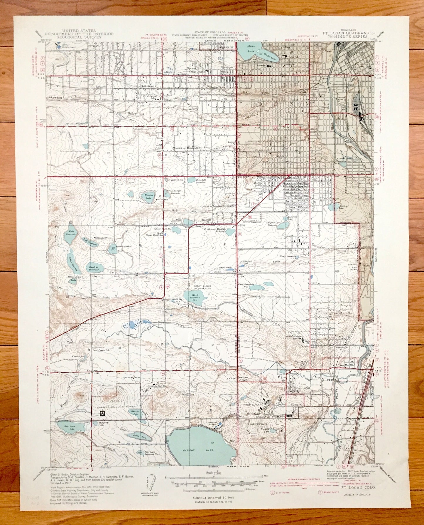
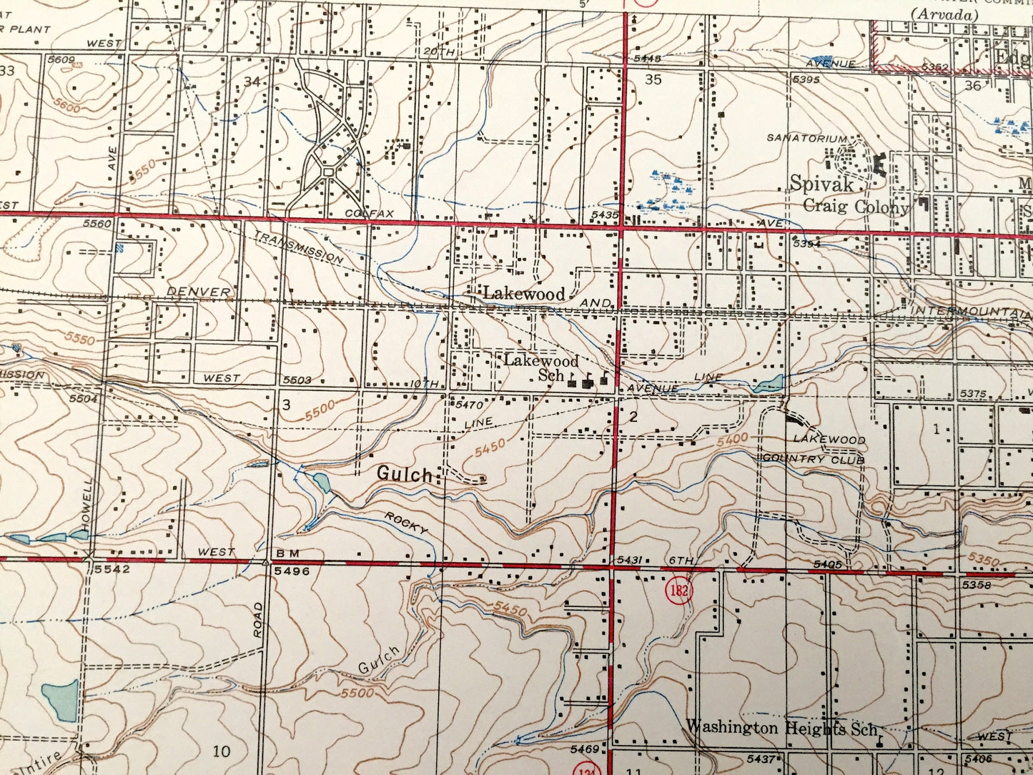
Antique Fort Logan, Colorado 1941 US Geological Survey Topographic Map – Denver, Sheridan, Lakewood, Bow Mar, Edgewater, Arapahoe County, CO
Antique Fort Logan, Colorado 1941 US Geological Survey Topographic Map – Denver, Sheridan, Lakewood, Bow Mar, Edgewater, Arapahoe County, CO
Beautiful, antique map of Denver and Fort Logan, Colorado and surrounding Arapahoe County area. This is an authentic 1941 print from the U.S. Geological Survey and not a computer reprint.
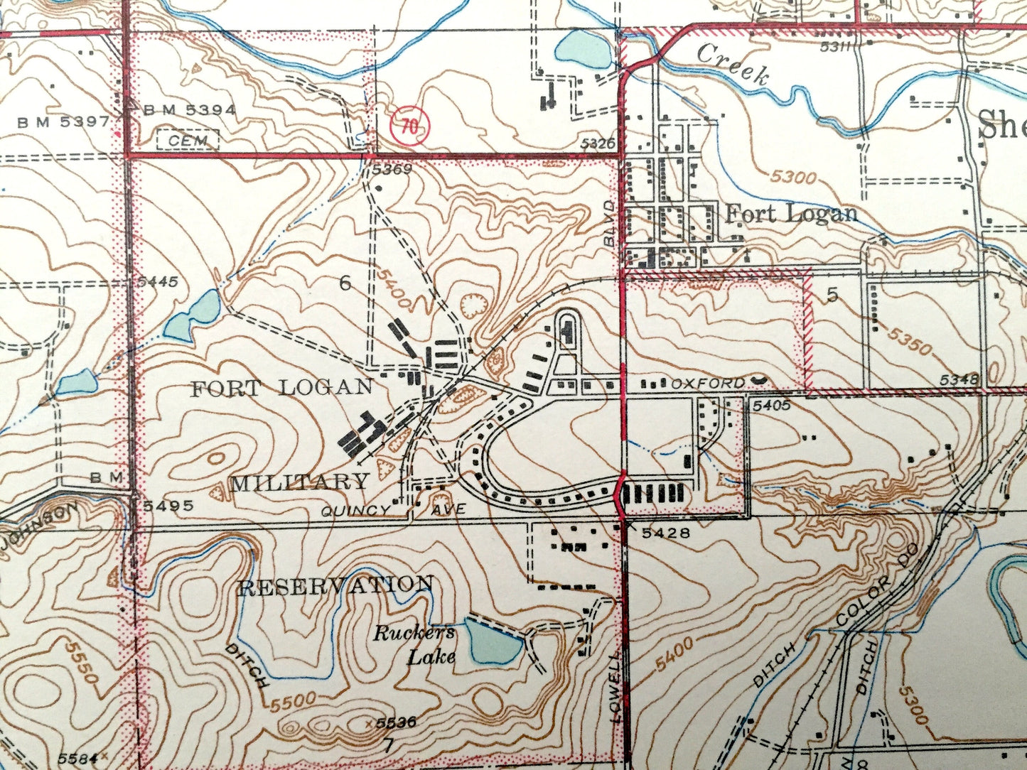
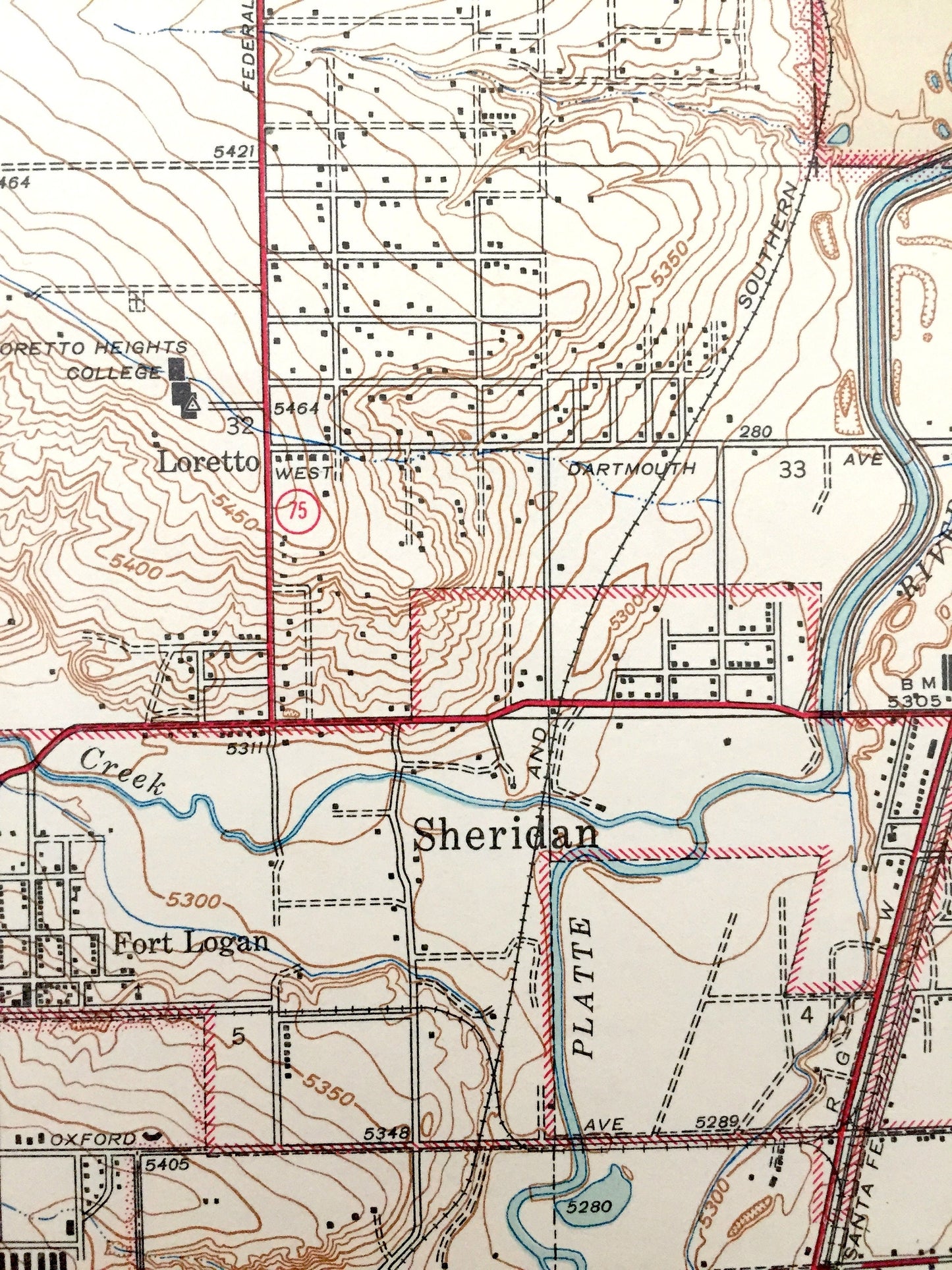
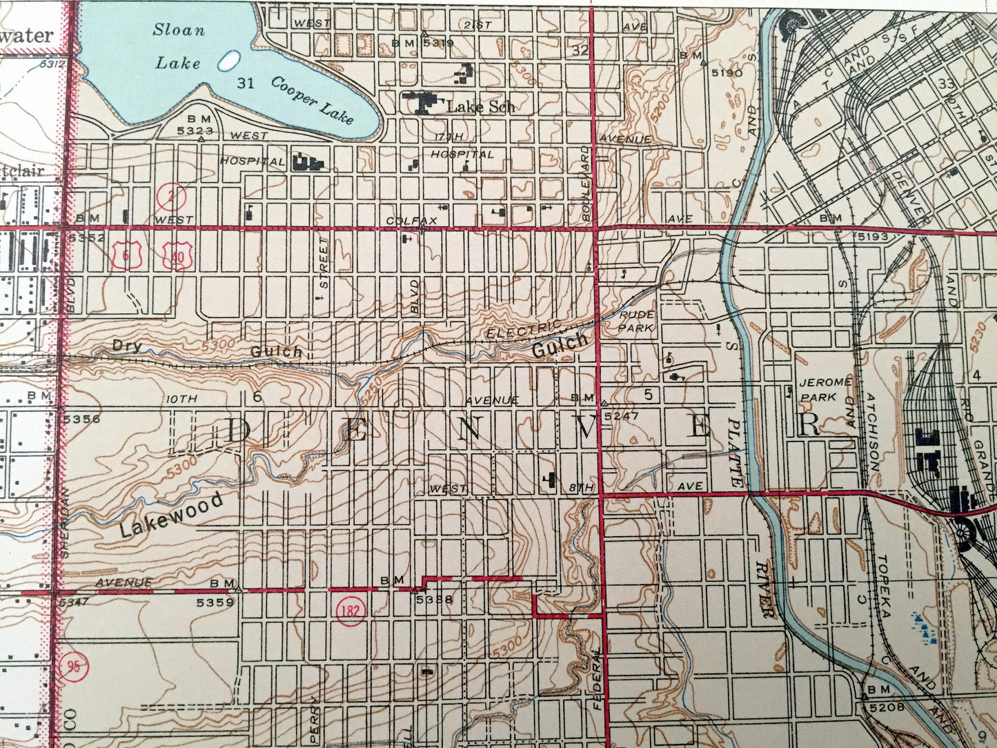
See what Colorado looked like over 75 years ago. Lots of intricate details and geological contours. Map even has little squares for every house that existed. The USGS cartographers were very thorough back then!
Perfect for the historian, map-lover, the curious or just as a conversation starter. Wonderful and rare. Vintage maps such as these make great gifts.
Edition of 1941, printed 1941
Dimensions: 16" width x 20" height
----
Features
Cities & Towns: Denver, Spivak, Craig Colony, Edgewater, Sheridan, Fort Logan, Bow Mar, Lochmoor, College View.
Points of Interest: Arapahoe County, Denver County, Fort Logan Military Reservation, Marston Lake, Sloan Lake, Cooper Lake, South Platte River, Green Gables Country Club, Jerome Park, Lakewood Gulch, Bear Creek, and many more smaller ponds, creeks, houses, schools, roads, churches and train tracks.
Condition: Very Good condition, commensurate with age. This map is in incredible shape for being over 75 years old.
----
We will happily adjust shipping price for multiple purchases. Maps are rolled up and shipped in sturdy mailing tubes, never folded.
Couldn't load pickup availability
Share