My Store
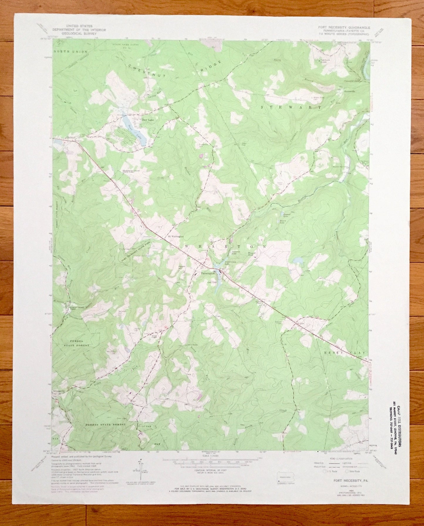
Antique Fort Necessity, Pennsylvania 1964 US Geological Survey Topographic Map – Fayette County, Farmington, Deer Lake, Chalkhill Wharton PA
Antique Fort Necessity, Pennsylvania 1964 US Geological Survey Topographic Map – Fayette County, Farmington, Deer Lake, Chalkhill Wharton PA
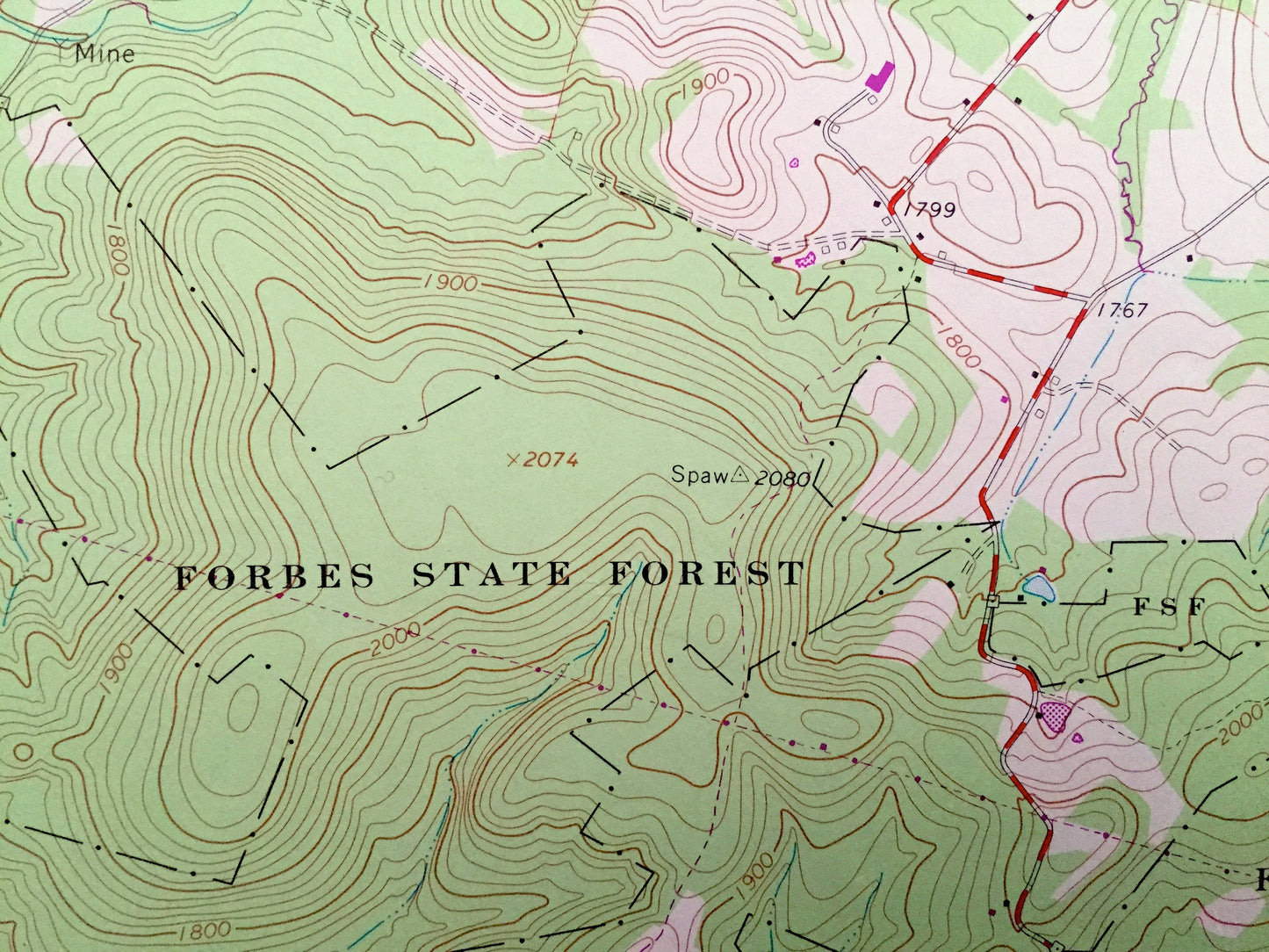
Beautiful, antique map of Fort Necessity, Pennsylvania and surrounding Fayette County area. This is an authentic 1964 edition, 1973 print from the U.S. Geological Survey and NOT a computer reproduction.
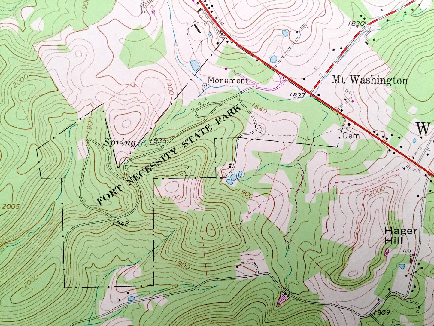
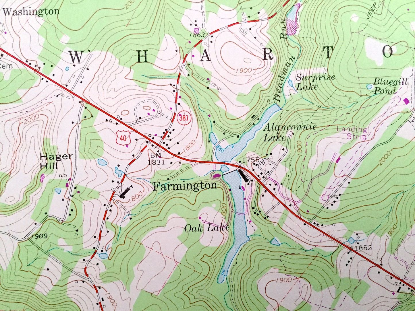
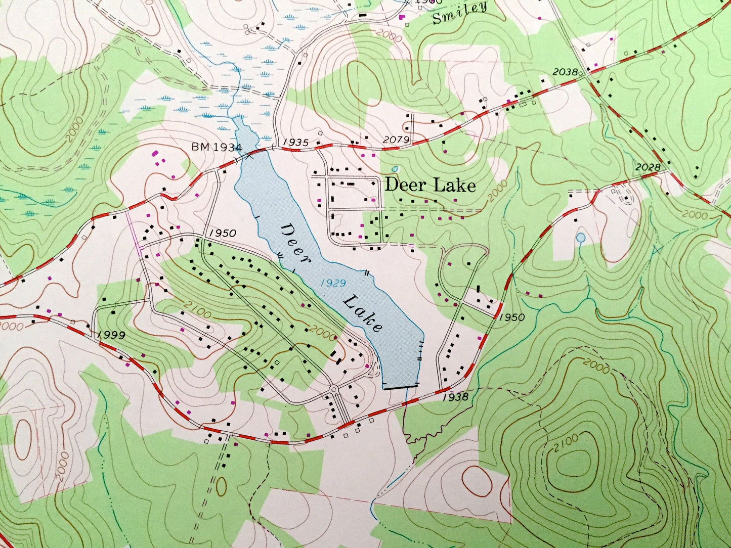
See what Pennsylvania looked like over 55 years ago. Lots of intricate details and geological contours. Map even has little squares for every house that existed at the time. The USGS cartographers were very thorough back then!
Perfect for the historian, map-lover, the curious or just as a conversation starter. Wonderful and rare. Vintage maps such as these make great gifts.
Edition of 1964, printed 1973
Dimensions: 22" width x 27" height
----
Features
Cities & Towns: Farmington, Deer Lake, Chalkhill, Stonerville, Wharton Township, Henry Clay Township, Stewart Township
Points of Interest: Fort Necessity State Park, Forbes State Forest, Braddock's Grave State Park, Deer Lake, Oak Lake, Surprise Lake, Jeep Trails, Chestnut Ridge, Kentuck Knob, Peters Lake, Russell Lake, Meadow Run, Cucumber Falls, State Game Lands, and lots more hills, streams, ponds, houses, schools, churches and roads.
Condition: Very Good Vintage condition, commensurate with age. This map is in great shape for being about 50 years old. Has light-edge wear, but this will read as vintage character when framed.
----
We will happily adjust shipping price for multiple purchases. Maps are rolled up and shipped in sturdy mailing tubes, never folded.
Couldn't load pickup availability
Share