My Store
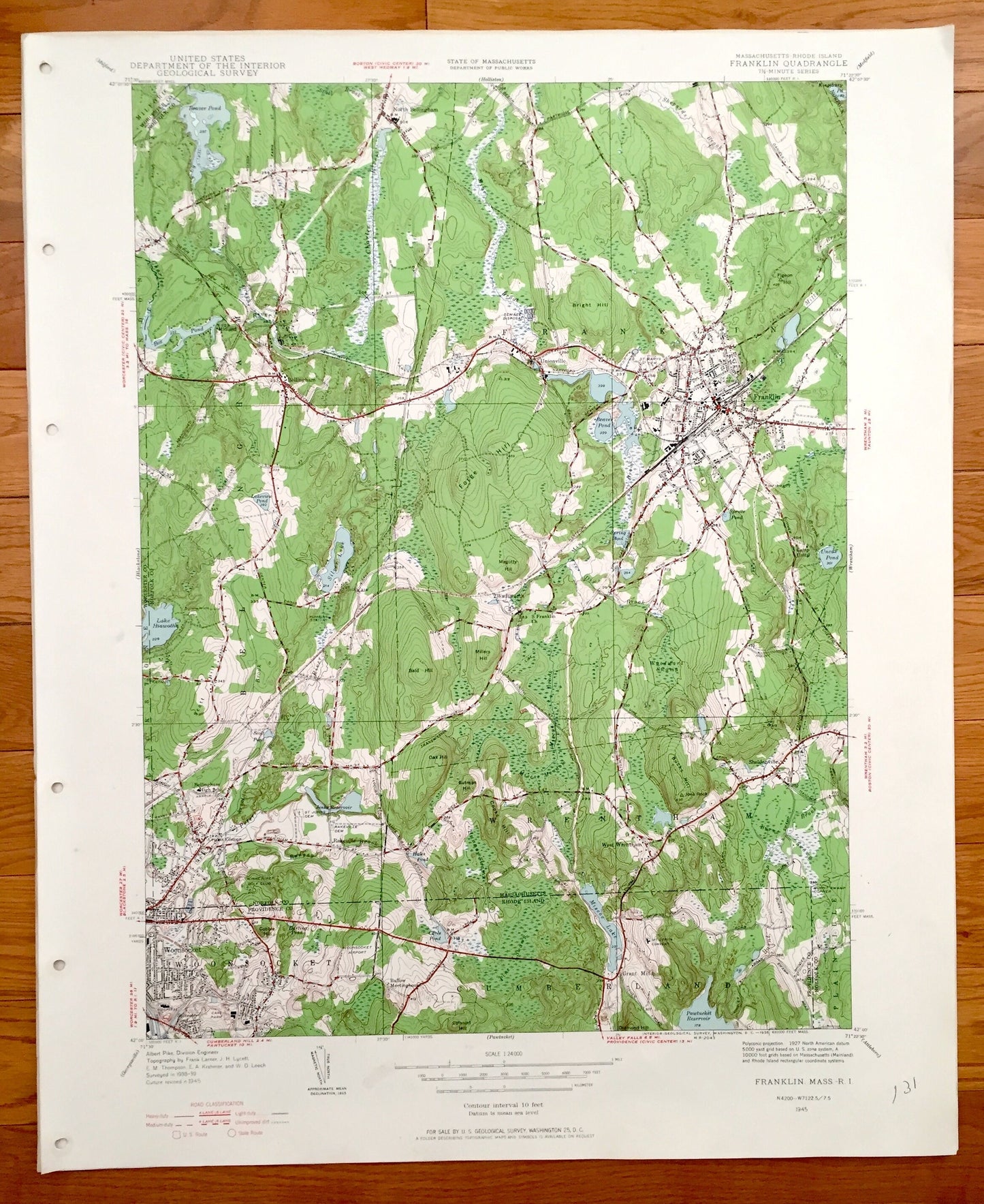
Antique Franklin, Massachusetts & Woonsocket, Rhode Island 1945 US Geological Survey Topographic Map – Bellingham, Wrentham, Woonsocket
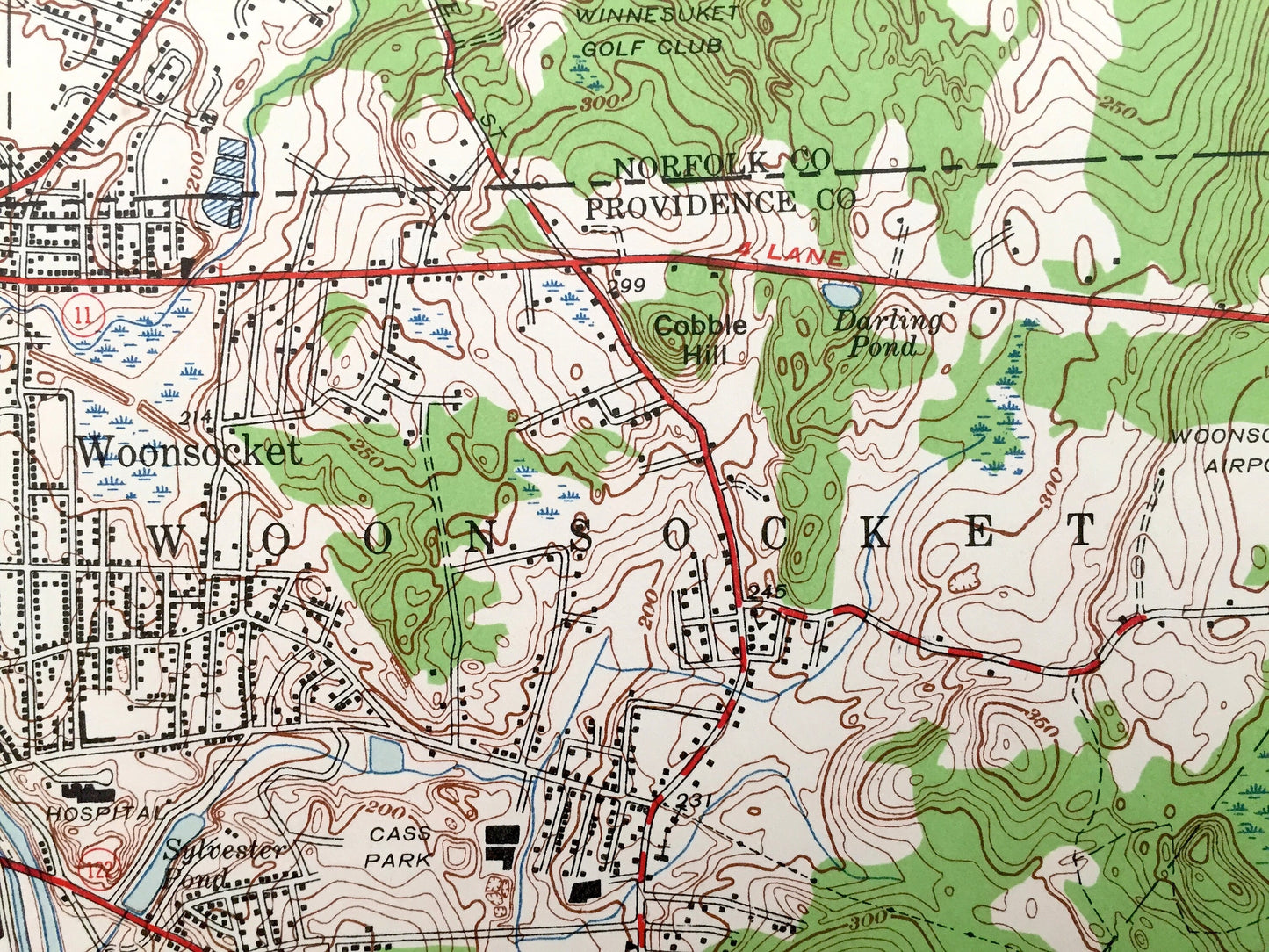
Antique Franklin, Massachusetts & Woonsocket, Rhode Island 1945 US Geological Survey Topographic Map – Bellingham, Wrentham, Woonsocket
Beautiful, antique map of Franklin, Wrentham, Bellingham, Massachusetts, including surrounding Woonsocket and Cumberland, Rhode Island. This is an authentic 1945 print from the U.S. Geological Survey and NOT a computer reproduction.
See what Norfolk & Providence Counties looked like over 70 years ago. Lots of intricate details and geological contours. Map even has little squares for every house that existed at the time. The cartographers were very thorough back then!
Perfect for the historian, map-lover, the curious or just as a conversation starter. Wonderful and rare. Vintage maps such as these make great gifts.
Edition of 1945, printed 1945
Dimensions: 22" width x 27" height
----
Features
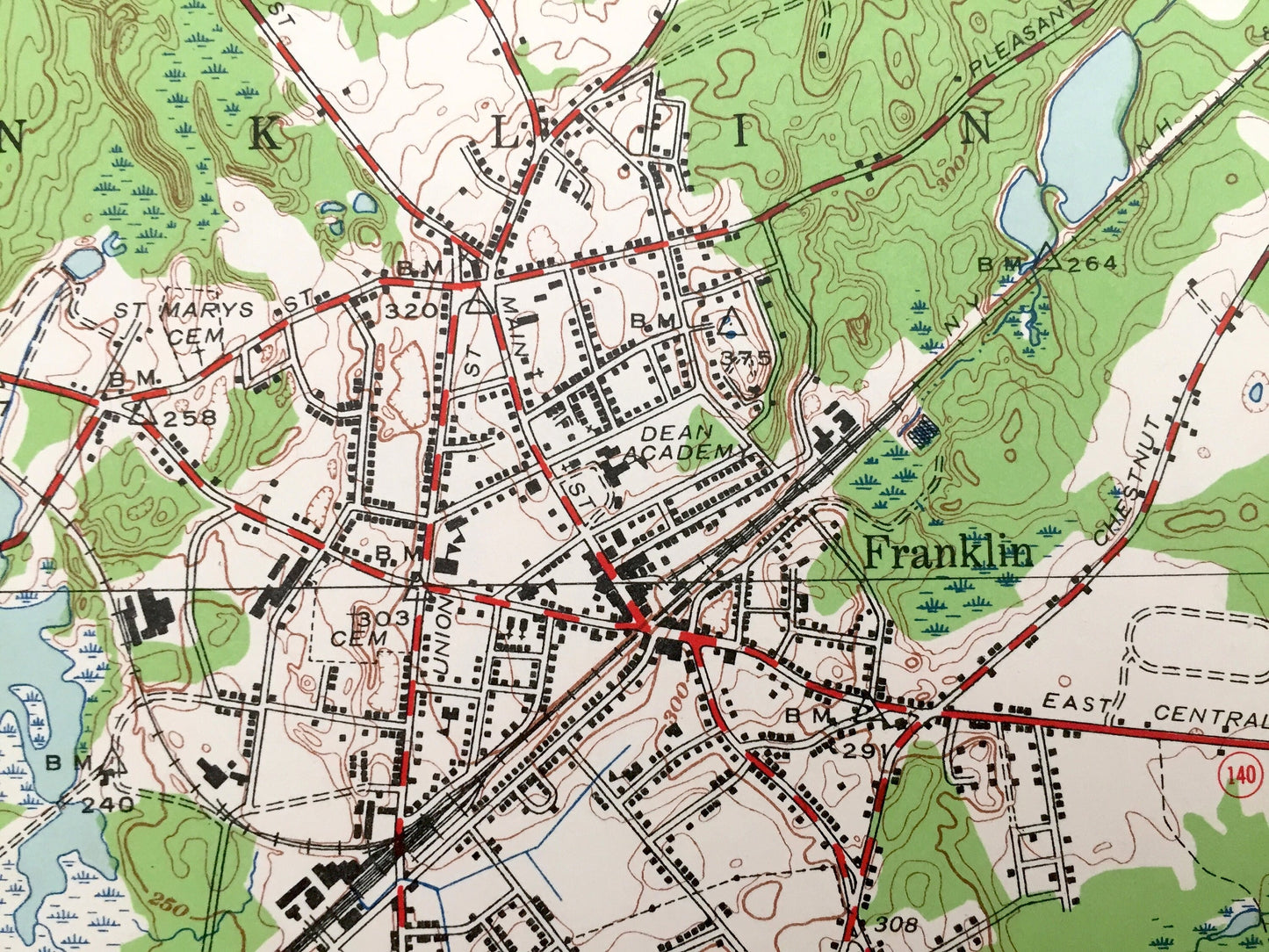
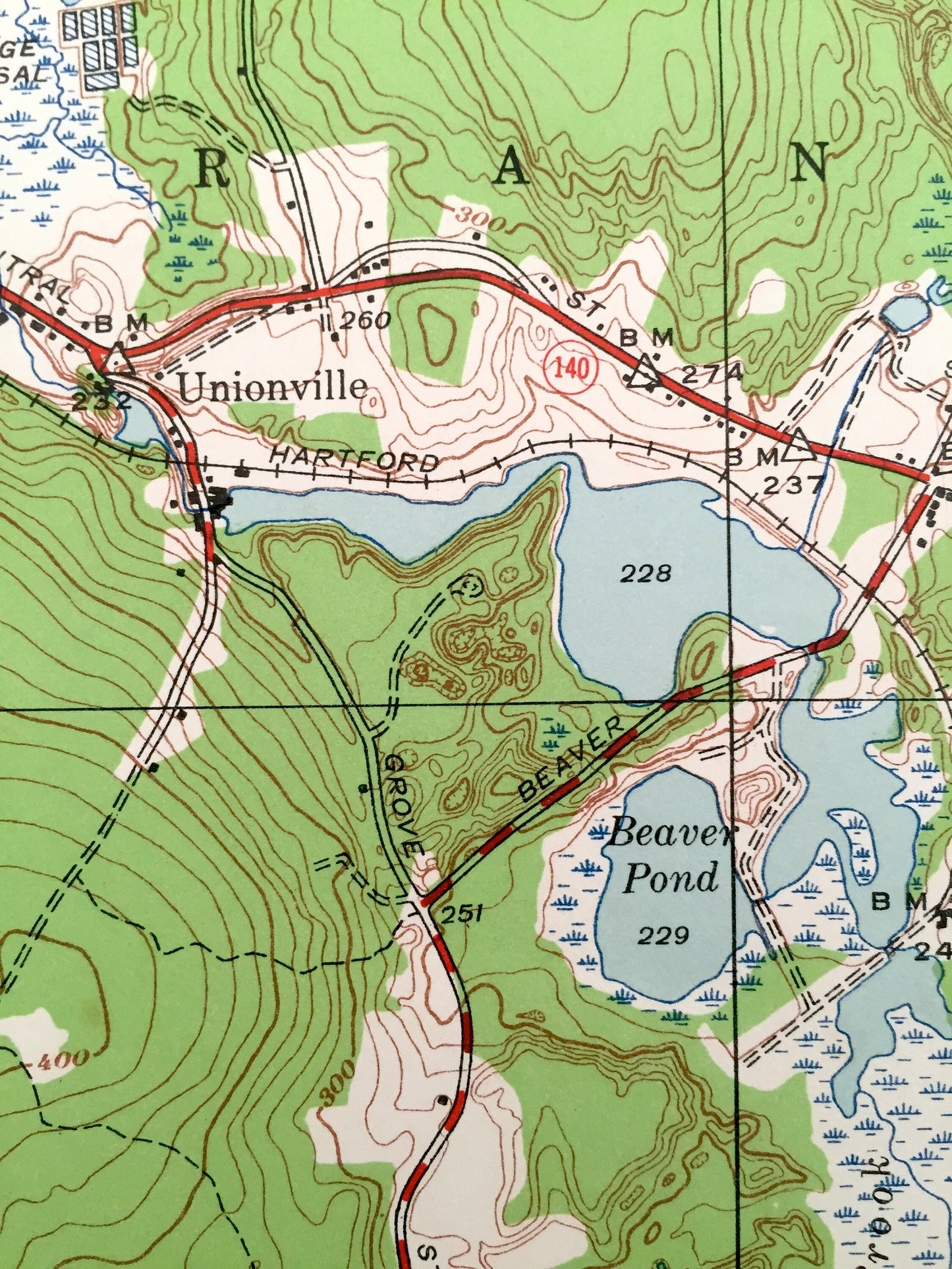
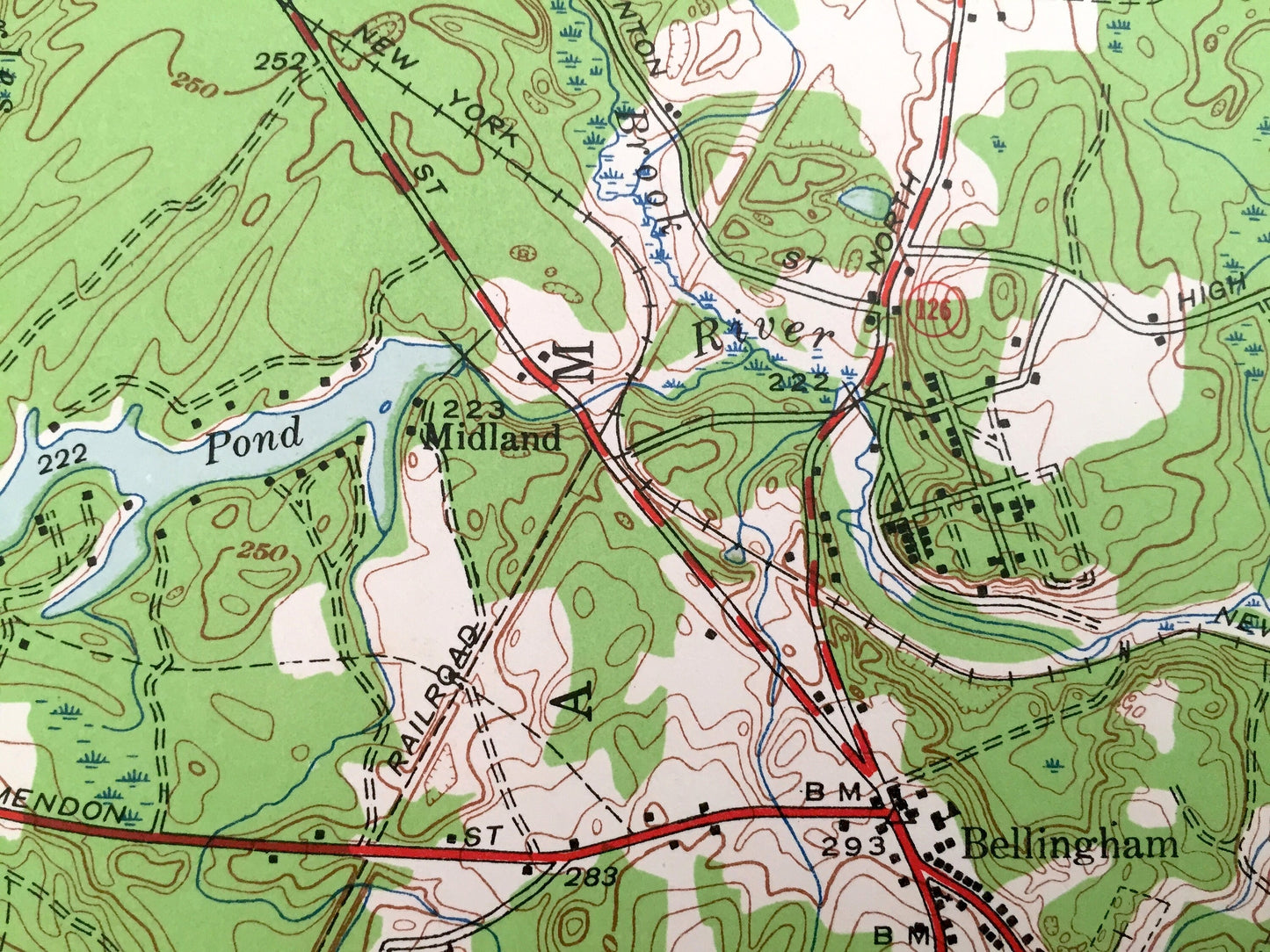
Cities & Towns: Massachusetts: North Bellingham, Bellingham, Midland, Unionville, Franklin, West Wrentham, Wrentham, Plainville, Sheldenville.
Rhode Island: Woonsocket. Cumberland.
Points of Interest: Beaver Pond, Maggoty Hill, Bellingham High School, Winnesuket Golf Club, Woonsocket Airport, Ballow Meetinghouse, Pawtucket Reservoir, Woodward Swamp, Camp Unity, Dean Academy ( Dean College),
NY New Haven and Hartford Railroad, and lots more hills, mountains, streams, ponds, houses, schools and roads.
Condition: Very Good condition, commensurate with age. This map is in incredible shape for being over 70 years old. Map has punch holes but these are easily concealed with framing or placing a similar-colored paper behind the map, as can be seen in the photos.
----
We will happily adjust shipping price for multiple purchases. Maps are rolled up and shipped in sturdy mailing tubes, never folded.
Couldn't load pickup availability
Share